Update Fri @ 9:51 AM —
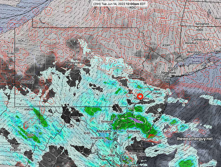
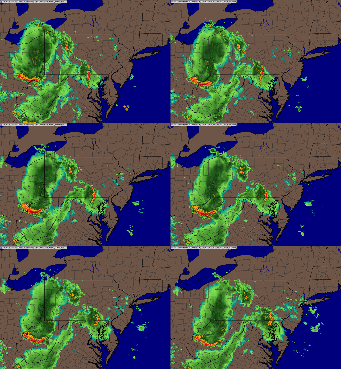
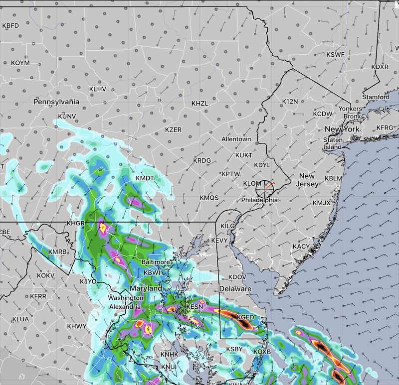
The HREF model, which combines the NAM-NEST, HIRESW, RAP and HRRR, also was a bust.
The NBM (model blend) that is designed to blend and balance the forecast corrected for current conditions was a bust.
The NWS rescinded its tornado watch for nearby counties to our far west and northwest.
Of note, yesterday’s ICON and ECMWF were accurately forecasting no storms in Philadelphia. What can you can?
Updated Thu 9:35 PM — The latest HRRR has backed off the severe storm threat for us. In fact, it’s showing no rain! Radar shows storms losing their punch as they move towards us. Wow, what a forecast change!
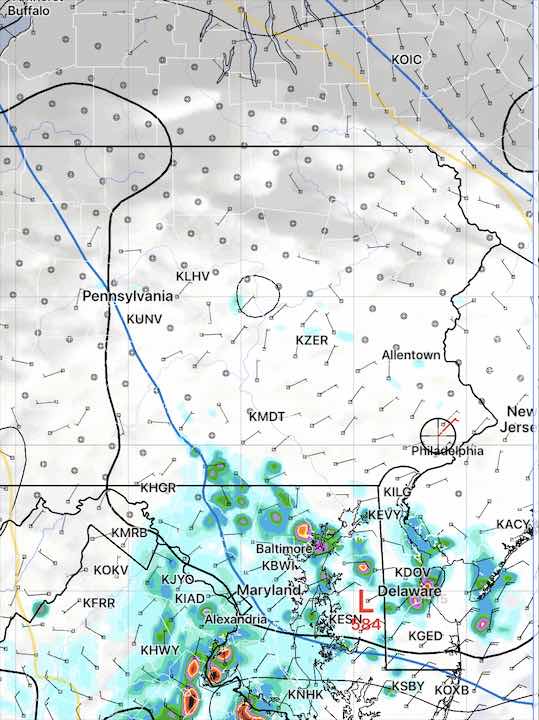
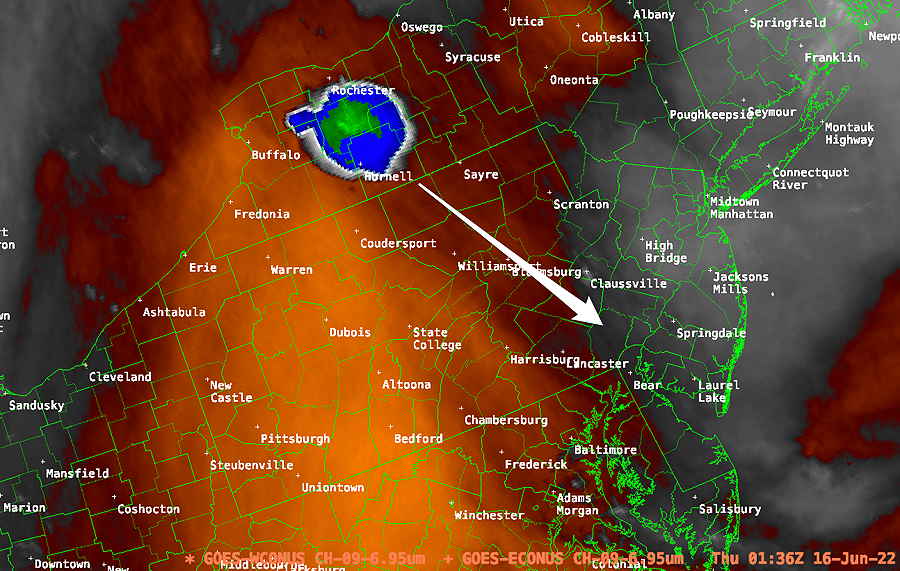
Update Thu @ 8:33 PM — As was the case last night, the “seed” for the storms tonight is visible on satellite water vapor imagery—

It should be noted that not all models are showing storms for the immediate PHL area. Some show only very scattered activity. The issue is that surface CAPE falls off very rapidly as one goes towards NJ.
Nonetheless, the latest HREF shows some heavy rain as early as 10 PM. I’m not sure we’ll see storms that early.
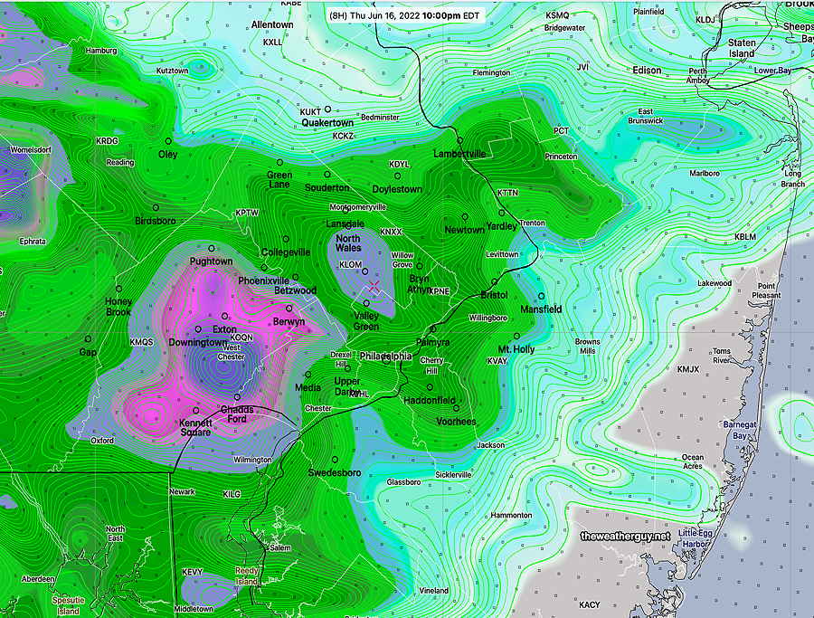
Update Thu @ 6:14 PM — A warm front was supposed to have moved through on two previous occasions Wednesday and Thursday. One didn’t have to be a meteorologist to know that it hadn’t moved through; our temperatures and dew points today relatively low. But tonight’s the night!
The models have the warm front moving through around midnight with more showers and thunderstorms. These storms may pack a greater punch than those that moved through this morning. Indeed, there’s the possibility of severe storms.
| 9/1/21 Tornadoes (example of severe) | Today‘s Forecast NAM NEST 18z | Impact |
| CAPE 3500-4200 Joules/kg | 3300 | ⚑ |
| Helicity 800-1100 m^2/s^2 | 450-500 | ⚑ |
| Vertical Shear 35-45 | 25-28 | ⚑ |
| Precipitable Water 2.0″ | 2-2.2″ | ⚑ |
| Lifted Index (minus) 7-9 | minus 9 | ⚑ |
| Peak Wind Gusts 40-50 | 30 | ⚐ |
| Aligned Storm Motion and Shear Vectors- YES | No | ⇓ |
| Jet stream- Highly Cyclonic | Flat wavy** | ↑ |
| Jet Stream Speed – High | low-moderate | ↑ |
| 500mb – Highly Cyclonic | flat wavy | ↑ |
↓ indicates works against Severity
Update Thu @ 9:09 AM — Current models show that additional storms associated with a cold front late this evening will significantly diminish in strength as they approach Philadelphia.
Updated Wed 10:50 PM — Tonight’s early models have become available. A very interesting scenario is setting up .
First, the seed of these potential storms shows plainly on water vapor imagery—
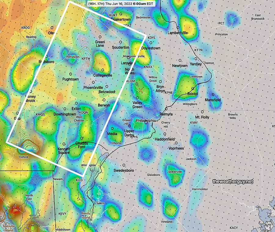
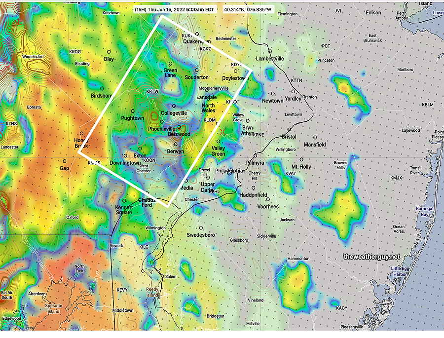
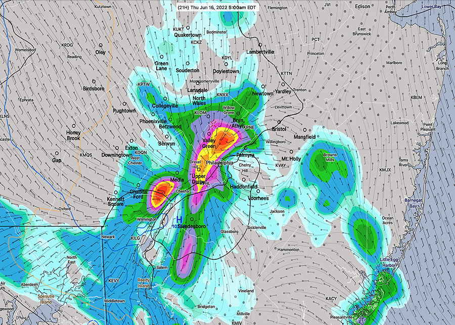
All models show storms developing and moving through our area between 5 AM and 9 AM. The NAM-NEST forecast suggests a bow echo storm possibility.
This is an unusual setup. There’s almost no CAPE from Philadelphia eastward. Just to our west, there’s a sharp gradient to much higher CAPE. Yet the models show very impressive storm development and heavy rain, especially west. Additionally, there’s high helicity just to our west.
Based on the severity parameters, I would ordinarily discount any possibility of severe weather Thursday morning except far western suburbs, but the models still have very strong storms forming and moving east. Tomorrow will be a learning experience for me.
Update Wed @ 5:51 PM — This afternoon’s 2 PM (18z) models have become available. All models show a disturbance dropping down in the upper wind flow, similar to Monday morning’s setup.
The rain and thunderstorms are forecast to come through between 5 AM and 8 AM Thursday morning with some models having additional isolated storms popup around 10 AM.
There is the potential for strong storms specifically in the western sections of our area. It appears the largest hazard may be brief heavy rains, although the HRRR shows elevated hail parameters and cloud tops suggestive of severe storms (??).
| Last September‘s Tornadoes | Thursday’s Forecast NAM-NEST (18z) |
| CAPE 3500-4200 Joules/kg | 1400 –>50 |
| Helicity 800-1100 m^2/s^2 | 360-425 ⚐ |
| Vertical Shear 35-45 | 21 |
| Precipitable Water 2.0″ | 1.9-2.2″ |
| Lifted Index (minus) 7-9 | minus 7 to minus 1 |
| Peak Wind Gusts 40-50 | 21 mph |
| Aligned Storm Motion and Shear Vectors- YES | NO (↓) |
| Jet stream- Highly Cyclonic | Anticyclonic (↓) |
| Jet Stream Speed – High | Low ** (↓) |
| 500mb – Highly Cyclonic | Anticyclonic (↓) |
Severity Parameters Impact: ⚑ indicates favors Severity ⚐ indicates Possible Severity
↓ indicates works against Severity
The next major model runs will become available between 9:35 (HRRR) and 10:16 PM (NAM-NEST) I’ll update before 10:45 tonight.
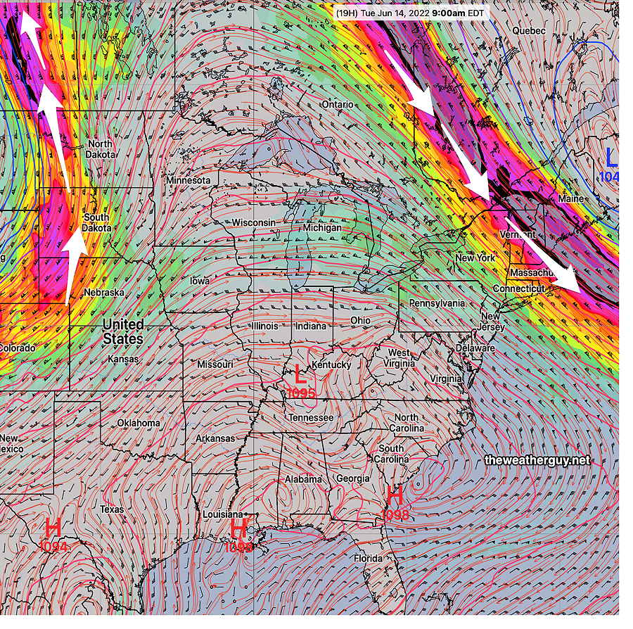
Update Wed @ 9:55 AM — A persistent upper air pattern has been with us over the past week or so. Any change has been short-lived, as the same pattern reasserts itself. The upper ridge pattern in the middle of the country today is very similar to what it will be this weekend—

But before we get to the weekend, a warm front moves through late tonight and early Thursday morning with clouds and some showers/possible thunderstorms early Thursday morning—
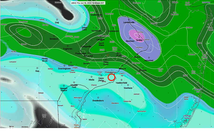
Clouds clear for some very warm humid weather Thursday afternoon. A cold front moves through late Thursday night. Current forecasts have most of the activity to our north with this front.

