
#weather #paweather #wx #pawx #philadelphia #phillywx
Wednesday Forecast Update
Update Wed 04/26 @ 9:48 AM — Some showers are moving in a bit earlier than forecast by most of last night’s models (with the exception of yesterday’s NAM-NEST). Additional scattered showers expected especially mid to late afternoon and evening. There will be breaks of sun at times today.
(It’s interesting that the two most recent NAM-NEST model runs did not show the showers this morning, but yesterday’s 18z run did. Such is the state of precipitation forecasts.)
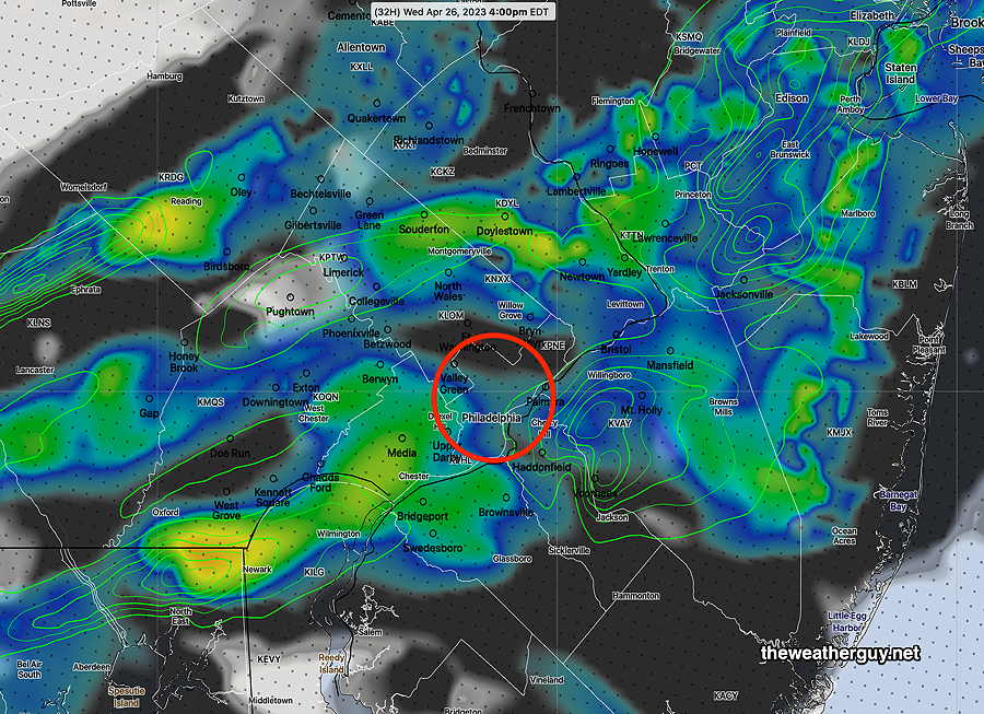
According to the latest HRRR (12z) most of the showers will develop during the late afternoon and evening and most of the activity (not all) will be a bit north of the city—
Wednesday Forecast Update
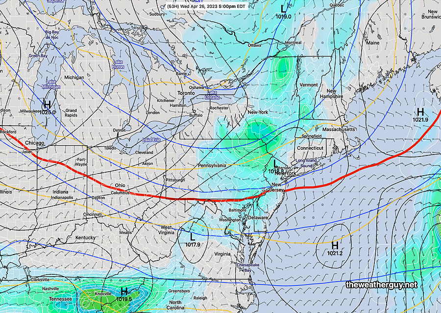
Update Tue 4/25 8:28 PM — No significant change in the forecast from the forecast made this morning (below). Inspection of this afternoon’s models suggests that a warm front type situation will be part of the trigger for the showers Wednesday. The showers will be scattered and there may be breaks of sun with any showers. Any sunshine will increase instability promoting the possibility of low level thundershowers.
It still looks like plenty of rain this weekend, as early as Friday, but there are timing differences now between the GFS and the ECMWF. So it may rain Saturday or Sunday or both days. Or some of the rain may be late Sunday, with rain-free periods during the daytime. Too soon to nail that down.
Update Tue 04/25 @ 10:14 AM — It does appear that some scattered showers and low-level thundershowers will develop during Wednesday afternoon. Clouds move in late morning and showers/thundershowers can be expected from about 1 PM to 8 PM.
The scattered showers will develop dynamically in-place, rather than moving in from the west as a upper air wave moves through.
Here’s the latest HRRR cloud/radar forecast—
FYI, the models continue to forecast a fairly rainy weekend, now including Saturday and Sunday. Updates later.
Focus on Wednesday and after
Update Mon 4/24 10:27 PM — This afternoon’s models still have some showers on Wednesday but the timing ranges from starting in the early afternoon or early evening in our immediate area.
This weekend’s weather still looks very ‘interesting’ as heavy rain is looking more likely on Sunday from a stalled surface low enhanced by a highly amplified jet flow. Unsettled weather is possible late Friday and even some part of Saturday from the same system.
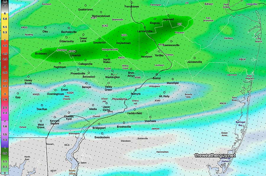
Update Mon 04/24 @ 8:57 AM — Last night’s models are signaling a change in the forecast as early as Wednesday. An upper air low pressure system north of the Great Lakes will rotate a disturbance through our area on Wednesday —
Here’s the latest NAEFS forecast for Wednesday showing weak low pressure over us—
The disturbance is weak, but enough to set off some showers on Wednesday. So what appeared to be a quiet few day of weather has changed into something less straightforward.
Today, Monday, and Tuesday will be the nicest days of this week. (Today will have some periods instability cloudiness develop in the afternoon.)
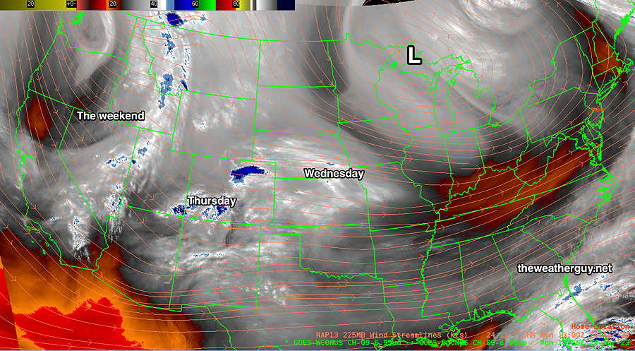
Additional disturbances and a developing trough (labeled “The weekend” above) will affect us Thursday through the weekend.
Quiet and Cooler
Previously Posted Sun 6:50 PM —
An upper air disturbance brought some clouds late today, Sunday, after a beautiful, mostly sunny day in the immediate PHL area. Areas east of us in NJ had some lingering clouds from the system that gave us the rain last night.
Following this disturbance, cooler air will be moving in for much of the first half of this week. Not much happening Monday through Wednesday, as high pressure and cool temperatures control our weather. Mostly sunny, some instability cloudiness at times.
We may get affected by a disturbance moving to our south on Thursday, with a chance of some showers.
Things look ‘interesting’ for next weekend. A highly amplified upper trough will develop and the models are showing a coastal secondary low that may develop and linger. There’s fairly good agreement among the ECMWF and GEFS models for this to occur. Cool, breezt and very rainy weather is expected. The time frame, depending on the model, is as early as Saturday, possibly lingering through part of Monday. I’ll keep an eye on this during the week.
Here’s the current NAEFS forecast for next Sunday—
