
#weather #paweather #wx #pawx #philadelphia #phillywx
Friday Forecast Update
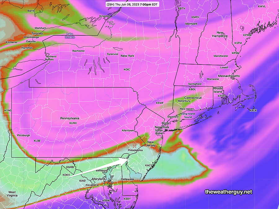
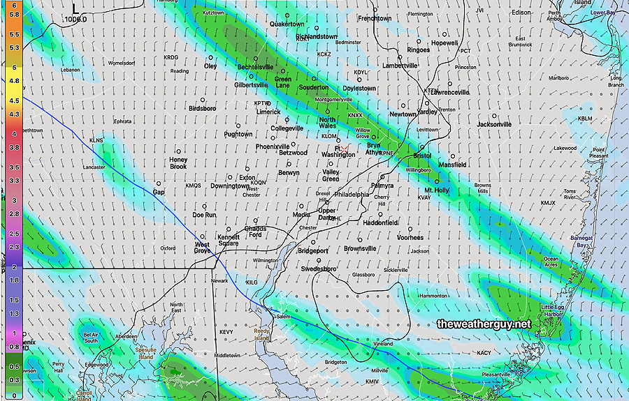
Update Fri 06/09 @ 9:20 AM — A disturbance rotating around the upper low over eastern Canada will bring a mix of cloudiness and sunshine late morning into the afternoon and evening. Most models keep any showers too far to our west, but the Canadian models have been consistently forecasting the possibility of light showers around here, most likely during the evening—
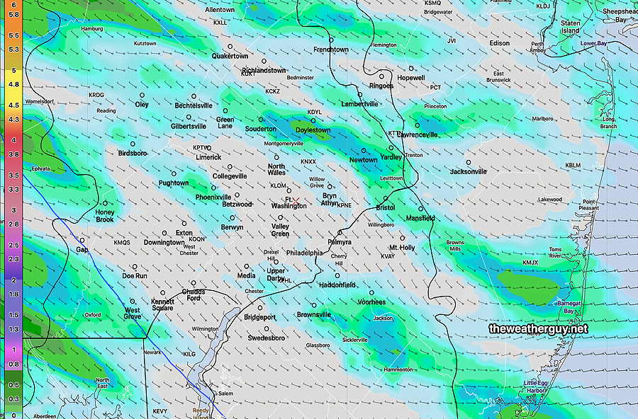
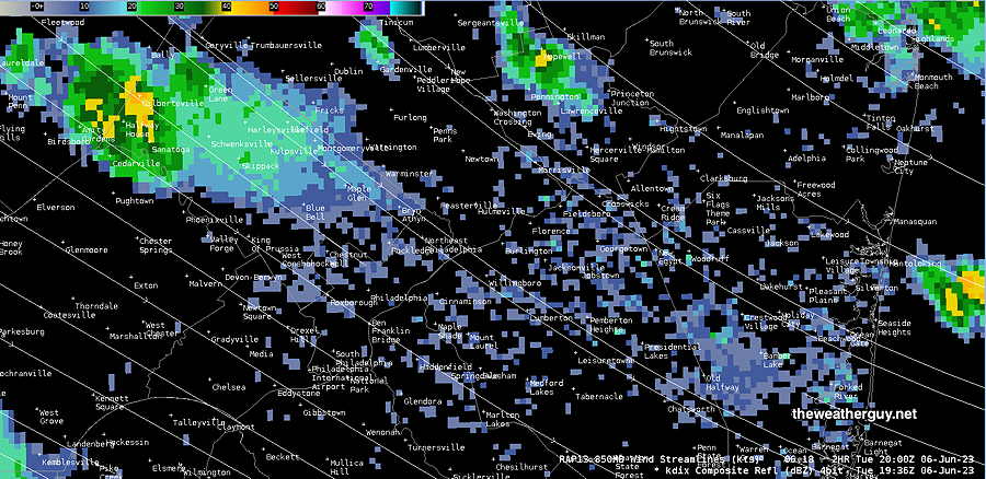
Showers, if any, will be light and scattered. Update Fri 06/09 @ 9:47 AM — This morning’s RAP and HRRR are more similar to the above HRDPS. showing more shower activity in and near Philadelphia. The RAP shows a line of showers/thundershowers about 8-9 PM passing through Philadelphia.
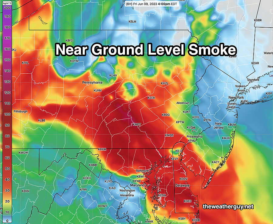
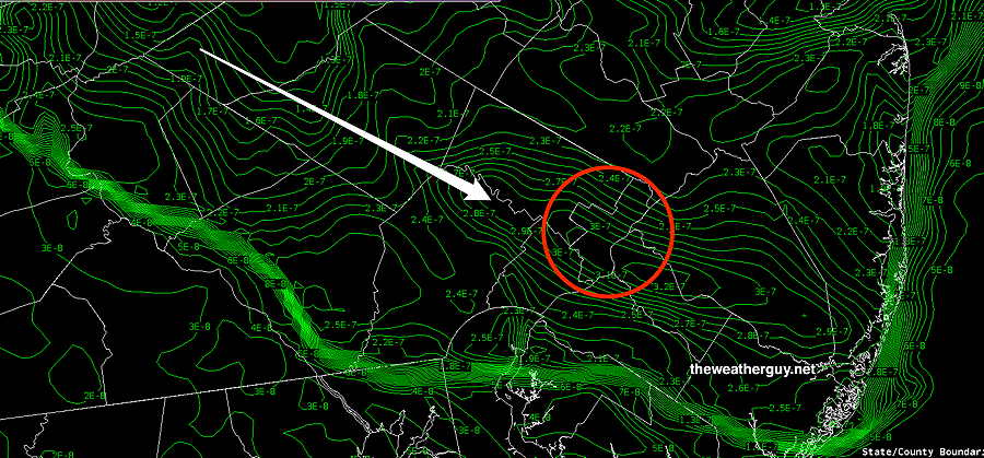
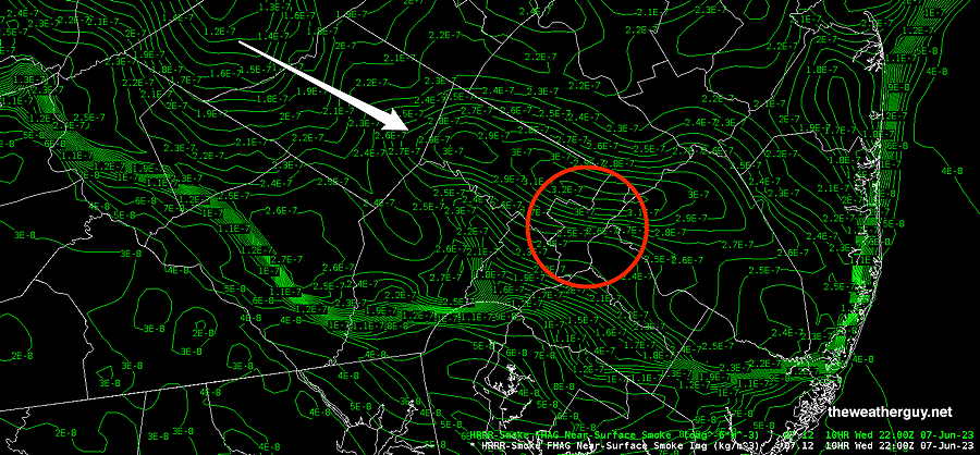
As for smoke, here’s the very latest smoke level forecast at near-ground level for 4 PM Friday—
The weekend is looking much warmer and currently, no rain is forecast. A change in the general weather pattern still on-track for next week.
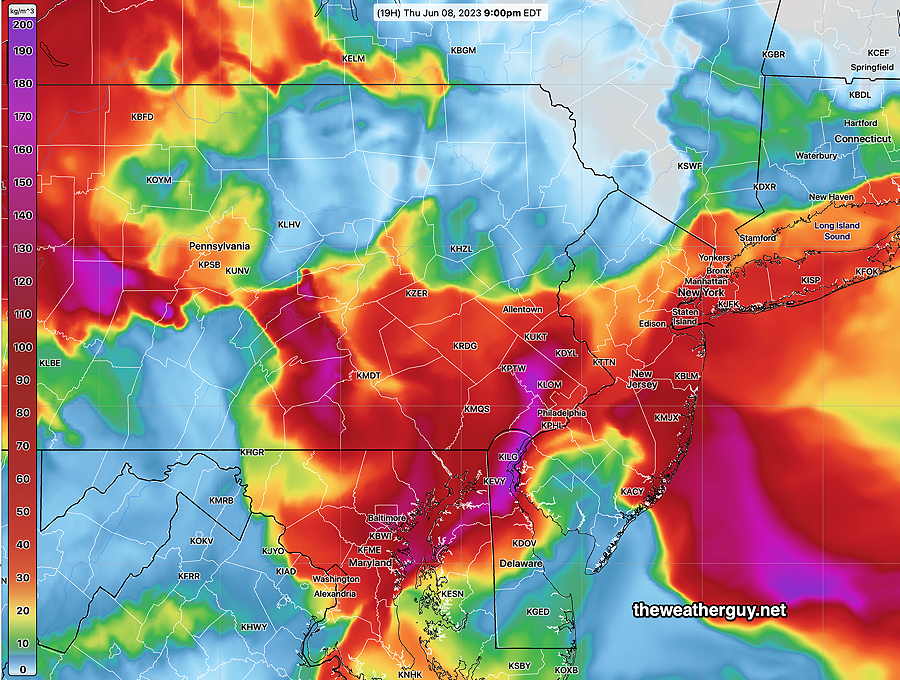
Philadelphia Smoke & Friday Forecast Update
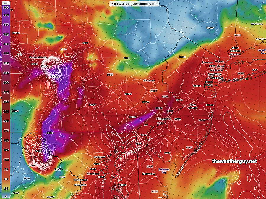
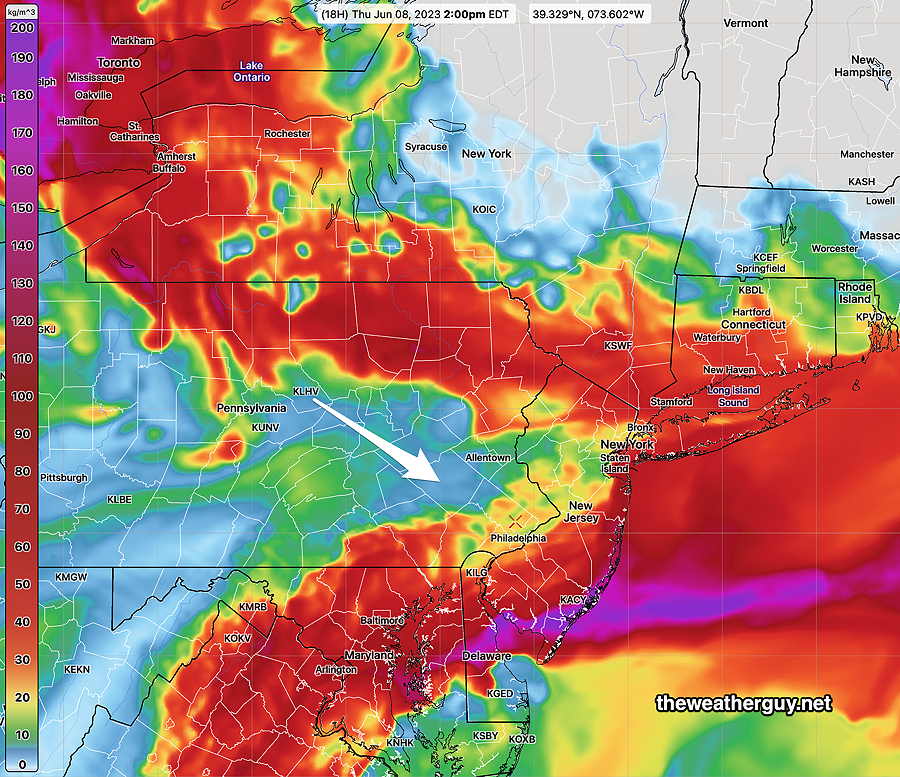
Update Thu 06/08 @ 5:58 PM —Smoke levels improved this afternoon, but it appears that more smoke and particulates will move through through this evening, before the end of the Phillies game.
This evening’s smoke levels—
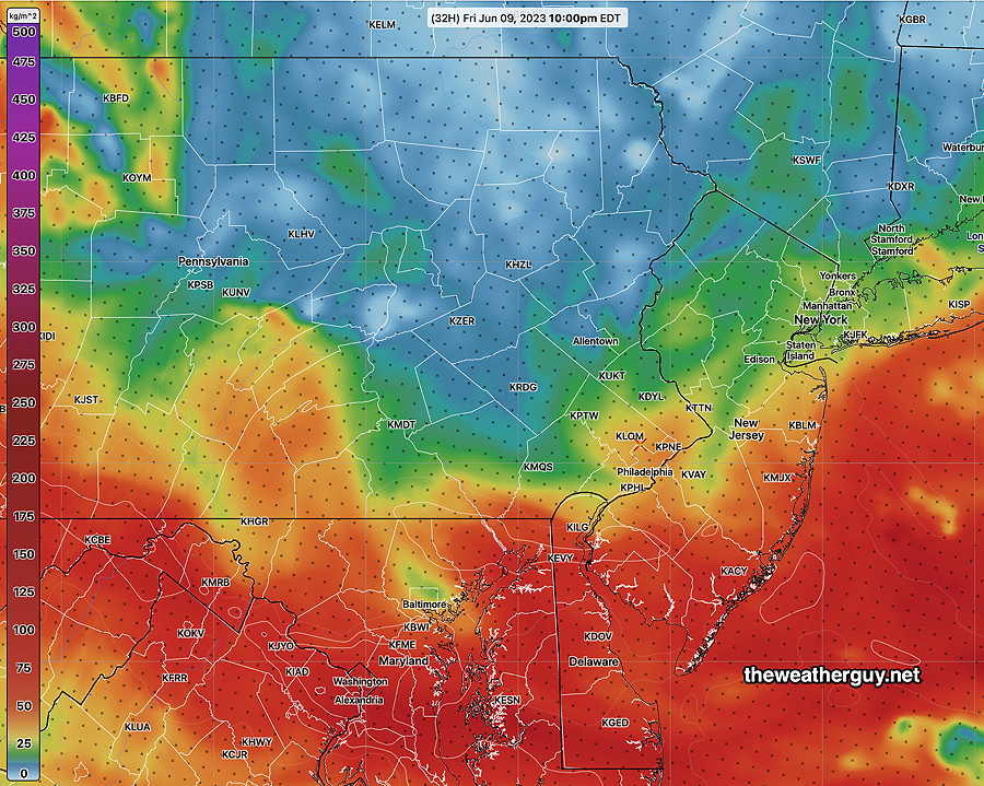
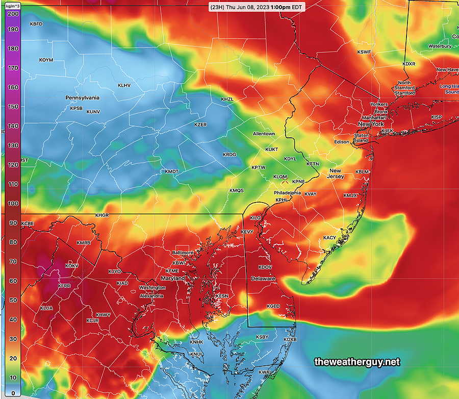
For Friday evening, about 24 hours later, smoke levels improve significantly—
Friday — As for the weather, some scattered showers and thundershowers are possible Friday afternoon and evening. Most of the activity will be far west of the city and near the Jersey shore.
Philadelphia Smoke Forecast Update
Update Thu 06/08 @ 7:25 AM — Here’s the latest HRRR extended smoke forecast. This is the forecast for smoke at ground level to 8 meters above ground level (about 26 feet above ground)
By noon, the air quality at ground level is improved, especially west of Philadelphia—
The forecast above is for smoke levels 8 meters above ground. While the ground level smoke will be significantly reduced in some areas today, the sky will look quite hazy and smokey due to high levels of smoke still being present at mid and upper levels of the atmosphere.
Unfortunately, the HRRR shows low level smoke increasing during the second half of the Phillies game tonight at 9 PM—
Regarding rain on Thursday, while some areas far northwest and in Delaware/Maryland may get some showers this afternoon and evening, little to no rain is currently expected in the Philadelphia area today.
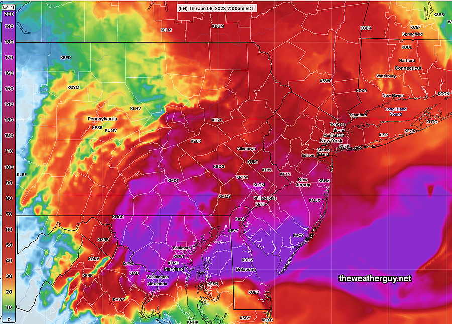
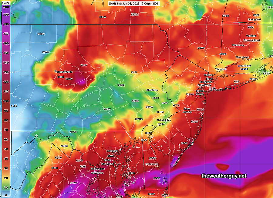
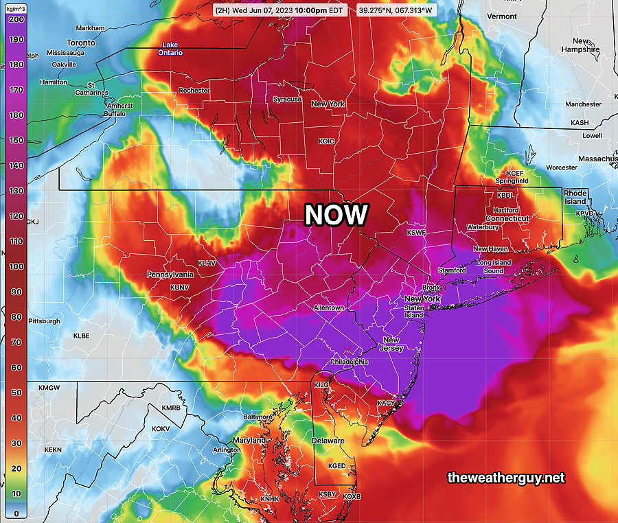
Philadelphia Smoke Forecast Update
Update Wed 6/07 @ 10:22 PM — The latest HRRR shows the Philadelphia area in the thick of smoke at 10 PM—
The HRRR shows that things improve temporarily Thursday afternoon near ground level—
Update Wed 06/07 @ 8:35 PM — As I mentioned earlier, I never thought I’d be programming for HRRR smoke model downloads for Philadelphia. I’ve gotten a better handle on these specific parameters and I’ve updated the graphics.
This afternoon’s HRRR shows things improving at the surface during the early afternoon Thursday, but things get nasty again during the evening.
Most HRRR model runs only forecast out to 18 hours. The next HRRR model run that forecasts out to 48 hours will be available after 10 PM. I’ll update later this evening with the new HRRR regarding the smoke forecast for tomorrow.
As for the weather pattern change, it’s still on track. Some showers are possible later Friday and some rain later Monday, as the jet stream finally flattens and the blocked pattern breaks down by next Wednesday.
Philadelphia Smoke Forecast
Update Wed 06/07 @ 5:50 PM — I never thought I would have to download a smoke forecast parameter for the Philadelphia area. But the HRRR model has a separate model for smoke (particulate matter- fine) and I’ve spent a fair number of hours today leaning how to program the download and process this parameter.
It appears that the current HRRR model keeps the heavy smoke with us through most of Thursday, with some improvement early Thursday evening in southern areas as some cleaner air punches in from the west.
Where there’s smoke there’s fire
Update Wed 06/07 @ 9:42 AM — The current smoke situation here is a serious health risk. All the result of the incredible stretch of dry weather that has affected the local Philadelphia region but also areas in Canada.
One of the many capabilities of the HRRR is low level smoke concentration forecasts. Here’s the current HRRR analysis at 8 AM today—
Unfortunately, more smoke is on the way. Here’s the HRRR forecast for this afternoon and evening—
Update Tue 06/06 @ 5:40 PM — Despite some radar echos, most areas had little rain. Perhaps the RRFS will be a big improvement in forecasting when it’s released the end of this calendar year?
Wednesday looks to be sunny and continued cooler than average, with highs in the mid 70s.
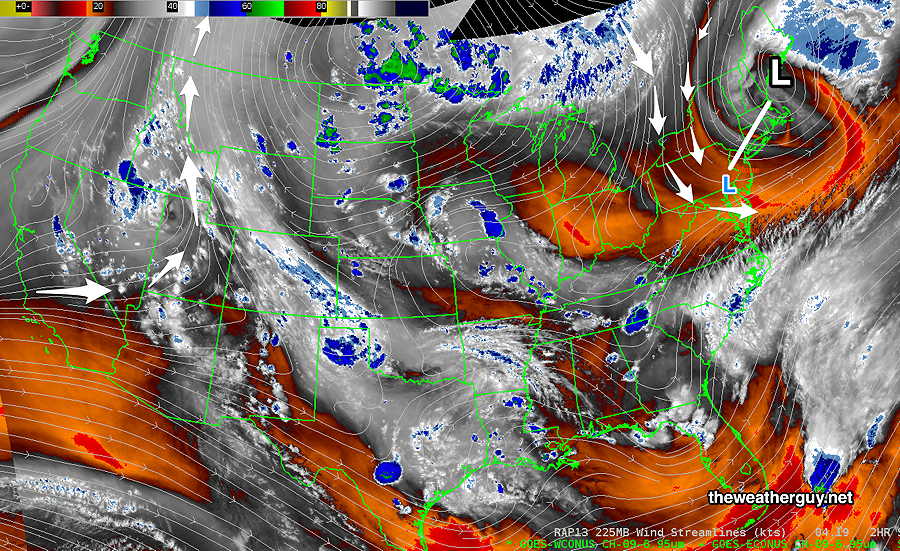
Several models are now forecasting a large scale change in the stagnant jet pattern and are predicting rain for our area next Monday and Tuesday. A significant change in the jet stream pattern is expected by next Wednesday through Friday.
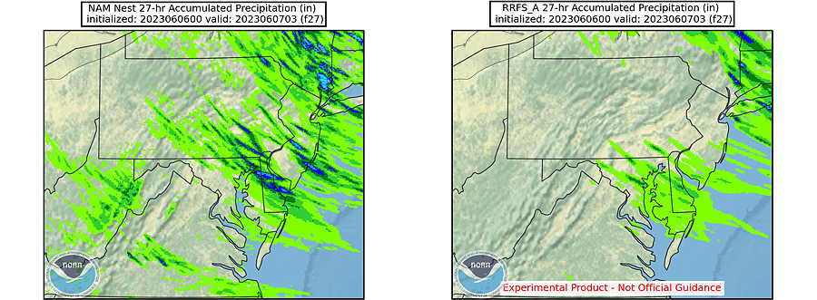
Update Tue 06/06 @ 7:23 AM — The uncertainty with the isolated/scattered showers this afternoon continues. Capturing this is a forecast comparison between the NAM-NEST (also shown below) and the new RRFS model (still experimental)—
There’s another chance of showers this Thursday afternoon or evening.
Update Mon 06/05 @ 5:32 PM — It’s been back and forth with the chance of showers on Tuesday. There’s a range from little to nothing with the GFS, while the NAM-NEST is forecasting the most shower coverage. Showers possible as early as 2 PM, but 4-6 PM is most the most likely time frame. Most areas will see no showers.
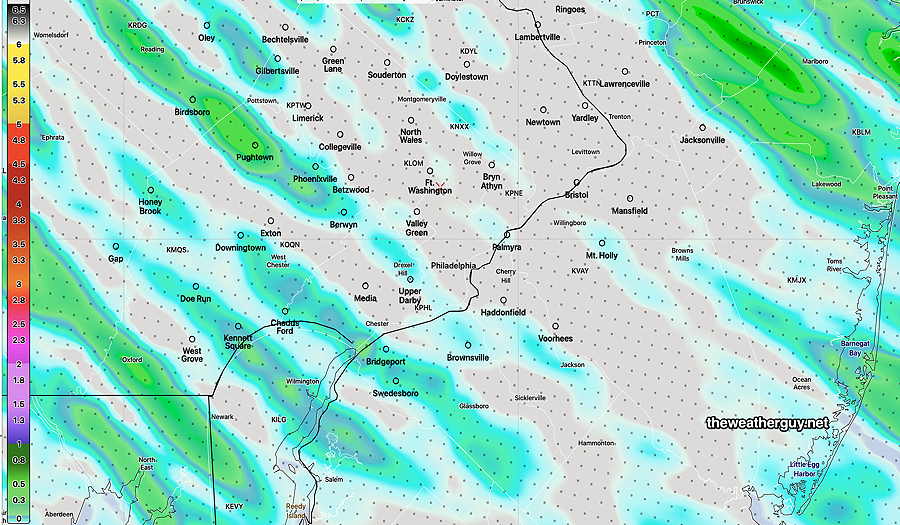
Here’s the NAM-NEST total accumulation forecast for Tuesday which is at the high end—
The Canadian HRDPS is probably the closest to the HREF and HRRR and is probably closer to the the likely actual amounts and coverage—
The experimental RRFS has almost no shower activity.
Update Sun 06/04 @ 8:37 PM —I think l need to retract that ‘dry’ forecast for Tuesday. Several of this afternoon’s models (18z) are showing scattered shower/thundershowers, similar to what we had the other day.
Previously Posted Sun 5:08 PM —
The blocking pattern (Omega block Ω ) that’s been with us for weeks will maintain it’s hold over our weather through the coming week.
(There are finally signs that the block will break down between the 10th and the 15th of this month and we’ll see a change to a more typical summertime pattern likely next week —More heat, more humidity, maybe more thunderstorms.)
Monday looks to be mostly sunny to partly sunny/partly cloudy in the afternoon.
Tuesday: Regarding the current blocking pattern, a deep upper cyclonic flow currently over New England will rotate a disturbance around its center resulting in the formation of a surface trough moving through our area on Tuesday.
For Tuesday, the latest GFS, ECMWF and today’s earlier NAM-NEST have some potential showers moving through, both earlier in the day and especially late afternoon Tuesday. We could use the rain.
Unfortunately, the latest NAM-NEST, Canadian GEM and the still-experimental RRFS have little in the way of showers for us from this system. (Little in the way of clouds too.) I’m leaning towards a fairly dry Tuesday for us.
After a sunny Wednesday, another disturbance may rotate through on Thursday with more clouds and maybe some sprinkles.