#Philadelphia #weather #PAwx
Friday and Saturday
Posted Thursday 03/21/24 @ 8:28 PM — Friday looks to be one of the better days this week. While temperatures will still be colder than seasonal average (56º average while Friday ~50º), winds will have reduced considerably and we’ll see sunshine in the morning and early afternoon. This afternoon’s models show an area of cloudiness moving in about 2-4 PM from the south, out ahead of the storm to affect our area Friday night into Saturday.
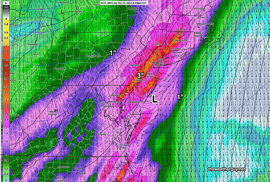
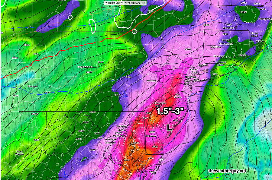
Saturday still looks cloudy with heavy rain. The exact axis of the rain now varies from model to model but many areas will see at least 1.5″ to up to 3″.
RRFS and ECMWF Open Data
Yet Another Heavy Rainstorm
Posted Thursday 03/21/24 @ 9:24 AM — The forecast for Saturday continues to trend towards higher rainfall levels. A storm, originally thought to move east into the Atlantic, just brushing us, now has a forecast track that has its heavy rainfall axis directly over the Delaware Valley on Saturday. The latest ECMWF continues that trend with rainfall here in the 3″ range.
It’s also looking VERY WINDY Saturday night. Stay tuned.
Colder Thursday- Heavy Rain Saturday
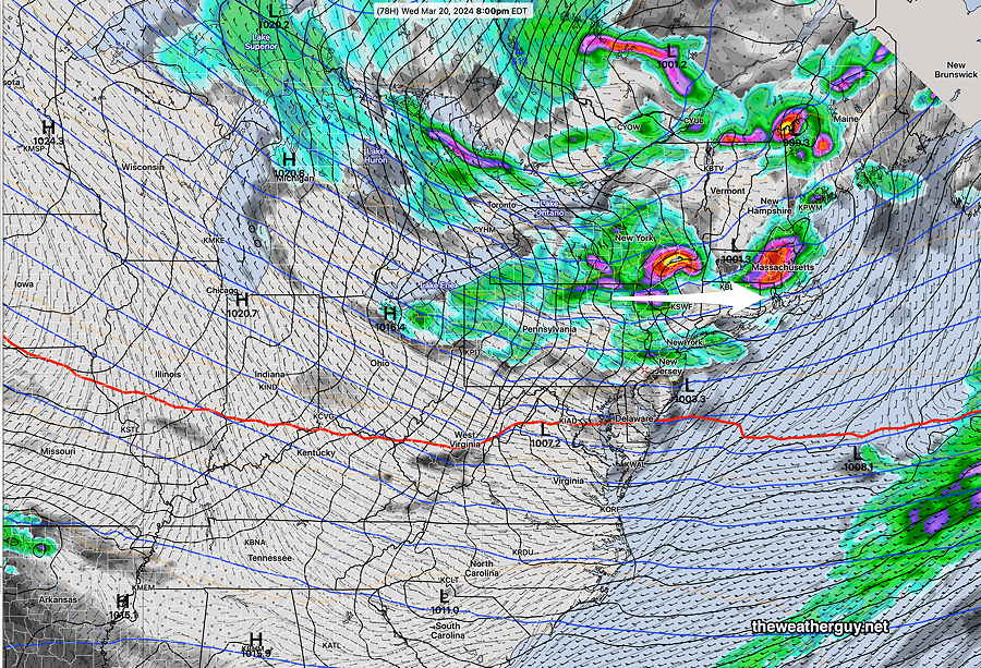
Posted Wednesday 03/20/24 @ 8:39 PM — The cold front moved through and the high winds predicted for this evening have developed. The latest RTMA shows there are wind gusts in the 40+ mph in and around Philadelphia this evening.
Thursday should be sunny and still windy. It will be cold with highs of only 43º (Blue Bell) 45º (Philadelphia)
Friday sunny with highs 48º- 51º
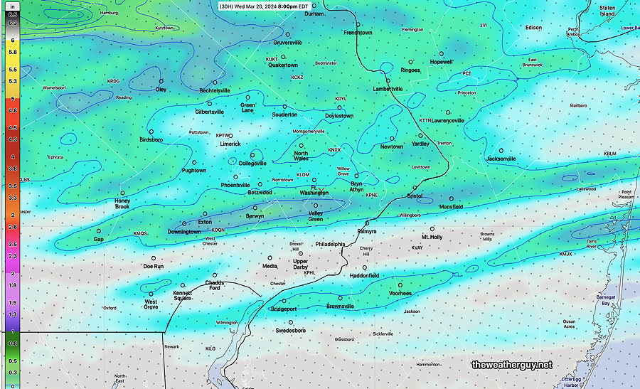
A coastal storm will affect us late Friday night after midnight through Saturday. Heavy rain, especially east into NJ. Another 1-3″ rainfall for our area!
Windy Somewhat Wet Wednesday
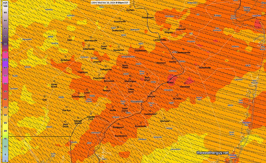
Posted Tuesday 03/19/24 @ 9:00 PM — I was thinking a few days ago that this week might be a bit boring here weather-wise, but another cold front behind a clipper disturbance will bring some very strong winds on Wednesday afternoon and evening.
Several models keep the light showers north of the city, but the trend this afternoon has been for showers to move through parts of the city as well.
Winds gusts are expected to be high, especially late afternoon and evening. The NAM-NEST has gusts 35-40+ mph. (The Canadian HRDPS is in its own realm with gusts near 50 mph, but it shouldn’t be totally ignored. )
Saturday is looking rainy from a coastal storm, originally expected to move to our east, but now appears to track westward and bringing another 1″ plus of rain to our area, greater amounts east in NJ.
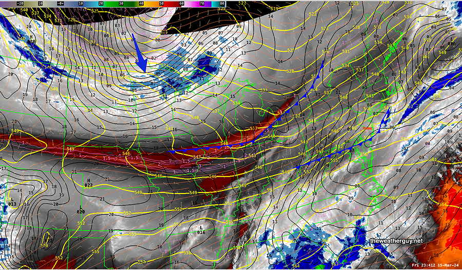
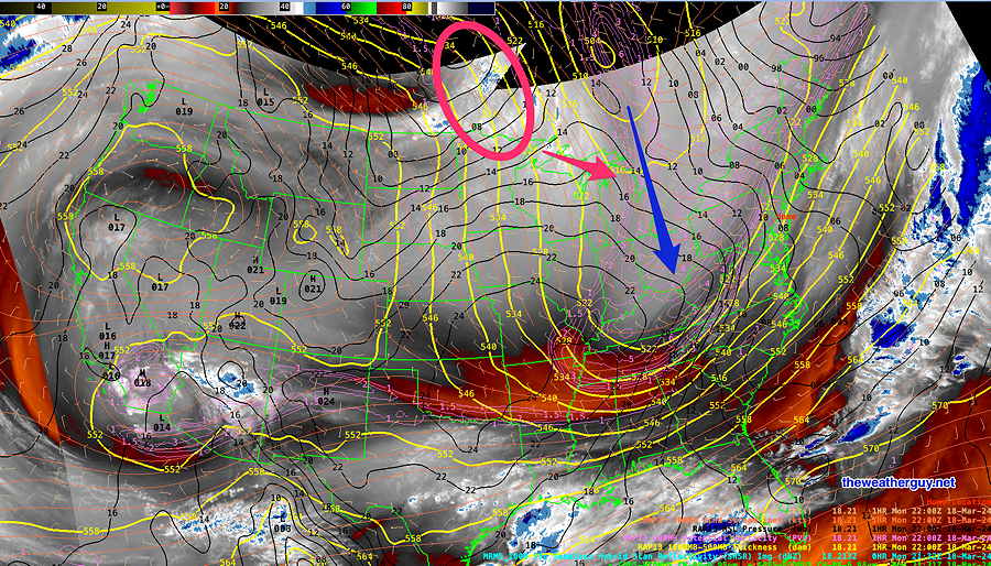
Posted Monday 03/18/24 @ 6:15 PM — We had periods of clouds moving through today from “lake effect” precipitation that stayed in northwest Pennsylvania. The coldest core of this cold outbreak is poised to move in on Tuesday. Here’s the latest water vapor image—
The models are in increasing agreement with a clipper disturbance bringing light showers on Wednesday, with the ‘heaviest’ precip north of our area. Total rainfall here looks quite light.
Some heavy rain looking more likely late Friday into Saturday.
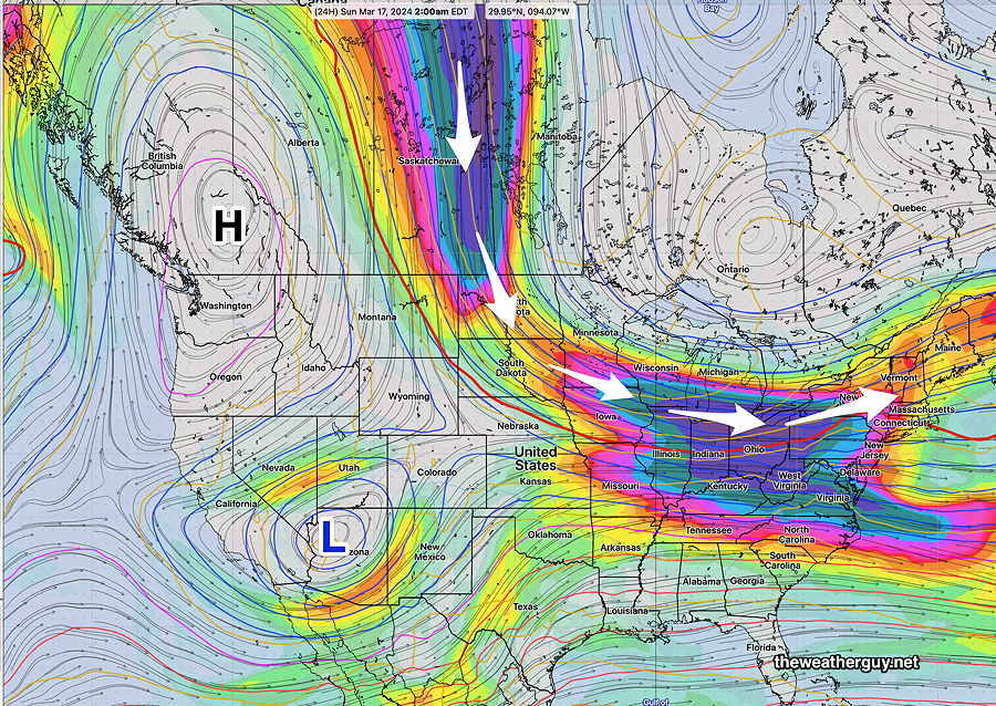
Originally Posted Sun 8:15 PM —For the coming week, the blocked pattern remains with our area being in the colder part of the jet flow. Not much happening beyond that.
Over past months, it seemed like every potential storm was inundating us with heavy rain. Things seem to have changed, with recent disturbances passing to our south and north.
The same is expected this coming week with a northern clipper disturbance late Wednesday staying mostly to our north and a more potent system later in the week (Friday-Saturday) that appears to stay [mostly] to our south.
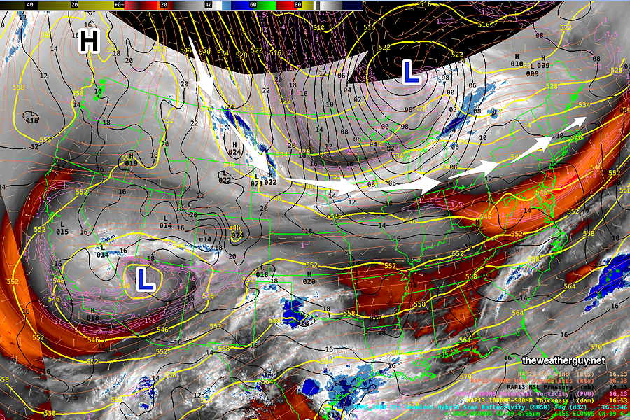
Here’s the current system for late Wednesday, according to the Canadian RGEM—
It’s been well-advertised that the coming week will be cooler/colder. Generally sunny skies expected but there may be periods later in the week where warm air tries to make it back here, resulting in some clouds.