#Philadelphia #weather #PAwx
Weekend Outlook
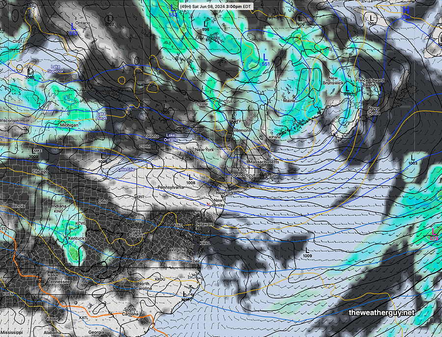
Posted Thursday 06/06/24 @ 7:44 PM —The forecast for Friday and the upcoming weekend is looking considerably brighter than it had been earlier this week.
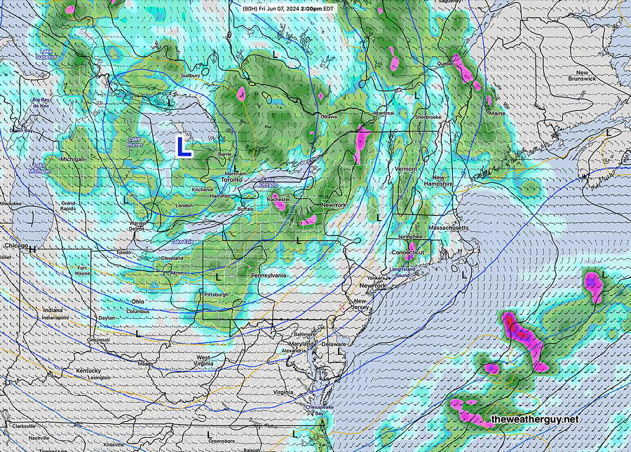
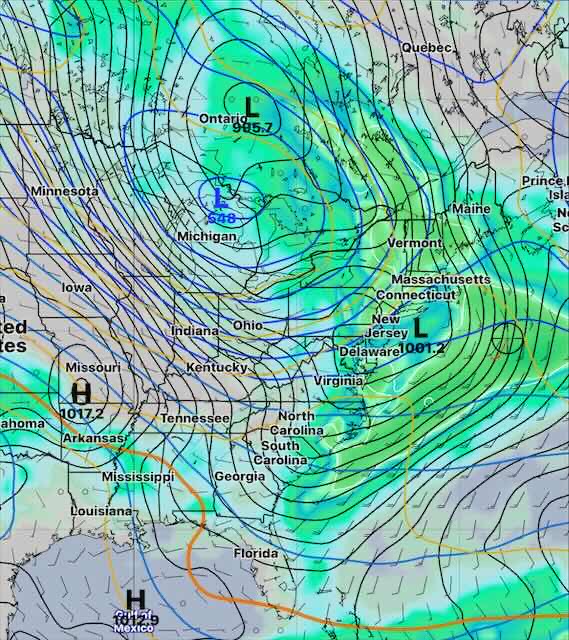
Most of the clouds and showers associated with the upper low in Canada will stay well to our north. Plenty of sunshine with occasional clouds is expected, and temperatures will remain somewhat below seasonal averages.
Expect highs in the low 80s Friday through Sunday. Some clouds and light scattered showers may still occur during the afternoon Sunday.
Specifically, the development of an increasingly dry pattern here in the Delaware Valley. We may begin to see the a similar situation to what we had last summer with very little rainfall.
That rainfall we had this past Wednesday night might be the last significant rainfall here for at least the next two weeks and possibly longer.
While not surprising for the middle to end of June, I do see some very hot weather here by about June 15th. That heat dome, once established, may persist.
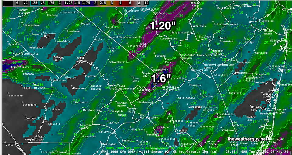
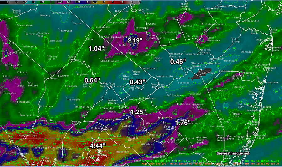
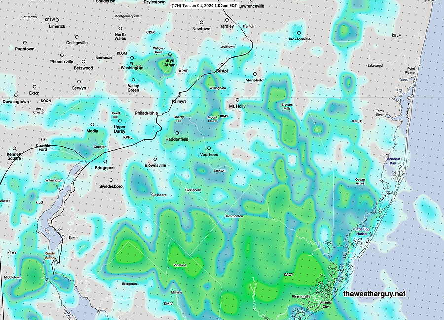
As expected, many areas received only small to moderate rainfall, less than 1/2 inch.
Here’s the MRMS rainfall summery —
Thursday- Afternoon Shower/Thundershowers
Posted Thursday 06/06/24 @ 7:40 AM — An upper air disturbance will move through today, Thursday, between 2 PM and 6 PM from the northwest. Expect some showers and thunderstorms to move through at that time. Some gusty winds and quick moving heavy rain possible in some locations. Before that time, we may see some sunshine or sunhine though high clouds.
Heavy Rain Possible in Some Areas
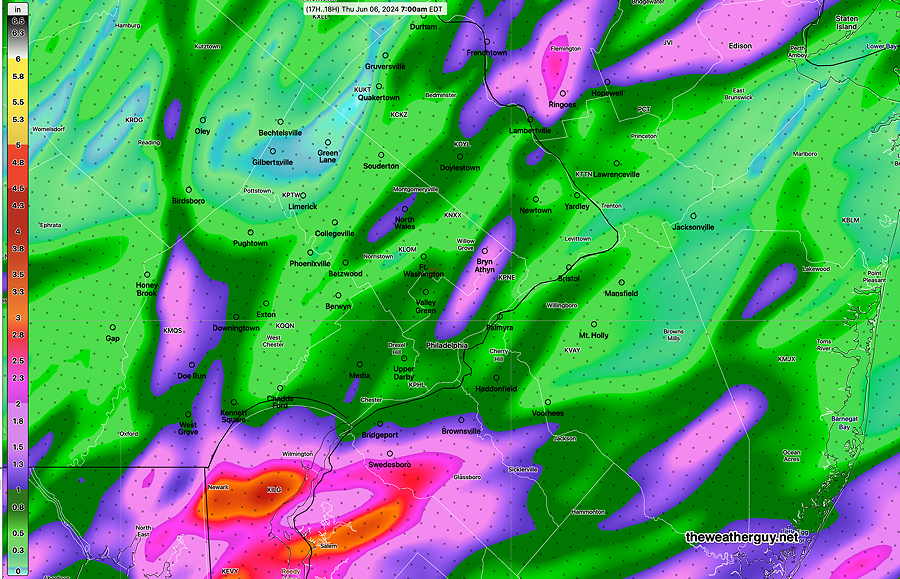
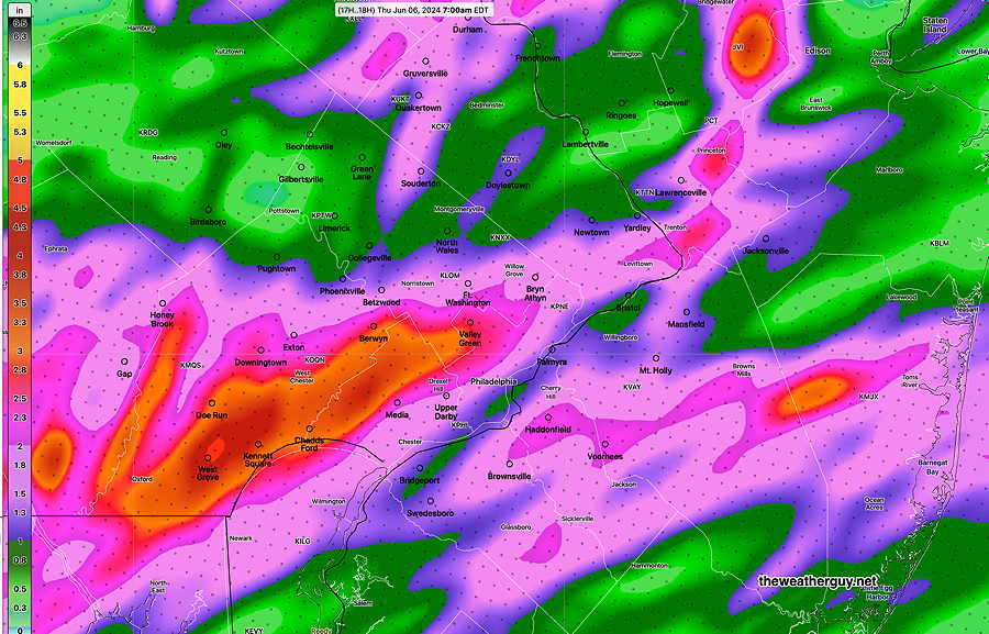
Posted Wednesday 06/05/24 @ 4:38 PM — The models have come together with rain moving in from the southwest between 6 and 8 PM Wednesday evening. The models are forecasting areas of heavy rainfall in some areas; as always, they differ in the exact location.
Some of the rain will come in the form of thunderstorms. While some storms may be strong, severe weather doesn’t appear likely.
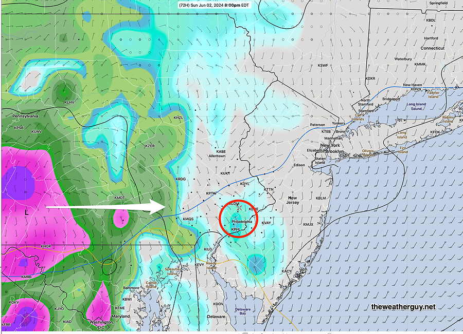
The following two images shows the difference in location between the latest HRRR and the latest NAM-NEST heavy rainfall forecasts—
Posted Wednesday 06/05/24 @ 7:41 AM — The question for today- when will the rain start in the Philadelphia area. My forecast yesterday, based on the Canadian models, had activity moving in as early as 1-3 PM. This rain is associated with a warm front.
Today, the Canadian models, along with a good many others, have a later start for the rain, between 6 PM and 8 PM. The GFS has some activity breaking out ahead of the main area of rain as early as 4 PM and the latest NBM also has some light activity as early as 4 PM. So quite a range!
Either way, the heavier showers and possibly thundershowers will be here between 6 and 8 PM and continue until at least midnight to 2 AM. The heaviest activity will be in southern Chester county and down near Wilmington DE.
On Thursday morning, a lull in activity, followed by additional rain by late morning into the afternoon.
Friday looks cloudy but dry now. Saturday looks pretty good, especially at the NJ shore.
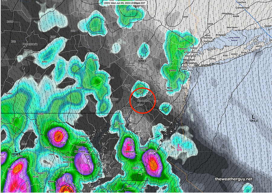
Posted Tuesday 06/04/24 @ 4:50 PM — There’s been a shift towards an earlier start for the showers moving in on Wednesday. We’re back to an earlier start of about 1-3 PM moving in from the west-southwest. While the showers will be widely scattered at the start, expect the rain to fill in by late afternoon and early evening.
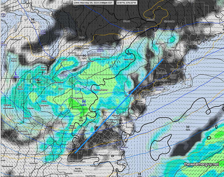
This morning’s Canadian RGEM had the best forecast for the showers south of us along the Chesapeake occurring right now. Here’s its forecast for 2 PM Wednesday—
Just an aside— while we’ve had plenty of rain showers over the past month, most of the rainfall in the immediate Philadelphia area and South Jersey has been on the light side in most areas. We haven’t had those 1-3 inch generalized rainfalls recently. Nor have we had any lines of heavy thunderstorms. A trajectory towards a drier summer??
Posted Tuesday 06/04/24 @ 9:08 AM — Tuesday should be sunny, warm and pleasant. Any instability showers late afternoon will be west of Lancaster and Reading.
Wednesday looks to be mostly cloudy. Some models have the showers from the next system moving in as early as 2-3 PM. A majority of models hold off the showers until the evening.
This past Sunday, it looked like the period between late Wednesday through this coming weekend would be stormy. Things have backed off and it appears that the word to describe this period would be “unsettled”, with much of the energy and heavy rain sliding off to our far northwest.
We’ll have to see how the upper low and the surface lows position themselves for a more definitive forecast for late Thursday into the weekend. A nicer weekend now looks possible with the showers staying far north for Friday and much of Saturday. Sunday maybe not.
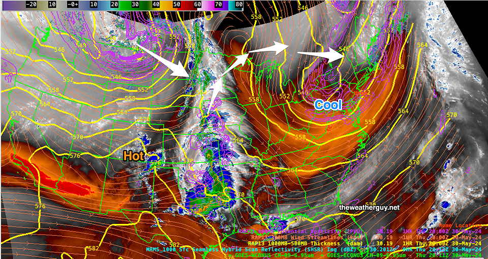
Nonetheless, the upper air contours were mostly anticyclonic and there was not enough upward vertical motion present to get things going.
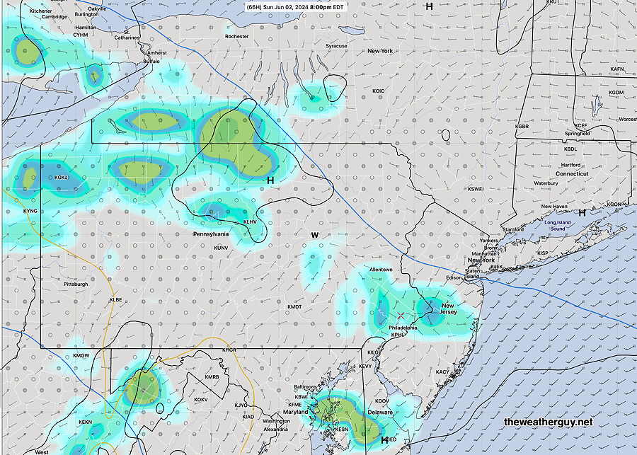
Posted Monday 06/03/24 @ 9:48 AM — An upper air disturbance along with moisture and thermal instability will result in scattered showers and thundershowers today, Monday, after 4 PM. Most models have most of the showers from Philadelphia and southward, as shown by the latest model blend (NBM), although the latest GFS has some additional activity further north—
For Tuesday, sunny skies in the morning will have some clouds and sunshine through high clouds in the afternoon. Showers develop to our west Tuesday evening as the next weather pattern develops.
Beginning early afternoon Wednesday , our area comes under the influence of a slow moving upper trough and associated surface low pressure systems. Considerable rain, showers and thundershowers are likely, possibly into the weekend.
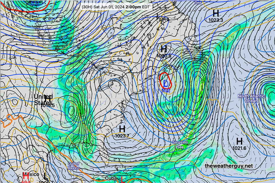
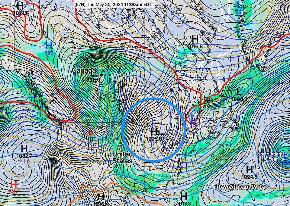
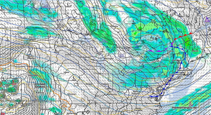
Originally Posted Sun 7:31 PM —Following a weak upper air disturbance that will move through late Monday afternoon and evening with widely scattered showers and some thunder (mostly affecting areas to our south and South Jersey), we’ll be moving into a somewhat blocked pattern with an upper trough dropping into the eastern US.
The trough will become entrenched by late Wednesday—
Showers and thunderstorms expected by Wednesday afternoon and unsettled weather through at least Friday.