
#Philadelphia #weather #PAwx
Rain-Free through Sunday
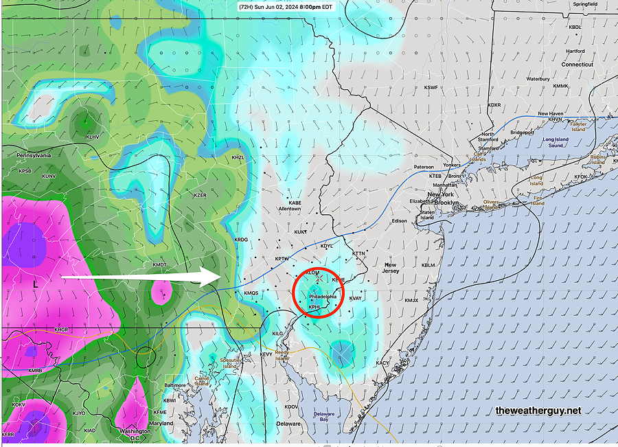
Posted Friday 05/31/24 @ 9:13 AM — The latest model runs have backed off on the light showers that had been expected to move in during the day on Sunday. It now appears that we’ll have gradually increasing clouds and any light showers, if any, won’t move in until early Sunday evening.
The latest ECMWF , which had been quite aggressive with the rainfall Sunday evening, has joined the latest GFS with little in the way of rainfall—
So a very nice weekend overall.
Saturday we’ll get into the low 80s (81-83º) and Sunday (82-84º) Due to the cloud cover, there’s a bit more uncertainty regarding high temps on Sunday.
Delightful through Saturday
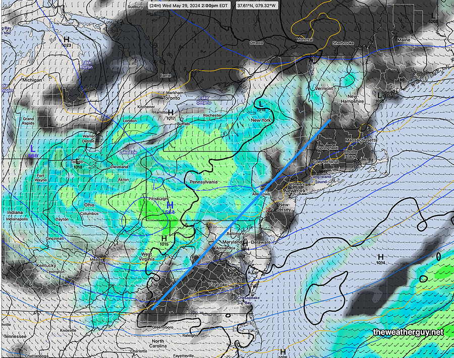
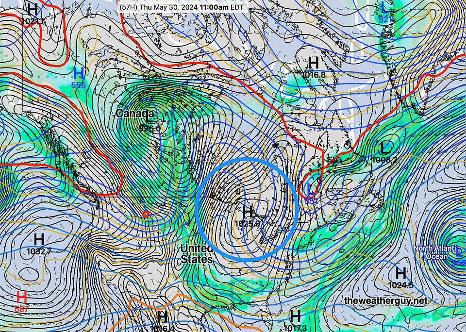
Posted Thursday 05/30/24 @ 9:42 AM —The cold front moved through last night and unseasonably cool delightful weather will be with us through Saturday.
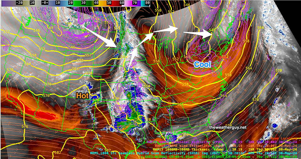
Current water vapor imagery shows the air mass over our area and the disturbances setting up to move in sometime Sunday—
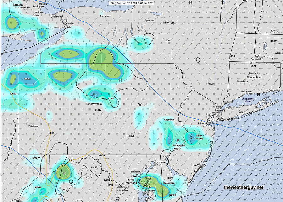
The big question is the timing of the next system on Sunday. Current trends are for it to be cloudy with light showers possible in Philadelphia Sunday afternoon. The light showers may arrive at the shore later in the evening.
Gusty Showers/Thunderstorms Wed Evening
Posted Wednesday 05/29/24 @ 8:39 AM — A cold front associated with an upper and surface trough will move through this evening.
The models have come together with a time frame of 6-8 PM, earlier southwest Chester county, for showers and embedded thunderstorms to move through. Some locations will receive an inch of rain, while adjacent areas less than a quarter of an inch. So the heavier rain will be spotty and localized. The heaviest rain is expected northern Bucks county and north of Allentown, as well as north central NJ.
The experimental RRFS model didn’t do bad for last Sunday’s rainfall. Here’s the RRFS total rainfall forecast for this evening—

As mentioned yesterday, the storms will move in from the southwest with gusty winds, which appears to be the main potential hazard. Truly severe weather not expected.
Skies clear by daybreak Thursday.
The weekend had been looking fine, but the latest NAEFS shows a warm front with showers moving in on Sunday—

Showers later Wednesday Afternoon
Posted Tuesday 05/28/24 @ 7:44 PM — A surface and upper trough approaches Wednesday with an increase in clouds after noontime with with showers and maybe some thunder during the afternoon.
Western suburbs may see some showers as early as 1-2 PM, but many models hold off the showers until 4-6 PM closer to the city. Some models are showing gusty winds preceding the showers late afternoon.
Total rainfall looks to be light. Showers continue into early Thursday morning with rapid clearing by about 10 AM. Becoming windy.
Cooler and windy for Thursday afternoon.
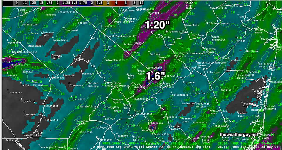
Previously Posted Tue 12:20 PM —Sunday’s rains were not all that heavy or severe. Here’s the MRMS-based rainfall summary —
Following a system that may bring us some rain later Wednesday, a large, cool high pressure system will bring very nice weather possibly through the weekend—
Next week should see a return to much warmer temperatures.