Model Blend low temperature forecast for Friday night (before daybreak Saturday) —
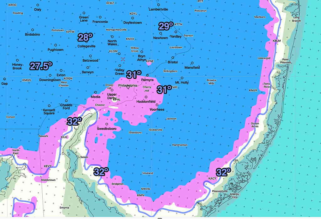

Model Blend low temperature forecast for Friday night (before daybreak Saturday) —
Despite the complexity of the weather scenario regarding the remnants of Hurricane Zeta moving through our area, the models continue to show similarity in timing, and have the usual range of rainfall amounts. In general, the models show the heaviest rain from Philadelphia south into Maryland and Delaware.
This will primarily be heavy rain event for us, although some gusty winds (> 30 mph) are expected late Thursday evening into early Friday morning.
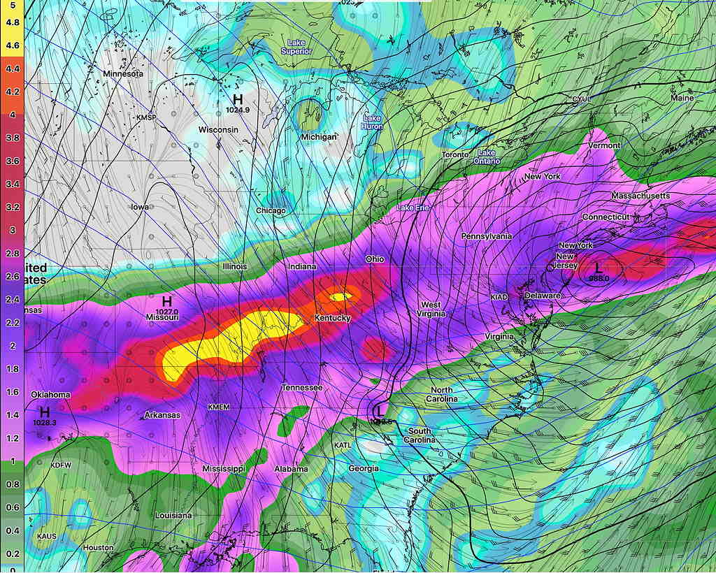
Here’s the range of expected total rainfall, with amounts in the 2-3.5″ (European) ECMWF, 2.0-2.6″ (Canadian GEM), German ICON 2.0- 2.5″.
The GFS and GEFS show 2.5-3.0″ of rain.
For some reason, the Model Blend (NBM) is in the lower range of 1.25″.
Rain starts after midnight Wednesday and continues through Thursday. Some lingering showers possible on Friday.
Temperatures near or below freezing are expected Friday night.
A complex weather scenario involving a strong upper air”closed low”, a surface low, and the remnants of Hurricane Zeta will affect our weather from Thursday into at least early Friday.
The complexity of this setup can’t be over-emphasized and it’s likely that no existing weather model can accurately forecast how this will finally come together. Despite the complexity, the models are in relatively good agreement right now.
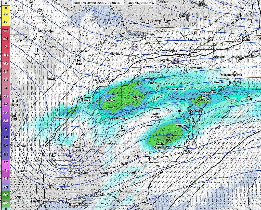
It appears that the upper air low and the tropical remnants will remain separate, preventing explosive development like we had with tropical storm Isaias. However, things could change and that possibility will need to be watched.
The models currently show a heavy rain event, starting Thursday morning and lasting into very early Friday morning. The CMC and GFS models have total rainfall amounts in the 2.0″ to 3.5″ range for the Philadelphia area.
As early as last Friday, the German ICON model was ahead of our GFS the Canadian models in predicting Zeta’s formation. The ICON model did very well with Isais’s precip totals. Here’s the latest ICON model cumulative precipitation forecast for the storm—
I expect changes in the forecast. Stay tuned.