A TASTE OF WINTER ON FRIDAY

Forecast Updated Thu 7:38 PM — Today’s models continue the trend of diminished transition to snow Friday morning; some models have eliminated that possibility entirely. Any changeover will occur before daybreak. Maximum wind gusts also occur about 2-4 AM. Friday will still be windy and chilly.


Forecast Updated Thu 7:30 AM — Last night’s models have begun to play down the amount of snow Friday morning.   The changeover to snow will occur around daybreak and the snow tapers off quickly.  Peak wind gusts, near 50 mph, will occur earlier as well, before daybreak.   Still very windy through Friday.


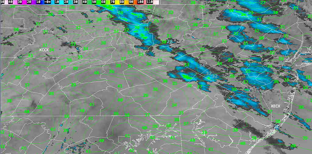
from Wednesday evening…

I wish I could say this coming Friday will be our last taste of winter this season, but weather forecasting beyond a week is fraught with limitations.

That said, most of today’s models continue with some heavy rain on Thursday with low pressure subsequently moving off to our south on Friday. 

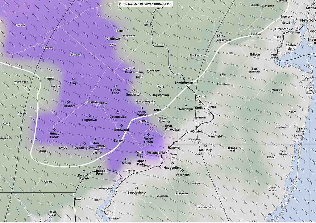
Cold air will be swept in behind the surface low and there is the expectation that a period of snow will develop Friday morning, as early as daybreak for some models but mostly likely around 8-9 AM.  A few hours of rain changing to sleet, then all snow is predicted as the precipitation tapers off.

Rapid Refresh Model (RAP) for 9 AM Friday morning. (violet is snow) (Click on image for a larger view.)

Surfaces will be wet and ground surfaces will not have chilled much, so little accumulation is expected; yet a coating of snow is possible according to the model blend (NBM).

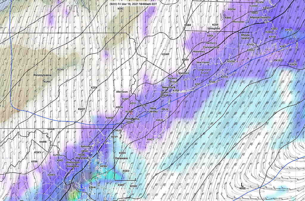
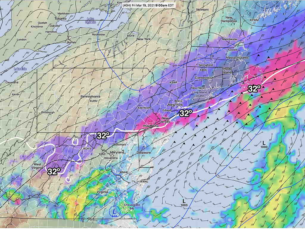
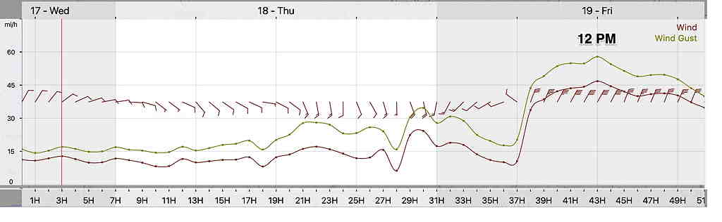
As cold and WINDY as it will be on Friday and Saturday, look for moderating temperatures by Sunday.   High wind gusts, according to the RAP

RAP Wind forecast Meteogram  (Click on image for a larger view.)

Next week promises temperatures in the 60s!  It won’t be long before the focus of this blog will be thunderstorms, not snow.

WEATHER OUTLOOK

Forecast Updated Tue 11:00 AM — For many areas, the snow never made it to the ground, although the model forecast was pretty good Here’s the current situation at 11 AM—

Current Radar and RAP temperatures  (Click on image for a larger view.)


from last night…

With current average high temperatures for this week running in the low to mid 50’s, today’s cold temperatures made it difficult to remember that [astronomical] Spring starts in another week.

This week, we’ll have a few more reminders that we’re still in winter.

Tomorrow, Tuesday, may have a brief period of light snow showers/flurries in the morning, especially northwest of the city. Indeed, the model blend shows a greater than 50% chance of light snow showers far northwest of the city before a change to light rain.

This afternoon’s RAP model shows very light snow showers moving through late morning.  No accumulation expected.  (The air has been so dry, it’s unclear how much of this may evaporate before reaching the ground.)  

Rapid Refresh Model (RAP) precip type forecast for 11 AM Tuesday  (Violet is snow) (Click on image for a larger view.)


Tonight’s 00z HRRR model, just available, has a similar forecast.

The total amount of precipitation on Tuesday will be very light, possibly not enough to reduce the wildfire danger.

A more significant rain maker is expected on Thursday, as the low pressure system that caused the blizzard in Colorado moves eastward with possible secondary low pressure development near the coast.

The GFS model suggests enough secondary development and cold air to allow a changeover to light snow showers early Friday morning. Right now, no accumulation expected.

GFS v 16 Friday 10 AM forecast  (White is cloud cover, violet is snow)  (Click on image for a larger view.)

Weather… and Other Things 'Up in the Air'