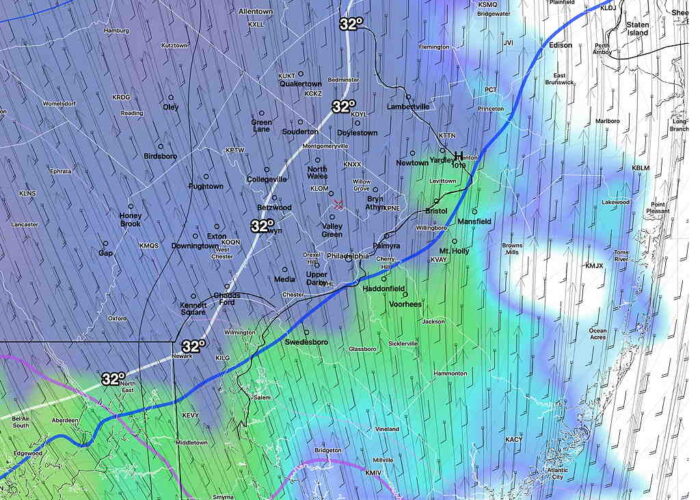
Forecast Updated Sun 5:36 PM — This afternoon’s NAM has backed off on some of the precip and I think the earlier RAP model’s higher snow totals are too high. Either way, lower snow accumulations are expected on roads and dark asphalt. While the NAM still has about 0.4-0.5 water (QPF) falling, temperatures are above freezing by noon. It’s going to tough to accumulate much snow on paved surfaces.
This is a fast moving disturbance. Precip starts 9-11 AM and tapers off around 3 PM. Any snow comes as a heavy slug early.
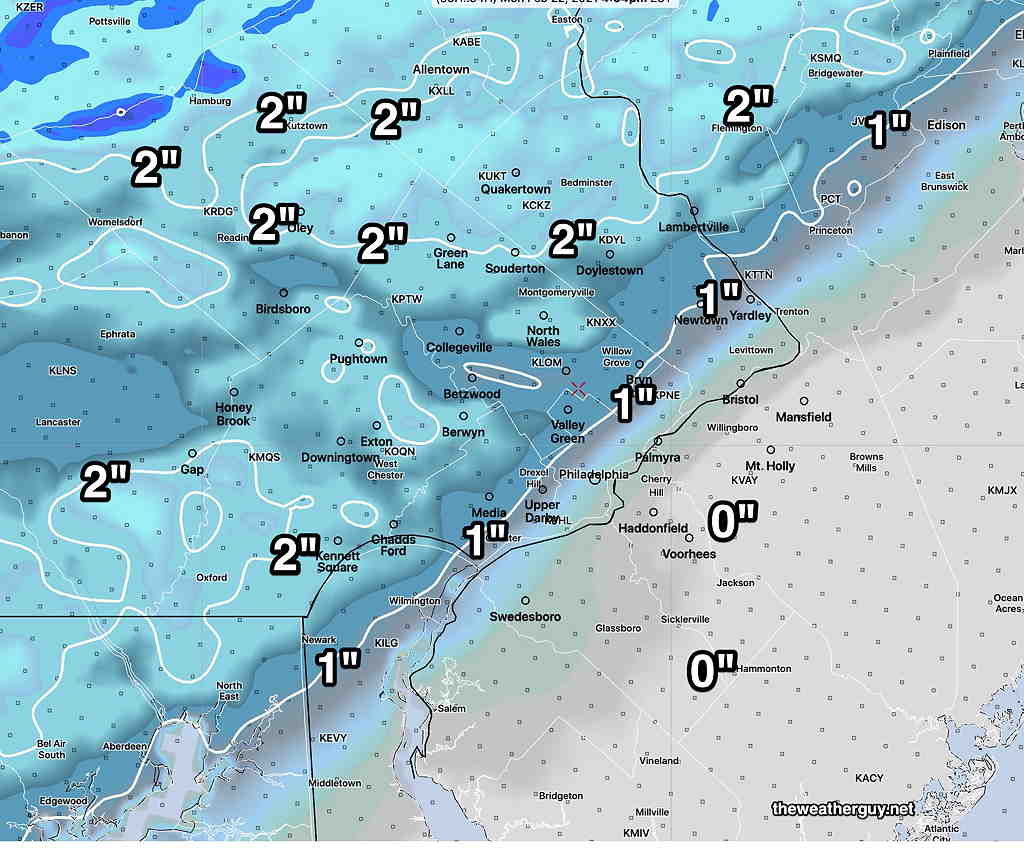
This afternoon’s (18z) HRRR is very similar to its model run earlier this morning, so here’s the same graphic posted earlier, which are the likely snow totals for Monday—
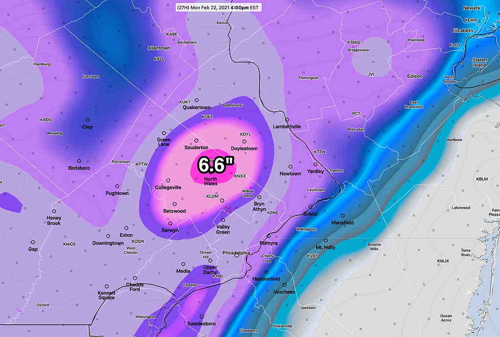
Just to share how crazy numerical weather prediction models can be, here’s the very latest Canadian GEM regional model—
Forecast Updated Sun 12:13 PM — This morning’s models have become available. Here are the trends: the QPF has increased with the NAM and RAP models have total water equivalents as high as 0.6″ water.
The temperatures at the surface continue to be at or above freezing, but the upper atmosphere maintains its cold, allowing precip to fall as snow in areas north of the west and north. Precip still starts 9-10 AM and tapers off around 3 PM.
Latest RAP (Rapid Refresh) Model—
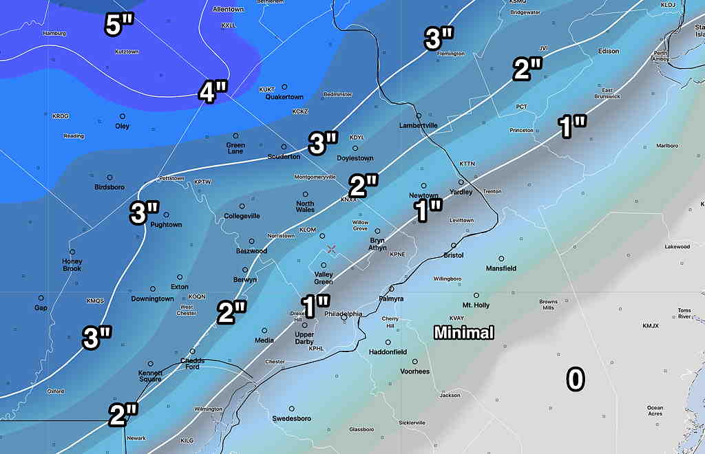
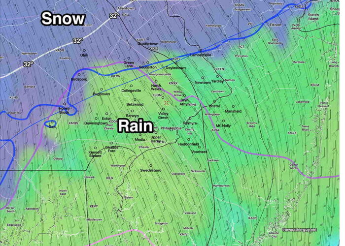
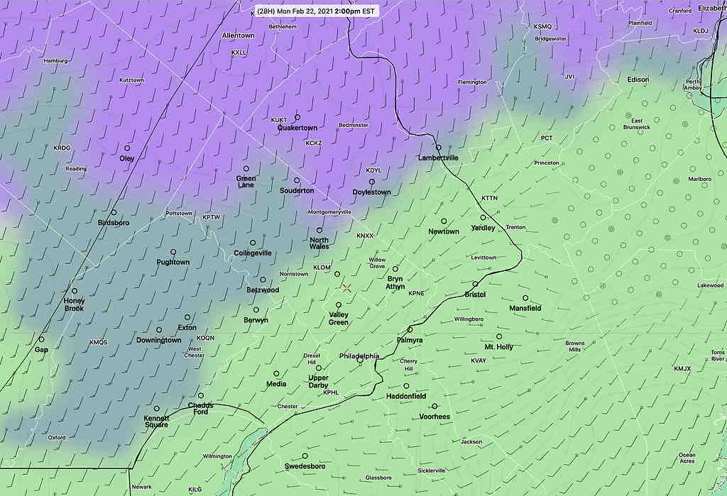
Predominant Precip by 2 PM—
from earlier Sunday morning..
Monday’s wintry weather is almost within a 24 hour range and it’s worth trying to take a stab at the snow totals.
As mentioned in my previous update, the trend has been for the precipitation to start from west to east about 9:00-11 AM Monday.
This storm will be vastly different from the several previous storms—
- The models have been consistent with total water falling (QPF) will only be 0.3″ water equivalent or less in the immediate PHL area, in contrast to much greater amounts in previous storms.
- The thermal structure of this storm is vastly different. This storm will have southerly winds at the surface and surface temperatures will be at or above freezing for most of the area once things get going. (Previous storms had northeasterly or easterly winds at the surface.)
- In contrast, upper air temperatures will be colder northwest of the city, supporting snow formation but the surface temperatures will go against accumulation.
- We’re into the final part of February. The solar angle is higher and “insolation” effects through clouds are more likely to interfere with and cause melting on dark asphalt road surfaces when the precip occurs during the daytime hours.
Whatever starts as snow will mix with or change to rain, as depicted by this graphic with snow totals, especially in the green shading and south of the magenta line—
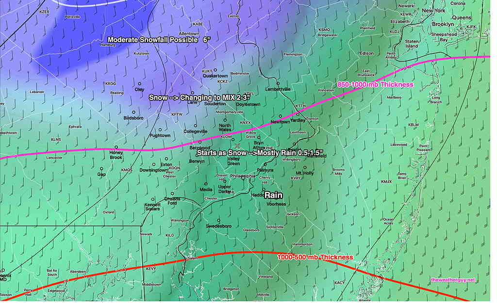
The latest HRRR shows these snow totals before a mix and change to rain in most areas. This only shows snow totals. (Much of the area will eventually become mostly rain, as depicted in the SREF above) —

The Model Blend (NBM) is similar to the above forecast, as is the German ICON model.
I’ll update this evening with the latest models.

