Tue 05:03 PM Update — This afternoon’s NAM-NEST, just available, has the heaviest “action” as the front moves into NJ between midnight and 3 AM. Very heavy rain and high wind gusts possible.
Tue 12:10 PM Update — Heavy rain and gusty winds. Reviewing this morning’s models, the rain will move in in two main waves.
The first round about 3-4 PM, with the possibility of some thunderstorms. Available energy (CAPE) is in the low range, so thunderstorms should be not that impressive.
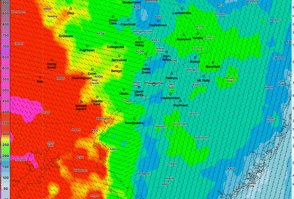
The second round will be between 9 and 1 AM. The actual front moves through about midnight. Helicity values very high (>300 J/Kg) with the frontal passage, especially in western suburbs. High wind gusts (35-40mph) expected ahead of the actual front. CAPE values low, so thunder not expected with this second round.
NAM NEST Helicity values at 11:30 PM Tuesday. (Click on image for a larger view.)
Total amount of rain will be 1.25-1.5 inches with some locally heavier amounts possible.
Sun 7:45 AM Update — The models are still pointing towards sun breaking through late morning or early afternoon.
The warm front approaching our area will slowly move north of our area through Sunday. Before that time, we’ll have classic warm prefrontal weather with a weak E or SE wind flow, fog, low clouds and scattered sprinkles or drizzle possible.
The sun breaks through the clouds late morning, 10 AM to noon, according to the the latest NAM NEST and a somewhat later according NBM, but it appears that the actual warm front moves through Sunday evening with additional showers late afternoon and evening.
High temp 78.5° sd 1.5°. Dew points rise to 69-70° It will feel humid.
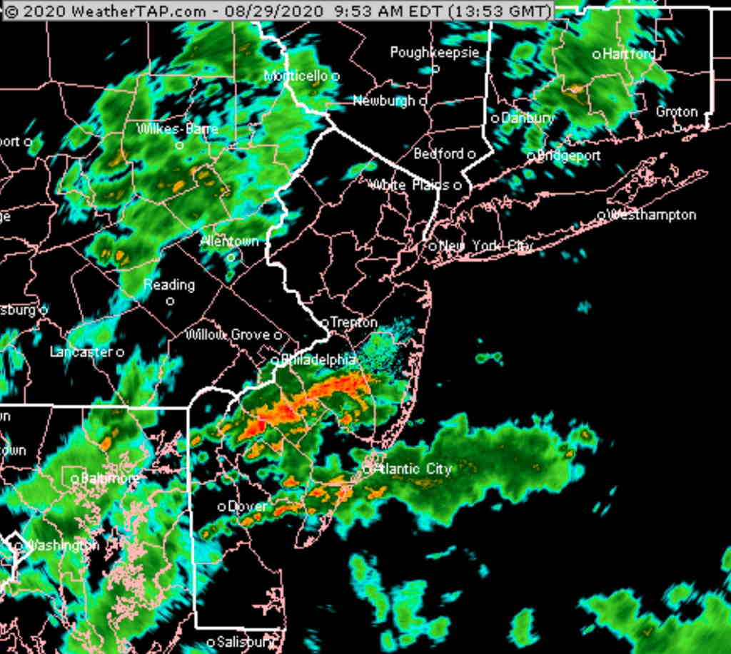
The heaviest rain is falling in the areas of the highest PWAT, as posted last night. Other areas have scattered showers.
Radar image 9:53 AM Courtesy of weathertap.com (Click on image for a larger view.)
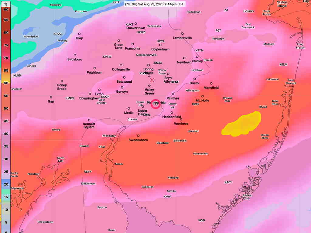
The latest model blend (NBM) has the highest probability of rain today just to the south of Philadelphia, but all areas have elevated chances —
NBM 1 hour precip probability at 2 PM today (Click on image for a larger view.)
Note that these are 1-hour probabilities; anything greater than 25% is meaningful.
Still expecting some partial clearing and breaks in the overcast during the 2-5 PM time frame. However any breaks/sun may initiate thunderstorm development due to a highly unstable atmosphere.