
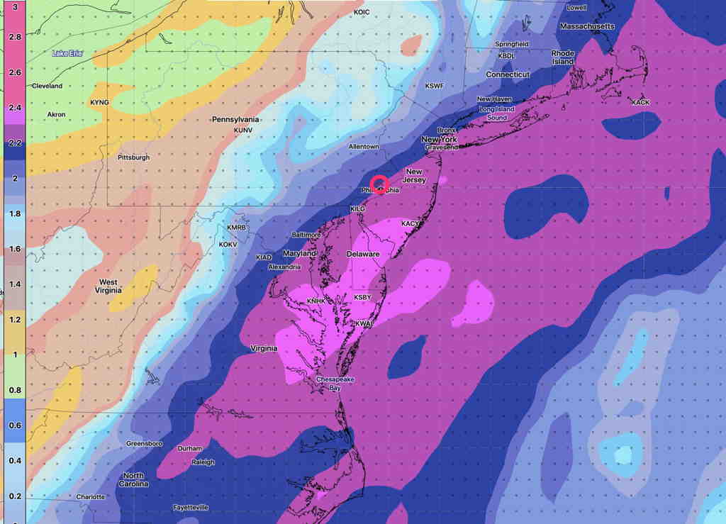
The moisture maximum, as reflected in the precipitable water parameter, or “PWAT” maximum, will move just to our south, as previously forecast —
The energy associated with both Laura, the non-tropical low, and the cold front will move through in separate batches. Showers and rain will move through during the overnight hours. There may be a break in the action Saturday morning, but rain returns around noon and continues though the mid afternoon. Total rain about 1 inch, locally higher.
The GFS (new pre-release version) has rain ending around 5PM with even some sun possible later Saturday afternoon. The HIRESW has similar forecast, but has additional showers and clouds after 8 PM with the actual cold front passage.
Saturday—
- Rain and cloud details above
- High Temp 81º sd 2.1º Dew Point 73-74º
- Winds SW 5-10 mph Gusty mid afternoon. Becoming NW around 10 PM after the cold front passage
High pressure builds in for Sunday. A few upper air disturbances may produce periods of “fair weather clouds” and instability stratocumulus.
Sunday—
- Sunny early, then a mix of sun and clouds in the afternoon.
- High temp 78.6º sd 1.3º
- Low Humidity. Dew points upper 50s.
- Winds WNW 10 mph becoming gusty to 20mph in the afternoon.