#Philadelphia #weather #PAwx #PhillyWx
Uncertainty
Posted Sunday 06/08/25 @ 8:07 AM — I’ve been talking about an uncertain/low confidence forecast for this weekend and today, Sunday, is driving home that point.
Last night, the forecast for rain today had already been pushed from morning into mid-afternoon. The 06z models continue to show clouds at 8 AM, despite it being sunny now.
Current radar this morning is deceptive—
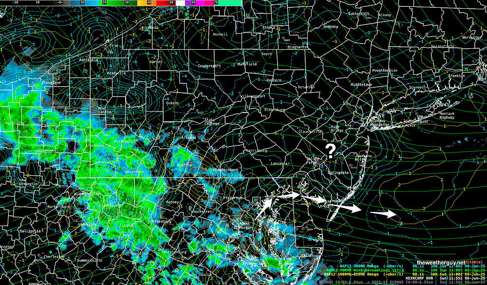
The latest REFS forecast (which did well yesterday) captures the same radar scenario as above, with minimal rain in Philadelphia even at 7 PM tonight—
However, even the REFS (along with the HRRR) show cloudiness right now, not the sun which is clearly visible through high cirrus.
The latest European AI model just became available and it accurately shows the the high cirrus. It maintains a forecast of clouds by afternoon with some light rain by 3-6 PM here in Philadelphia. So this AI generated forecast is what I’m going with today.
Forecast Update
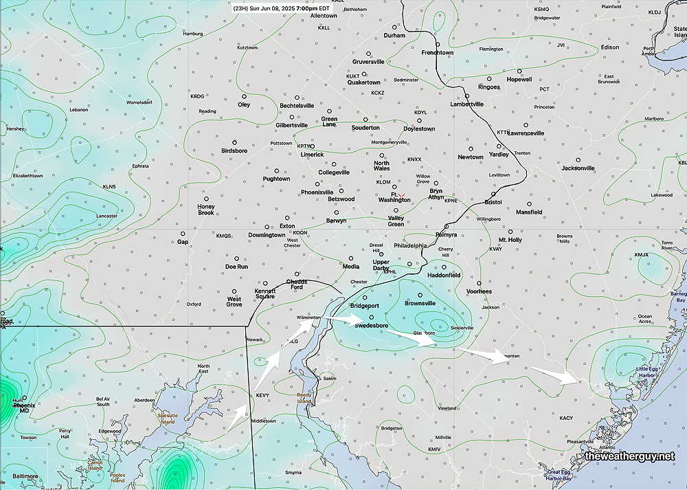
Posted Saturday 06/07/25 @ 9:49 PM — A quick update. It now appears that the rain will not make into our area until 2-3 PM Sunday. The rain will be quite light at the start. The heaviest rain late Sunday will be east of the I-95 corridor.
Posted Saturday 06/07/25 @ 9:46 AM — The REFS was spot-on with its forecast for rain to move in around 8:30 AM Saturday. I’m going to continue with REFS model forecast for the balance of Saturday and Sunday.
Saturday— continued cloudy with intermittent showers and possibly thundershowers. Shower activity picks up after 3 PM—
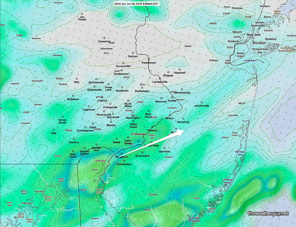
Sunday— cloudy. The latest REFS shows rain moving in earlier than previously forecast, as early as 9- 11 AM

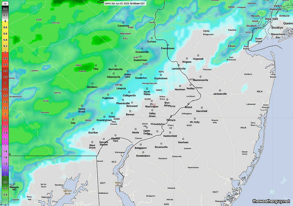
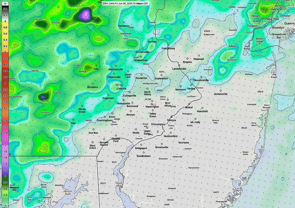
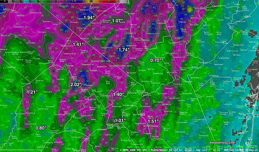
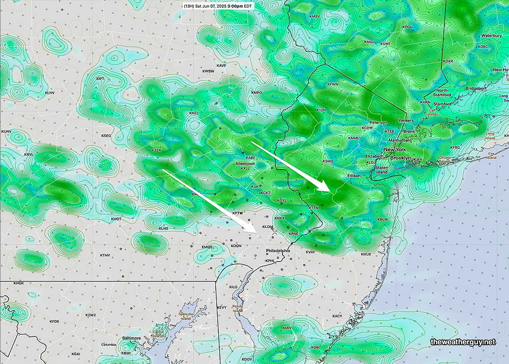
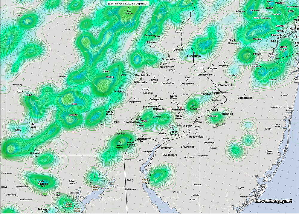
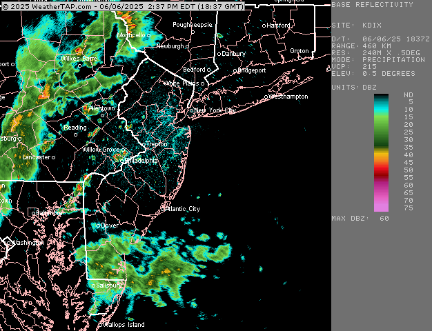
Originally Posted Fri 5:40 PM —This weekend’s forecast has clarified somewhat. As mentioned in yesterday’s post, there’s been a great deal of model spread (uncertainty) with the weekend forecast in recent days and that I’d likely lean towards the model that did the best forecasting today’s weather. Today’s best forecast was from the experimental (and hopefully soon to be released) REFS ensemble model. (The HRRR, NAM-NEST and NBM kept areas near the city and eastward dry.)
The REFS’s forecast from yesterday morning for today at 4 PM is shown below along with a radar loop from today below –
So staying with the REFS, here’s my current forecast for Saturday and Sunday, with help from the ECMWF-AI model and the NBM
Saturday Forecast
Cloudy with periods of rain and thundershowers throughout the day. Skies may brighten a bit towards evening as the rain ends.
NBM high temperatures: Blue Bell, PA 79º Philadelphia, PA 82º
Higher than normal uncertainty (based on standard deviation): ± 3º
Sunday Forecast
Some bright spots, possibly some sun through clouds early. Increasingly cloudy by afternoon. Rain and thunderstorms moves in between 3 and 5 PM from the southwest and continue into the evening.
NBM high temperatures: Blue Bell, PA 75º Philadelphia, PA 577º
Very high uncertainty (based on standard deviation): ± 3.5º