#Philadelphia #weather #PAwx #PhillyWx
Saturday Evening Thunder
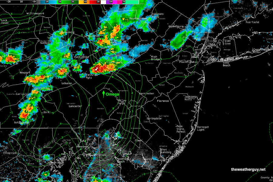
Posted Saturday 06/28/25 @ 5:31 PM — On the surface, tonight should offer some fairly heavy thunderstorms; there’s plenty of CAPE (exceeding of 3000 joules/kg) and plenty of precipitable water (2.1″) and an advancing cold front as a trigger.
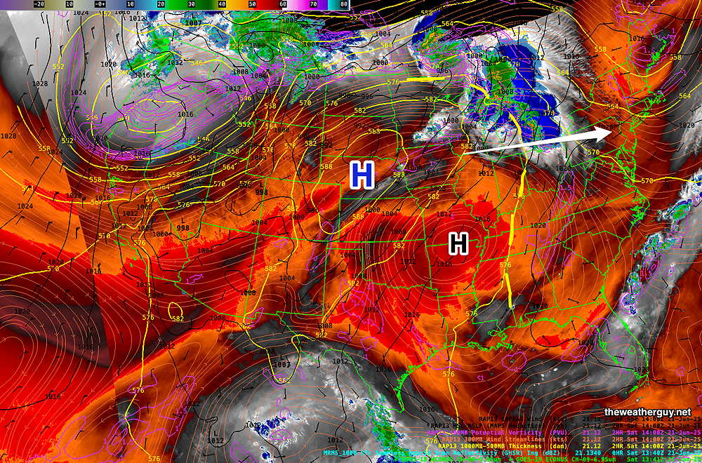
That said, the model forecasts aren’t all that impressive with the severity of the storms. There’s little to no jet stream energy aloft (the jet flow is far north of our region). Vertical wind shear, the ingredient needed to prevent thunderstorms from collapsing on themselves, is very low. Helicity is low-range elevated in the Allentown area, not so much here.
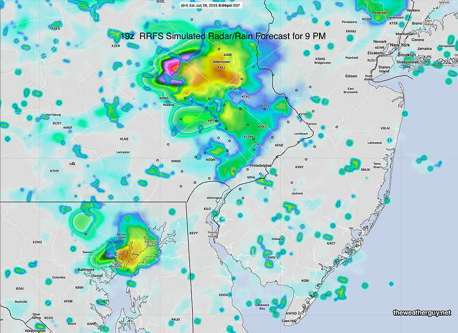
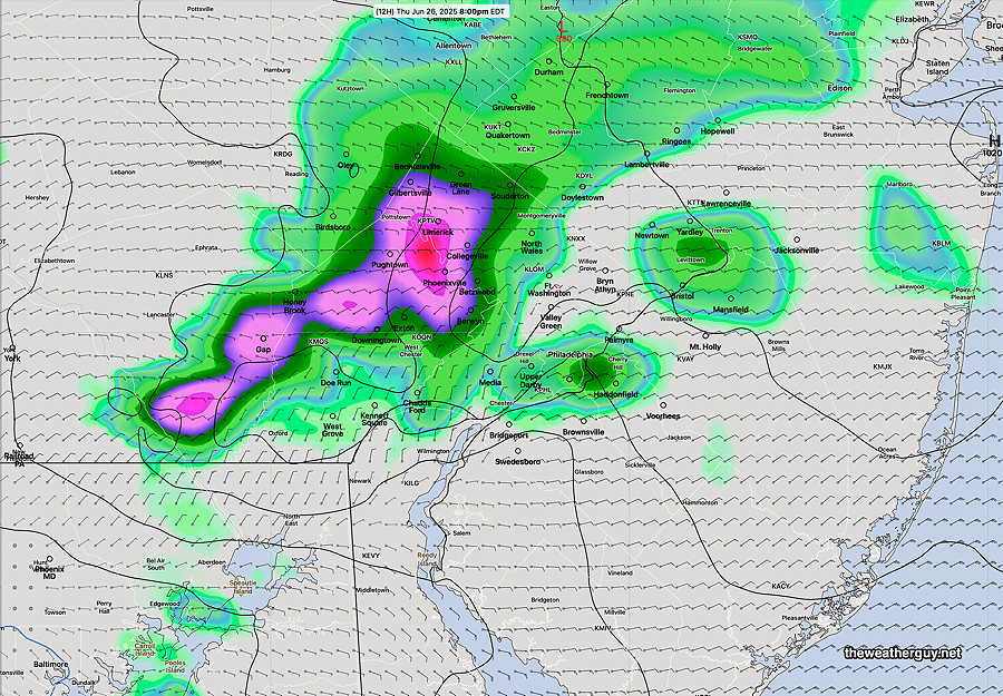
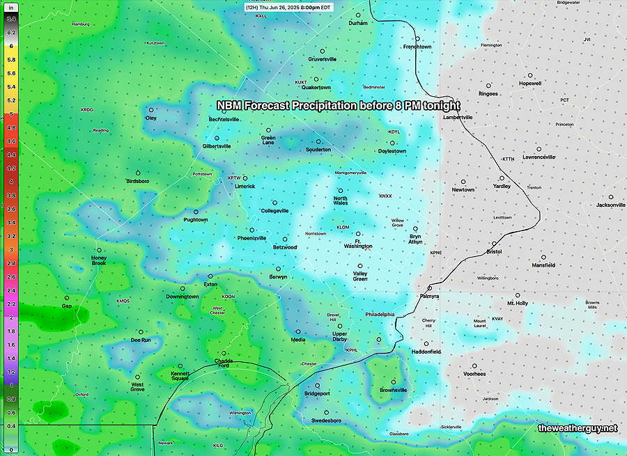
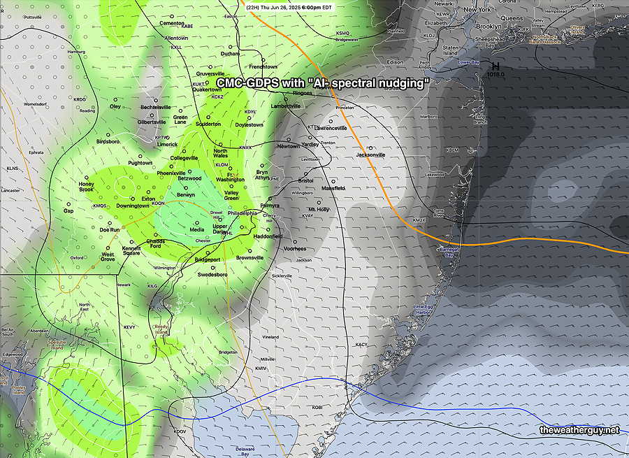
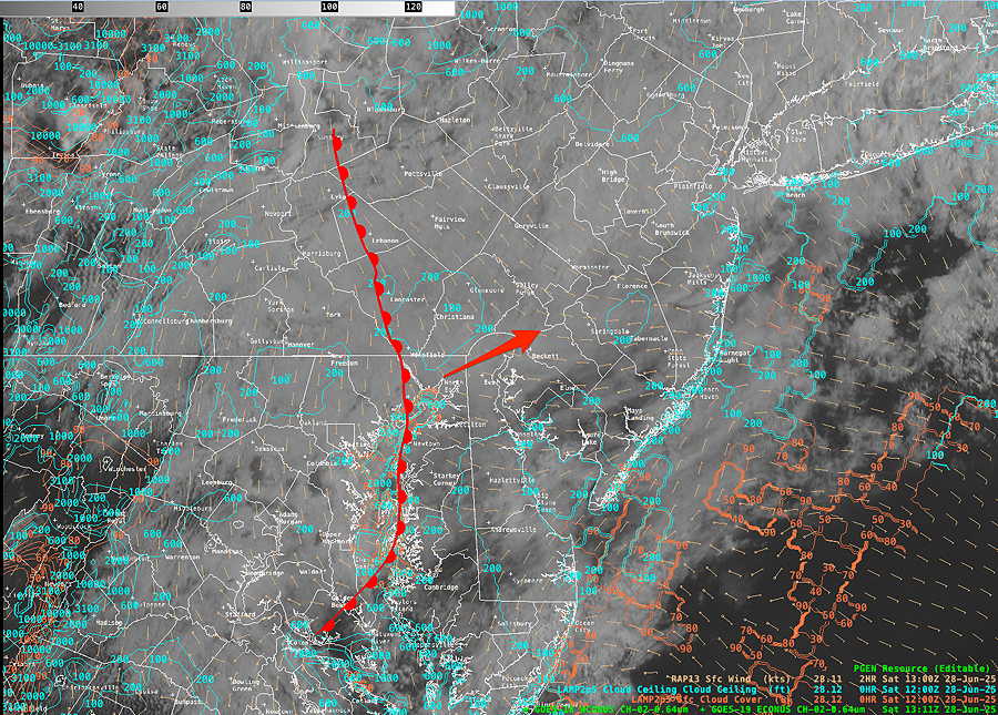
The latest Canadian RGEM just became available and it has some heavy rain closer to the city. This is in contrast to the US models and the AI model—
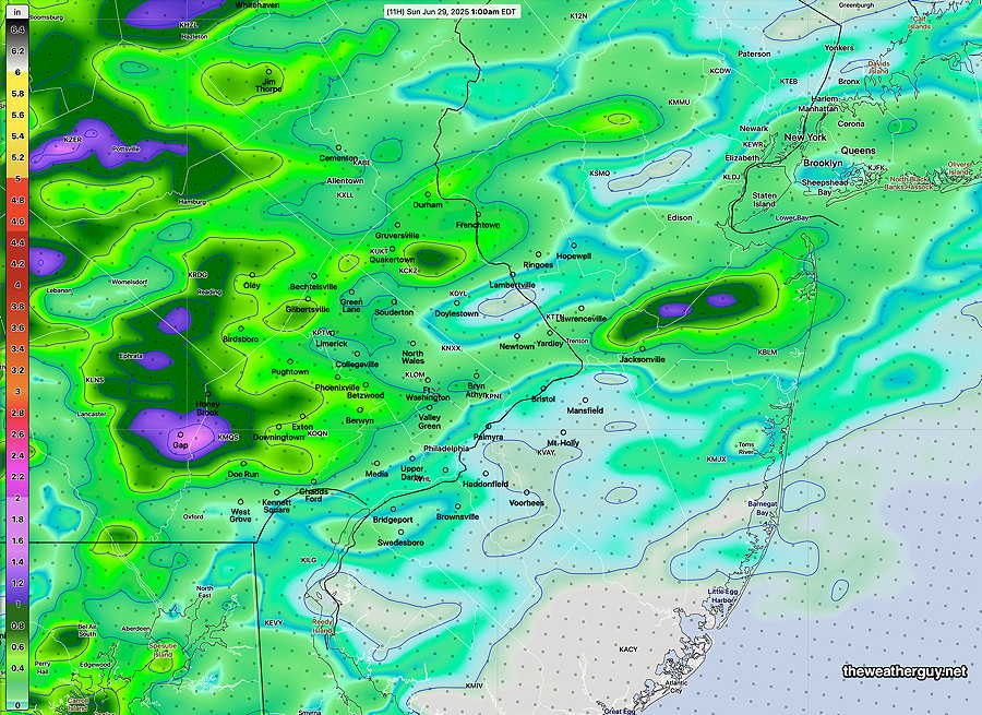
So expect some showers and thunderstorms. Severe is always possible, but I don’t think so. Always follow the NWS advisories for these sort of things.
Sunday continues to look sunny and dry.
Saturday Update
Posted Saturday 06/28/25 @ 9:19 AM — The warm front is just to our west and clouds are beginning to breakup in S Jersey and in central PA.
Showers and thunderstorms ahead of the next front (a cold front) will move in to western sections as early as 6-8 PM and continue through midnight.
Weekend Forecast
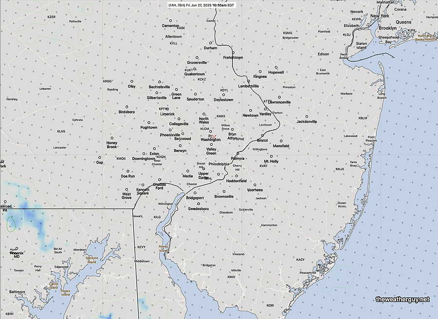
Posted Friday 06/27/25 @ 7:36 PM — Friday‘s rain was unexpected and not forecast by many models. Let’s see if we can do better with Saturday and Sunday.
Saturday: The front that went through late Thursday giving us the cool temperatures and easterly flow on Friday will return as a warm front and pass through between 10 AM and noon. The warm front will be preceded by showers and maybe some thunder, but there’s a wide range in model guidance regarding how widespread the showers will be.
Following the front, temperatures will rise into the mid and maybe upper 80s with dew points in the highly uncomfortable range of lower 70s. Many areas will see some sun by noon or sun filtered by clouds.
We may luck out with a dry period between noon and 5 PM. The atmosphere will be highly unstable and CAPE values will be close to extremely high levels of 4000 joules/kg. Shear will be very low, so pop-up storms will collapse on themselves and be short-lived and highly scattered. Pop-up storms will become more numerous, certainly by 5 PM and afterwards.
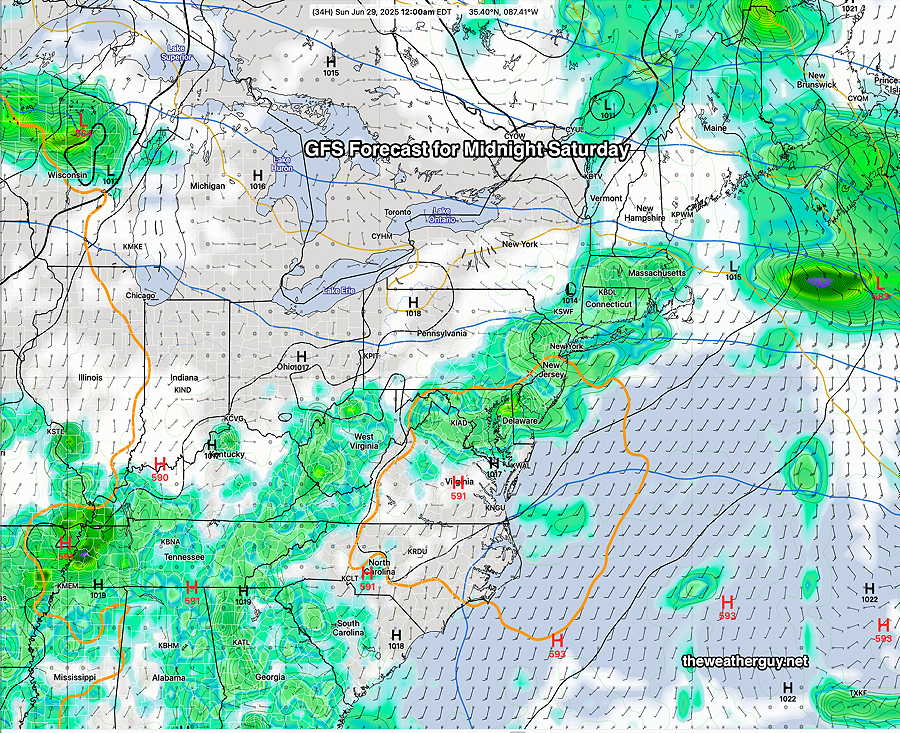
A line of storms will move through Saturday night around midnight into the hours before daybreak Sunday morning.
Sunday will be mostly sunny and less humid. A period of cloudiness is expected around noon, but the sun should return filtered through high cloudiness in the afternoon. Lower dew points in the mid 60s with highs in the low to mid 80s.
Friday and the Weekend Preview
Originally Posted Fri 9:29 AM —The backdoor cold front that pushed through on Thursday has become stationary to our west and our south.
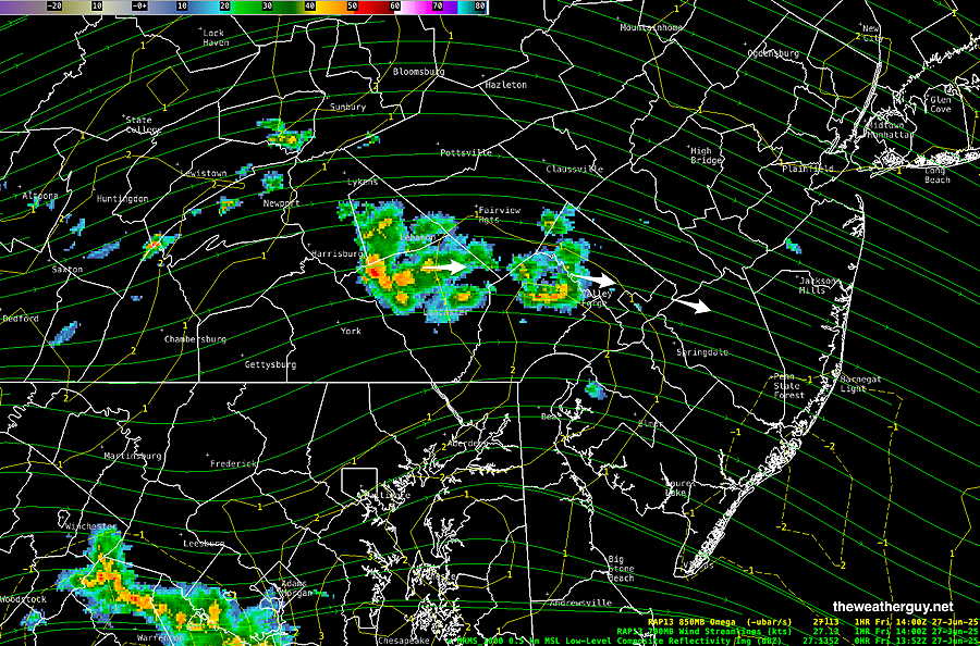
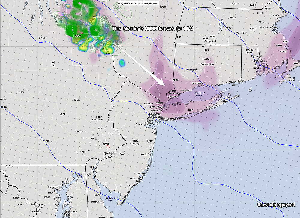
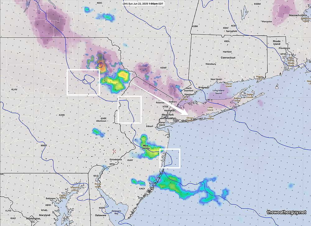
The RRFS forecast for the same time frame shows nothing!
What’s most disturbing- the NWS announced just yesterday that they’ll be retiring several models (NAM, HREF, HIRESW, NARRE) when the RRFS becomes operational in early 2026. See my RRFS page.
There is ongoing development of the RRFS where the plan is to take it from its current FV3 core to the MPAS (“model prediction across scales”) geometry. Here’s the highly experimental RRFS MPAS forecast for today which over-forecast the rain to our south, but captured these showers-
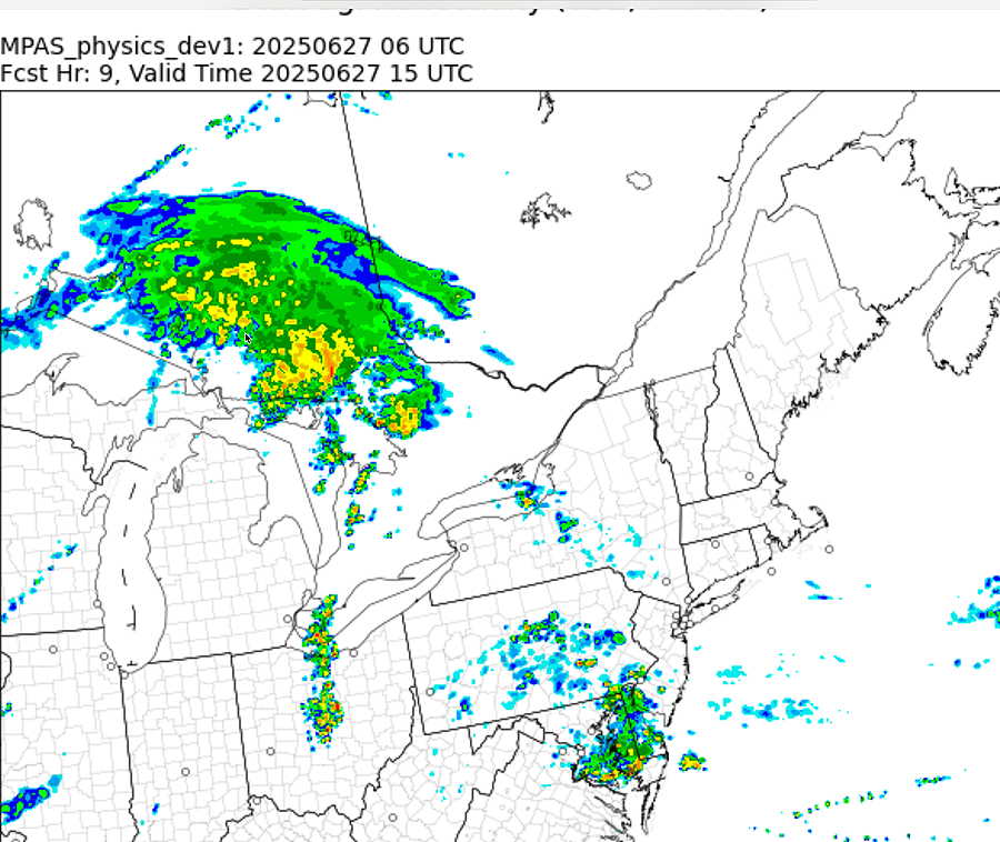
It’s not clear if the first operational release will be with the FV3 core or the MPAS core.
Originally Posted Fri 9:29 AM —
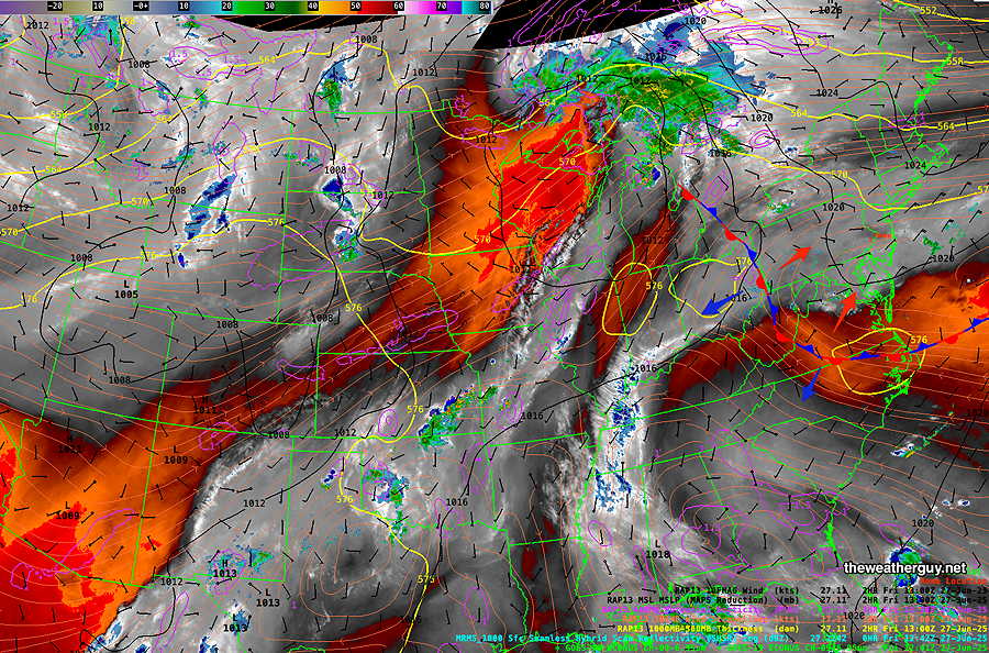
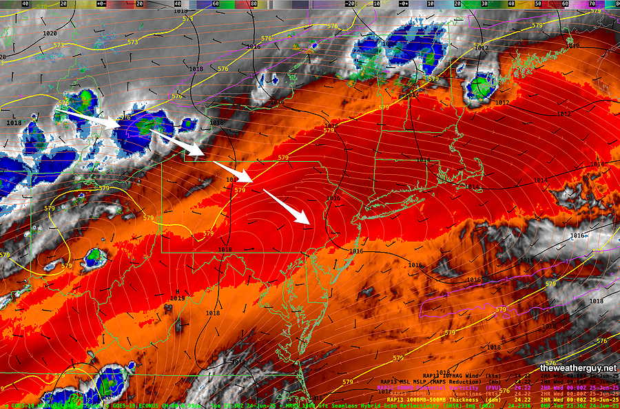
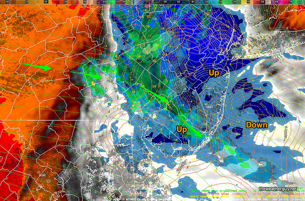
As a result, Water Vapor Temperatures indirectly reveal height, called the “effective layer” of the water vapor in a region, therefore revealing the mid and upper level 3D contours of systems.. Colder temperatures (blue- grey – white) indicate higher altitude, sometimes revealing upward motion. Red- Orange indicates warmer temperatures and a lower height for this layer. There are several water vapor “channels”; the one I display here is called the mid level height channel. (Click on image for a larger view.)
For today, Friday, a cool, stable easterly flow will keep skies cloudy, but the RRFS does have some sun filtered through high and mid level clouds early afternoon. Except for a quick possible sprinkle, the Philadelphia region should remain dry today.
Clouds return late afternoon and evening as the stationary front moves northeast as a warm front.
Saturday will have clouds in the morning, possibly with some showers, sprinkles and fog, then breaking for sunshine and increased humidity and temperatures as the warm front moves north. Showers and thunderstorms possible Saturday night, especially after midnight.
Sunday becomes sunny and quite warm, humid. Details will depend on the actual position and movement of the warm front.
Despite the unsettled and changeable weather this weekend, I don’t see much in the way of widespread substantial rain around Philadelphia
Due to a highly unbalanced political environment on X, I’ve considerably cut back auto-posting there. To receive all forecast postings, I recommend following me on mastodon.social or bluesky.social