#Philadelphia #weather #PAwx
Thursday – Friday Outlook
Posted Thursday 02/22/24 @ 9:54 AM — Clouds will be on the increase later this morning and it should be mostly cloudy by early afternoon. Light showers expected to move in from the west between 5 PM and 7 PM tonight.
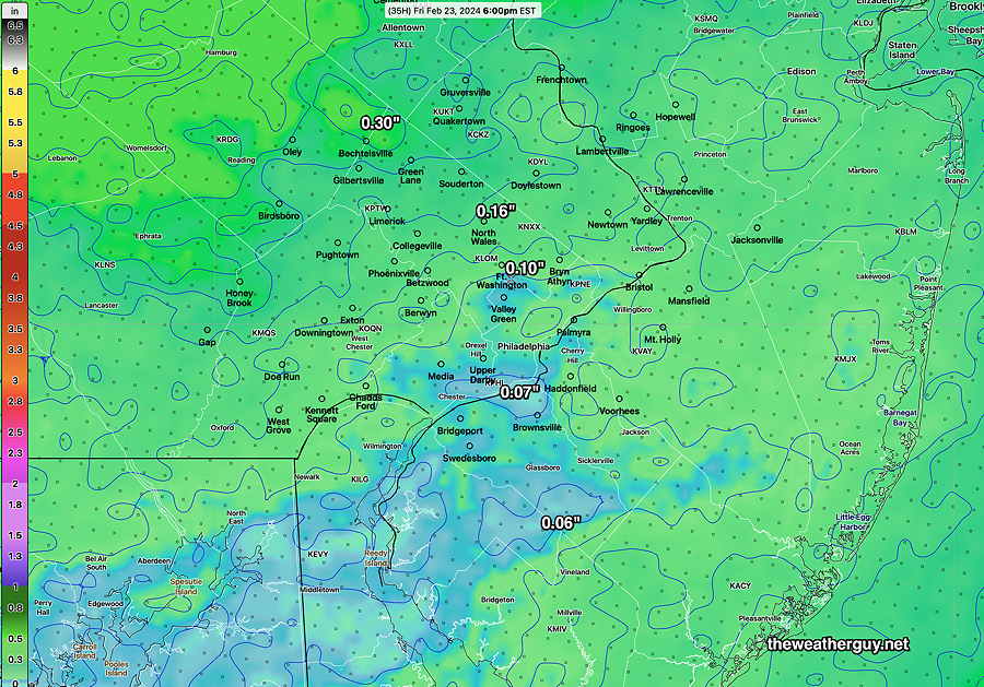
There’s still a trend for the rainfall to be on the light side. The latest model blend shows these amounts—
NOAA’s new model under development, the still-experimental RRFS, has show some big advances in its development over the past month with its own data inputs and some advances to its ensemble version. Just to see, here’s the current RRFS -Ensemble total rainfall forecast —
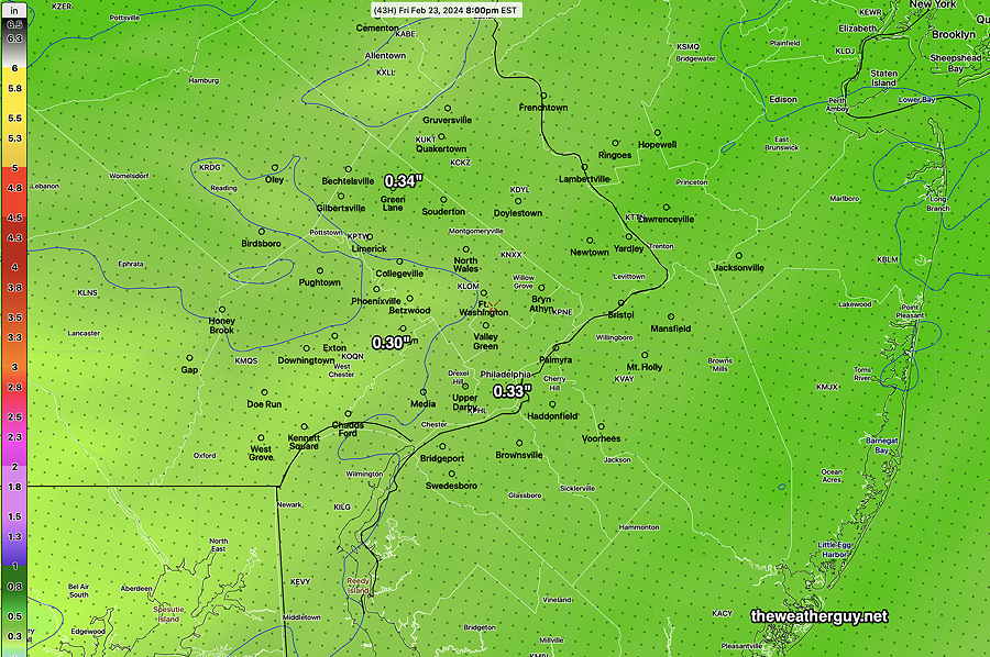
It looks like light rain/drizzle lingers into mid afternoon Friday, with some clearing before sunset Friday.
The weekend looks cold, although somewhat less so on Sunday.
Posted Wednesday 02/21/24 @ 7:06 PM — Sometimes the latest models are not the best in forecasting the immediate upcoming 6 hours. Such was the case with this morning’s HRRR and NAM-NEST which forecast more clouds than we had. Forecasting can be a challenge, even if supported by satellite imagery.
As for Thursday, clouds moving in ahead of a system to our west will have Thursday becoming increasingly cloudy. By late morning it will be mostly cloudy. The models are fairly consistent forecasting some very light rain moving in by 5 -7 PM. There’s a wide spread in forecast high temperatures: 46º – 48º ± 2.6º.
The big question continues to be the amount of rain that will fall here in the immediate Philadelphia area Thursday night through early Friday. There’s tremendous model differences, with the majority of the models having most of the rain bypassing our area to our north and south. The amount of rain forecast varies from a few hundredths of an inch to almost about 0.60″ inch of rain. The NBM (model blend) falls in the the low range of about 0.20″.
Here’s the latest GFS rainfall forecast. The Philadelphia area is in a doughnut hole—
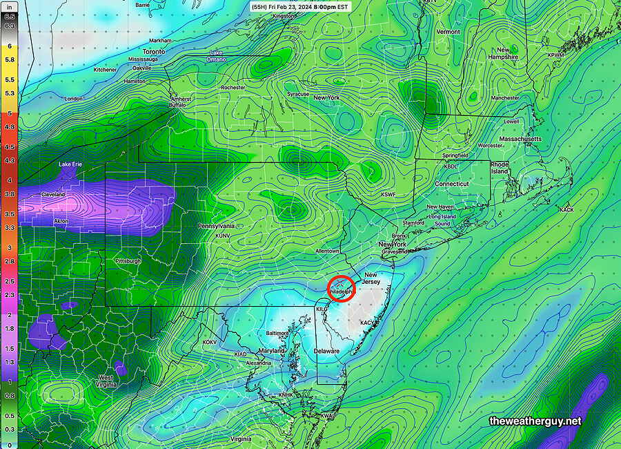
As was the case with today’s cloud cover, the models are having difficulty resolving the current weather pattern. As was the case yesterday, I expect further changes in the forecast.
Wednesday Update
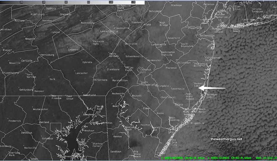
Posted Wednesday 02/21/24 @ 9:24 AM — A change in the forecast. The low pressure system in the Atlantic, originally expected to bring some cloudiness only to eastern NJ has pushed moisture further west. This morning’s HRRR and NAM-NEST show cloudiness pushing westward. The latest visible satellite image—
On water vapor imagery, a wind change line has set up, which I’ve drawn in as warm front. East of this line, we’ll have increased cloudiness—
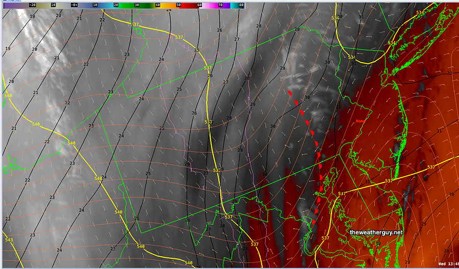
So today looks to have more cloudiness, with sunshine through high and mid level clouds, than previously forecast especially from just west of the city and eastward.
As alluded to yesterday, I expect to see forecast changes over the next day or so. The second system in the Atlantic is probably complicating the model forecasts.
Wednesday – Friday Outlook
Posted Tuesday 02/20/24 @ 7:50 PM —— Continued near -seasonable temperatures Wednesday with highs in low 40s with plenty of sunshine.
Things warm up a bit on Thursday, but with clouds moving in early afternoon. Highs in the mid to upper 40s. Rain should wait until late evening, but there have been some hints that we may see it start earlier.
There’s still some uncertainty about the rain expected late Thursday evening into Friday. Most models have very light rainfall for our area (0.20″), but there have been some model runs that crank out much more (0.60″)
The GFS has the rain ending by noon, but the NBM shows light rain showers lasting into Friday afternoon, perhaps from another low that forms along the cold front —
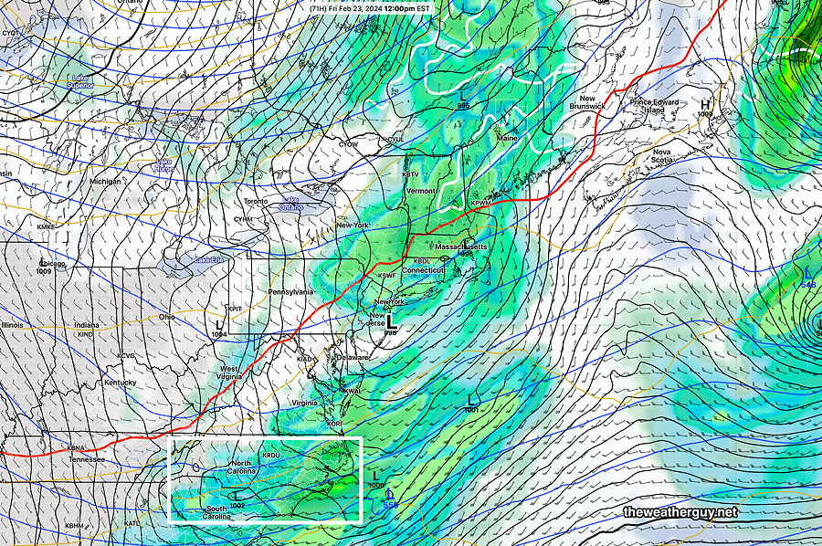
It would not surprise me if the light rain forecast for Friday changes in the coming days. Regardless, plenty of wind is expected later Friday afternoon.
Tuesday-Thursday Outlook
Posted Monday 02/19/24 @ 7:37 PM — There’s been clarification with the forecast for this week. We’ll be mostly sunny Tuesday through very early Thursday. (Some clouds from large storm system in the western Atlantic may spill back into NJ on Wednesday.) Temperatures will approach 50º by Thursday.
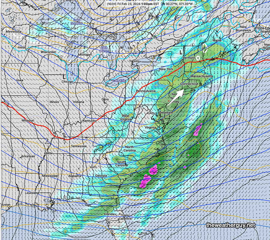
Low pressure approaches on Thursday. Thursday will have increasing cloudiness with rain moving in from the west as early as late afternoon or early evening. It will be rainy on Friday. It’s not clear how strong the storm will get on Friday. The ECMWF has only 1/2 inch of rain falling from this system—
Previously Posted Sun 9:17 PM —
Quiet weather is expected the early part of this week and the thought was there would be a general moderating trend in temperatures by Wednesday or Thursday. Looking at the latest NAEFS, however, I’m seeing large forecast changes from previous model runs in the overall jet level pattern, especially by Thursday.
More so, the coast storm that was expected on Friday may not develop as previously forecast.
Frankly, the current forecast upper air map is a bit confounding.
Here’s the NAEFS jet level forecast for Wednesday—
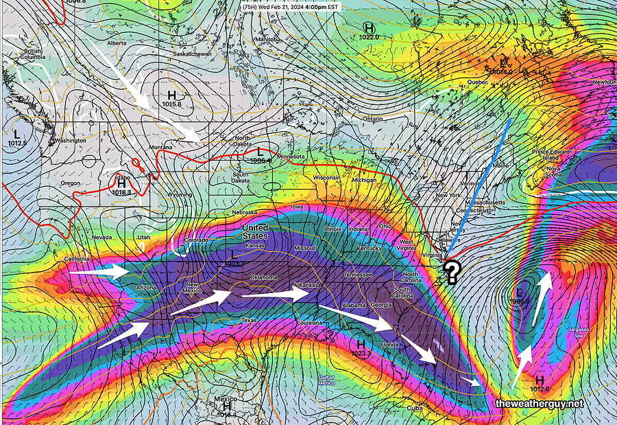
So, until things clarify, I don’t have my usual big picture summary of the coming week’s weather. Right now, I think we can safely forecast through Tuesday. And maybe expect some milder weather by Thursday.
For Monday we can bank on sunny skies.
Tuesday will be sunny in the morning with some high clouds later in the afternoon as a warm front tries to approach.
For the rest of the week, we’ll have to wait to see if the warm front makes it here and we’ll have to determine what will happen with the low pressure system. Some time next weekend looks colder again.

Are we finished for snow? Want more but fear we might be.
On a pure probability basis, the chance of a major snowfall is decreasing as we get closer to the Spring Equinox. Then again, we had a major snowfall in mid-March 1993. But we’ve had a lot of climate change since 1993 and this entire winter, there’s been a lack of cold air around here. I don’t see any snow through the end of February.