WEEKEND WEATHER FORECAST

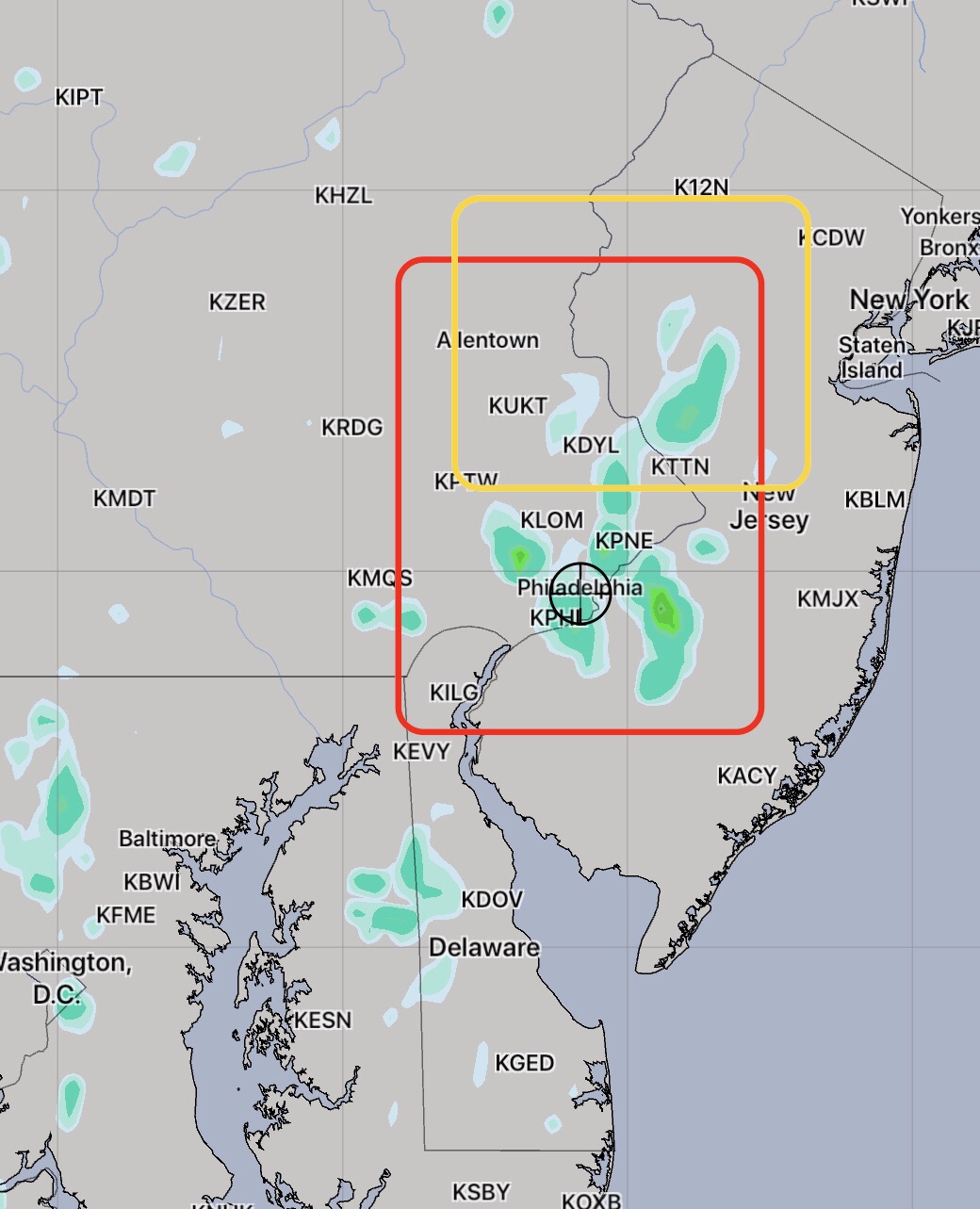
[su_note note_color=”#d9f2da”]8 AM Sat Update: Last night’s models have showers/thunderstorms breaking out in a very scattered way as early as 2-3PM throughout the Delaware Valley and into NJ. Not every area will see a thunderstorm but large areas certainly will. This will not be a moving line of storms, but rather a spontaneous, dynamic formation, highly scattered in coverage.

HIREF Model Simulated Radar 4:45 PM Saturday

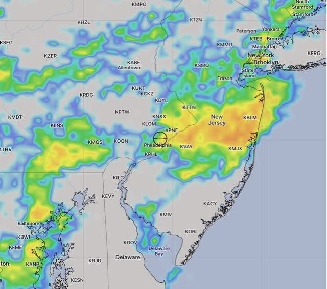
The high chance of showers continues until about 8 PM, when they will start dissipating. [/su_note]

From last night…

A cold front will slowly approach on Saturday and is expected to spark showers and thunderstorms over a large area.  Looking at the models, the front loses steam as it enters our area and much of the dynamics that aid in thunderstorm development reduce as the front approaches Philadelphia . So the heaviest storms may not reach us.

This weather scenario is best handled by a probability basis rather than a deterministic basis.

There is an elevated possibility of showers throughout the day. Highest probability is late afternoon. Thunderstorms are expected in the far northwest suburbs (Allentown) during the mid afternoon into evening.

In the immediate Philadelphia area, tonight’s WRF has the thunderstorms occurring most likely between 5-8 pm.

There will be a mix of sun and at times, considerable cloudiness. High temps near 92 with high humidity.

For Sunday, the front will still be in our area and scattered showers and thunderstorms are still possible. High 86.  Specifics aren’t possible until Saturday night or Sunday morning’s models.


Friday Forecast

[su_note note_color=”#d9f2da”]8 AM Fri Update: The most recent model runs vary in their areal coverage of thunderstorms later this afternoon. Generally the coverage is less than yesterday.  The High Resolution Ensemble Forecast (HIREF) which had the best forecast yesterday has showers and thunderstorms between 4-8 PM in the area in red. Last night’s GFS and NAM have fewer thunderstorms in the area in yellow, to our north.

HIREF accumulated rain forecast 5:30 PM Friday

Any thunderstorms will be slow movers and precipitable water values (PWATs) are very high – 2.1 inches, meaning any area getting showers will have very heavy rains.

[/su_note]

From last night

A poorly defined warm front will move through overnight and Friday morning. It will be cloudy in the morning and some models have a significant amount of cloudiness with some sun for the rest of the day.  With uncertainty in the amount of cloudiness, there is a wider than usual range in high temps from 87 through 90. All models have it uncomfortably humid with dew points in the 70s.

The statistical models have a 78% chance of showers and thunderstorms in the afternoon. In the city, highest chances are between 4 and 8pm, although tonight’s high resolution models are not that impressive with the coverage of the showers on Friday.

As we saw today, the best models get the timing and placement of the showers approximately accurate, but the timing is often off by an hour or two and the exact placement is rarely exactly correct.  Today was also a bit hotter than had been predicted.


Fourth of July Forecast

10:30 AM Update WRF model Thurs 2:40 PM Precip forecast

[su_note note_color=”#d9f2da”]8 AM Thurs Update: Last night’s 2 AM model runs have sun in the morning, some clouds mid afternoon with showers popping up west of Blue Bell about 3 PM.

HIREF (High Resolution Ensemble Forecast) 3-4 PM Thurs for Precip

[/su_note]

[su_note note_color=”#d9f2da”]11 PM Wednesday: Tonight’s models have more sun, fewer showers for Thursday. Any showers developing are further west of Philadelphia.[/su_note]

A poorly defined frontal boundary to our south will allow weak impulses to spawn showers and thunderstorms Thursday afternoon. A southeasterly wind flow will keep much of atmosphere in NJ stable and no convection or rain is expected east of Philadelphia.

My post earlier in the week had the showers developing fairly far west of Philadelphia, but the latest models have showers developing early afternoon near Philadelphia and westward. Showers are possible throughout the afternoon Thursday, but are expected to subside around sunset. It will be mostly cloudy and high temperatures will be around 90.

High Resolution Ensemble Hourly Precipitation Forecast for 5 PM Thursday

The frontal boundary to our south is expected to move north as a warm front on Friday, with increased chance of showers.