A cold front will move through later tonight with minimal light showers. Low pressure developing well to our south and moving east over the weekend will provide significant cloudiness for Saturday.
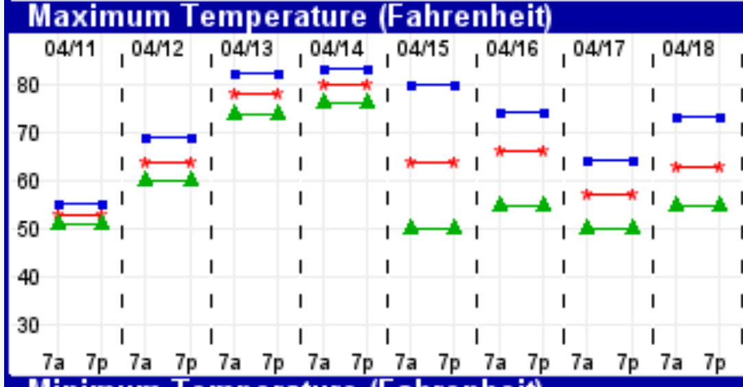
Saturday will be cloudy after some light showers before daybreak. It will be unseasonably cold, with high temperatures near 45.
There’s a chance of some wet flurries, especially in south Jersey Saturday night.
Sunday will be mostly sunny and continued cold. High 45.
The evolution of the storm that had been predicted to bring snow to Philadelphia continues. Lets’s cut to the chase- there’s no snow for Philadelphia on Saturday. Here’s the current model forecast:
The cold front is expected to move through before 8 AM on Saturday morning. Depending upon your model of choice, either light rain showers (GFS), or close to zero precip (NAM) falls before 8 AM. Temperatures too warm for snow during the precipitation before daybreak; after the front passes, it will be unseasonably cold for April on Saturday, but dry.
So Saturday is dry after 8 AM.
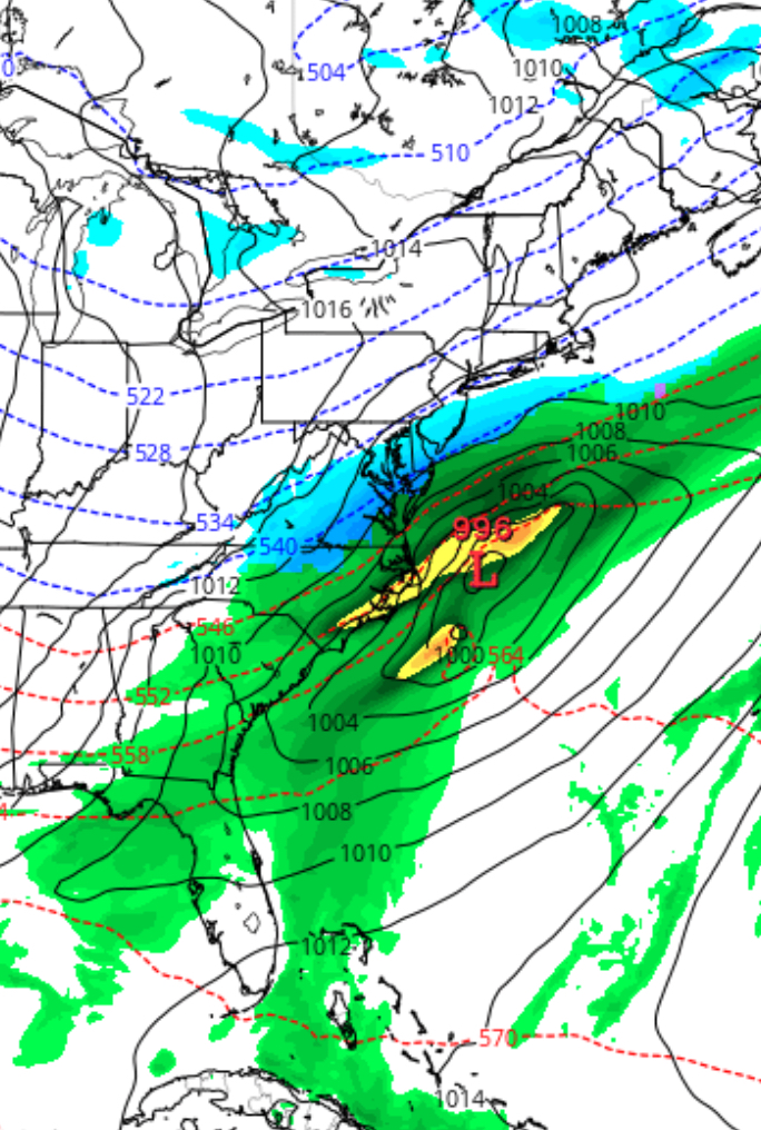
The front sinks further south and low pressure develops much further south than had been forecast earlier in the week. Any snow will be much further south than our area.
GFS Forecast Saturday night 2 AM
Depending on the sharpness of the upper air flow, the low pressure may track as a coastal storm that brushes south Jersey Saturday night (GFS) or misses our area entirely (NAM) Saturday night. It will likely miss us, since I favor the NAM in these situations.