Posted Sunday 07/28/24 @ 10:00 AM — Except for the HRRR, the models are holding back the clouds at the shore until this evening. Sunny skies with haze from wildfire smoke here in the city. (The smoke levels here are not anywhere near the levels of last summer. )
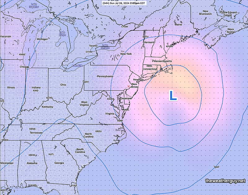
The upper level low to our east will result in some instability showers/thundershowers late Monday afternoon. Increasing chances of showers and thunderstorms Tuesday and Wednesday due to an approaching warm front.
Forecast Update
Posted Saturday 07/27/24 @ 5:20 PM — Today’s ample supply of “fair weather clouds” were courtesy of the upper level cyclonic flow around the developing closed low, as discussed below.
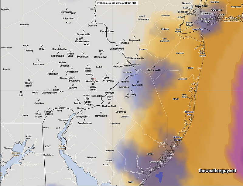
The forecast for Sunday remains mostly on-track. There will probably be more “fair weather cloudiness” around the city and this afternoon’s higher resolution models are predicting increasing high and mid level cloudiness at the Jersey shore about 3 PM—
Today’s 18zNAM-NEST cloud forecast for 4 PM Sunday. (Low clouds- blue, mid-level clouds- maroon, high clouds- yellow tan) (Click on image for a larger view.)
Posted Saturday 07/27/24 @ 9:32 AM — Last night’s ECMWF has backed away from a strong westward movement of the upper closed low on Sunday; it has joined most of the other models with a northward or west-northwest motion.
As a result, clouds with this system should remain offshore until Sunday late afternoon or evening. (Only the experimental RRFS has cloudiness at the shore Sunday afternoon.)
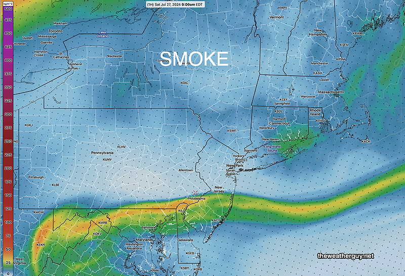
FYI, some of the haze in the sky over the past day or so is from smoke and particulates from the wildfires in Jasper Canada. A plume sunk south of us this morning—
12z HRRR smoke – integrated vertical column smoke/particulates . (Click on image for a larger view.)
An general increase in smoke particulates is forecast. Smoke at the ground level is not currently forecast.
Originally Posted Fri @ 5:24 PM — —This looked to be a weekend where the forecast required no meteorologist; anyone could make a slam-dunk forecast for sunny skies both days with just a barometer and a wind vane.
However, things are looking a bit more interesting for later in the day Sunday, especially at the Jersey Shore.
First, high pressure builds in for Saturday with sunny skies—
NAEFS model statistical “mode” version with overlayed GEFS model “bias-corrected” precipitation forecast for Saturday. (Click on image for a larger view.)
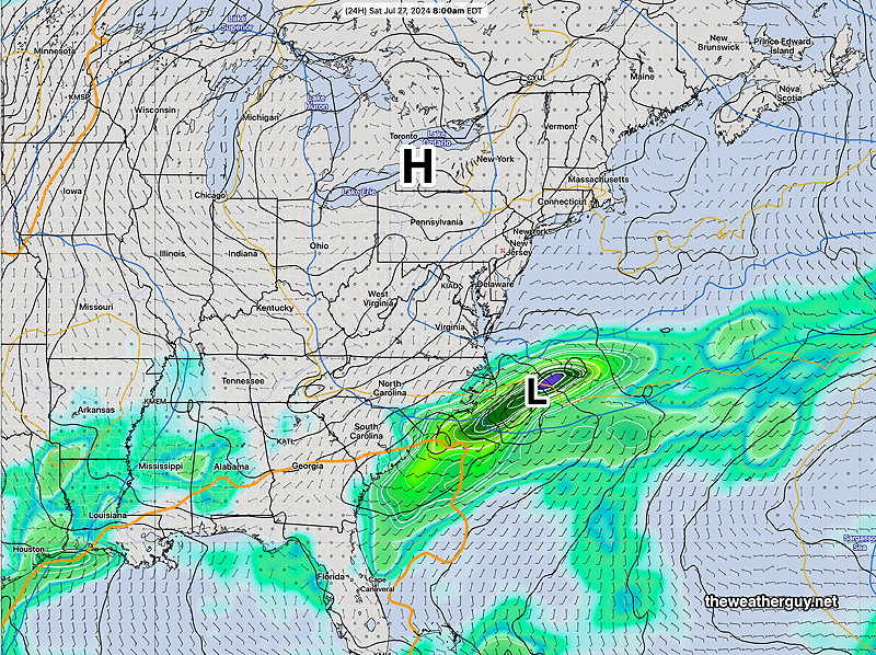
For Sunday, there’s now some uncertainty regarding the cloud cover, especially east towards the Jersey shore on Sunday afternoon due to the formation of a closed low in the mid and upper atmosphere—
NAEFS upper 500 mb mid-level closed low Sunday 2 PM. This may cause cloudiness east into NJ and at the Jersey Shore. (Click on image for a larger view.)
The position of this closed upper low is also uncertain, with the latest ECMWF model having it closer to the coast and with a track that retrogrades it westward going into Monday.
So not a slam dunk forecast. Still likely sunny and quite nice in Philadelphia.
Saturday
Sunny and quite nice. Warmer.
NBM high temperatures: Blue Bell, PA 87º Philadelphia, PA 88º uncertainty (based on standard deviation): very low ± 0.9º
Sunday
Mostly sunny in the morning, some increasing cloudiness in the afternoon, especially east towards the Jersey Shore. Slightly more humid with dew points near 60º
NBM high temperatures: Blue Bell, PA 89º Philadelphia, PA 90º uncertainty (based on standard deviation): very low ± 0.9º