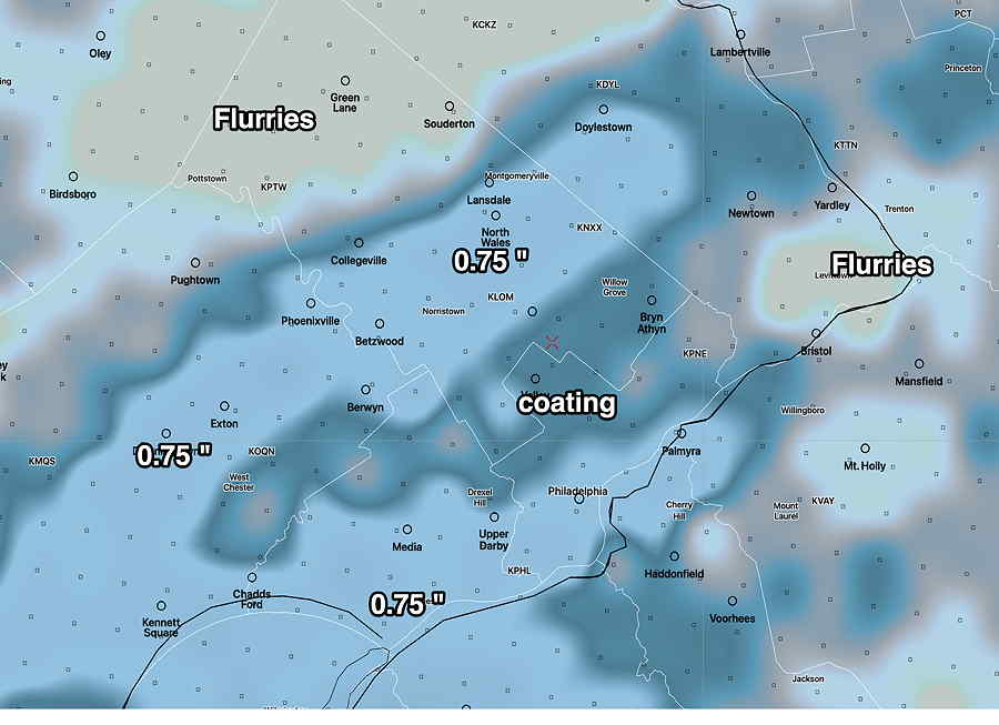
Update Sat @ 5:55 PM — More models are on-board with very light snow Sunday evening. The NAM and NAM-NEST have about 0.5-1″ by 1 AM Monday. The location of anything more than a coating varies by model. The HREF is provided below which shows the spotty nature of the snow forecast—
HREF forecast snow accumulation midnight Sunday. Very spotty accumulation. Location of greatest snow shouldn’t be taken literally. The forecast amounts are in the range of model error and model noise. (Click on image for a larger view.)
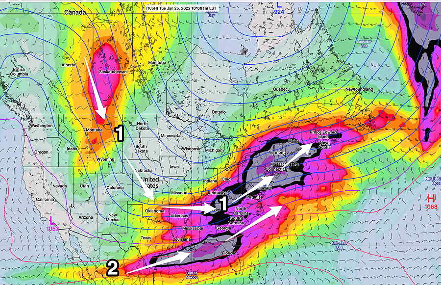
Things still uncertain for Tuesday. The NAM continues as an outlier with several inches of snow. Other models have a coating to less than 1 inch. Stay tuned.
Update Sat @ 11:19 AM — Sunday looks to be mostly sunny in the morning, increasingly cloudy during the afternoon. The weak upper air disturbance and cold front coming through Sunday night looks to have only some snow flurries, maybe a coating far western areas.
The possible storm on Tuesday is only being forecast by the NAM model. Other models have little development. This is not one of those situations where my “never ignore the NAM” mantra necessarily applies. In this sort of thing, the NAM is often off-target. But I’ll keep an eye on it.
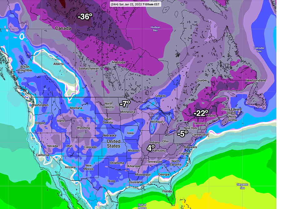
This weekend’s weather will be influenced by an upper air trough that has been with us for over a week. Very cold air is contained in this trough and our temperatures will be well below seasonal average through the weekend.
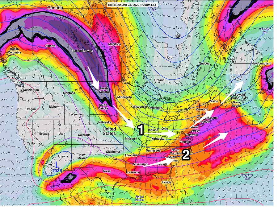
Canadian GEPS Low temperatures (NOT wind chills)expected 7 AM EST Saturday morning. Our low temperature will be about 11ºF (Click on image for a larger view.)GEFS forecast for Sunday 1AM showing upper air trough (1 )of the northern stream. The southern stream (2) will combine too far to our south and east to affect us. (Click on image for a larger view.)
A low pressure system predicted to form off the coast Saturday will move off well to our south and east. Cape May NJ will be on the very northern fringe.
Previously Posted Fri 5:04 PM —
The next active period may be Tuesday into Wednesday, when a more potent disturbance in the southern stream (2) may phase with the northern stream(1) closer to the coast, but the models currently have it occurring further north and east of us—
Friday night’s models are suggesting a greater possibility of coastal storm development on Tuesday.
GEFS Upper air flow on Tuesday at 10 AM showing strong jet stream from northern jet stream (1) and strong jet streak of southern stream (2)
Previously Posted Fri 5:04 PM —
Saturday
Sunny and continued very cold. Gusty winds in the morning, subsiding in the afternoon. High temp 28.6º ± 2.6º (NBM model Blue Bell)
Sunday
An upper air trough axis moves through.
Some cloudiness in the early morning, especially north and west of the city. Then partly/mostly sunny. Continued cold. Gusty winds. Clouds move in late afternoon.
The GFS is forecasting an upper air disturbance possibly bringing a dusting/coating of snow late evening Sunday, towards midnight.The NAM has some light snow earlier in the evening.