#Philadelphia #weather #PAwx
Posted Thursday 03/14/24 @ 9:50 PM — We did reach an official high of 77º in Philadelphia on Thursday with sunshine. Could not have been a nicer day.
Friday will be cloudy with very light and widely scattered showers in the morning and afternoon as a weak cold front passes through. The cold front really just means a slight reduction in temperatures and a wind shift. The upper air dynamics will pass to our north and the latest models actually show minimal precipitation for us. Indeed, the HRDPS shows no rain at all in the immediate PHL area on Friday and the HRRR isn’t far from that.
Saturday looks very nice!
Another cold front comes through on Sunday.
Posted Thursday 03/14/24 @ 10:07 AM — The forecast for Friday has clarified as the GFS joins the rest of the models with rainfall of about 0.3″. Rain moves in during the early afternoon Friday.
As for today, Thursday, the latest NBM appears to be running low again and this time with a standard deviation of over 3º, indicating high spread with the model forecasts. For today, we’ll use the Canadian HRDPS which tends to run just a bit high—
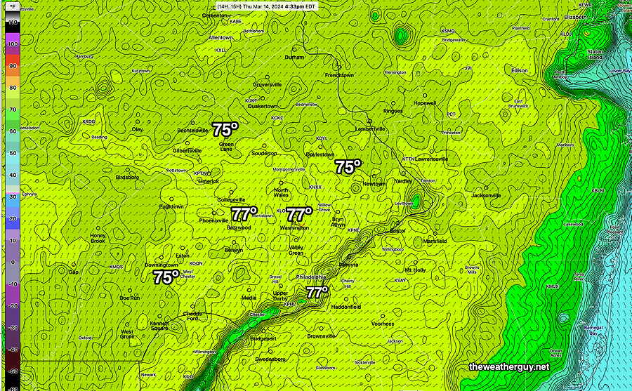
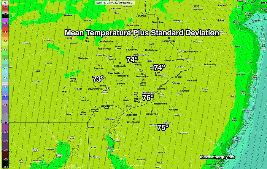
Posted Wednesday 03/13/24 @ 9:17 PM — Today’s high temperatures were predicted by the NBM, but only if the standard deviation was added to the mean temperature. The mean was too low, something I’ve seen before. With more sunshine on Thursday, I’ve taken the liberty to add the sd to the NBM mean temperature forecast for Thursday—
As for Friday, a cold front moves through during the day. There’s a wide range of forecasts for Friday’s rainfall with the latest GFS having low pressure develop along the front with significant rain during the evening (0.8″) Most other models have significantly less (0.20″ -0.0.35″) The GFS has some light shower activity during the day Friday, with heavier rain at night. Other models are much drier during the day. So an uncertain forecast for Friday at this time.
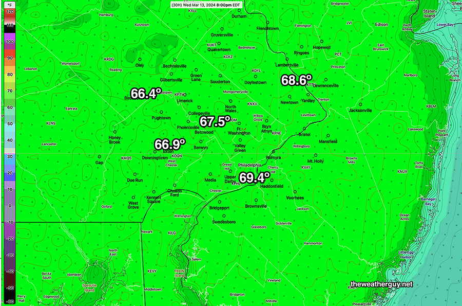
Posted Tuesday 03/12/24 @ 8:53 PM — It still appears that we’ll have some mid-level cloudiness late morning into at least mid-afternoon on Wednesday. High temperatures upper 60s to approaching 70º in some areas—
Posted Monday 03/11/24 @ 7:47 PM — A quick update to the forecast for the week. Latest GFS shows some cloudiness on Wednesday as warm air moves in aloft. Also, Thursday is now looking cloudy.
First Posted Mon 4:20 PM —Deep low pressure stacked vertically high in the atmosphere with a strong pressure gradient along with a strong jet flow aloft of over 200 mph has given us the high winds over the past 36 hours. It will move off to the northeast and winds should gradually subside.
Here is the current satellite water vapor image showing the low pressure east of Maine and the next weather systems down the road—
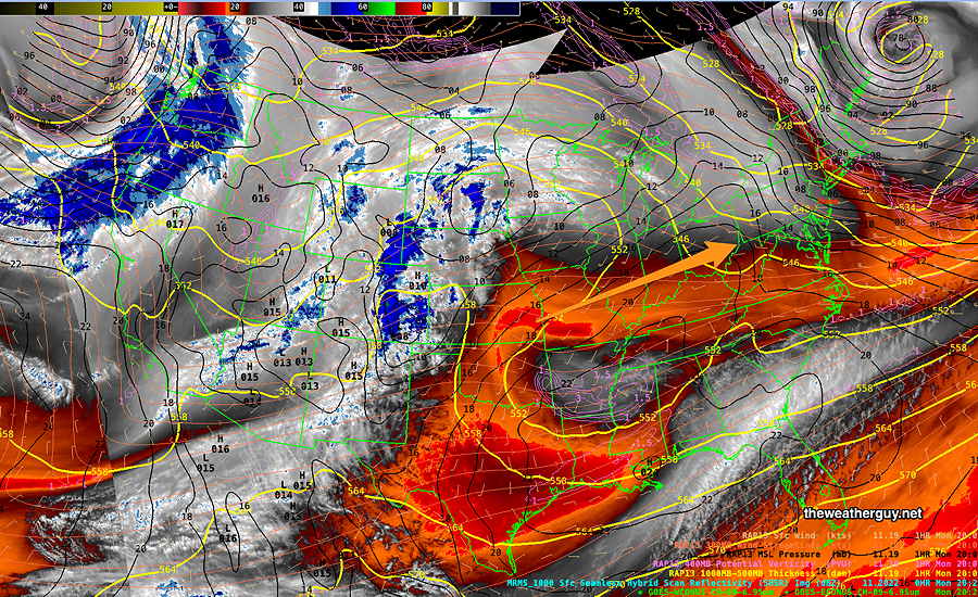
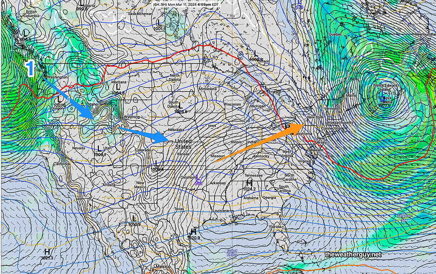
The weather map (NAEFS model) corresponding to the above water vapor image is below. A building ridge in the middle of the country will move eastward with warmer air. The system labeled (1) will affect our weather next weekend—
The warmer temperatures have been well advertised on the radio/TV weather. Here’s the NBM forecast highs for Blue Bell (add about 2º-3º for Philadelphia.)

Overall, sunny through Wednesday. Some gradually increasing cloudiness on Thursday with the high temperatures at or above 70º
Weather and Standard Time-> Daylight Saving Time
Twice a year, I feel compelled to talk about Daylight Saving Time and how it negatively affects timely access to updated evening weather model data before bedtime for those of us on the east coast.
Frankly, I love Daylight Saving Time and the extra hour of daylight we get in the late afternoon. The problem for us weather people is that major weather models are run worldwide at “00z” (Coordinated Universal Time or what used to be called Greenwich Mean Time). This corresponds to 7 PM Eastern Standard Time, but 8 PM Eastern Daylight Time. That hour makes a big difference.
Since numerical weather models take 2-5 hours to ingest data, compute and process, many of the major models become available too late in the night to be any use for us on the East Coast for planning our activities the following day.
When you hear “tune back in at 11″, you’re not going to see any change in the 5 day forecast at 11PM during Daylight Saving Time and you’ll likely see little change in the next day forecast; new model data simply hasn’t become available yet.
So for us weather people, the return to Daylight Saving Time has a negative impact on last minute evening updates regarding the next day’s weather.
Here’s some of the changes in some model availability (eastern time) :
| Model Name (00z model run) | Daylight Time | Standard Time |
| GFS 24 hour | 11:46 PM | 10:46 PM |
| GFS 5 day | 12:20 AM | 11:20 PM |
| NAM 24 hour forecast | 10:05 PM | 9:05 PM |
| NAM-NEST 24 hour forecast | 10:12 PM | 9:12 PM |
| HREF 48 hour forecast | 11:25 PM | 10:25 PM |
| Canadian HRDPS 24 hour forecast | 11:50 PM | 10:50 PM |
| Canadian RGEM 24 hour forecst | 12:10 PM | 11:10 PM |
| ECMWF* | 2:00 AM | 1:00 AM |
| ECMWF (free open data version) | 3:15 AM | 2:15 AM |
I’ve written extensively about Daylight Saving Time over the past years—
Little Known Facts about Daylight Saving Time and TV Weather Forecasts
