
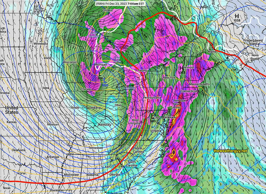
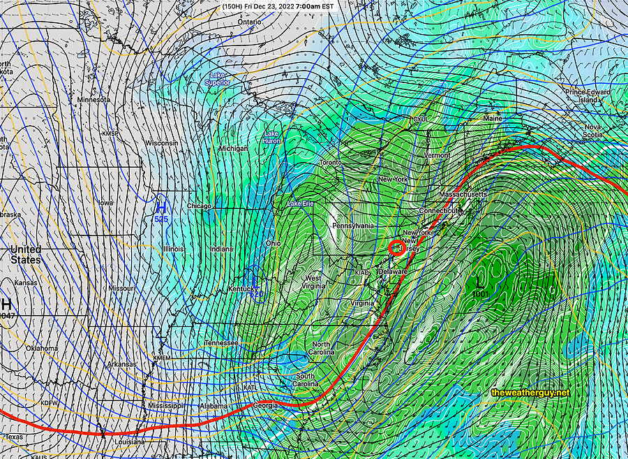
Update Sun 12/18 @ 5:55 PM — For snow lovers, the forecast for the coming winter storm continues to disappoint. All models show a rain event for us (albeit, heavy rain with high winds).
The latest GFS shows things tapering down from rain to possibly some snow flurries during the early evening hours Friday—
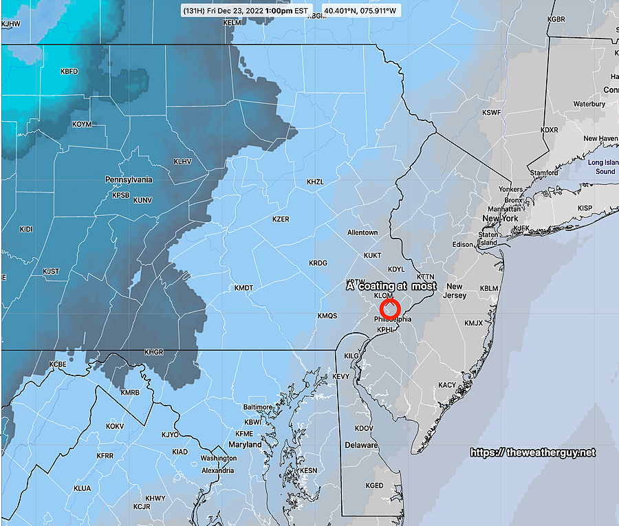
This afternoon’s NBM continues to show a coating of snow possible (< 0.3 inches) but that is within the background noise level of the model.
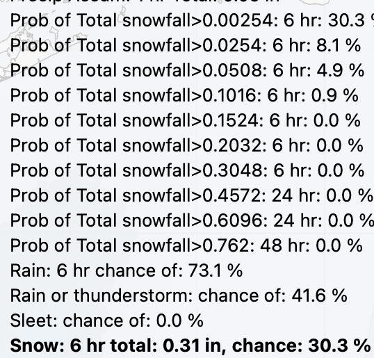
Here’s the latest NBM statistical numbers (meters. .0254 =1”) :
For those of you holding out hope, there’s still a reasonable amount of statistical spread with some statistical models. More about that tomorrow.
Update Sun 12/18 @ 9:16 AM — The forecast for this week’s winter storm has continued to clarify and the current secondary low development is expected (at this time) to be further inland, causing the Philadelphia area to be on the warm side of the storm. Heavy rain and high winds are expected.
NOAA and the NWS has just released the preview version (called the parallel run) of the new NBM model (version 4.1) this past Thursday, and major improvements in precipitation type forecasts suggests that I lean heavily on this new NBM model for the storm precipitation type forecast.
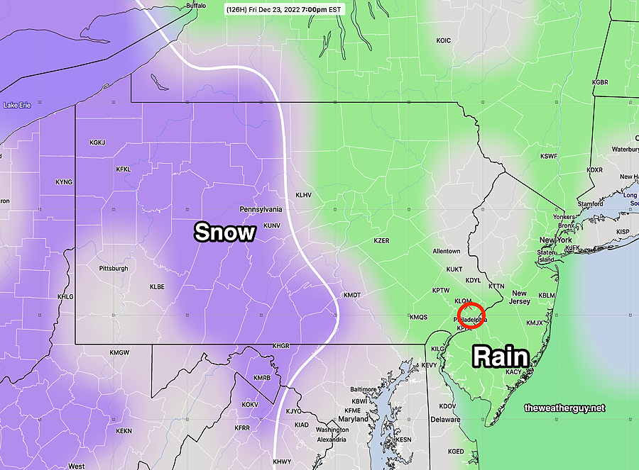
Time frame for the storm here— According to the new NBM, some light rain develops Thursday morning and the rain becomes increasingly heavy through the day, night and Friday. Rain tapers late Friday afternoon or early evening. Temperatures remain above freezing through the evening, so any ‘White Christmas’ we get will be only from snow flurries here.
Current NBM Snowfall —
Update Sat 12/17 @ 5:41 PM — Today’s models have moved towards a predominantly heavy rain event for late Thursday through Friday. A possible changeover to some snow later Friday for us.
Still plenty of time for the forecast to change.
Previously Posted Sat 10:28 AM —
A major storm is forecast by numerous models for the period late Thursday through late Friday. There are significant differences in how each model is handling the storm’s trigger energy that is still in the Pacific Ocean at this time (Saturday).
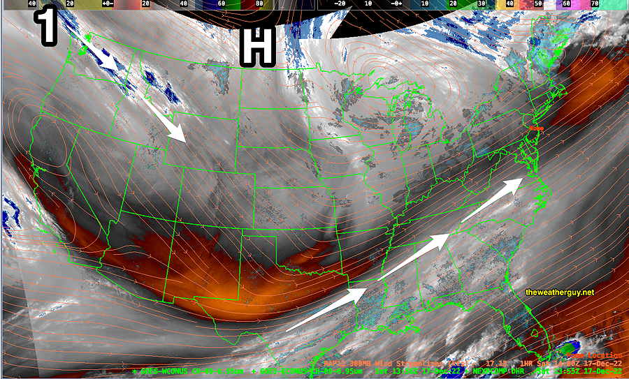
The current water vapor image captures the current upper air configuration—
As of today (Saturday) there are several possible scenarios for the storm, the main ones being—
- Main storm remains with the upper low pressure system, putting us on the warm side of the storm with heavy rain/wind. A changeover to snow may occur at the end
- A significant coastal storm develops, with enough cold air on the western side to have a significant snowfall here. The upper low is further south and east; the secondary low is further east.
Scenario 1: ECMWF (mostly rain—> possible snow) —
Scenario 2: NAESF: (mostly snow- heavy) —
The storm is expected at 140 hours in the future. Most models only extend 51-84 hours in the future, so we’re limited at this point in time to several global models and their statistical variants. The jet stream energy creating this storm is still very far away.
Stay tuned.