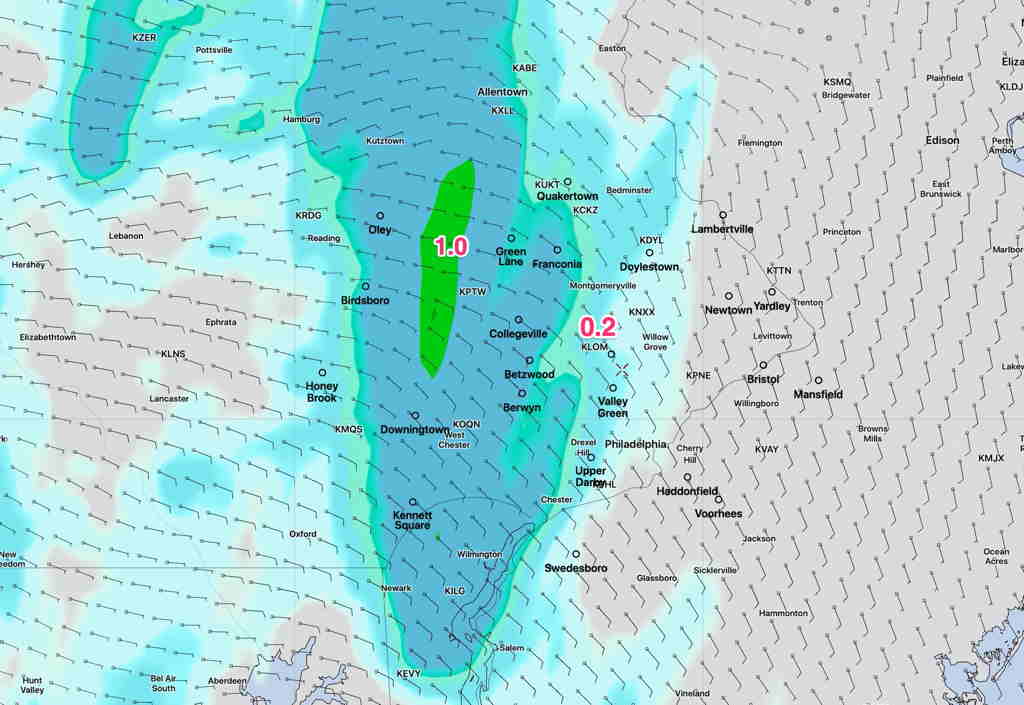
[su_note note_color=”#ffffff”]Updated Fri 10:35 AM — This mornings models continue with showers moving in about 12-1 PM. While most areas will receive about 0.2- 0.4 inches of rain, there will be isolated areas that have downpours of much more. These areas will be west of Philadelphia.
NAM-NEST Accumulated Rain by 5 Pm Friday (Click on image for a larger view.)
[/su_note]
An upper air low moves towards us as it weakens. Rain moves in about noon.
Friday —
Cloudy
Rain moves in about noontime. QPF 0.2-0.4 inches, more west of the city
[su_note note_color=”#ffffff”]Updated Thu 07:07 AM — The 2AM (06 UTC) model runs are more optimistic about sunshine today. They have high pressure again suppressing clouds to our south for much of the day. [/su_note]
Thursday’s forecast had been looking clear cut– high pressure nosing in would continue to suppress clouds and moisture to our south.
Tonight’s HRRR and RAP models just became available (these short range models are the first to become available this early during Daylight Saving Time) have moisture and clouds just reaching Philadelphia. Areas just north of the city will have mostly sunny skies; areas just south look to be mostly cloudy.
For Thursday—
Areas just north of the city will have mostly sunny skies; areas just south look to be mostly cloudy.