WEDNESDAY SNOW FORECAST UPDATE

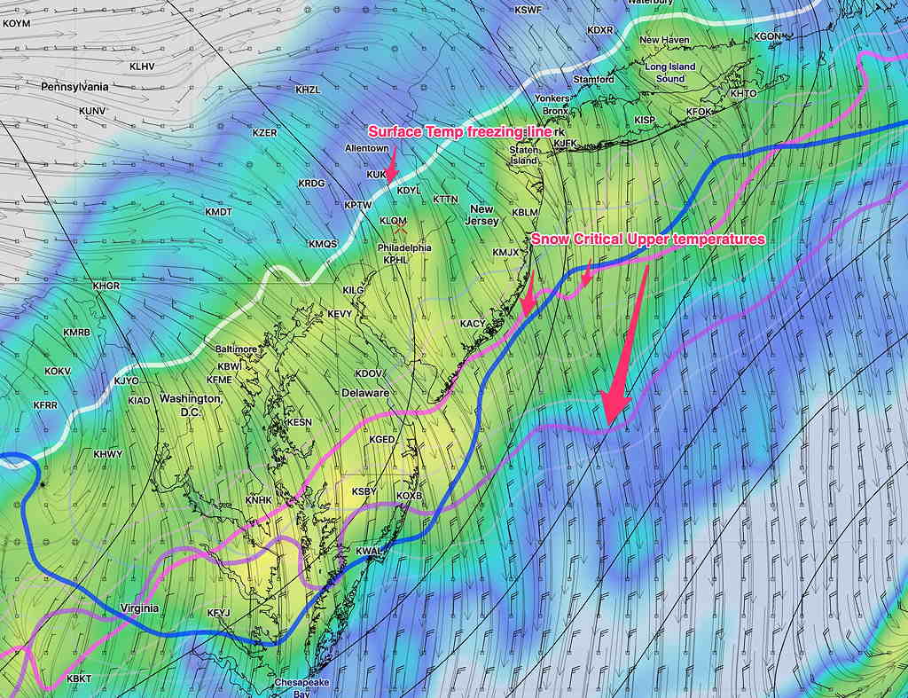
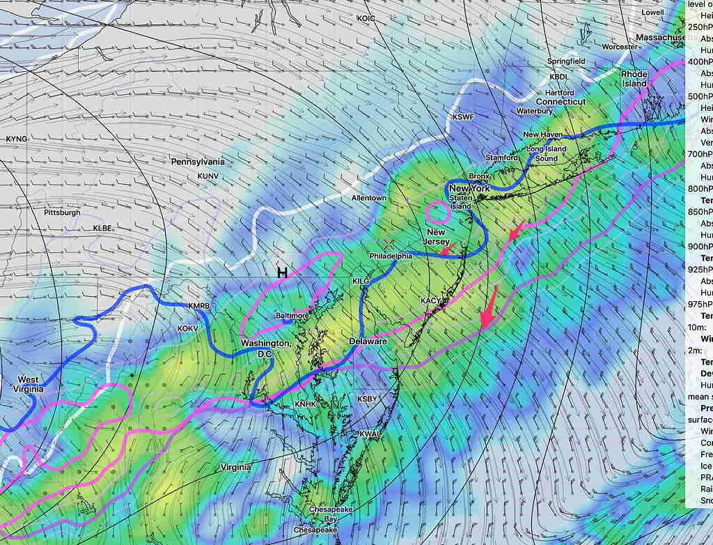
As posted last night, the GFS, NAM models were leaning towards 0.40 to 0.8 inch of snow accumulation, ending between 7 and 8 AM Wednesday morning.  It’s not unusual for these post-frontal passage snow events to trend lower on the snow forecasts, as cold air often scours out the moisture available for snow.  The models are showing less wave development on the front and faster influx of cold air.

This morning’s high resolution NAM NEST has just a  coating of snow. (0.27 to 0.45 inches of snow, basically nothing to a coating). The NAM has just a coating or snow showers, based on built-in snow algorithms.

If I use my time-tested, old-fashioned NAM FOUS data technique, I’m still at the 1 inch accumulation.

BTW, over the past year or so, I have developed software and scripts that automatically download real-time raw model data directly from the NCEP and the CMC.  (You may have noticed the new model graphics I post here.)

I think I may be running into a situation where my forecasts are distracted by “too much information”.

The most recent HRRR from 7 AM today shows nothing accumulating, with the precip remaining a wet mix of rain and snow!

So the trend is for a minimal snow accumulation.   Stay tuned.

WEATHER UPDATE FOR WEDNESDAY MORNING

[su_note note_color=”#defcdc”]Update Mon 10:15 pm: Tonight’s NAM, NAM Nest and the two WRF models have become available. I’m staying with the 1 maybe 2 inch snow totals, even though the built in snow algorithms are showing about 0.5 inches of wet snow.  Snow ends 8-9 Am Wednesday. We’ll have a better handle tomorrow.

Update Mon 10:50 pm:  Tonight’s GFS has also gone into the 0.5 inch snow accumulation range. So the trend is for less snow, less than an inch.
[/su_note]

The models are in fairly good agreement that rain will change to snow sometime after midnight Tuesday and light wet snow will be falling until sometime between 7 and 9 AM Wednesday morning.

The NAM built-in snow algorithms have only a half inch of snow accumulating, although if I use my old NAM FOUS data technique, it’s probably about 1.5 inches.

The GFS, Canadian High Resolution and the European are in the 1.3-2.0 inch range of accumulation using their built-in algorithms.

We know that these sort of post frontal passage scenarios often change, usually in the direction of less snow.

GFS Forecast Simulated Radar and Critical Snow Temperatures for 3:30 AM Wednesday. Click for larger image.

Tonight’s model runs will fall into the range of the 36-48 hour short range higher resolution models, and I’ll do a quick update later.

After the snow stops, it will become sunny by Wednesday afternoon, but fairly cold.  Treated roadways will be clear by afternoon.

LIGHT SNOW WEDNESDAY MORNING

[su_note note_color=”#defcdc”]Today’s models continue with the idea of weak low pressure developing along the front as it moves through early Wednesday.

There are differences in timing and snow amounts, but the statistical models, the GFS and the European have increased snow totals to 3 inches. We’ve seen these forecasts change drastically, but I’m letting you know that some amount of snow is expected during the morning rush hour on Wednesday.   Stay tuned [/su_note]

On my previous forecast, I mentioned that I would keep an eye on the strong cold front  moving through Tuesday night into Wednesday morning.  I mentioned that snow showers were possible Wednesday morning.

The most recent model runs suggest a trend that the rain mixes with and changes to snow sometime after midnight Tuesday as the upper atmosphere chills down, supporting snow.

While strong cold fronts often scour out any residual moisture, the models are showing that some weak low pressure development occurs along this front as it moves through, with moisture lingering after the cold air moves in aloft.

Latest GFS model forecast for Tuesday 11 PM showing snow-critical temperatures (arrows) have moved southeast of us.  Cold enough for snow. Shading is simulated radar.

The GFS has about 1 inch of wet snow for the Philadelphia area ending about 9-11 AM Wednesday morning  The NAM about 0.8 inches.   We know that things change.   Stay tuned.

Weather… and Other Things 'Up in the Air'