WEATHER UPDATE

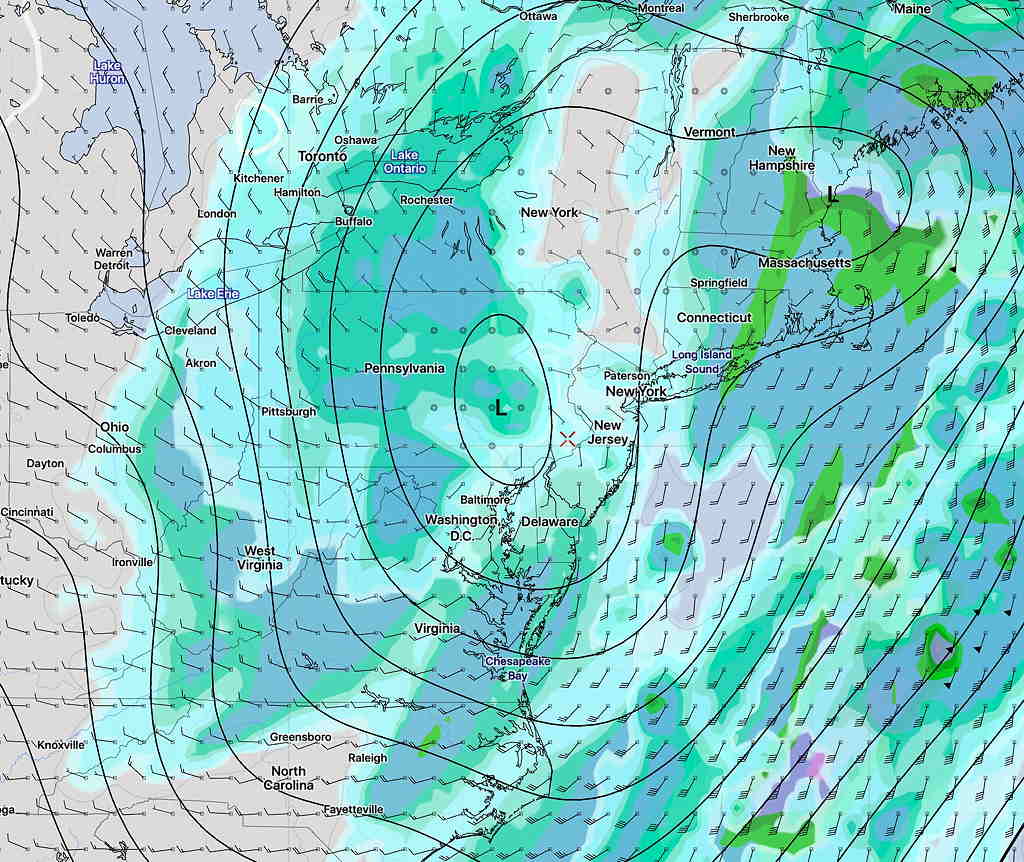
Only the NAM Nest and WRF-NMMB models predicted the earlier clearing and sunshine that we saw Saturday afternoon. So what does that say about the Monday model forecast? More about this in a moment

First, for Sunday: Departing deep low pressure will bring some clouds on Sunday morning as upper air disturbances rotate through our area.  More sunshine expected by Sunday afternoon.  Windy and chilly with highs in the mid 40s.

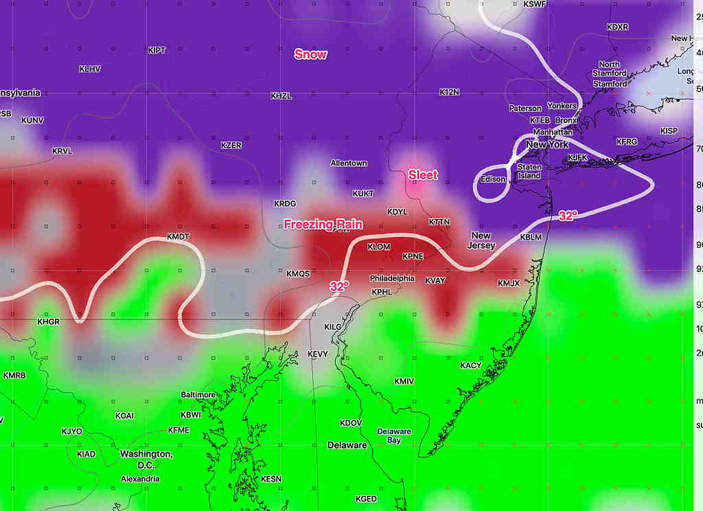
Monday: The latest models continue to predict a cold air damming event with warm moist air rising over entrenched cold air at the surface.  Snow is expected about 8-9 AM Monday and will change to and mix with sleet and freezing rain. The current prediction about the changeover time (snow to a mix) is late morning or early afternoon. It may remain a mix for a prolonged period. Total QPF has remained low and expected snow/sleet totals remain less than an inch.  (Tonight’s NAM shows a much higher QPF, which I’ll ignore for now.)

For this storm, I’m going to focus on the NAM NEST, the NBM and the WRF-NMMB, which did the best with today’s weather.

We won’t have a real handle on Monday’s forecast until tomorrow.  Stay tuned.

MONDAY WINTER WEATHER OUTLOOK

A winter-time precipitation scenario is setting up for our area on Monday.

A front moving through this weekend will return as a warm front, but with over-running precipitation and cold air damming.

What was originally forecast to be a quick change from light snow to rain has evolved into a “cold air damming” scenario where cold air trapped at the surface likely will result in a prolonged period of sleet or freezing rain. (The models are showing mostly freezing rain.)  The GFS also shows some dynamic cooling- as the precip increases, the surface temperatures drop.

Some amount of wintry mix may be falling into the late afternoon and longer north and west of the city.

The QPF is expected to be light and the predicted snow accumulation is about 0.5 inches, but the prolonged freezing rain possibility may present a travel issue.

GFS Categorical Precipitation type for 2 PM on Monday. Click for larger image

The ‘event’ is more than 50 hours in the future time frame.  The higher resolution models, with the exception of the NAM NEST, only predict 36-48 hours in the future.

These things are tricky to forecast.  In our area, the models tend to under-predict the duration of the mix precip.

Stay tuned.


WEEKEND WEATHER FORECAST

[su_note note_color=”#defcdc”]Update Fri 11:30pm: Tonight’s models have the heavy rain occurring Friday night. Scattered showers on Saturday.

Watching the wintery mix on Monday morning.  The NAM keeps the snow to our north.  The GFS has light snow —> freezing rain —>rain by afternoon. Stay tuned.[/su_note]

Our weather this weekend will be affected by a deep and intensifying low pressure that has already approached from the south and will be located over us by 1 PM on Saturday:

GFS hourly precipitation rate forecast for 1 PM Saturday

Saturday will be rainy, windy but very mild. Rain may be heavy.  High near 60!

Rain shuts off by late afternoon Saturday as the low moves up to our northeast.  It will remain windy.  Clearing and chilling down Saturday night but still windy.

For Sunday: The effects of the deep low will remain with us on Sunday in the form of windy conditions. It will be mostly sunny.  Temps will drop to more seasonable highs of 46.

[su_note note_color=”#defcdc”]A wintry mix is being forecast by the models for Monday morning, likely towards the end of the rush hour.  Some snow –> rain expected for Monday morning into afternoon as temperatures warm above freezing.  Accumulations of zero to a coating expected in the immediate PHL area at this time;  everything should change to rain by early afternoon, according to the GFS.

The European Model shows a delayed changeover and a continued period of snow into the afternoon with accumulations of a few inches. Stay tuned. [/su_note]


Weather… and Other Things 'Up in the Air'