Brief Update Wed 08:55 AM — Model-predicted high temperatures in the Philadelphia area on Friday are trending warmer- a summer-like Friday! High temps most likely in the mid 80s with dew points in the 60s.
Truly summer-like weather after these unseasonably chilly past few days! It will be breezy and increasingly windy/gusty later in the afternoon.
A cold front approaches later Friday afternoon with showers and thunderstorms moving from northwest to southeast. Current predicted time frame for the showers/thunderstorms is 4 -7 pm for the immediate PHL area (NAM) but closer to 9 PM (GFS)
The instability cloudiness and showers we had today will dissipate tonight as cold high pressure builds in for Tuesday behind the departing upper air low.
Tuesday will be
Sunny with some fair weather clouds
Unseasonably cool. High temp 57.2º sd 1.6º
Winds from the NW 7-10 mph, occasional higher gusts.
The anomalous dip in the jet bringing this cool weather will transform to more of a ridge pattern by Thursday and especially Friday.
A Bermuda high will bring much warmer temperatures. Friday’s high temps will likely approach 81º (model blend), but some thunderstorms later on Friday will move in ahead of another cold front—
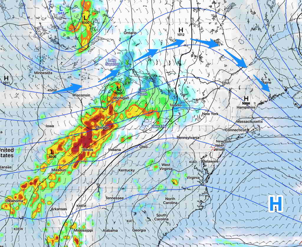
GFS Forecast for late Thursday. Blue arrows depicts upper ridge. (Click on image for a larger view.)
The extended range models show a much more seasonable temperature pattern developing after this week.