The models overstated the cloudiness for this afternoon big time. A beautiful afternoon. I guess there was a good reason the NBM showed such high uncertainty.
While there had been uncertainty about the cloud forecast for this afternoon, the latest models show significant cloudiness this afternoon and the NAM-NEST, HIRESW and NBM show the possibility of scattered light sprinkles moving in about 2 PM from the east.
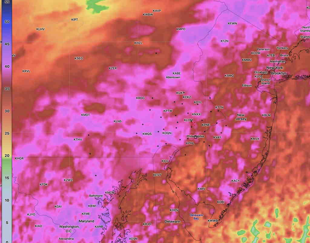
This morning’s low temperatures at 7 AM, based on the RTMA (Real Time Mesoscale Analysis)
RTMA temperatures at 7 AM Sunday morning (Click on image for a larger view.)
In yesterday’s forecast, I mentioned the possibility of cloudiness for Sunday afternoon. Several of the models have low cloudiness moving in on an easterly flow Sunday afternoon.
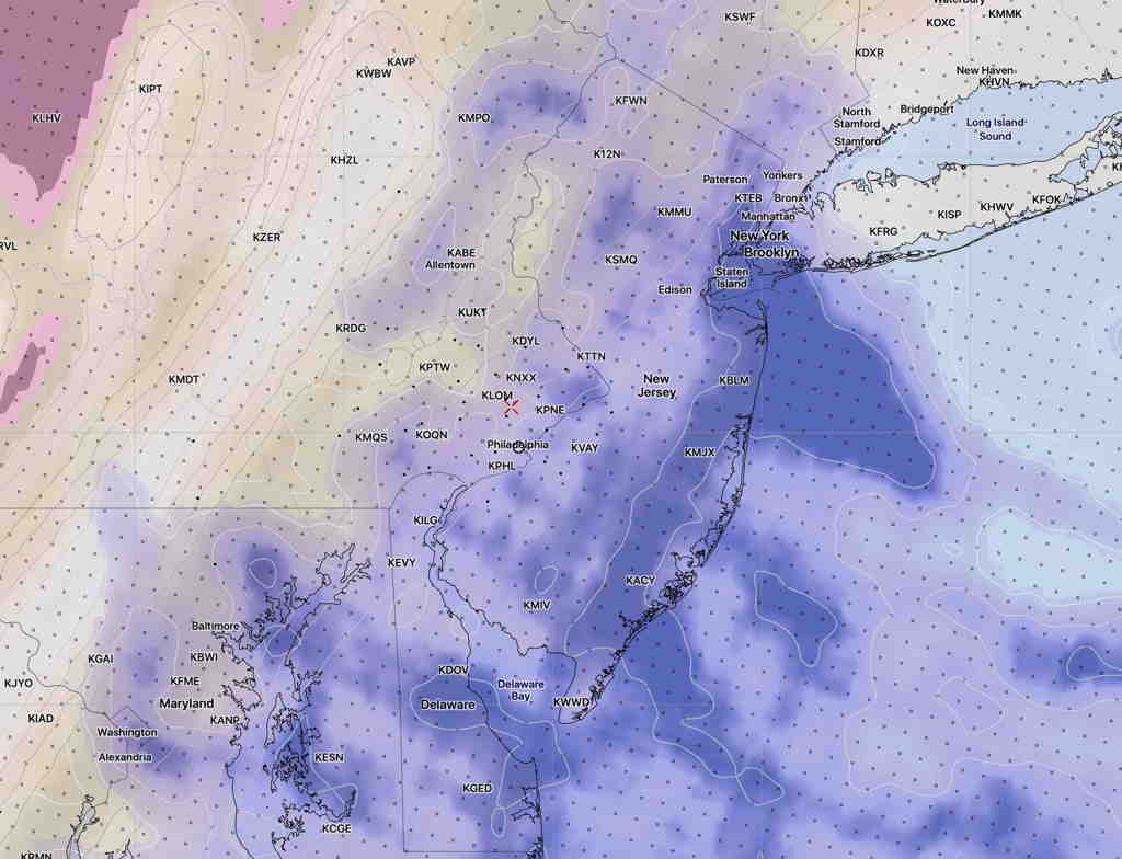
The model blend statistical treatment shows about 40% mean (average) cloudiness, but the standard deviation (a measure of the spread in the models or it can be interpreted as uncertainty) is as high 45-50%, especially west of Philadelphia Sunday afternoon by 3 PM.
NBM Cloudiness Standard deviation at 3 PM (Click on image for a larger view.)
The high resolution NAM-NEST shows low level cloudiness moving in, with a mix of high and middle level clouds further to our west—
NAM NEST cloud forecast (high, medium, low clouds) for 3 PM Sunday. Low level clouds are in blue. (Click on image for a larger view.)
So, there’s uncertainty in the degree of cloudiness for Sunday afternoon, but I’m thinking it might be significant by 3 PM.
High temp Sunday 63.7º with a high confidence of 0.8º standard deviation. (The standard deviation can be thought of as 67% of the time, the temperature will fall with ± 0.8º of the mean temp 63.7º)
Low pressure is moving northeast off the coastline on Friday as high pressure builds in from the west.
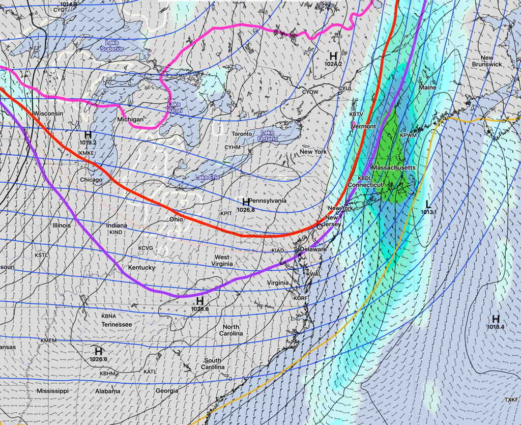
A quick dip in the jet stream will occur tonight with some chilly temperatures by morning, as depicted by the “540 thickness line” (red line) in the SREF model—
SREF forecast for 8 AM Saturday (Click on image for a larger view.)
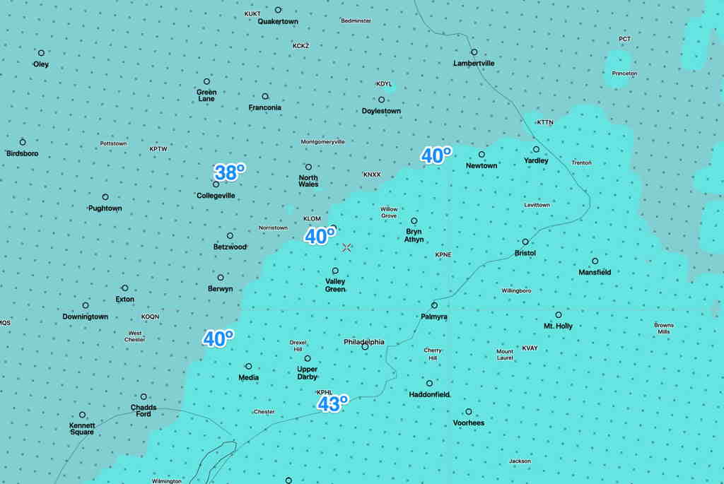
Some chilly temperatures Saturday morning—
NBM low temps Saturday morning 8 AM (Click on image for a larger view.)
Saturday—
Sunny
Starting from a low temperature of 37-43º, the (NBM) high temp 58.3º sd 1.3º
Somewhat windy in the morning.
Winds NW 10-12 gusts to 15. Winds subside in the afternoon.
For Sunday, winds shift to the SSE and milder temperatures move in. Some high cloudiness expected too.
Sunday—
Mostly sunny. Some high cloudiness possible in the afternoon.
High temp (Model Blend- NBM) 62.8º
Winds SE 10 mph, some gusts to 15 mph around noon.