#Philadelphia #weather #PAwx #PhillyWx
Thursday Thunderstorms
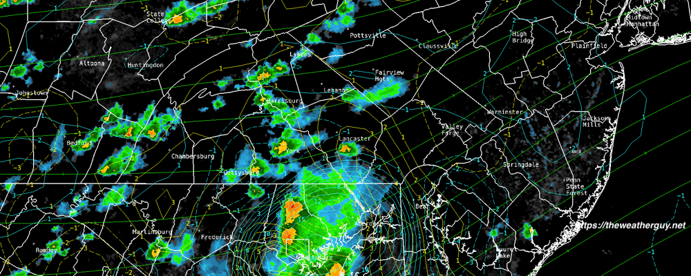
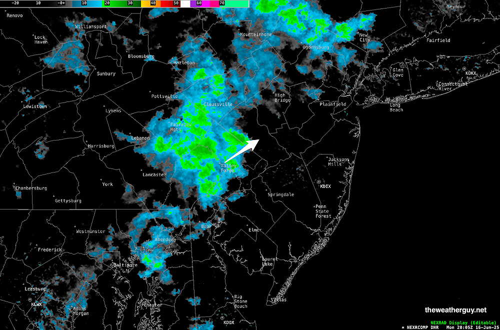
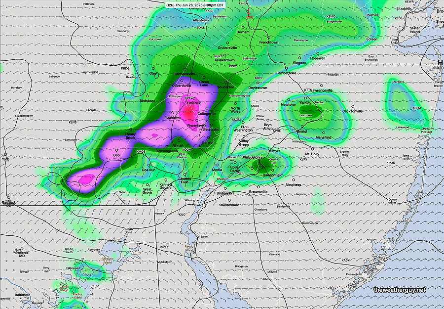
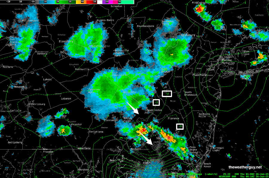
Posted Thursday 06/26/25 @ 5:13 PM — The NWS has issued a severe thunderstorm watch. Some strong thunderstorms have developed far northwest of Philadelphia. Latest radar at 5 PM—
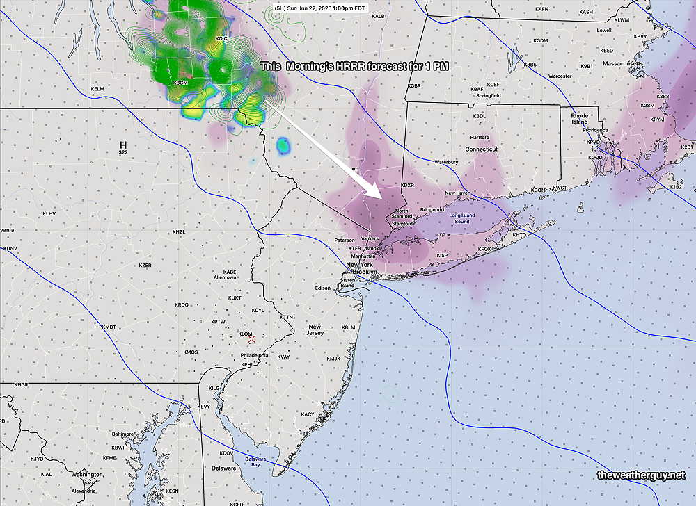
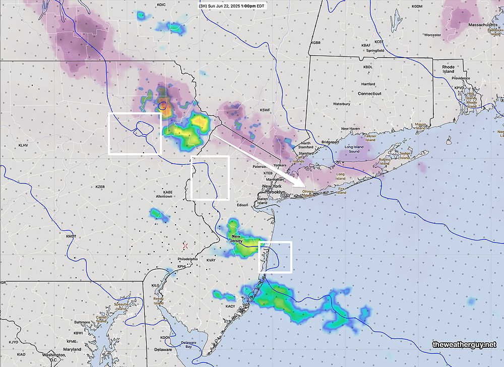
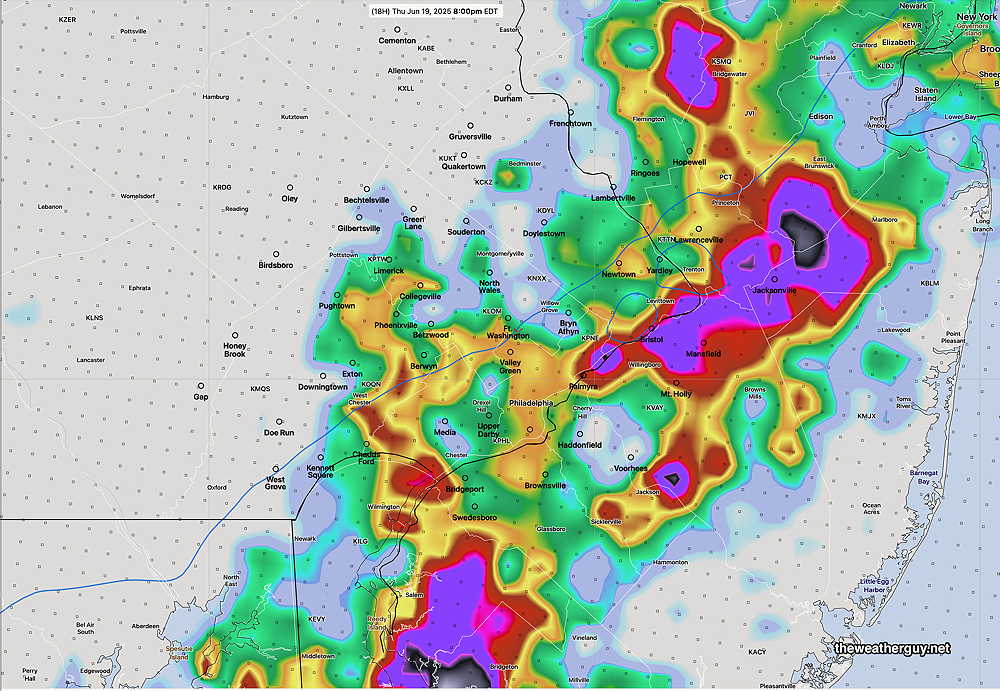
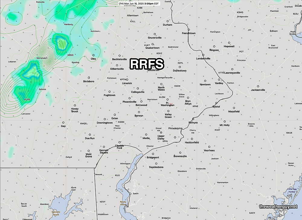
The models have only been so-so with today’s forecast. Many models have forecast areas of storms that have not materialized late this afternoon. That’s particularly true of the experimental RRFS which forecast many areas of rain at this very time.
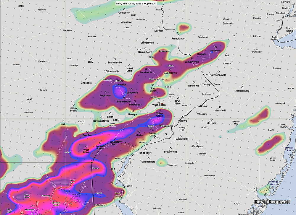
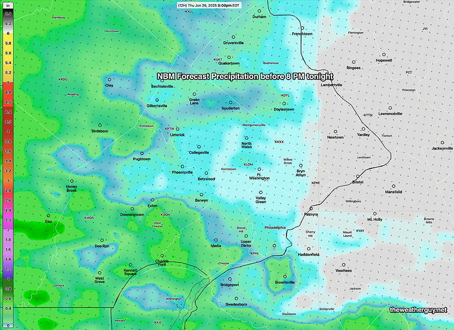
The trend mentioned in this morning’s update suggests the heaviest activity will remain just west of Philadelphia, as shown in the NBM graphic earlier.
The latest HRDPS and NAM-NEST capture the most likely forecast, again keeping the heavy rain to our west.
These things are tough to forecast with high precision. I guess we’ll see what happens in the next few hours.
Thursday Forecast
Posted Thursday 06/26/25 @ 9:44 AM — Nailing down the forecast locations and timing of thunderstorms yesterday met with mixed results; the additional storms forecast towards midnight didn’t materialize.
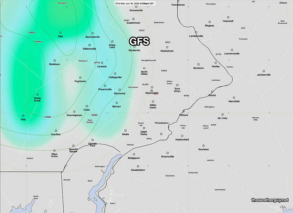
Today, Thursday, presents another thunderstorm forecast challenge. Model forecasts range from storms developing as early as 2 PM near the city to storms mostly staying to our west and south (and South Jersey) through most of the afternoon and evening.
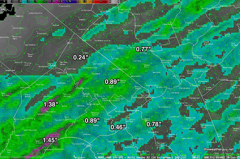
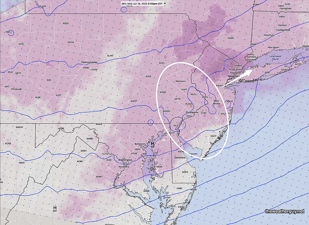
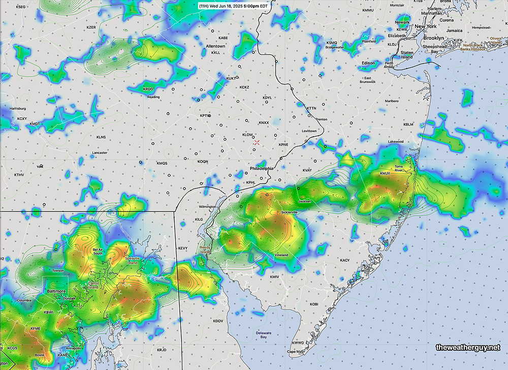
The NBM total rain accumulation captures the overall trend of any showers and storms staying to our west, south and east—
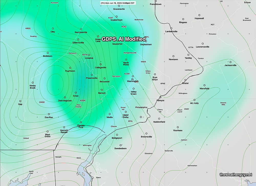
In contrast to this NBM forecast is the latest ECMWF-AI model, which does have showers and storms in the immediate Philadelphia area by mid afternoon.
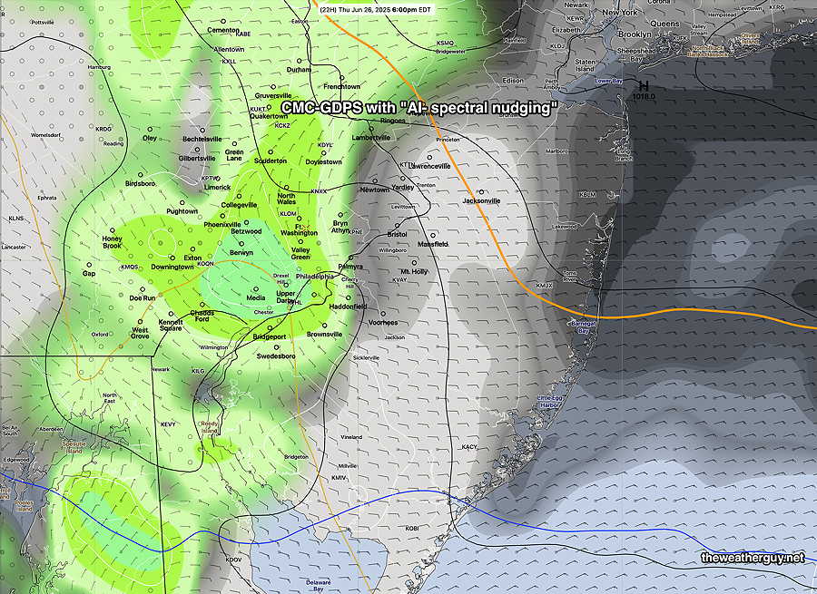
Also in contrast to the NBM is the Canadian GDPS- with “AI spectral nudging” which has thundershowers in and near Philadelphia between 3 PM and 7 PM.
A tough call. I guess we’ll find out.
Wednesday Night into Thursday
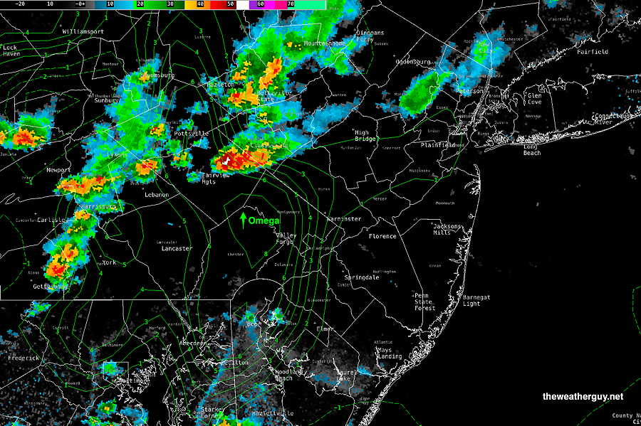
Posted Wednesday 06/25/25 @ 8:16 PM — Isolated to scattered storms developed. Very low wind shear has resulted in the storms forming and then collapsing. (Wind shear is needed to keep thunderstorms alive.)
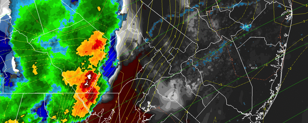
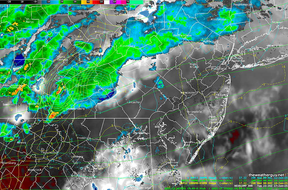
Current radar at 8:10 PM
Today’s HRRR was unusually poor in forecasting the current storms. The experimental RRFS did better. Continuing with the RRFS, it is shows additional scattered short-lived storms through 3 AM as the backdoor cold front slowly moves through.
Thursday will have a mix of clouds and sun. Isolated to scattered storms are expected to begin to pop about 3 PM into Thursday evening. More details tomorrow.
Wednesday into Early Thursday
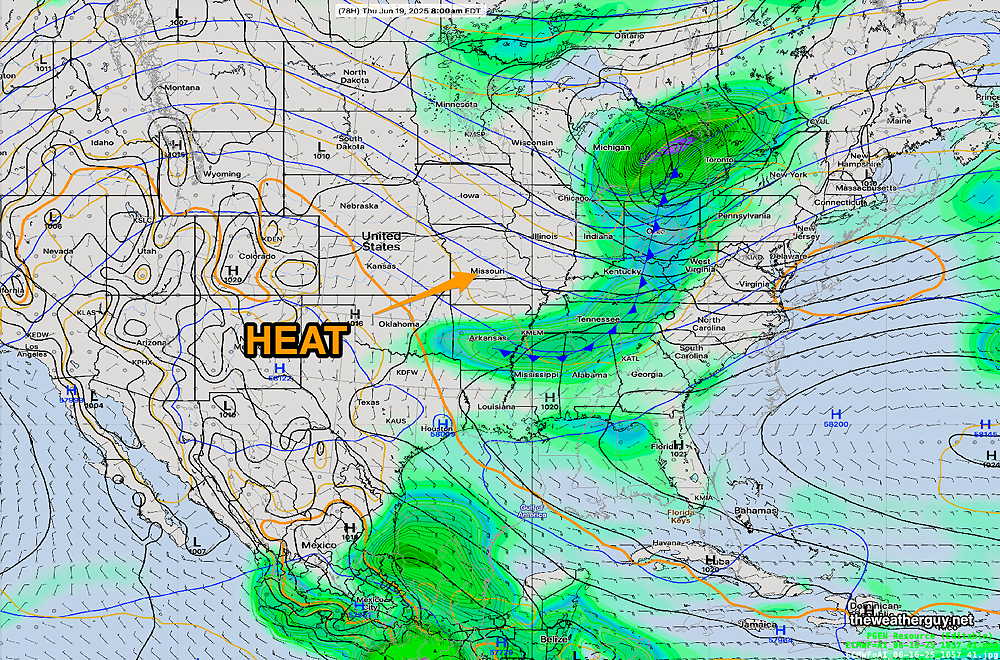
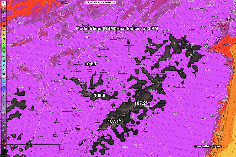
Posted Wednesday 06/25/25 @ 8:30 AM — As described yesterday, the heat dome will retreat late Wednesday as cooler high pressure slowly noses in from the northeast (backdoor cold front). Before that time, temperatures will again approach high levels, between 98º to 100º in and near the city.
Dew points will be higher today at peak temperature time, and I’ll have to resort to the Heat Index temperatures to capture the full impact. (I avoid posting heat index values since I think they’re often used to unnecessarily sensationalize, exaggerate heat episodes on TV broadcasts. Maybe not so today.)
As for thunderstorms, high heat, high humidity and several short waves ahead of the approaching backdoor cold front will create conditions ripe for thunderstorms with heavy rain. The latest HRRR is least on-board with storms here, but the AI models, the NAM-NEST, Canadian RGEM,and the RRFS show the possibility of isolated storms (especially in the wind shift/convergence zone in NJ) as early as 2PM.
Increasingly thunderstorm coverage expected late in the afternoon and especially in the evening hours (6 PM to midnight) where they should become more numerous. Not everyone will see a storm, but those that do will likely see some heavy rain. Severe winds, always a possibility, are not expected at this time.
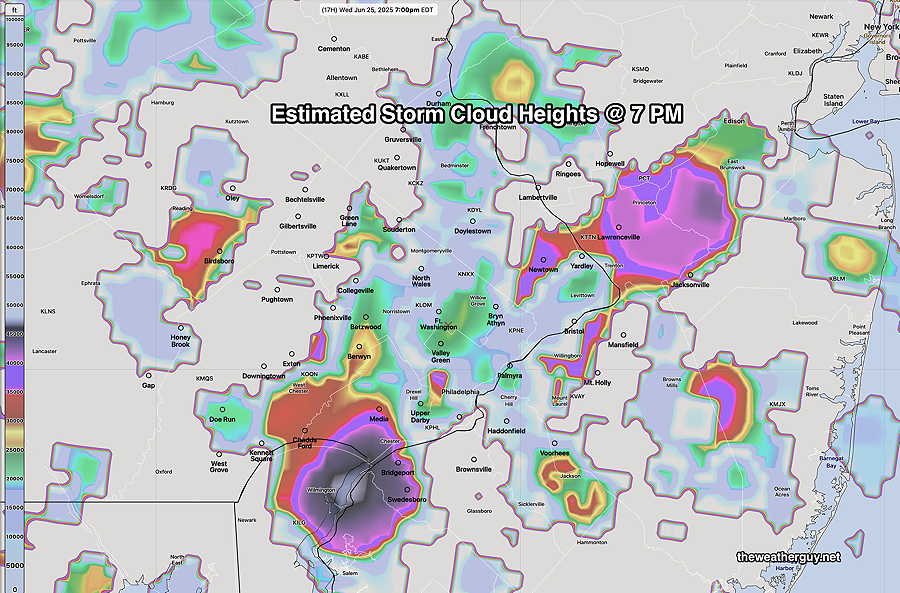
To convey the scattered nature of the storms, here’s another model parameter that attempts to predict the strength of individual thunderstorm cells at 7 PM.
Wednesday- Heat Early Afternoon Reduced by Thunderstorms
Posted Tuesday 06/24/25 @ 7:57 PM — Disturbances moving across the upper heat dome are expected to bring showers and thunderstorms to our area Wednesday afternoon and evening. Some may be strong.
High temperatures of 99º and possibly 100º in parts of the city will be reached early, before 2 PM.
Thunderstorms develop and move in from the northwest and develop in place as early as 2 PM and continue into the evening. Impressive thermal instability (negative 8 “lifted index” and near 40 K index) and high CAPE values approaching 3000 J/Kg could make any storm strong to severe.
I’ll update Wednesday morning.
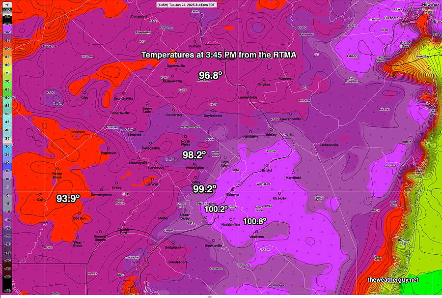
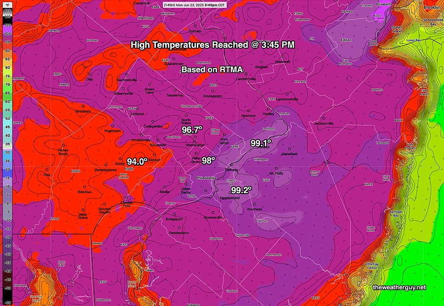
Here’s the RTMA temperatures at 3:45 PM—
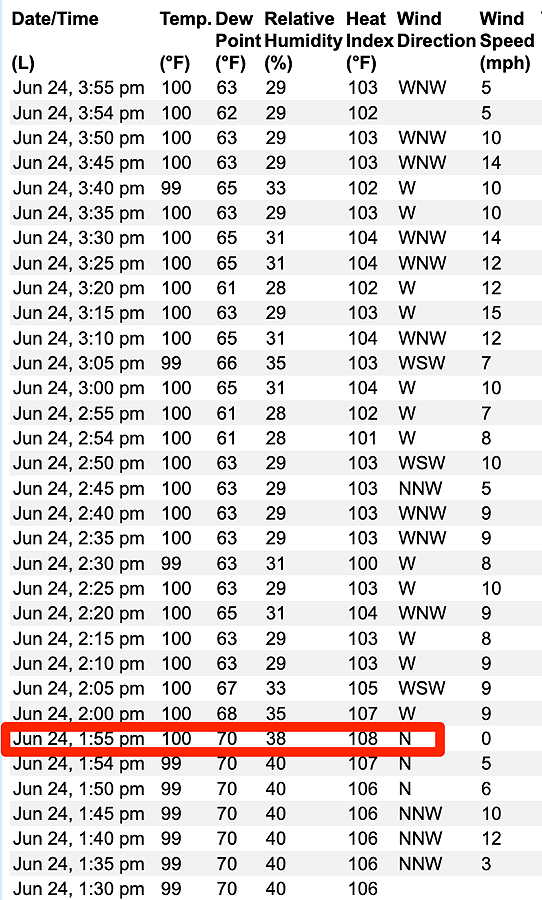
Here’s the official readings from the NWS Philadelphia Airport KPHL—
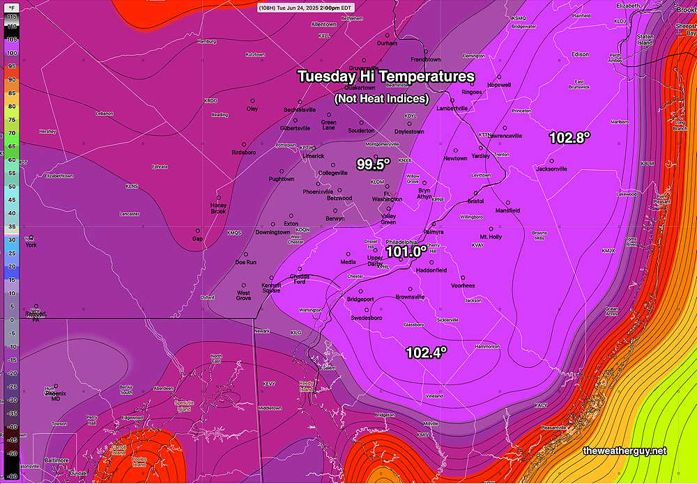
Heat Continues
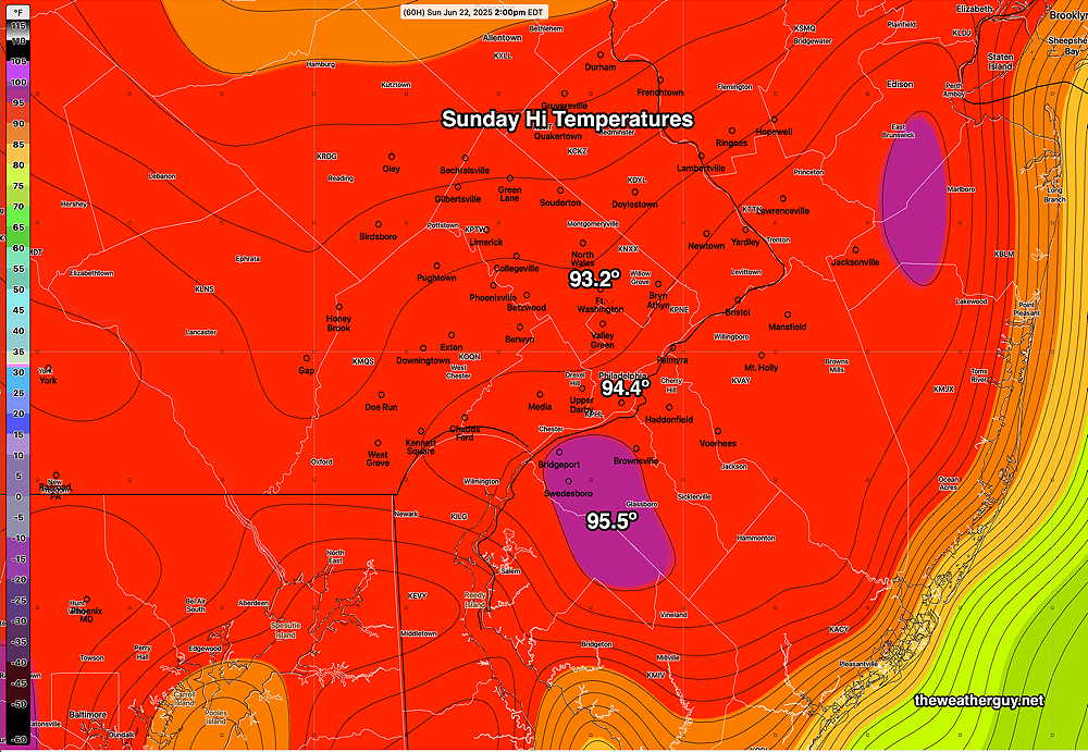
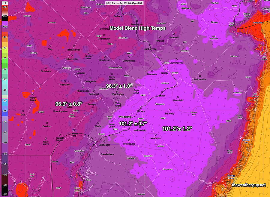
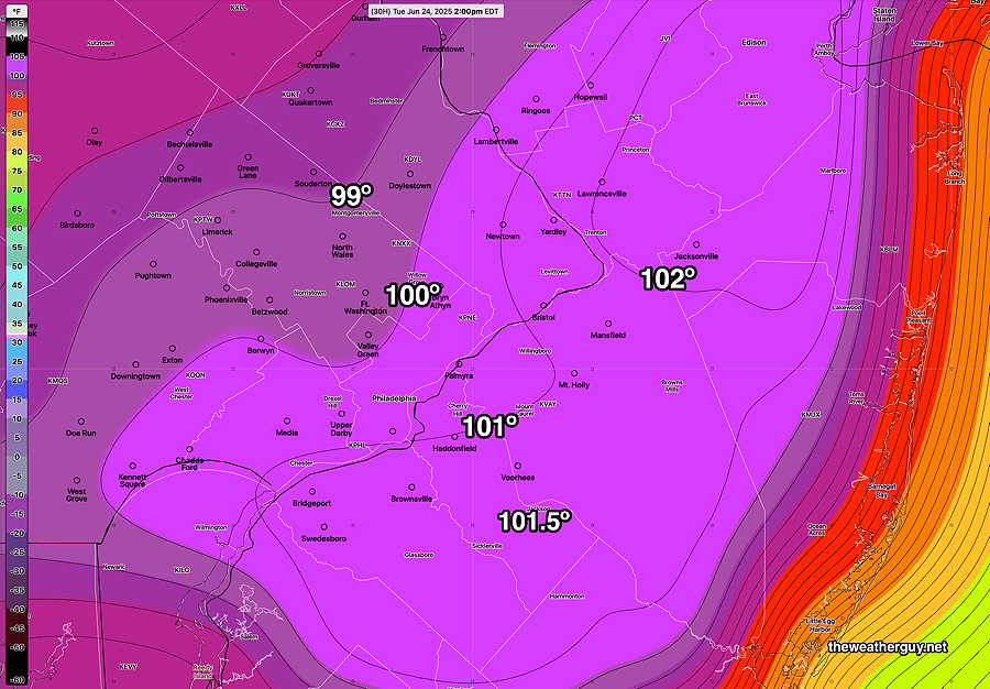
Posted Tuesday 06/24/25 @ 9:26 AM — Many models have similar high temperature forecast for today. The latest Model Blend (NBM) just became available. Here’s its forecast highs with degree of uncertainty (standard deviation) for today, Tuesday—
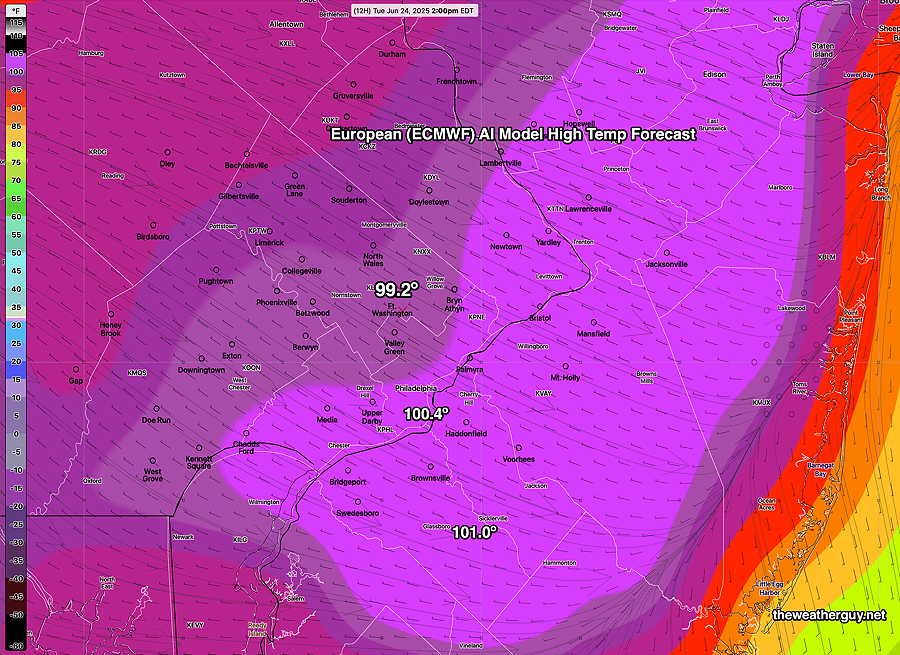
Here’s the latest ECMWF-AI model high temperature forecast—
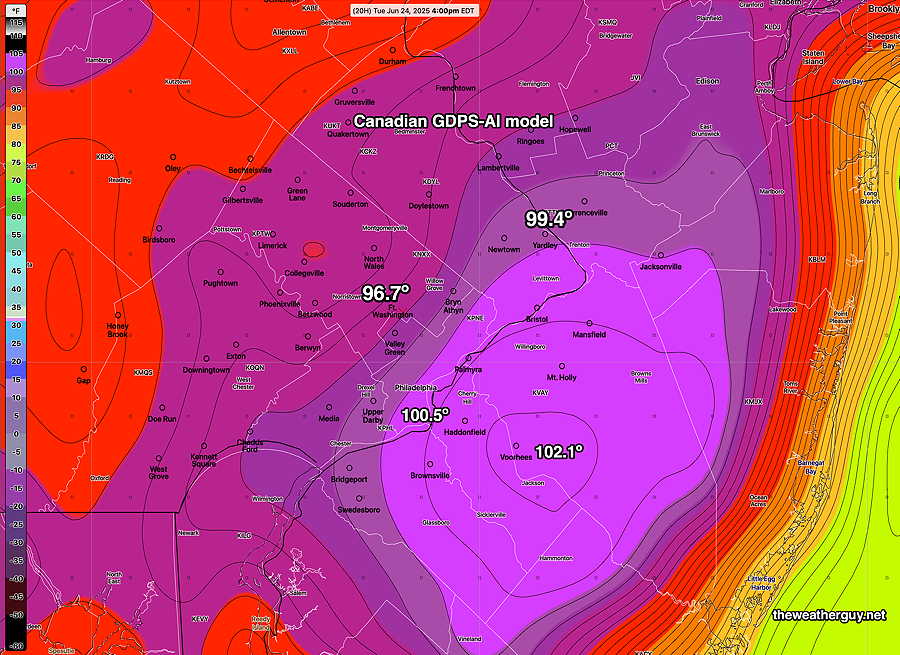
Here’s the new Canadian CMC GDPS-AI forecast—
Heat Recap
It really felt hot today! Temperatures seem to have only reached 99º in this area, but dew points were 70º (and where highs were only 96º, e.g. Blue Bell, the dew points were closer to 74º and 75º
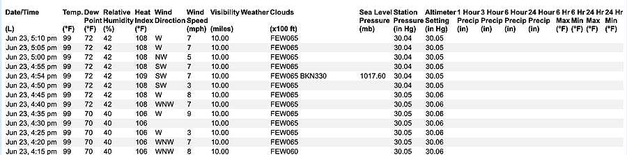
Here’s the RTMA @ 3:45 PM, capturing the area’s temperatures—
The NWS has modernized their website for KPHL airport, now showing temperatures every 5 minutes—
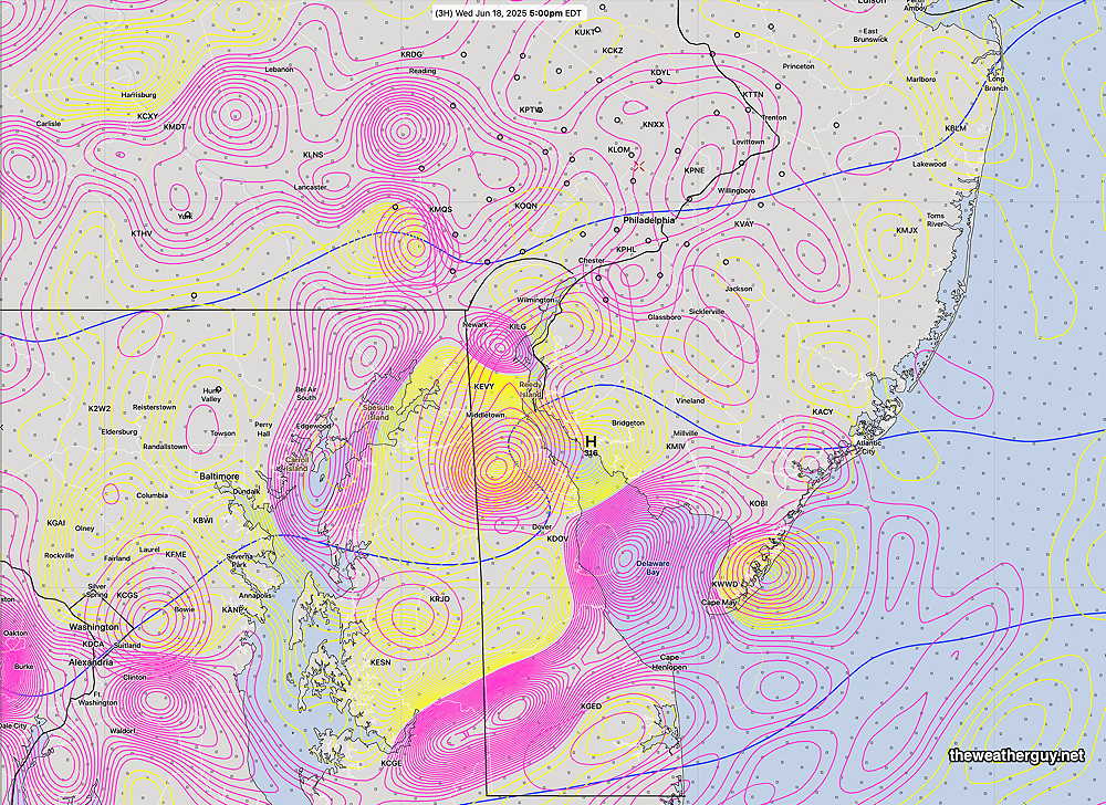
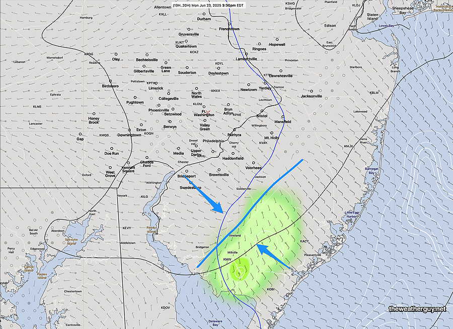
Of interest is the localized area of showers that developed, as predicted by the new Canadian GDPS-AI along with the wind convergence zone—
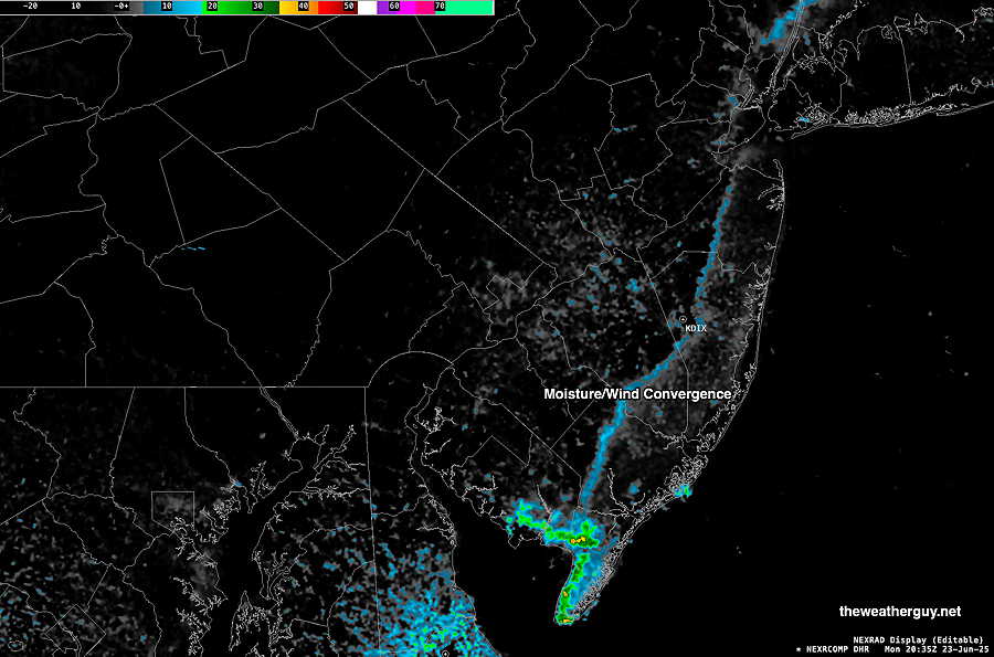
It’s interesting that the experimental RRFS did not predict these showers in Cape May. (The NAM-NEST did predict these as well.)
For Tuesday, here’s the latest ECMWF-AI temperature forecast—
Stay cool!
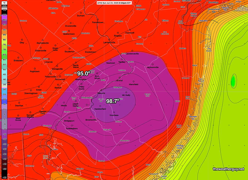
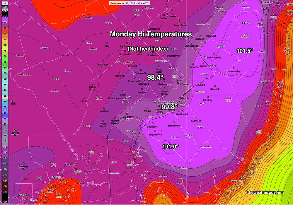
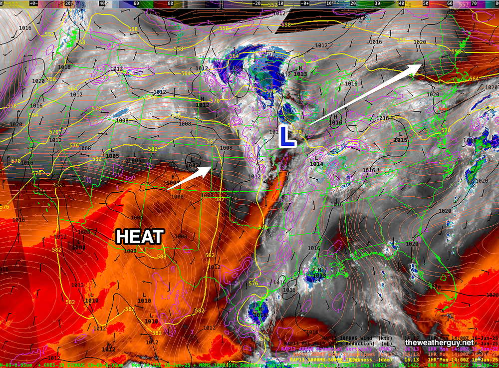
Originally Posted Mon 9:22 AM —Yesterday’s high temperatures were diminished by the unexpected and unforecast clouds and showers.
The heat will be here for sure today.
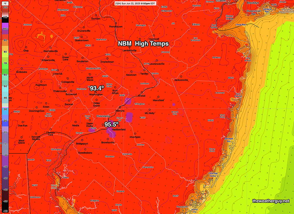
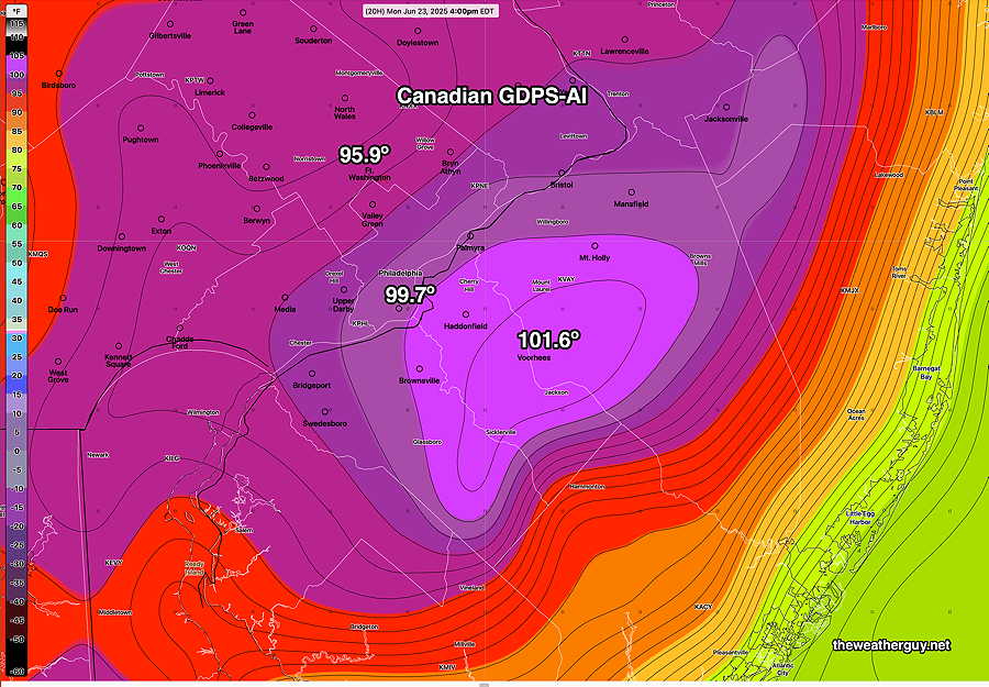
Continuing with the “experiment” from yesterday, here is the new Canadian GDPS-AI along with the Model Blend (NBM) forecast high temps for today. likely about 3-4 PM—
Here’s the Model Blend (NBM) high temps—
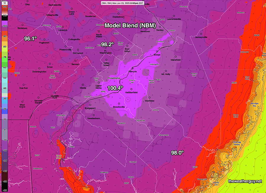
The “Open Data” version of the ECMWF-AI single is very similar to the above.
Just to see if the Canadian has any unique insights, it is forecasting some thundershowers to develop in NJ at 3-4 PM due to the development of a moisture convergence zone—
Stay cool!