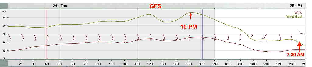
Thu 10:07 PM Update — Tonight’s models have increased rain amounts to over two inches. Highest winds about midnight. Squall line comes through about 3AM. Snow flurries possible late morning, especially western suburbs. Windy and increasingly cold Friday afternoon. Some sun breaks out during the afternoon.
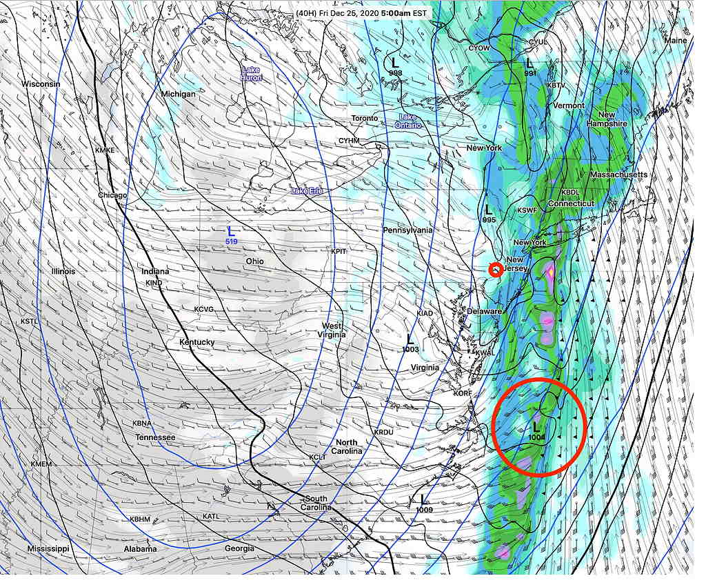
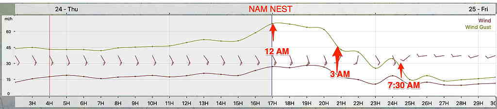
Storm Update- High Winds. A squall line moves through about 3 AM Friday. Cold front passes through 7-8 AM Friday morning.
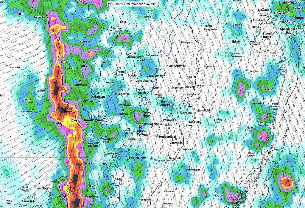
The latest models are coming in. They show rain starting, depending upon your location, between 12-3 PM today. Rain totals between 1.5 and 2 inches by Friday morning.
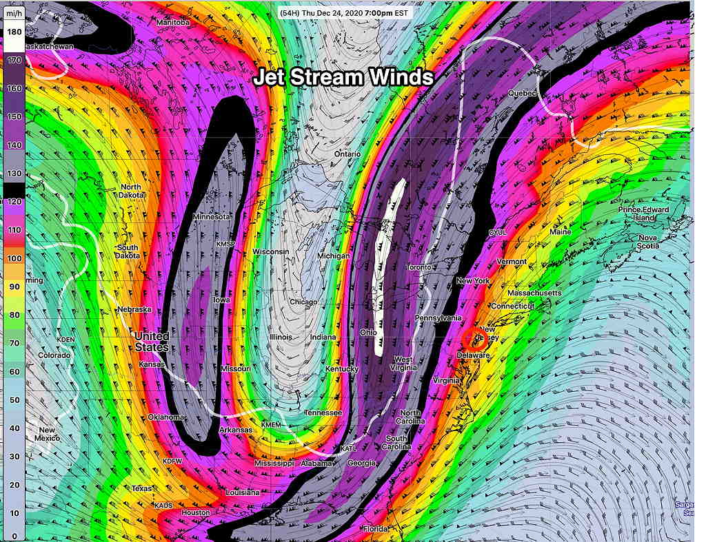
Very windy with wind gusts 50-65 mph, especially with the squall line that moves at around 3AM, ahead of the actual cold front. The actual front moves through about 7-8 AM with a sharp wind shift. Rain showers should end with the frontal passage at that time.
Slight differences in timing of peak wind gusts between NAM NEST and GFS models—
Cloudy Christmas Day. Windy and increasingly cold. Snow flurries possible, especially far western suburbs.