The main model used in US weather forecasting is the GFS (Global Forecast System), a model that continues to be developed and improved. The last major upgrade to the GFS model occurred in June 2019 with the release of the GFS-FV3 which was “version 15” in its evolution.
I wrote a brief post about this model back then, describing the changes in “FV3” ( Finite-Volume Cubed Sphere Dynamical Core) geometry that the model uses to divide up the atmosphere into geometric units that can be handled mathematically. The complexity of these models is amazing and the NOAA scientists that create these models can only be admired.
The new version of the GFS model continues with the FV3 geometry (in the long line of this model evolution, this will be GFS version 16) and it has just become available this past week on a full time NOAA server. It’s available in what is referred to as a test “parallel mode”, meaning that it is running at the same time the current operational version (v 15) is running.
If you’re into technical stuff, or just want to be dazzled by the science of these models, check out this early presentation from the NOAA Model Evaluation Group. It gives a brief history of the GFS model development and also presents the improvements, short-comings and challenges of the new GFS v16 model. The official GFS v16 evaluation website can be found here with plenty of additional information.
If all goes according to plan, it should become the GFS model early February 2021.
I would expect general improvements in weather forecasts with its release. Additionally, the GFS model is used to set the boundaries and initial conditions for several other models—
GFS-MOS
UKMET
MAG
HRRR
RAP
NWPS
NBM
HWRF
HMON
GEFS
So several other models’ accuracy will benefit when the GFS v16 becomes operational early 2021.
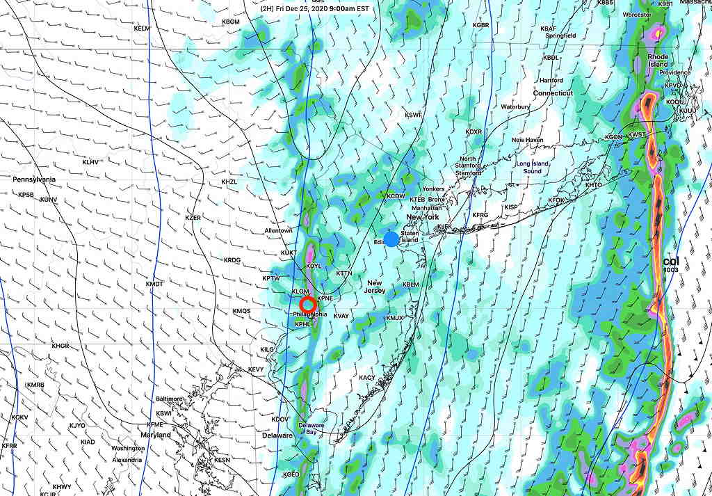
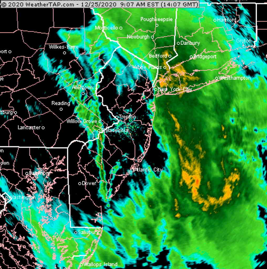
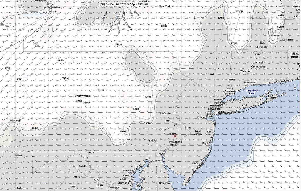
What could be a better example of the new GFS model’s improvement than today’s cloud forecast? Last night’s operational GFS had forecast for it to be sunny here at 3 PM today, keeping the clouds to our west —
The new, soon to become operational GFS version 16, had a correct cloud forecast for today at 3PM—
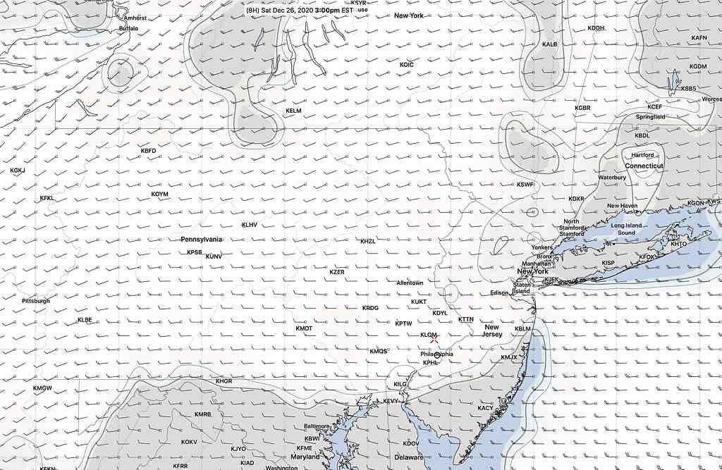
Last night’s indecision about cloud cover for today would have been less of a dilemma had I used the new GFS.
One of the issues of the new GFS is that the new model’s data size is almost twice as large as the existing GFS. NOAA is concerned about the data download size issue and it is expected to limit data download rates within the month for all their models. We’ll see how that plays out.
Another minor issue— the higher complexity of the new GFS takes more computational time. As a result, the new model take 7-12 minutes longer to complete. As an example, the first 24 hours of the current GFS become available about 10:37 PM EST. With the new GFS model, the first 24 hour forecast data will become available about 10:46 PM EST.
Those 11 PM TV weather entertainers are going to have even less time to update their forecasts during Eastern Standard Time.
The new model is an overall improvement, but not without its problems. It tends to handle tropical systems not so well, sometimes developing systems that don’t actually form. Certain parameters used for forecasting thunderstorms are understated, especially when soil moisture is low. Forecast temperature biases, while improved, also have their issues. You can be sure that scientists are already hard at work with a future version 17.
One more thing— the HRRR and RAP models were updated earlier this month and have shown improved forecasting accuracy and an increase in model forecast length. The HRRR has become a full 48 hour model and the RAP a 51 hour model. These same models are expected to start using the same FV3 core geometry used by the GFS in their own next iterations.
Several other high resolution models (HIRESW and HIREF) have been upgraded to the FV3 core geometry and are planned for release in the next few months. Their output is now available as “parallel” models.