
Thursday evening, Christmas Eve, is looking quite rainy and windy. Friday cold, windy with clouds. The weekend looks to be dry and cold.
A very strong cold front will move through Thursday evening and night, Christmas Eve.
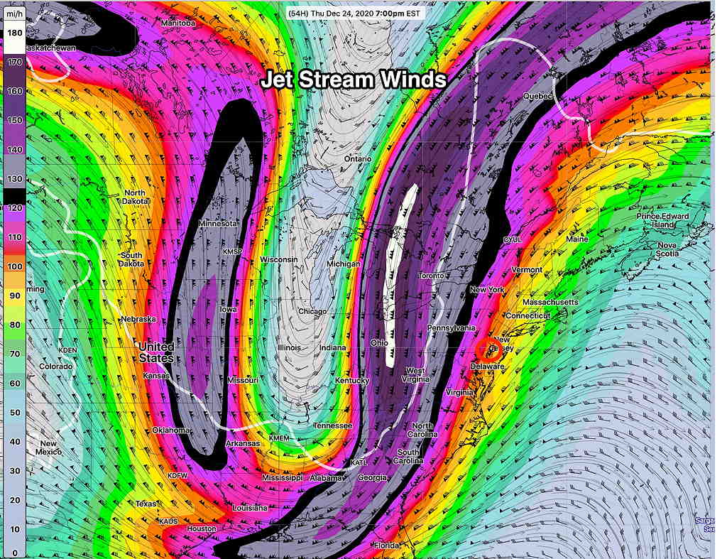
An extremely sharp dip in the jet stream will usher in a cold front, that most models have moving through between 1 and 2 AM Friday morning. Preceding and accompanying the the actual frontal passage will be fairly heavy rain (1+ inch) but also very high wind gusts.
Rain starts late Thursday afternoon and gets heavier during the evening and night-time hours. Winds will pick up as the evening progresses. Wind gusts of 50-60 mph are predicted with the highest winds with the front passage about 1 AM Friday morning.
There was some thought over the weekend that low pressure might develop along the front, but all models have ruled out snow here with the exception of snow flurries.
Cold air filters in during the day Friday on brisk winds. The early morning temperatures will be the high temperatures of the day and temperatures will fall during the day. Wind chills in the teens.
Instability cloudiness will also be with us Friday and a snow flurry can’t be ruled out.
Saturday will be cold and still a bit windy. Highs will struggle to reach 30º. Right now it looks to be sunny, but it’s difficult to time upper air disturbances which may bring periods of clouds.
An approaching storm from the Midwest will bring some increasing cloudiness during the day on Sunday.