Sat 10:33 AM Forecast Review — It appears that it’s going to be sunny today and my cloudy forecast based on last night’s HRRR and RAP possibly went astray. All a learning experience!
Sat 11:31 AM Update — Some models still have those clouds coming in about 1-2 PM. We’ll see!
Sat 03:03 PM Update — The clouds came in at about 2 PM.
The cold front passed through this morning and the cold air has moved in Friday afternoon and evening.
The dip in the jet stream allowing cold air to move in will relax and the upper air circulation will move from a trough to a ridge on Saturday.
Several models have sunny skies for Saturday, but tonight’s HRRR and RAP models just becoming available show considerable cloudiness on Saturday, especially from Philadelphia and northward as an area of moisture and an upper air “vorticity” moves over us from the south.
HRRR upper moisture (shading) and vorticity (Click on image for a larger view.)
I have lower than usual confidence about Saturday’s cloud cover, but I’m going with sunny early, then considerable cloudiness on Saturday, based on the HRRR and RAP models. It will be cold and somewhat windy mid-day with gusts to 20mph. High temp 30.4 sd 1.4º(NBM)
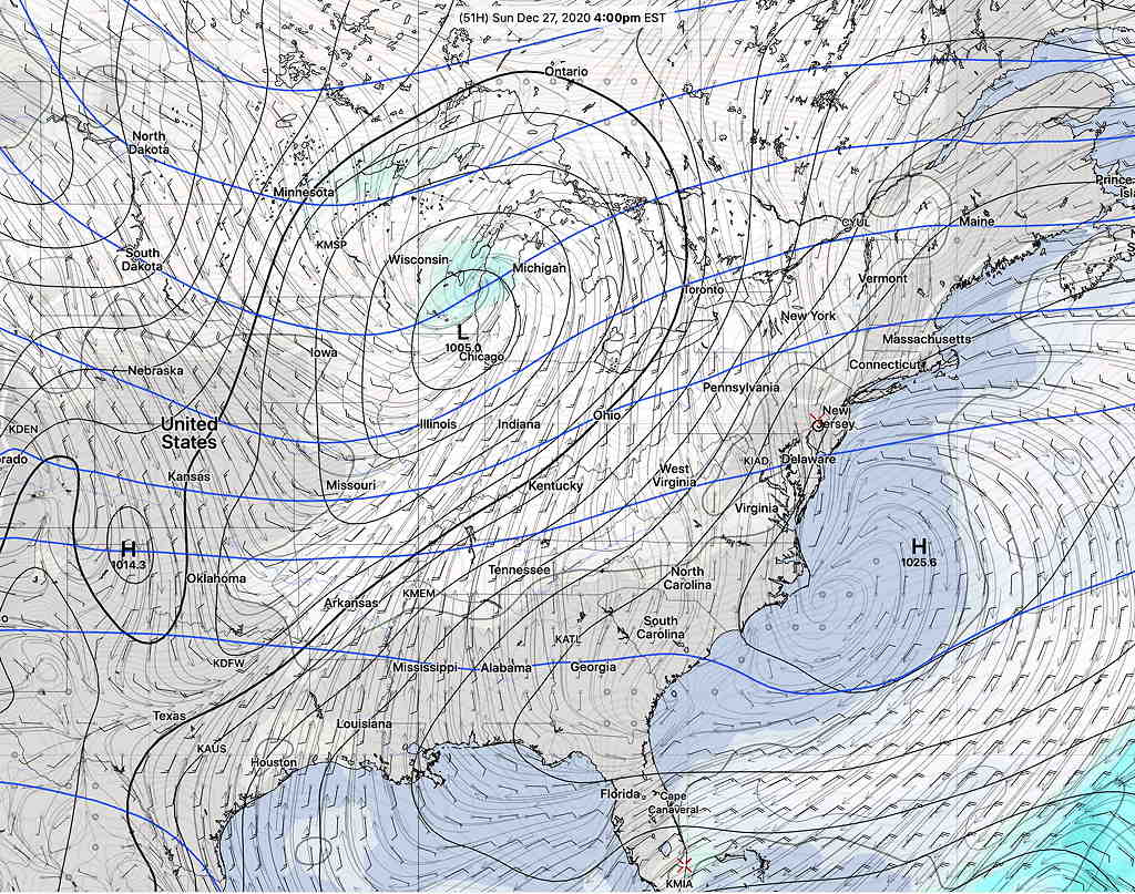
Sunday will be mostly sunny through thin, high level clouds from an advancing low pressure system in the Midwest. High temp 39.4º sd 1.6º (NBM model). Winds light.
GEFS Model showing advancing clouds from system in Midwest (Click on image for a larger view.)
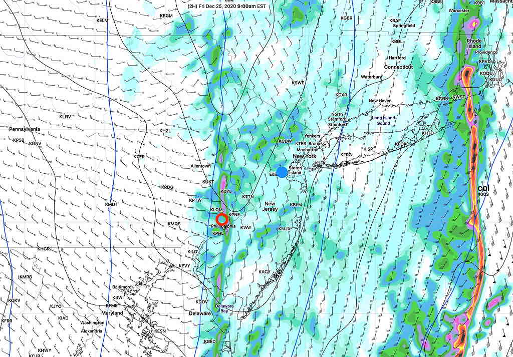
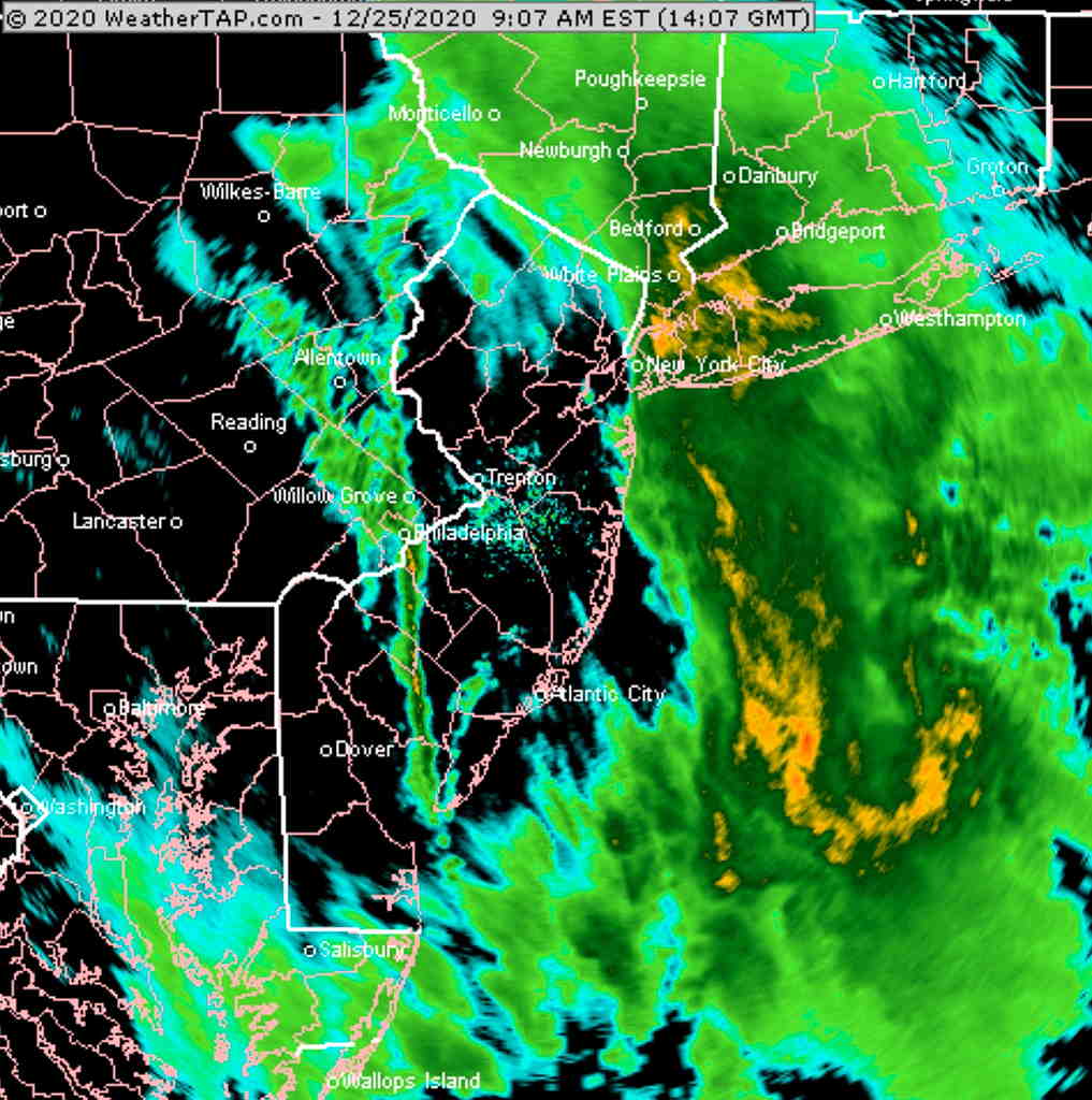
Thu 10:07 PM Update — Tonight’s models have increased rain amounts to over two inches. Highest winds about midnight. Squall line comes through about 3AM. Snow flurries possible late morning, especially western suburbs. Windy and increasingly cold Friday afternoon. Some sun breaks out during the afternoon.
Storm Update- High Winds. A squall line moves through about 3 AM Friday. Cold front passes through 7-8 AM Friday morning.
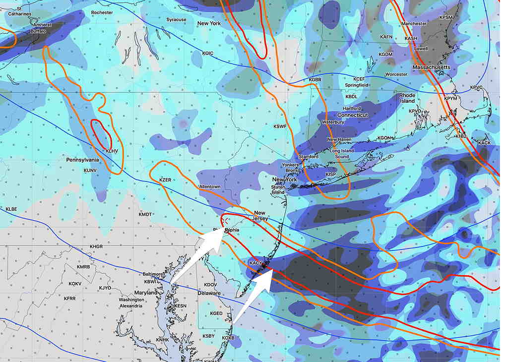
The latest models are coming in. They show rain starting, depending upon your location, between 12-3 PM today. Rain totals between 1.5 and 2 inches by Friday morning.
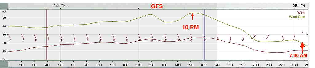
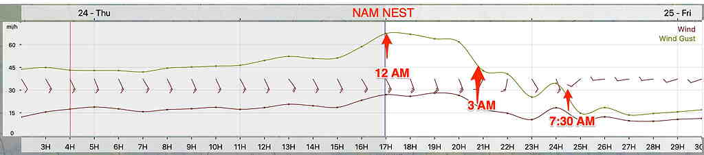
Very windy with wind gusts 50-65 mph, especially with the squall line that moves at around 3AM, ahead of the actual cold front. The actual front moves through about 7-8 AM with a sharp wind shift. Rain showers should end with the frontal passage at that time.
Slight differences in timing of peak wind gusts between NAM NEST and GFS models—
GFS Wind Meteogram (Click on image for a larger view.)
NAM NEST wind meteogram (Click on image for a larger view.)
Cloudy Christmas Day. Windy and increasingly cold. Snow flurries possible, especially far western suburbs.