Forecast Updated Sun 10:45 AM in green box below
For the past two weeks, the weather models have been not been at their best. I’m not sure why. Most of the models have been updated since the fall (HRRR, RAP, NBM, HIRESW, HREF and GFS) and this is their first summer hot season. Clearly, there’s something wrong, as they are not handling very hot weather and convective activity accurately.
I haven’t been able to find any public discussions or presentations from the scientists at NOAA in the “Model Diagnostics and Verification Group”. One thing to notice— new model development is conspicuously missing from their website.
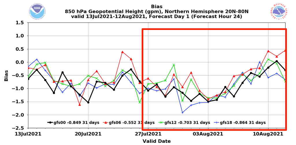
Here is the current GFS bias error (comparison of forecast to observed measurement) for the past two months. Notice that over the past 10 days, the negative bias error has been greater than average. (no surprise here!)
I’m sure the people responsible for evaluating model performance are working on it.
WEEKEND FORECAST:
A cold front will slowly pass through tonight while a secondary cold front moves through Saturday afternoon. The above discussion about model error was ‘inspired’ by the fact that there are huge differences in the forecast for Saturday.
Friday Evening
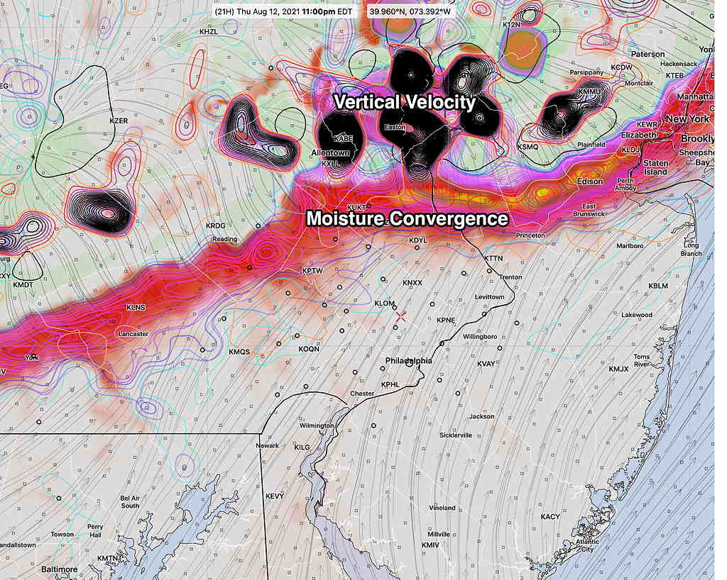
The approaching cold front will trigger showers and thunderstorms, but most models have the storms diminishing as they approach the immediate PHL area. Some storms may remain intact to our north (Trenton) and just to our south (Wilmington DE). A few isolated storms may sneak through. (Latest GFS hot off the wire shows some rain in Philadelphia 8-9 PM ) Similar to yesterday, they encounter high CIN and a dome of stable hot air. Here’s the latest HREF with its 1 hour rain forecast—
Saturday
The NBM still has a high of 89.4º ± 1.1
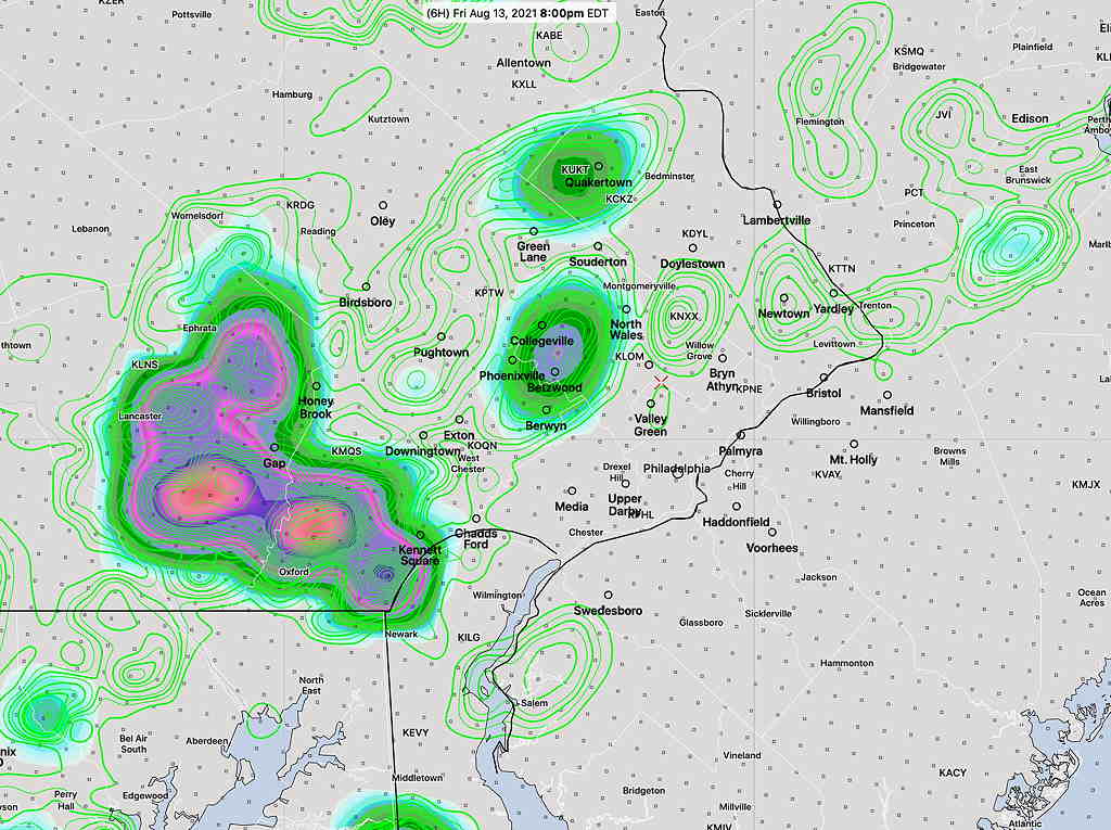
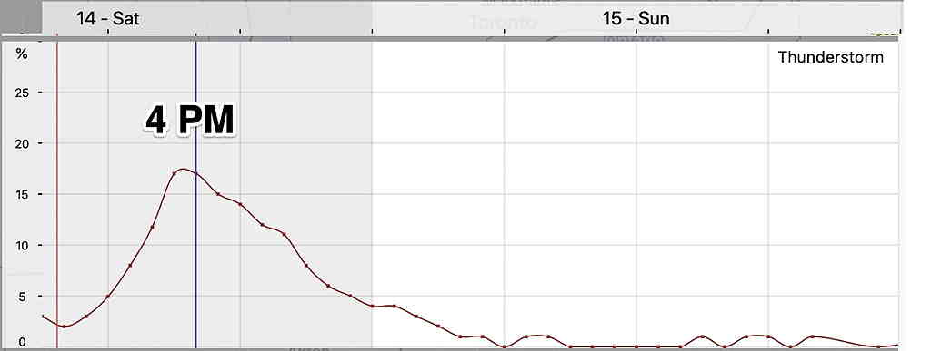
Here’s where things get less certain. A secondary cold front moves through between 1-3 PM. Many models have Saturday mostly sunny. The ICON model and the SREF have some showers and thunderstorms with the frontal passage during the afternoon. Additional scattered storms possible in the evening Some models (GFS) are less impressive with the showers/thunderstorms.
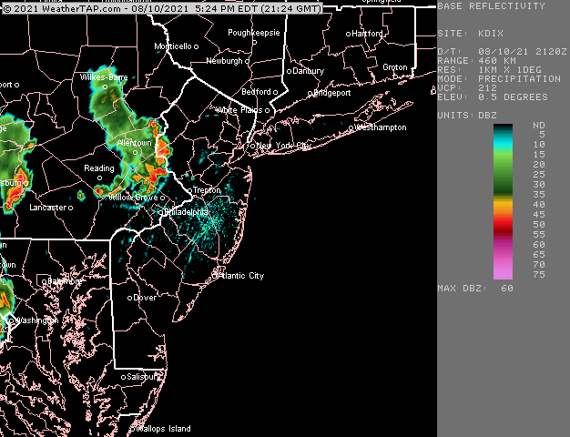
The HREF has showers/thunderstorms, scattered,starting at 4 PM and extending into 9 PM. Most of the activity west, east and south of Philadelphia. Some of the rain will be locally heavy. (With current track record, I wouldn’t put too much stock in the exact forecast placement.) Here’s the HREF forecast for rain (hourly accumulation) Saturday at 7 PM—

Sometimes, the best forecast is to indicate that forecast is uncertain and lower than usual confidence.
Sunday
Moisture from this stalled front is moving northward. The three versions of this morning’s HIRESW model all maintain some degree of high and mid-level cloudiness through noon and then considerable high level cloudiness in the afternoon with some sun filtering through. Next week looks very unsettled as tropical storm remnant moisture will move in to our area.
Sunday looks to have some cloudiness in the morning, especially south of the city, becoming sunny and cooler. NBM high temp 84.1º ± 2.0º.