
There has been a significant change in the likely track of Hurricane Dorian. The US Navy COAMPS-TS and the European ECMWF were the first to pick up on this changed track. The GFS has joined the pack with this likely change in track.
Here’s the current COAMPS-TS track and intensity forecast:
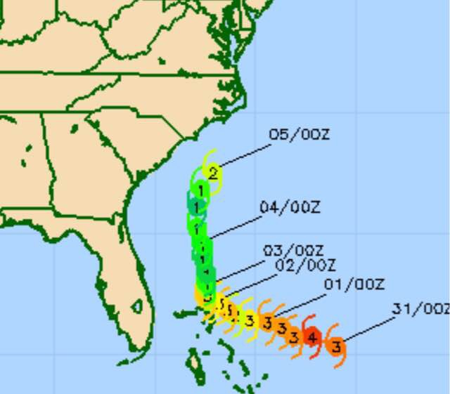
(The COAMPS is known to have a northeasterly bias, so this track may be over-done slightly in northeasterly directional movement. )
The current likely landfall area, based on the latest GFS, is near the border of Georgia and South Carolina.
As for our Philadelphia weather, Saturday continues to look good with mostly sunny skies. Some cloudiness may sneak in late in the day.
Sunday is still looking mostly cloudy, with some sunny breaks possible. The models keep us dry in Philadelphia and east into NJ, however the models also show significant areas of vorticity (upper air disturbances) that may wring out showers. (Currently NOT shown by the models.)
Monday is currently looking like a mix of sun and clouds, more humid, still dry during the day. The models again appear to be ignoring the vorticities that often bring some scattered showers.