
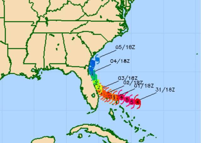
Hurricane Dorian continues to confound forecasters as the forecast track and predicted intensity keeps changing.
Rather simplistically, I’ve hung my hat on one of a multitude of hurricane models, the COAMPS-TS, based on its low 24 hour error margin.
The latest COAMPS-TS just available has moved the track further westward again, closer to the track that it had forecast Thursday evening.
We’ll have to see if the next runs of the GFS and ECMWF models move in the same direction.
As for our weather in Philadelphia, Sunday is looking better with a mix of periods of clouds and periods of sun, especially from Philadelphia and eastward. (The same strengthening of high pressure that will be giving us some sun tomorrow is likely the same feature that has moved Dorian’s forecast track to the west again.)
Sunday will be rain-free until evening here.
Clouds are expected to move in later Sunday. Scattered showers appear likely Sunday night and on Monday.