Category Archives: Winter Weather

SATURDAY STORM UPDATE

Update Wed 07:41 PM — Today’s models don’t show any significant changes with the forecast.  However, the timeframe (84 hours) of the storm now falls into the range of the NAM and SREF models.  With these higher resolution models, we have the following trends:

Snow starts perhaps a bit later, about 11 AM.  Heavier precip starts early afternoon.  A changeover or mix with sleet starts as early as 3-4 PM.

But it may not be a straight progression towards rain- several models, especially the NAM and CMC have the precipitation rate increasing enough about 5-6 PM that dynamic cooling occurs and a mix back to snow may occur despite surface temperatures rising above 32º.

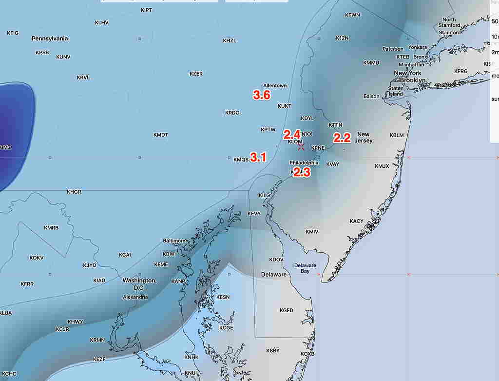
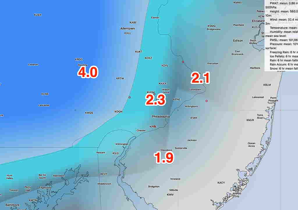
Here’s a 3 frame gif of the precipitation type at 1PM 4PM and 7 PM–

This afternoon’s NAM Snow-sleet rain prediction at 1PM, 4 PM, and 7 PM Saturday.  White line is 32º surface temp line. Blue snow, pink sleet, green rain, red -freezing rain. 

Snow accumulations are still in the 1-2.5 inch range.

The storm significantly tapers and ends about 9 PM.

Once we get into the 48 hour time frame, we’ll have a better handle on the timing and fine points.


Update Wed 07:21 AM — Last night’s models continue a similar forecast as yesterday: Snow begins between 9-10 AM Saturday and mixes with and changes to rain late Saturday afternoon 3-6 PM.

The GFS GEFS and CMC are somewhat similar with a 2 or so inch  snowfall before being tamped down by sleet and rain.  The ECMWF is still coming in with about 1 inch or less.  Keep in mind:  the models have over-estimated snow totals so far this year.

Here’s a change:  Precipitation now ends about 8 PM, according to the GFS.

This morning’s GEFS snow depth totals

The storm is just in the 90-95 hour forecast period.  By later today, it will fall into the range of some of the higher resolution models, the SREF and the NAM.

I’ll update this evening.

SATURDAY STORM UPDATE

Update Tues 07:41 PM— Today’s GFS, GEFS, CMC and ECMWF have become available and continue with the trends discussed this morning:

Snow starts mid morning Saturday instead of before daybreak.  A changeover from snow to rain occurs between 3 and 5 PM Saturday.

The GFS is maintaining 4 inches just west of the city before being tamped down with the rain late in the afternoon. The GEFS (Statistical “Ensemble”) version of the GFS has 2.3  inches.  The Canadian CMC GDPS has 1.8 inches and the European ECMWF has less than an inch. All have a  mix and change to rain 3-5 PM.

It’s important to keep in mind that the models have over-predicted snow accumulation for every storm so far this season.  The storm is still 100+  hours in the future.  We probably can’t make definitive snow forecasts until Friday.  This will be a minor snow at best.

GEFS Snow Depth Forecast for 7 PM Saturday


Update Tue 08:53 AM — The EKDMOS is great for temperature forecasts, but it also gives a good indication of the degree of uncertainty in the coming days’ forecasts.  Notice the increase in “spread” between possible maximum temperatures on Saturday- Sunday (1/18, 1/19) compared to the two days prior—

EKDMOS max Temperature forecast

…From earlier Tues:

Last night’s GFS, GEFS, CMC and ECMWF have become available. Here are the current trends with the storm forecast for Saturday—

All models are showing the snow to start somewhat later now.  Instead of starting before daybreak, the models have it starting about 9-10 AM Saturday. With the later start and daytime warming, warmer air moves in somewhat earlier.

A changeover to a mix may occur sooner around the city and immediate suburbs.   That said, the GFS is still showing 4.2 inches (Ft Washington and KLOM- Blue Bell) Canadian 2.6 and ECMWF 1.2 inches snow before mixing with sleet and rain.  The Canadian has a burst of heavy precip over us late afternoon, resulting in snow falling through dynamic cooling, despite the fact that surface temps will have moved above 32º.

A changeover to rain is expected between 4-6 PM Saturday and precip should end by midnight.  It doesn’t look like cold air rushes in immediately behind this storm.

These numbers are provided simply as a guide.  It’s important to know that this doesn’t appear to be a major storm for the PHL area. Accurate Snow Forecasts more than 24 hours in advance are almost impossible to do in this area.

Areas north and west of Allentown/Reading will have several inches.