A low pressure system over the Great Lakes Friday night into Saturday is expected to slowly move to the east as a secondary coastal low develops north of us along the New England Coast.
The possibility of this setup has been showing in the models for almost a week and until today, was expected to start Friday night and quickly changeover to rain Saturday.
As is seemingly always the case, things have changed with the last two model runs of the GFS, Canadian and ECMWF.
Here’s this morning’s model forecast—
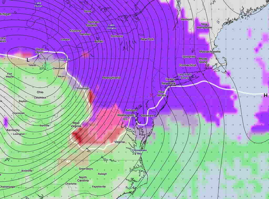
GFS PTYPE (precipitation type) forecast for Saturday noon. Violet-snow, pink-sleet, red-freezing rain, green- rain. White line is 32º degree surface temp line.
Snow starts before daybreak Saturday and changes to rain during the afternoon. Hard to believe, but the current GFS shows 4.7 inches of snow (Fort Washington) before a changeover to rain by 3 PM.
We all know that this is going to change by the time Saturday rolls around, but I think it’s useful to see what the current forecast trends are. Stay tuned.
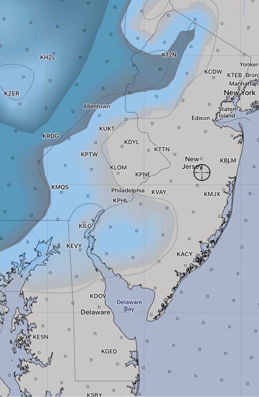
6:20 PM : Latest GFS and NAM show almost no snow accumulating in Philadelphia and much of NJ. Areas north and west of Allentown may have more than an inch.
Latest GFS snowfall forecast
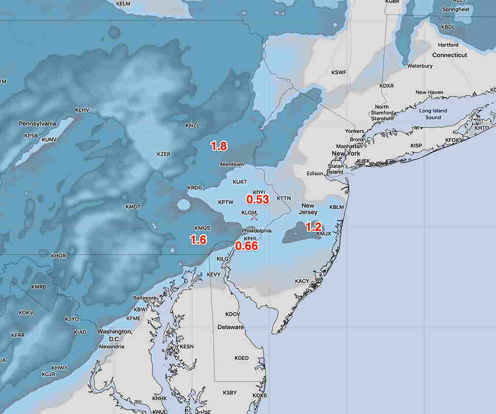
12:35 PM: Latest Canadian and NBM models show decreased QPF and temps too warm to accumulate near Philadelphia. This supports the new GFS. Some light snow falling, but not expected to accumulate. A coating, at most. The earlier NAM and NAM Nest are now outliers.
10:43 AM: Latest GFS just available has less than 1/2 inch for most of our area. Too warm! The HRRR has almost nothing.
Last update before I head out the door. So many models, so little time!
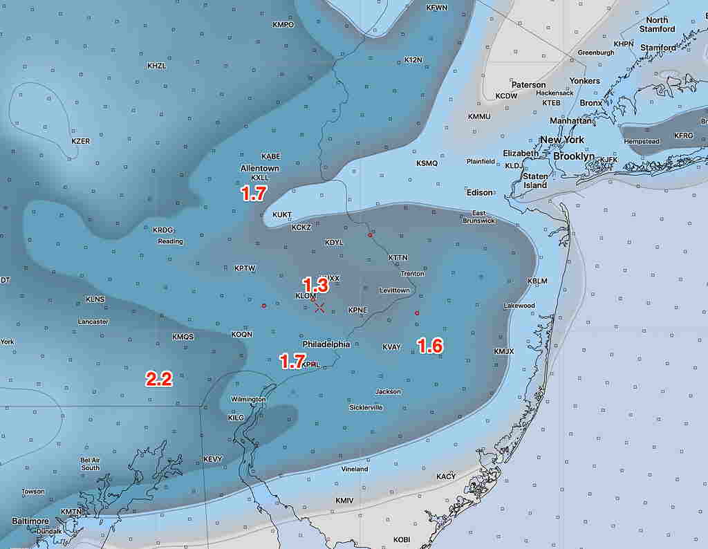
Latest NBM, NAM-NEST and WRF-ARW available. I’ll cut to the chase:
This morning’s NAM NEST high res snow depthThis morning’s lower resolution NAM snow depth
I think the NAM-NEST is the best bet and supported by the NBM.