Latest NAM maintains mostly cloudy conditions for Sunday. A northeasterly flow will bring cool conditions with highs in the mid 70s. Areas in NJ may have lingering showers.
[su_note note_color=”#d9f2da”]9AM Sunday Update: I was surprised to wake up to widespread showers. Current radar has showers extending as far west as Reading. While lingering showers had been expected in NJ, this coverage of precipitation was not forecast for PHL and west. The latest short range models (HRRR, NBM-H) now have showers lingering until about 2-3 PM in PHL!
I can’t remember a time in the past where the model forecasts have repeatedly been so far off in the short range. [/su_note]
[su_note note_color=”#d9f2da”]2 PM Sunday: Yet another update: The latest NBM-H has the showers lingering through the rest of the afternoon! Looking back to my Friday forecast, the GFS did better for Sunday’s forecast of showers all day. [/su_note]
Upper air low pressure remains near the area for Sunday.
After some slow clearing in the morning, there should be periods of sunshine in the morning and early afternoon.
Instability with abundant moisture and some heating from sunshine will allow for showers and thundershowers to develop late afternoon into Sunday evening.
While a widely scattered shower can’t be ruled out, much of the day before 3 pm should be dry.
More showers and thundershowers should develop between 3 and 7 pm, although the intensity is not expected to be as great as Saturday’s storms.
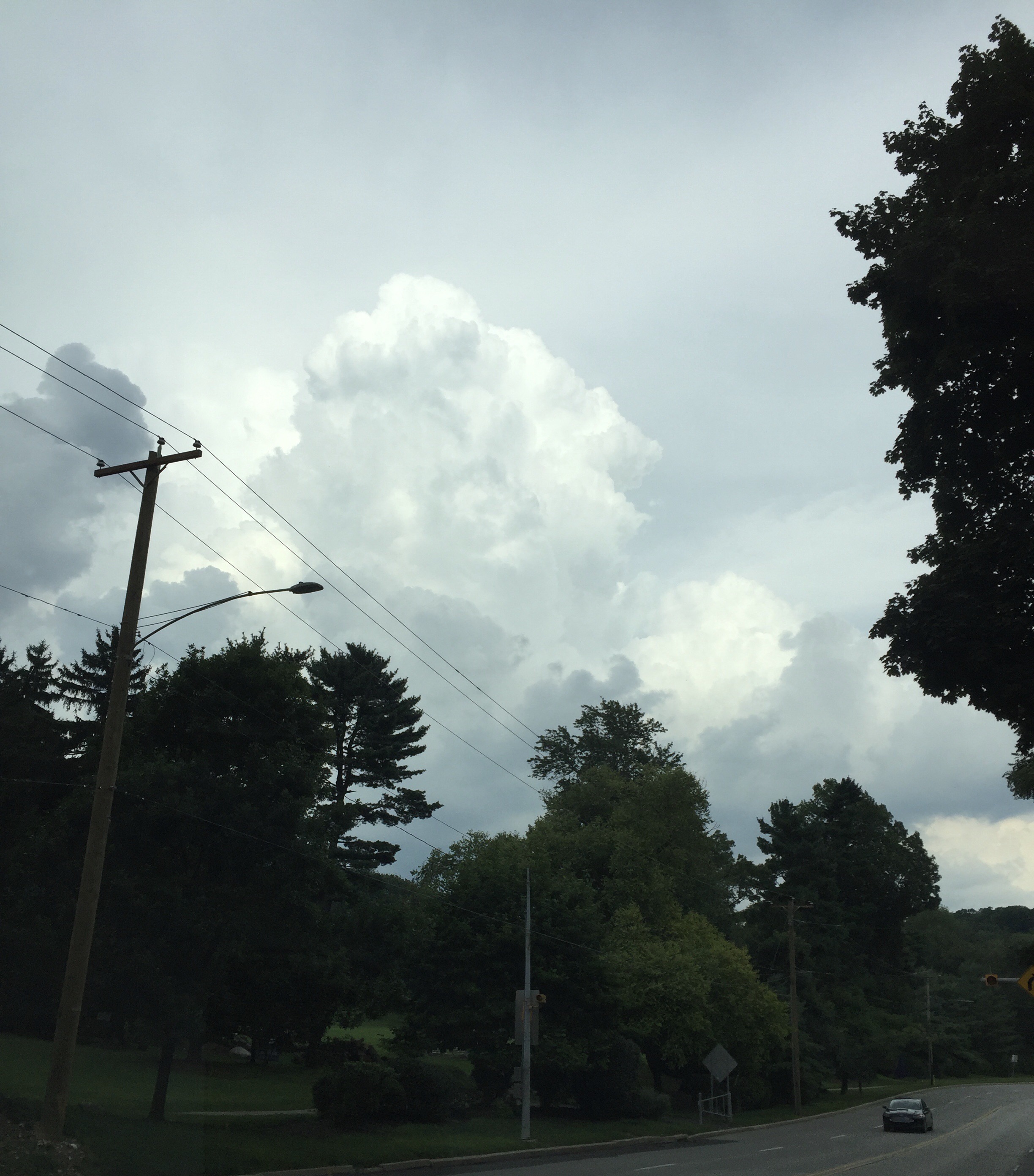
A front will move through Philadelphia late this afternoon and early evening (Friday) with showers and thunderstorms. Some storms are developing ahead of the front this afternoon in the warm, humid air. The dynamics suggest the possibility of heavy thunderstorms in PHL, although the strongest dynamics may move through to our north.
[su_note note_color=”#d9f2da”]Updated 9 PM Fri: The heaviest storms were well north of the Philadelphia area. Rainfall was less than forecast. The sky appearance was impressive [/su_note]
Towering cumulonimbus cloud over NE Philadephia 5:30 PM
By Saturday morning, the front will have moved off the coastline resulting in sunny skies with gradually falling humidity/dew points as the day goes on. Highs will be around 86 with a light wind out of the west.
For Sunday, some cloudiness very early, then partly to mostly sunny. Lower dew points in the 60s and highs around 85.
A return to unsettled weather and humidity for early next week.