[note note_color=”#bceaed” text_color=”#333333″ radius=”3″]Updated Fri 05:14 PM — Philadelphia Airport has had over 4 inches of rain so far! The NBM forecast from this morning was pretty good. The NAM NEST had the rain tapering around 2 PM; obviously a wrong call. [/note]
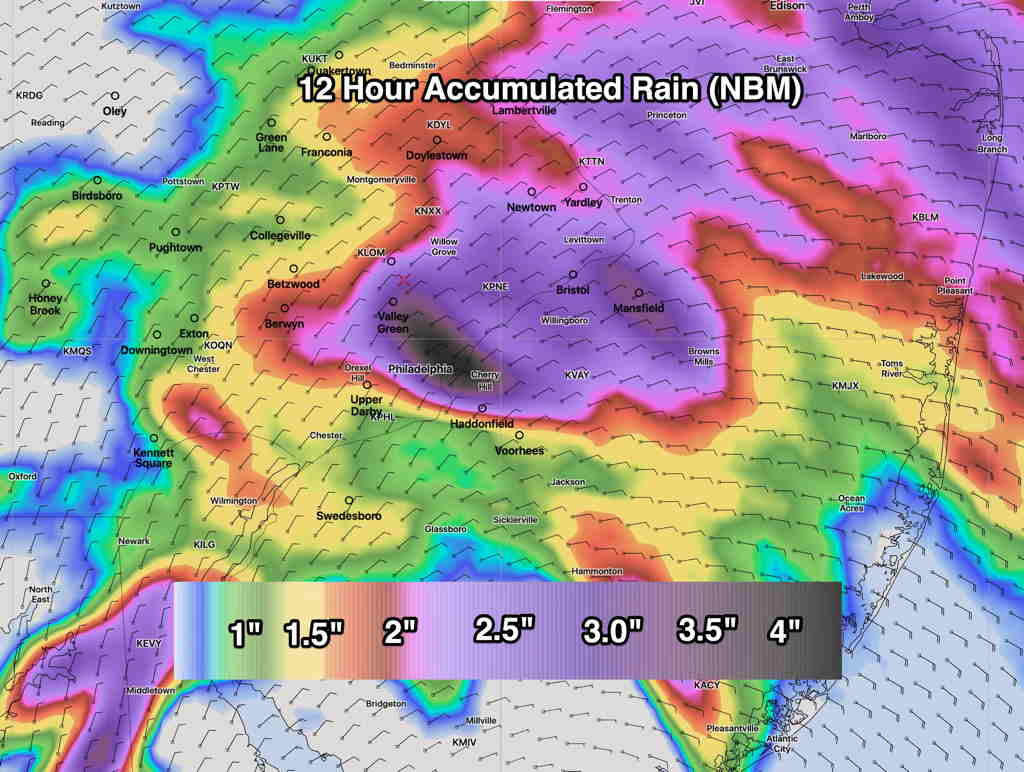
[note note_color=”#ffffff” text_color=”#333333″ radius=”3″]Updated Fri 09:49 AM —Updated with latest Model Blend (NBM) from 8 AM this morning.
Updated NBM (8 AM run) accumulated rain forecast. (Click on image for a larger view.)
[/note]
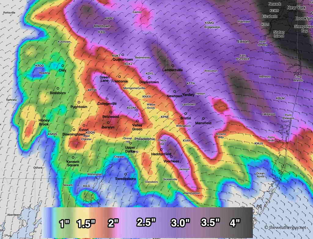
Updated with latest model blend (NBM) accumulated rain graphic.
The models that are run at 2 AM EDT (06z) continue with a similar forecast as last night. Rain will be starting shortly, if it hasn’t already started in your area. Precipitation amounts look to be a generalized 1.25-2 “ of rain with some local areas having 3-4”.(I’ll post a graphic shortly.)
Latest Model Blend (NBM) Accumulated Rain Friday. (Click on image for a larger view.)
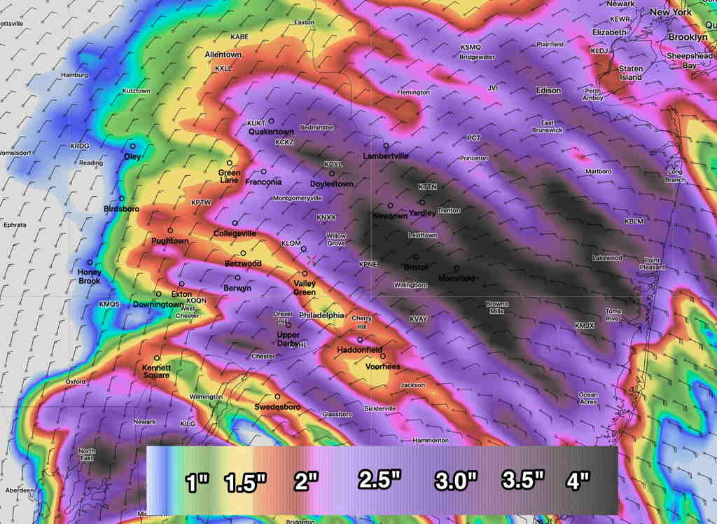
The only change noted in the latest models is a tapering in the rain about 2 PM around here, vs the previous forecasts which had the moderate rain going into the early evening hours. It appears that the main slug of precipitation shifts northward into northern NJ and northeastern PA.
Here’s the most recent (06z) NAM NEST (High resolution) accumulated rain forecast with a somewhat different area of precip maximum:
NAM NEST Accumulated Rain forecast (Click on image for a larger view.)
The cloudiness this morning had been predicted last night.
Cloudiness should dissipate from west to east.
Last night’s 2 AM (06 UTC) run of the major models show varying times for the cloudiness to break for sunshine. Most of the short range models (RAP, HRRR) have sunshine by 10AM-12 noon.
However, NAM, NAM-NEST and the GFS are a bit slower with the cloud clearing, having some cloudiness lingering until 1-2 PM here in the Philadelphia area.
GFS percentage cloud cover forecast 1 PM Saturday. (Click on image for a larger view.)
Most of yesterday’s storms only affected the northern parts of our area, from central Montgomery county, Bucks county and northward.
A cold front moves through this evening. The models are again forecasting scattered thunderstorms, this time affecting more of the immediate Philadelphia area including areas not affected yesterday. The storms are expected to be scattered; again all areas won’t receive rain.
The weather parameters that are indicative of severe weather (Helicity, Shear, CAPE) are not as elevated as yesterday.