Category Archives: Philadelphia Weather Outlook

WEATHER OUTLOOK

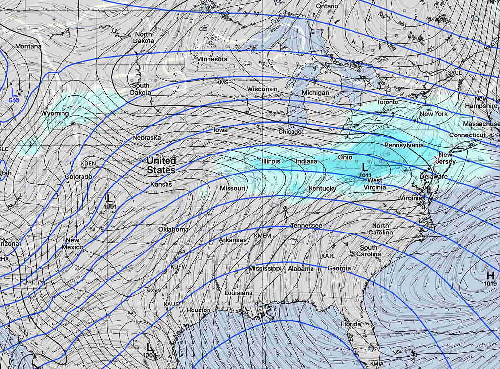
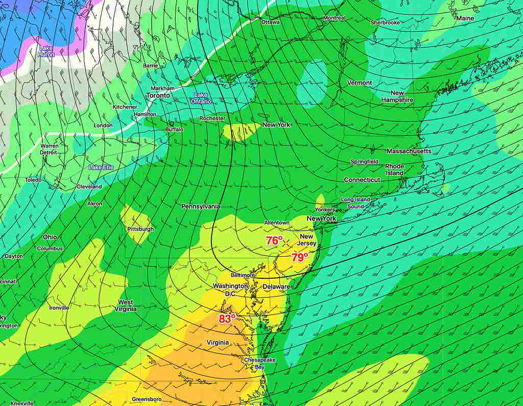
A generally dry period is coming up from today, Wednesday, through Monday.  Temperatures will be cool to seasonable 53-60 (average high is 60º).

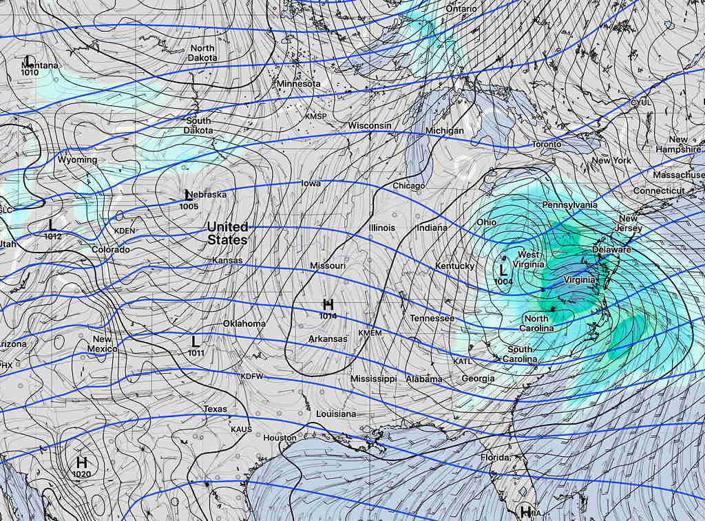
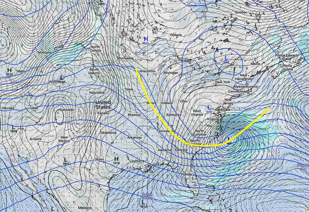
Late Thursday into early Friday morning, the retrograde low pressure to our east may cause some light showers.   Also some higher winds.

(Higher winds are not a “wind tunnel effect”, as some the TV weather entertainers call it. Winds are caused by pressure gradients between adjacent systems, higher gradients, higher winds.  A wind tunnel is described here.  Such a thing as a “wind tunnel effect” can best be felt at the corner of 15th and Chestnut Street on a windy day.  I wince every time I hear that term used so incorrectly. )

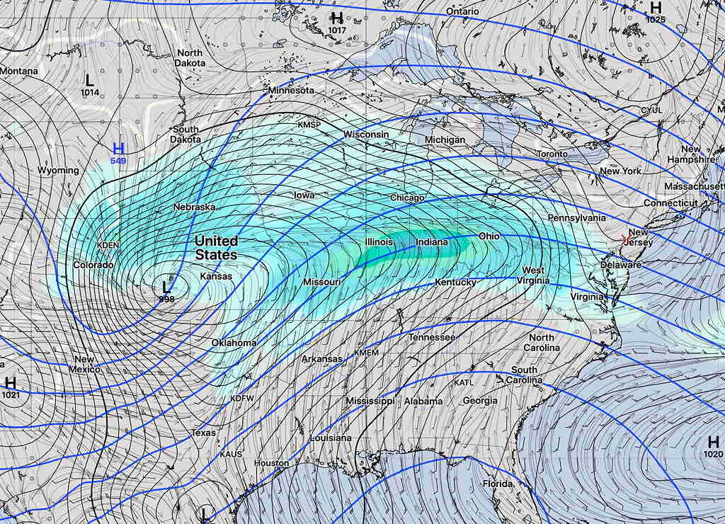
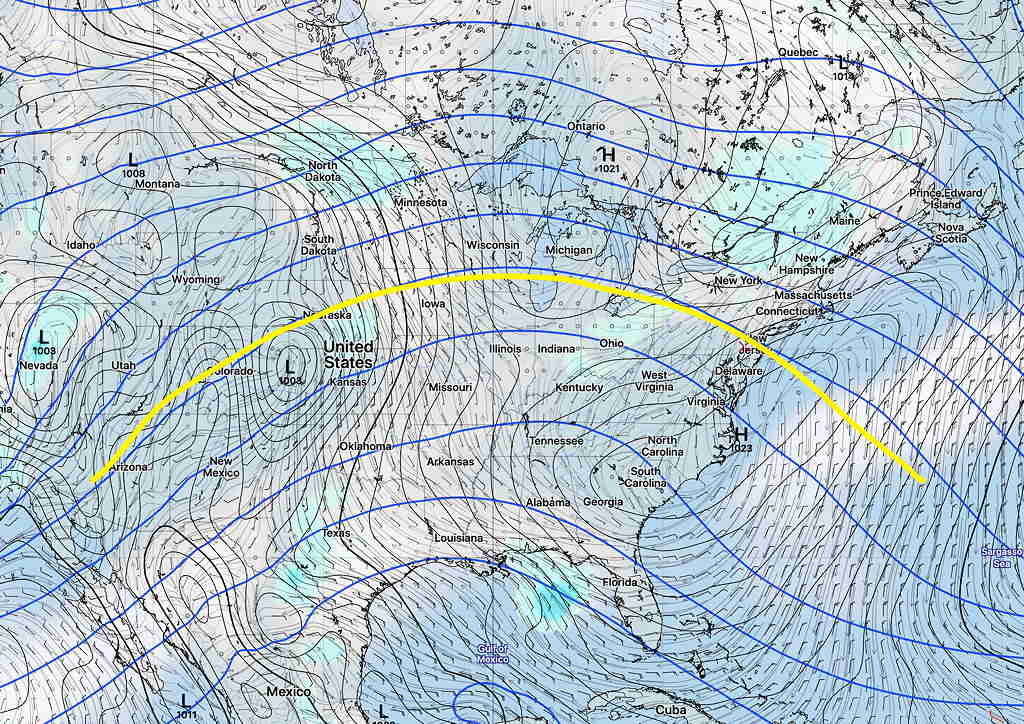
We are switching from a cyclonic pattern to a large scale upper air “ridge” pattern from the latter part of the weekend into next week.

GEFS depiction cylonic trough in yellow  (click for larger image)

Upper Air Ridge Pattern next week:

GEFS forecast for Tuesdays showing upper ridge

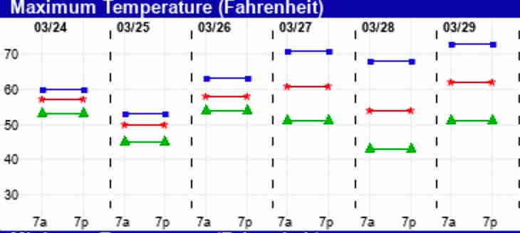
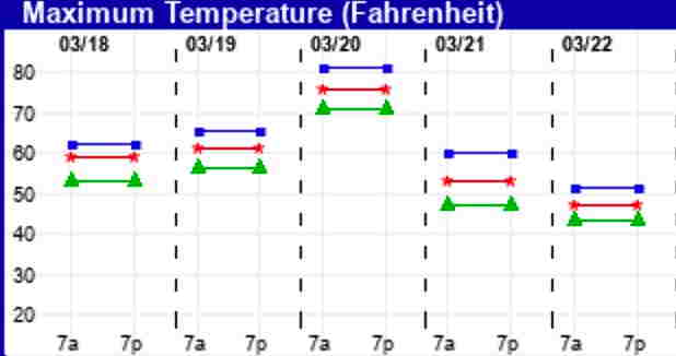
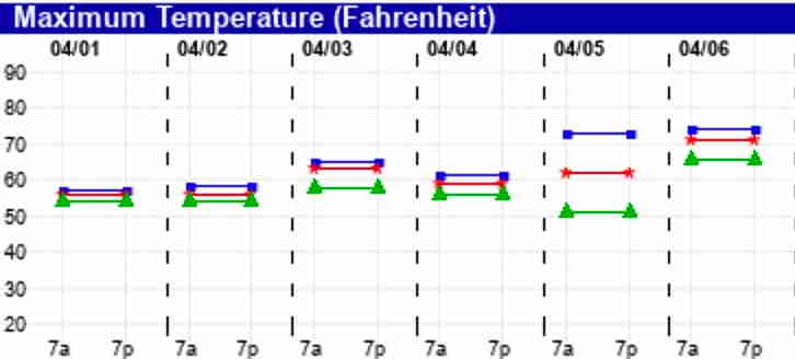
Here are the EKDMOS temperatures for the coming days:

EKDMOS High Temps

With things quiet, check back for the regular WEEKEND WEATHER FORECAST on Friday evening.

WEEK WEATHER OUTLOOK

An active and wet pattern is setting up for this week and especially this weekend.  Low pressure  developing in the middle of the country from a persistent jet stream dip spawn waves of low pressure passing over us almost every other day through the weekend.  The track of these waves will be along a stalled frontal boundary.

It should be said that there are uncertainties in the forecast for this week and weekend and this is reflected in the increasing ‘spread’ of the  EKDMOS high temperature forecast—

EKDMOS high temperature forecast 10 percentile, mean, 90 percentile shows high spread later in the week and weekend indicating increasing uncertainty.

For today, Tuesday, clouds should break for sunshine by noontime.

Wednesday, the first wave of low pressure approaching from the west will bring clouds and rain  according to the SREF

SREF (Short Range Ensemble Forecast) for Wednesday   (click for larger images)

I should add that the GFS has this wave on Wednesday passing more to our south along with its rain, so the short range forecast isn’t high confidence either.

A break in the action for Thursday.

Friday, another wave approaches with rain—

GEFS (GFS ENSEMBLE FORECAST) for Friday morning

For the weekend, the low pressure deepens in the center of the country and deeper waves of low pressure move along a frontal boundary towards us—

GEFS Weekend setup for more rain both Saturday and Sunday.

There currently are differences/uncertainties in the forecast between the short range models (SREF, NAM, etc) and the longer range global models (GFS, CMC) as early as Wednesday, so changes are possible as the week and weekend unfolds. Stay tuned.


WEATHER HIGHLIGHT OUTLOOK

Low pressure and rain moves through Wednesday night into Thursday with a warm front slowly advancing through the day on Thursday.

Thursday will be mostly cloudy after the main rain event ends late Thursday morning.

The warm front approaches on Thursday and moves through with considerable cloudiness before daybreak on Friday.

For Friday, temps will reach the mid and upper 70s, considerable cloudiness with breaks of sunshine expected.  Sometimes, the models underestimate the amount of sunshine and the high temps may be higher than currently forecast.

GFS Ensemble Bias Corrected High Temps For Friday

Here’s the EKDMOS (Ensemble Kernel Density Model Output Statistics high temperatures—

EKDMOS Temp forecast