Category Archives: Philadelphia Weather Outlook

WEEKEND WEATHER OUTLOOK

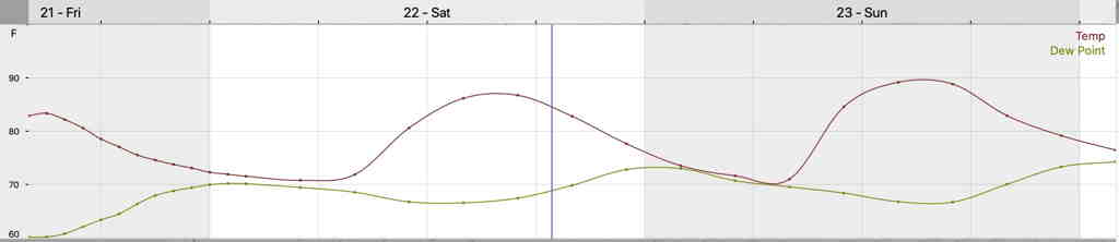
Today’s weather (Thursday) was nothing less than spectacular.  Low dew points, temps in the low 80s and clear skies, very light winds.  It doesn’t get any better.  Those of you, like me, who enjoy looking at the sky may have noticed cirrus clouds in the southern horizon —

Cirrus clouds on the southern horizon with some fair weather cumulus

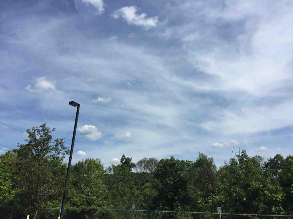
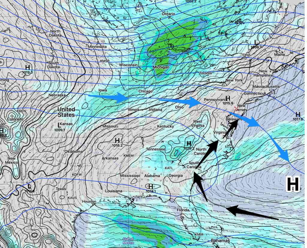
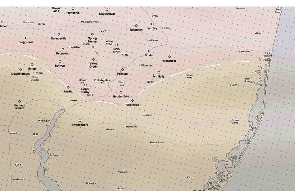
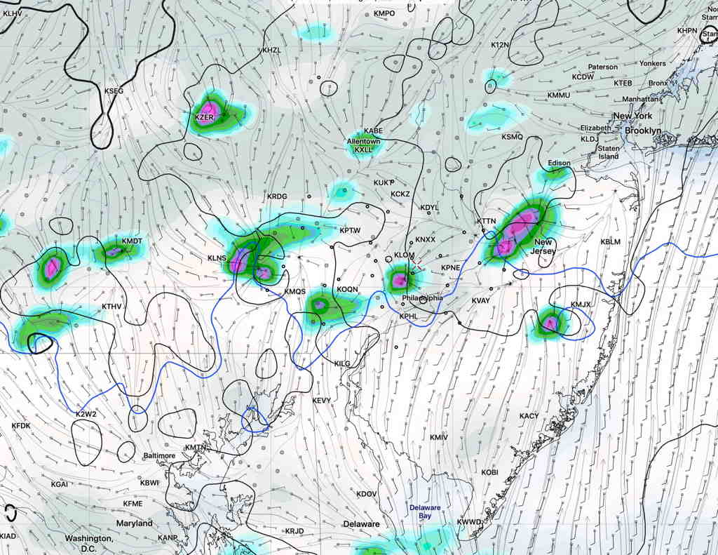
These clouds are the result of moisture that is moving in for the weekend.  This morning’s HIRESW captured this border of high level clouds very nicely (light brown shading)—

HIRESW-FV3 pre-release forecast -clouds high level  (Click on image for a larger view.)

This moisture will gradually make inroads into our area for the weekend.

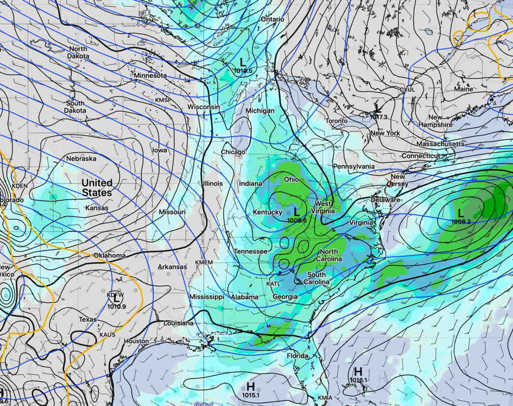
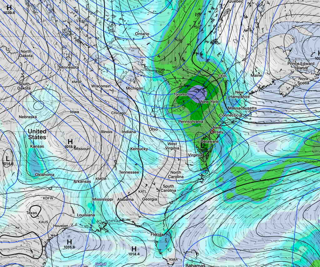
Earlier this week, the statistical models had a fair amount of clouds and showers.

However, the weekend forecast period is coming into range of the higher resolution models which show significant sunshine for Friday, Saturday and Sunday, albeit with some periods of cloudiness on Saturday and to a lesser extent on Sunday.

Scattered showers appear to be possible on Saturday, especially very early morning and again late afternoon.   These will be widely scattered; many areas will not see any.

HIRESW-FV3 1 hour precip forecast 6PM Saturday.  (Click on image for a larger view.)

Sunday appears better, with a lower chance of showers in the immediate PHL area.  

Dew points will gradually rise into the upper 60s to near 70º (more uncomfortable) by late Saturday into Sunday.

NAM Temp Dew Point Forecast  (Click on image for a larger view.)

Things will probably need to be more fine-tuned, but right now a pretty good weekend weather-wise is on-tap.

NOT THE BEST WEEKEND WEATHER OUTLOOK

Updated Thu 08:34 PM — Apparently, the huge difference in the weekend forecast is the result of a big difference in the European model and the our NOAA models.  It’s difficult to ignore our own models here.  So we’ll have to see how “beautiful” the weekend weather turns out to be.

I was watching the 6 PM news last evening and I heard the weather entertainer say it was going to be a “beautiful weekend”.   I said to myself,  ‘Gee, what is she talking about??’

An upper air trough and high pressure to our northeast will bring an easterly flow of cooler temperatures, but low pressure is expected to develop on the stalled boundary that is expected to sink to our south.

We will get some dryer air  on Saturday, but it’s not a sure thing how much sunshine we’ll see.  The statistical models, (the GEFS, SREF) along with the Model Blend (NBM) maintain a fair amount of cloudiness on Saturday.   Rain/showers are returning on Sunday.

Saturday  forecast SREF model—

Short Range Ensemble Forecast (SREF) for 2 PM Saturday (Click on image for a larger view.)

Sunday forecast GEFS model—

Global Ensemble Forecast System (GEFS)  for Sunday 4 PM (Click on image for a larger view.)

It’s still a bit in the future and things could change, but right now a beautiful weekend isn’t in the cards.

HOT WEEKEND, HUMIDITY NOT TOO BAD

Fri 12:48 PM Update — Today’s models continue with the forecast of temperatures in the 90s (Saturday 93º) Sunday (96-97º) but dew points will slip back into the 50s for Saturday and mid 60s for Sunday during these peak temperatures in the afternoon hours. That’s different than what you’re hearing from the TV weather entertainers.

A weak frontal system will move through late Friday with some very light widely scattered showers preceding the frontal passage. A few areas might have a heavy thunderstorm.

As mentioned earlier in the week, we are transitioning from an upper air trough pattern to more of an upper air ridge pattern this weekend.  A Bermuda High will pump in hotter and more humid air. (The ridging predicted earlier in the week will be less pronounced than previously thought.)

SREF model forecast for Sunday 12 PM  (Click on image for a larger view.)

This afternoon’s models have continued to forecast  temperatures in the 90s for Saturday  (93º) and Sunday (96º) afternoon.  Here’s the current NAM temp forecast for Sunday—

NAM Sunday 3 PM Forecast High Temps  (Click on image for a larger view.)

At the maximum heat of the day, dew point temperatures above 70º will be south and west of the immediate PHL area.

So with the high July heat, there will be no corresponding increase in water vapor; relative humidity and dew points will correspondingly drop to the somewhat less oppressive 60s during the maximum heat of each afternoon in our immediate area—

NAM Forecast Dew Point Temperatures Sunday afternoon.   (Click on image for a larger view.)

Little or no chance of rain over the weekend.

As is often the case, dew points will increase at night, so it will be very humid during the evenings and night time hours.   Some fog is likely in NJ Saturday night and early Sunday morning.