#Philadelphia #weather #PAwx
Posted Friday 03/14/25 @ 9:30 AM — This morning’s clouds weren’t accurately predicted by several models, most notably the GFS. Also missing this cloud forecast was the ECMWF-AI-Single. Higher resolution models — the HRRR and HRRR-dependent NBM along with the NAM-NEST did predict this cloudiness—
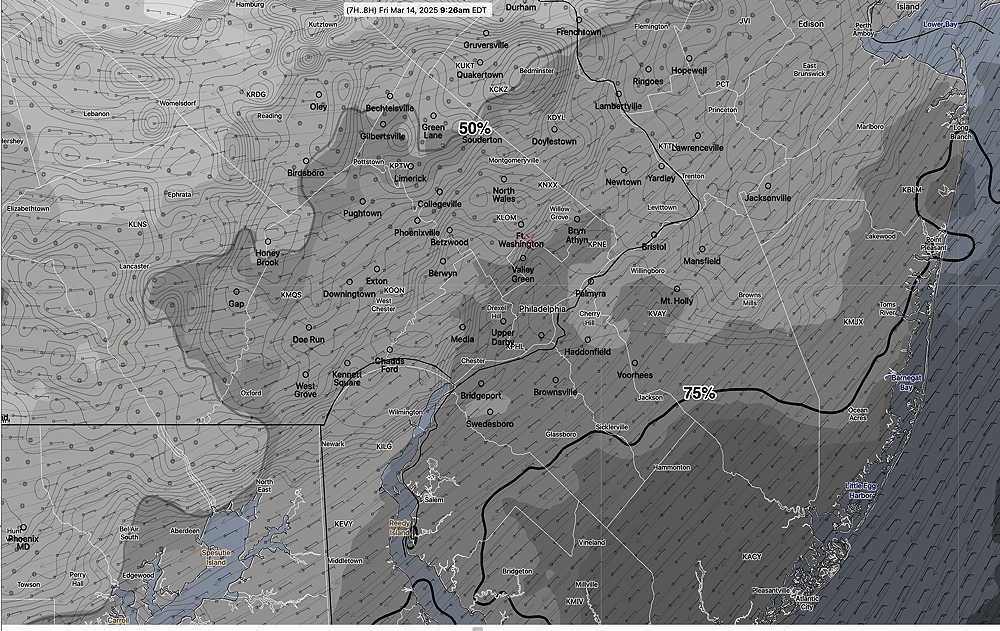
All models have the clouds dissipating between 11 AM and 1PM. Saturday looks cloudy but mild. Light rain begins as early as mid-morning on Sunday. Details later today with my regular “Weekend Weather Forecast”.
I’m looking for signs that the experimental RRFS will return. Its model runs are currently on hiatus, being evaluated for operational release. Its current status is available in this .pdf from NOAA.
(Gee, I wonder whether the TV people providing the “exclusive” forecast will acknowledge the blown forecast for today? They often don’t, or they find some area within a 100 mile radius that actually had the dark low clouds forecast.)
Hey, it may be too soon to celebrate, and some low clouds might still roll in from the east. That said, the latest ECMWF-AI just available has clouds thinning and dissipating for even more sunshine this afternoon.
Latest ECMWF-AI-Single at 2 PM—
If this new AI model continues to prove itself, I can reduce my data costs and eliminate many more models I download daily. (I’ve already eliminated downloading the HIRESW-FV3, the HIRESW-ARW, the HIRESW-ARW-MEM2, the RAP, and the SREF. )
Yet Another AI Model ‘Experiment’ Continued
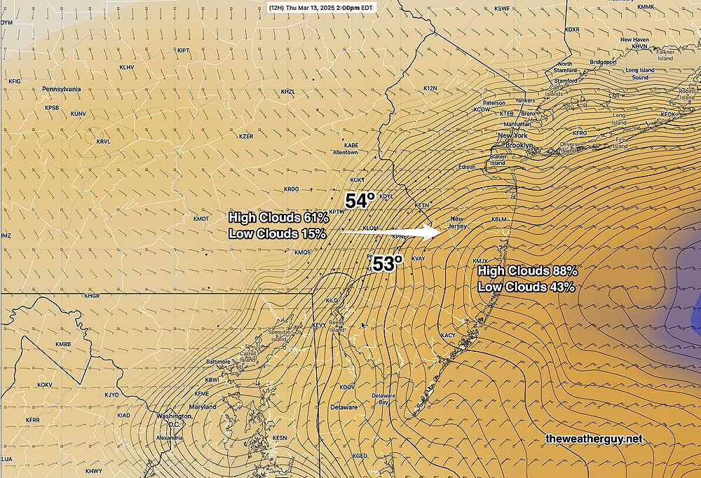
Posted Wednesday 03/12/25 @ 10:52 PM —Tonight’s models are even more emphatic about low clouds Thursday morning into the afternoon. Tonight’s NAM-NEST even shows some drizzle. As I posted earlier, the AI model shows sun through thin high clouds. We’ll see what happens.
Posted Wednesday 03/12/25 @ 8:07 PM — We had a sunny day today (Wednesday), very close to the AI model forecast.
I’m still seeing many of today’s models forecasting low clouds for Thursday, but today’s ECMWF-AI-Single model runs have only high cloudiness for Thursday, albeit with a thicker high cloud layer than forecast yesterday.
The latest ECMWF-AI-Single model just became available and it keeps its sunshine through high clouds forecast intact—
Let’s see how it plays out tomorrow!
Yet Another AI Model ‘Experiment’
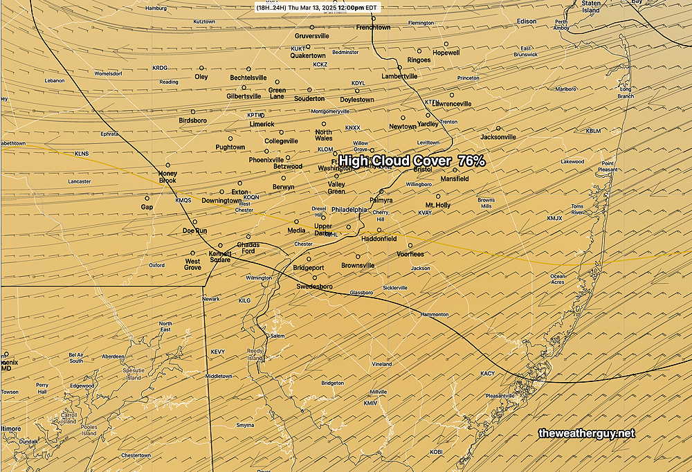
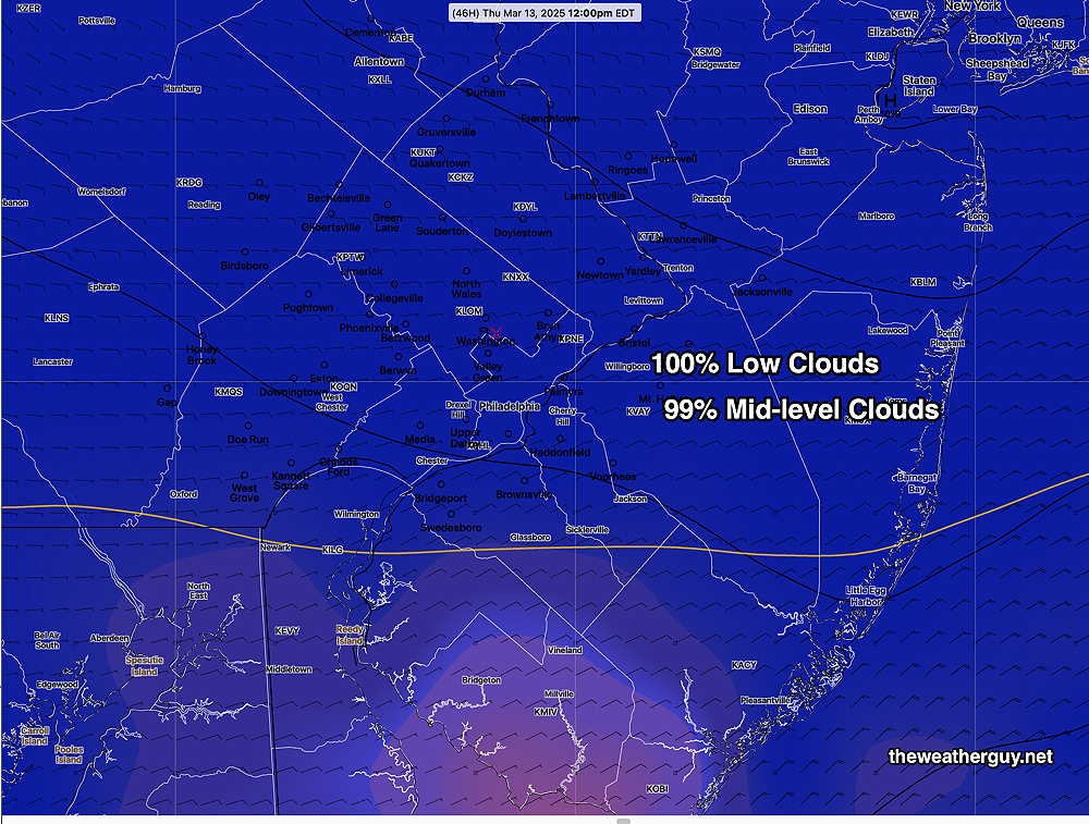
Posted Tuesday 03/11/25 @ 5:46 PM —The latest ECMWF-AI mode (single) and the latest GFS have very different forecasts for Wednesday and Thursday regarding cloud cover. An easterly flow behind a back door cold front may result in very cloud conditions.
Here’s the latest GFS cloud cover for Thursday noon—
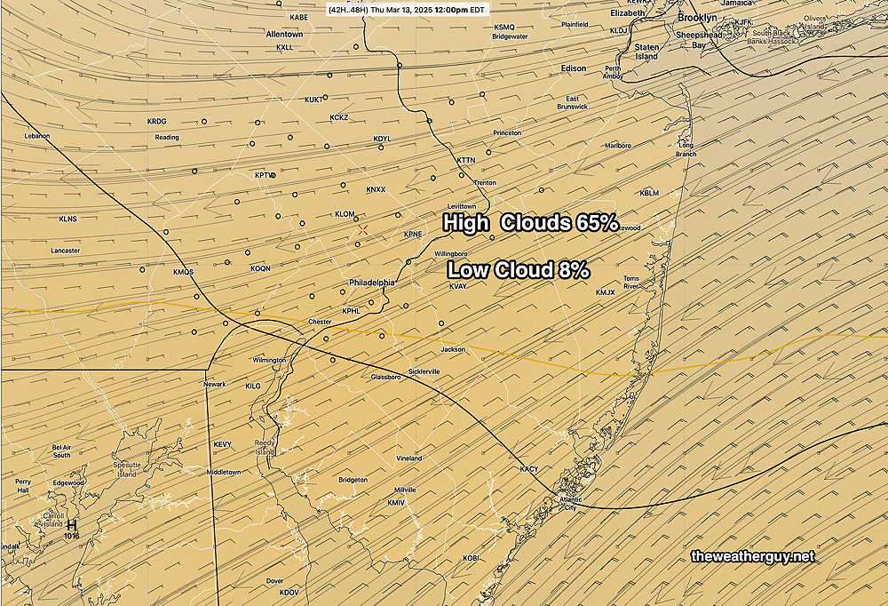
Here’s the ECMWF-AI-Single forecast for Thursday noon—
The two forecasts couldn’t be more different regarding cloud cover. Ordinarily, with these forecasts, I would go with the GFS model. (The GFS relative humidity fields support a very dark cloudy mid-day. The NAM-NEST also is forecasting low clouds. )
The ECMWF-AI-Single model has really impressed me regarding temperature forecasts. It’s also done well with rainfall. Let’s see how Thursday’s cloud cover turns out. (Or whether the models come together.)
Posted Monday 03/10/25 @ 5:07 PM —A large ridge of high pressure in the central US with a split jet flow moving around this central high will continue to bring above average temperatures to our area.
Dry weather is expected to continue until late Saturday afternoon or evening.
Previously Posted Sun @ 5:03 PM — —The big story (and actually the only story) for the weather this coming week will be the warmer temperatures expected. Additionally, winds and wind gusts will be considerably lower than recent days.
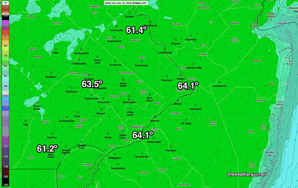
For Monday, here’s the latest model blend (NBM). What’s interesting is how close the the ECMWF-AI model is to the NBM model with less computational effort.
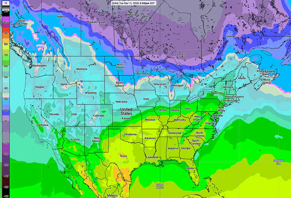
By Tuesday, warmer temperatures push in from the southwest. We’ll be in the 67º-69º —
It’s been well-advertised about the 70º temperatures for this coming Saturday. The latest AI model suggests we may not reach that.
The change to Daylight Saving Time always takes some adjustment. For me, the biggest adjustment is the one hour later availability of weather model data. One hour doesn’t sound like much, but it brings models out a bit too late in the morning to be as useful and too late in the evening to make the 11 PM TV weather. I’ve written about this many times over past years—
Little Known Facts about Daylight Saving Time and TV Weather Forecasts
Daylight Saving Time and Weather Models
“Check Back at 11” — TV Weather and Daylight Saving Time