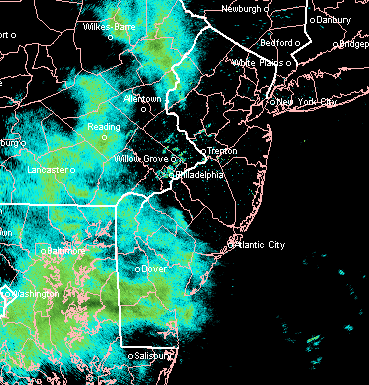
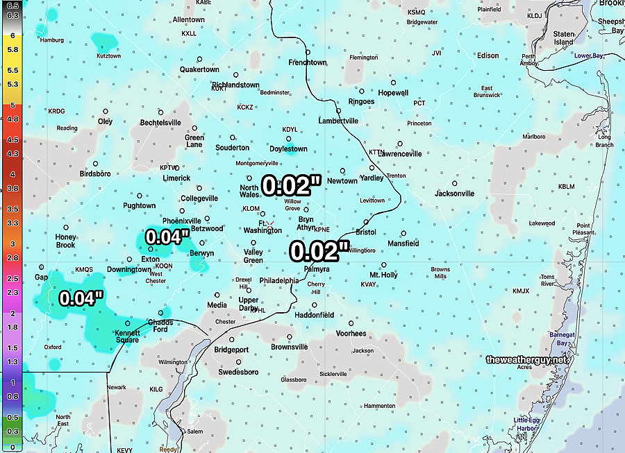
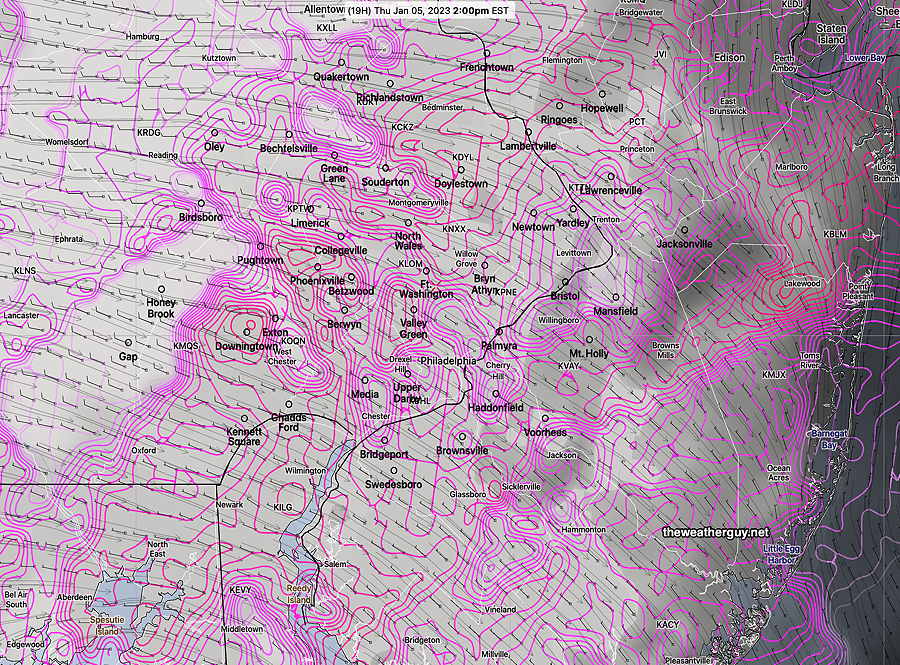
Update Tue 01/31 @ 4:32 PM — Just a quick update…latest ECMWF and NAM-NEST are forecasting very light snow between 3 AM and 6 AM Wednesday morning. A light dusting possible less than 0.20 inches, especially in South Jersey.
NAM-NEST snow-rain at 6 AM (Click on image for a larger view.)
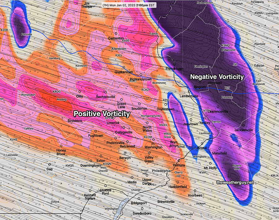
Who Predicted This Wet Snow?
Update Tue 01/31 @ 3:20 PM — So, I’ve been “off-duty” the past two days and I haven’t done a daily forecast, just a jet stream over-view yesterday. But I’m pretty sure I heard the forecast on the radio— ”some showers possible in the morning’. That was about it.
We’ve had very light, wet, non-accumulating snow falling for the past 4-5 hours.
So folks, this is going to have to be a Retroactive Forensic Forecast to answer the question, “what the heck is going on??”
Basically a cold front went through overnight, as had been forecast. Looking back at last night’s models, several were hinting for the front to stall just to our south and several waves of low pressure have apparently formed along the stalling front. That said, this morning’s HRRR had light rain, not light wet snow, and ending earlier than it has.
This morning’s GFS was not capturing this afternoon’s wet snow in its forecast, although the wavy nature of the thermal contours is apparent—
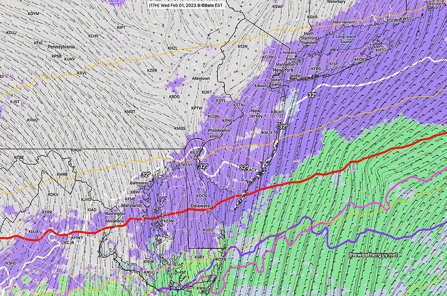
Today’s 12z GFS shows the 800 and 900mb freezing temperatures (blue and violet) are quite wavy, suggesting the weak waves of low pressure. The isobars just south of us are all “baggy” which also shows the very weak low pressure waves. Also notice the 32º surface temperature line (faint white) is north of us. It doesn’t have to be freezing outside to have snow. (Click on image for a larger view.)
I’ll have to check to see if there are any more surprises in store for us. Stay tuned.
Transitioning Jet Flow
#weather #paweather #wx #pawx #philadelphia
Useful Weather Link from the NWS—
The NWS has an Impact Based Decision Support Services(IDSS) websitethat provides detailed and up to date hour-by-hour weather information and forecasts. There’s a button that allows you to save a specific location URL to your web browser Favorites or Bookmarks.
Excellent! Better than most weather mobile apps!
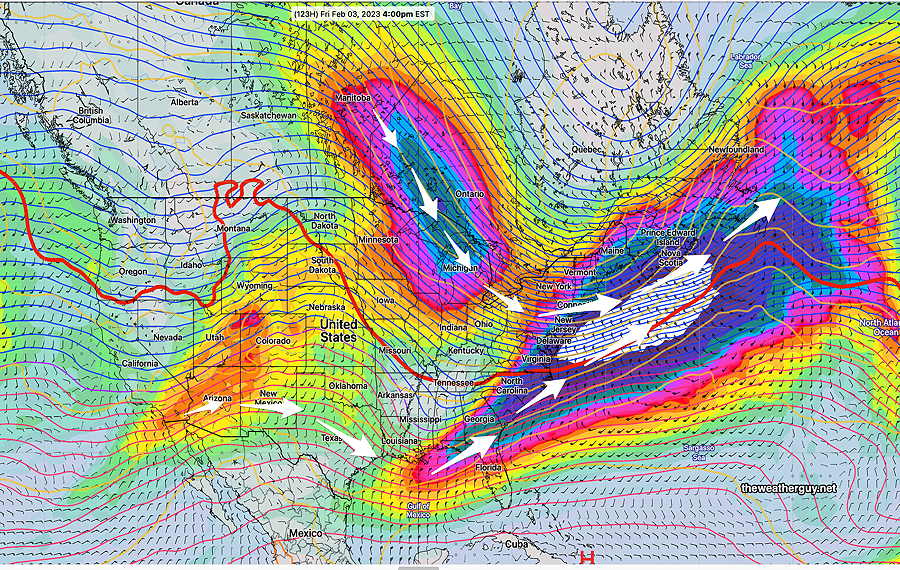
A split jet flow, flat in our area, will transition to a trough by Friday. Most systems will pass by to our south and to our north through Friday.
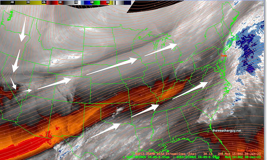
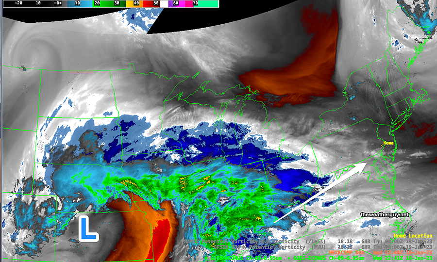
Current Water Vapor Image shows jet positions—
Monday Morning Satellite Water Vapor image (mid level) shows two jet streams and a flat configuration over our area on Monday morning. (Click on image for a larger view.)
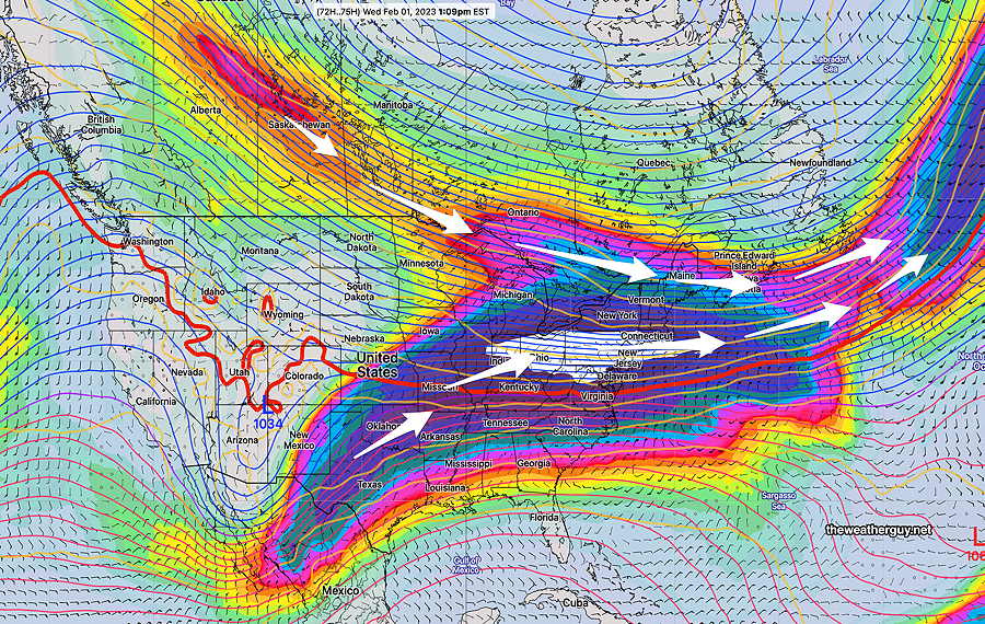
By Wednesday, things begin to change. Here’s the NAEFS model showing more detail at jet stream wind level as it transitions on Wednesday —
NAEFS Wednesday 250 mb (jet stream level) winds Strong jet streak over Pennsylvania (white color code) (Click on image for a larger view.)
By Friday, we’re under an upper level trough with cold air—
NAEFS 250 mb wind Friday forecast shows full transition into trough over our area. (Click on image for a larger view.)
No large storms expected to form here this week and no snowstorms expected here within in the next 10 days.
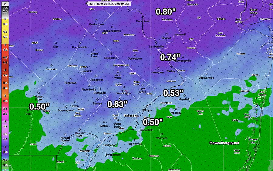
Update Wed 01/18 @ 6:19 PM — Low pressure will move in Thursday morning with rain starting between 7 and 10 AM—
Satellite Water Vapor image at 5 PM Wednesday with superimposed radar. (Click on image for a larger view.)
Rain through the day. Increasingly windy during the afternoon. Total rainfall is still expected to be from 0.5 -0.8″ rain —
Today’s HREF total precip by 2 AM Friday morning. Heavier rainfall to our north. (Click on image for a larger view.)
Friday looks fairly cloudy. Windy!
Today’s New York Times has an interesting article: “Can we talk about how we talk about the weather”. It addresses the increasing hype about storms and the use of exaggerated weather forecast descriptive terms. It touches on the new [absurd] trend in naming ordinary storms and pseudo-scientific, non-specific approach to what are “bomb cyclones” and “atmospheric rivers” and the “polar vortex”. And my favorite: media hype.
Long-time followers of this blog know of my disdain for all of this. I often see this blog as my crusade to cut through this on a regional level.
This blog has a small regular daily following, fairly large when a winter/summer storms loom.
As many of you regulars know, I’ve always geared what you read here towards authenticity, not the most re-tweets [or ‘re-toots’ in the Mastodon world].
Wednesday
Update Tue 1/17 9:39 PM — Tonight’s models are showing both periods of sun and periods of clouds for Wednesday. More sun than previously forecast.
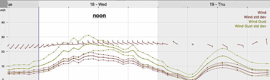
Update Tue 01/17 @ 5:17 PM — A strong upper air flow (jet streak) directly over us on Wednesday with low pressure in eastern Canada will cause mild but cloudy conditions for us on Wednesday. Some strong mid-level disturbances with a strong lower level jet will mix down some of these higher winds.
NBM wind meteogram for Blue Bell PA (Click on image for a larger view.)
So Wednesday looks to be fairly cloudy (with some sun early and some occasional breaks in the clouds.) (More sun east of the city into NJ. ) It will be WINDY. Highs 50º sd 1.2º Blue Bell.
Thursday looks quite rainy. 0.5″- 1″ of rain expected.
No snow on the horizon, but several coastal storms are forecast— next Monday and next Wednesday/Thursday. There’s just not enough cold air for snow here.
Nonetheless, the weather pattern has changed a bit over the past few days and during a more ‘normal’ winter, this pattern would bring us a good chance of snow.
Tuesday Update
Update Tue 1/17 10:59 AM — So much for the showers dissipating.
Radar at 11 AM. More showers than forecast.
Follow up –The showers turned out to be minimal. A few sprinkles.
Update Tue 01/17 @ 10:00 AM — As expected, the radar echos have arrived earlier than forecast. Latest radar, supported by current models, has the showers dissipating as they move towards the immediate PHL area and will pass mostly north and south of us —
RADAR 9:45 AM. Most activity will dissipate as it moves eastward. (Click on image for a larger view.)
Monday -Tuesday Update
Update Mon 01/16 @ 9:45 PM — Tonight’s models are leaning towards very light precip staying to our south. A few sprinkles in the morning possible northern sections.
Tonight’s 00z NAM-NEST accumulated precipitation by 7 PM. Barely anything north of the city. (Click on image for a larger view.)
Update Mon 01/16 @ 5:10 PM — This afternoon’s models continue with the forecast of clouds for Tuesday with some very light rain (0.01-0.02″) moving in between noon and 3 PM. A comparison of the GFS and NAM models with current water vapor imagery suggests the models may be a bit slow with the light showers, so it wouldn’t surprise me if we see some very light showers as early as 11 AM.
Water Vapor image with superimposed NAM potential vorticity (PV) contours (yellow) shows the actual image is more northeastward than the models, suggesting the system is moving somewhat faster than the model forecasts. (Click on image for a larger view.)
I should add that this afternoon’s NAM-NEST has no rain for our immediate area, having the light precip move to our north and south. The German ICON and Canadian RGEM models are similar. So there’s some uncertainty whether our immediate area will get any precip.
Update Mon 01/16 @ 9:05 AM — It’s still breezy/windy Monday and the winds will make it feel colder than the thermometer reading.
As for Tuesday, there’s some uncertainty in the amount (if any) of rain we’ll get in our immediate area. The low resolution models have the rain missing us, moving to the north and south of us.
The higher resolution models do crank out a small total amount of scattered showers (0.01- 0.02″) as captured by the latest NBMv4.1 model—
Today’s NBM 12z 12 hour accumulated rainfall through Tuesday. Very light amounts. (Click on image for a larger view.)
Previously Posted Sun 8:16 PM —
Our snow-less winter will likely continue for this coming week into this weekend. At one point last week, I had posted that enough cold air was building in Canada in the coming 7-10 days that we could could see a change in the pattern with the cold air sagging down into an upper trough.
There is no sign of that happening in the current medium range model forecasts.
This week will continue the pattern of milder than average temperatures, punctuated by low pressure systems that track up to the Great Lakes with their attendant cold fronts moving through each time.
Monday: Fair skies. Still breezy. Temps in the mid 40s.
Tuesday: The first example of this repeating pattern will be on Tuesday with showers moving through. The showers lose upper air support as they pass through our immediate area mid day Tuesday, and it’s uncertain if we’ll get much more than a few sprinkles if anything.
Here’s the current RAP model forecast for Tuesday—
RAP model simulated composite radar for 1 PM Tuesday. The rain is moving into an upper ridge and falls apart. (Click on image for a larger view.)
Wednesday: A mix of clouds and sun. Mild in the 50s
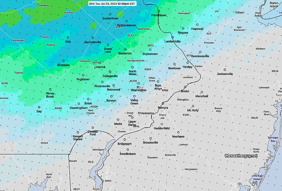
Thursday: A more robust system moves through on Thursday with rain.
GFS model forecast for Thursday at 1 PM. (Click on image for a larger view.)
Update Thu 01/05 @ 6:01 PM — A quick note that the latest GFS just available shows some light snow possible, western and southern sections late Sunday evening. Very light and not quite a storm. Stay tuned.
Thursday
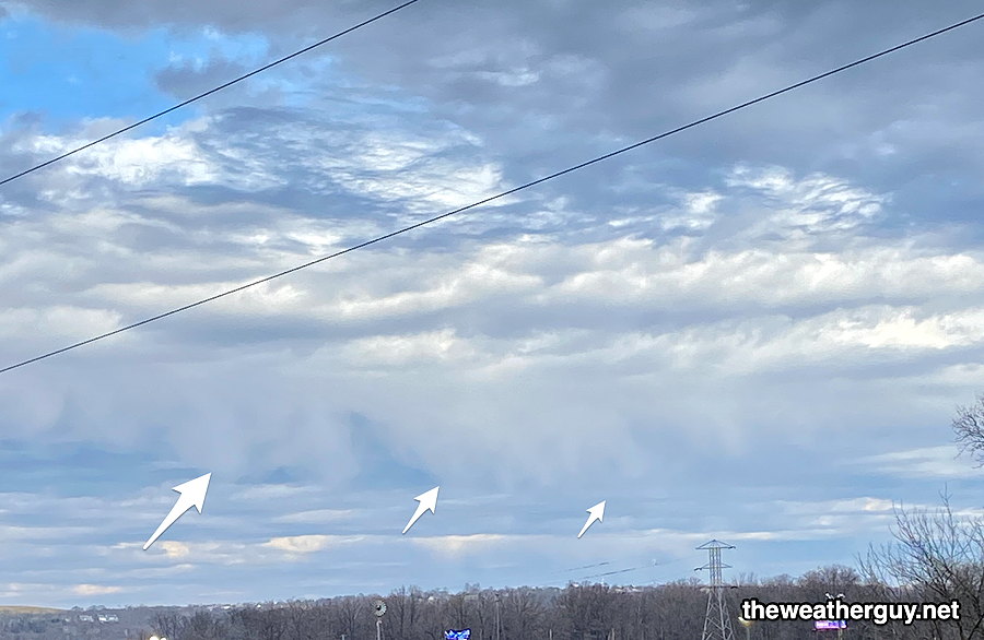
Update Thu 01/05 @ 5:36 PM — Some interesting weather sights from the Schuylkill trail today-
First, several areas of sprinkles and showers did develop during the afternoon, as forecast by the HRRR and NAM-NEST. Some unusual virga seen from mid-level clouds—
Virga from mid-level clouds (Click on image for a larger view.)
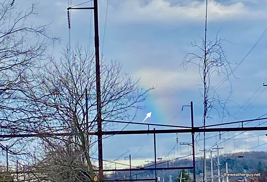
Another sight was a somewhat rare wintertime rainbow in the afternoon.—
Rainbow viewed heading east on the Schuylkill trail at about 3:30 PM (Click on image for a larger view.)
Update Thu 01/05 @ 9:36 AM — This morning’s HRRR and NAM-NEST show much more cloudiness this afternoon than previously forecast (previous forecast was “high uncertainty”). Even a few widely scattered sprinkles possible.
Update Wed 01/04 @ 8:38 PM — A cold front will move through this evening and temperatures over the next 24 hours will begin a descent closer to normal by late Friday.
Thursday will feature a mix of sun and clouds. High uncertainty about the amount of cloudiness due to increasing upper trough and a storm southeast off the coast.
Tonight’s 00z NBM cloud forecast (black/grey) with standard deviation (violet contours) High uncertainty in cloud cover. (Click on image for a larger view.)
An upper air disturbance and upper trough will bring some showers later Thursday evening and night.
The weekend looks closer to ‘normal’ temperatures. No snow on the horizon. Slight chance at the end of next week. Increasing chances of snow towards the third week in January when colder air might return.
Wednesday
Update Wed 1/04 8:08 AM — Clouds move in about 11 AM. Showers move in 2-4 PM, earlier western Montco and southern Chester counties. Rainfall amounts will be on the light side, 0.10 inches. Highs near 65º!
Update Tue 01/03 @ 8:03 PM — A cold front approaches. High cloudiness, perhaps with some breaks of sun early, then thickening and lowering clouds. Rain moves in between 2 and 3 PM (earlier west of the city.)
Increasing winds during the evening, ahead of the cold front that moves through about 11 PM.
Yet Another Wrong Model Forecast
Tue 11:04 AM Forecast Review — I didn’t have time last night to post a Tuesday forecast, but I can tell you that the models had only light showers barely making it into northwest sections of Philadelphia late morning and then exiting to our northeast. This morning’s models were similar.
12z NBM forecast for noon showing precip coverage barely making it into Philadelphia —
NBM model showing extent of rain forecast. (Click on image for a larger view.)
Current Radar at 11 AM —
Radar at 11 AM Tuesday with superimposed RAP model data. Significant rain covering all of Philadelphia. (Click on image for a larger view.)
Some of the rain coverage error can be explained by the resolution of the models, but not all of it.
I’m usually in awe about the weather models, but I can’t explain why there have been two consecutive days where the model forecasts have been substantially wrong.
Mon 5:23 PM Forecast Review — Today’s forecast was one of those where meteorologists just have to scratch their head, wonder what happened to the sunshine with 60º temperatures, and admit a failed model forecast.
Eating lunch outdoors today, I was wondering where the sunshine was. When it started raining about 1:30 PM, well…
I’ve gone back and reviewed the morning models. I’ve looked over every one of the 14 different models that automatically download each day to my own ‘little weather data server’, and every one of them had little to no clouds at noon and no rain during the mid-day hours.
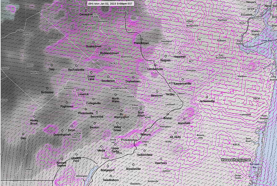
What I did find: the HIRESW and HRRR models showed areas of strong vorticity and a strong negative/positive vorticity couplet in the mid levels of the atmosphere (500mb) at 1-2 PM —
HIRESW-ARW-MEM2 shows a very strong positive/negative vorticity couplet. (Due to the conservation of momentum, these areas appear as pairs in the models. ) So the models showed there were dynamics for precipitation. Clearly there was an input error with the available moisture. (Click on image for a larger view.)
So with the models getting the dynamics correct, clearly there was an input error in the available moisture. There was much more moisture and clouds than forecast. (You can’t get rain when there are no clouds/moisture, despite the dynamics being present. ) At least we know what likely happened with today’s forecast.
MONDAY
Update Mon 01/02 @ 9:56 AM —The cloudiness this morning was expected. We should see more sun especially from Blue Bell and eastward towards noon, BUT the latest NBM shows advancing cloudiness by 2-3PM with more uncertainty elsewhere—
Monday’s 12z NBM shows clouds advancing from the west at 3 PM (black/grey) with considerable uncertainty in cloud cover (violet contours) elsewhere. (Click on image for a larger view.)
LACK OF COLD AIR
Update Mon 01/02 @ 9:44 AM — I mentioned yesterday that following the extreme cold of last week, there’s a relative lack of cold air in Canada right now. There’s no extremely cold, dense air mass to push the jet stream to our south.
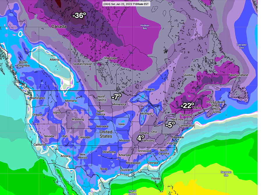
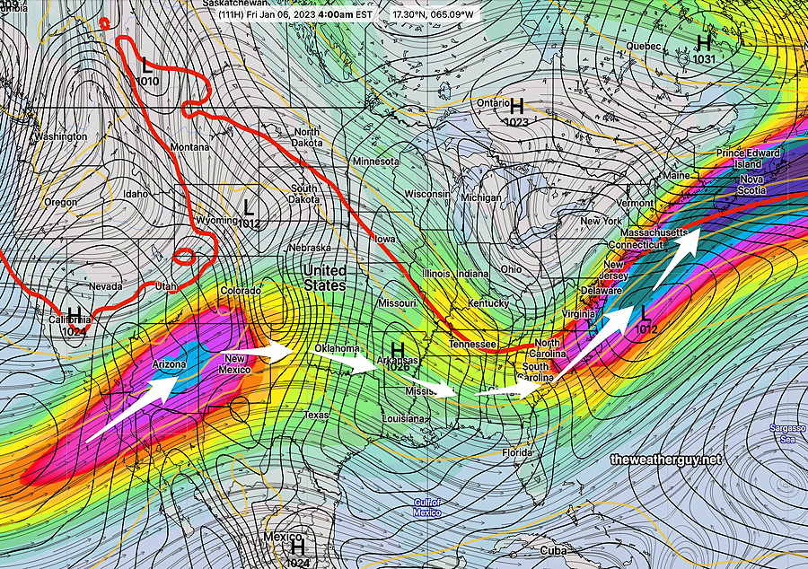
Here’s the forecast temperatures from last year, (January 21st) in comparison to today —
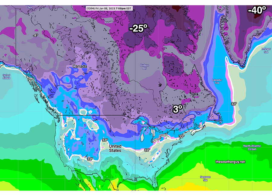
Jan 21 2022 (GEPS) showing a particularly cold outbreak here. (Click on image for a larger view.)GEPS forecast for Friday January 6th 2023 (Click on image for a larger view.)
While the temperatures change day to day, and the above maps are not a direct calendar day-to-day comparison, the temperatures in Canada this week are ‘milder’ than last January (and last January wasn’t a particularly cold season.)
For snow lovers, we won’t see much of anything until things chill down to our north.
MILD AND WET
Previously Posted Sun 8:12 PM —
This week’s weather will be influenced by a warm moist flow with the jet stream to our north. (There’s a lack of extremely cold air in Canada and Greenland after the main blob came down last weekend. It will take a week or two for it be replenished. )
Monday will be the nicest day of the week. We may has some low clouds and fog early Monday, but the fog will break for sunshine. Temperatures in the upper 50s to near 60º!
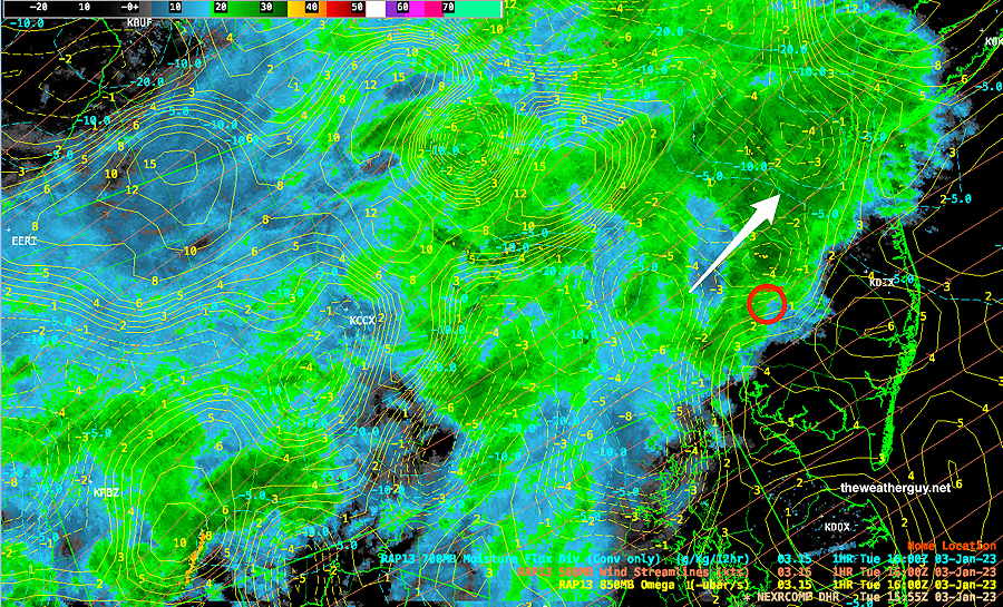
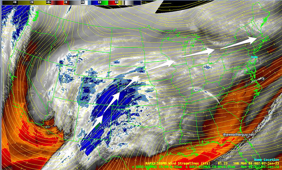
The current water vapor image shows the moisture stream that will affect us later Tuesday and Wednesday and again on Friday.
Sunday evening’s water vapor image with RAP model superimposed 500 mb wind streamlines (yellow) (Click on image for a larger view.)
The water vapor image (above) corresponds to the current GEFS forecast jet stream flow for the present time—
GEFS jet stream wind forecast (with surface high pressure contours) for the current time, Sunday evening. (Click on image for a larger view.)
Tuesday and Wednesday; Temperatures will be verymild, but we’ll have clouds on Tuesday and clouds with rain on Wednesday.
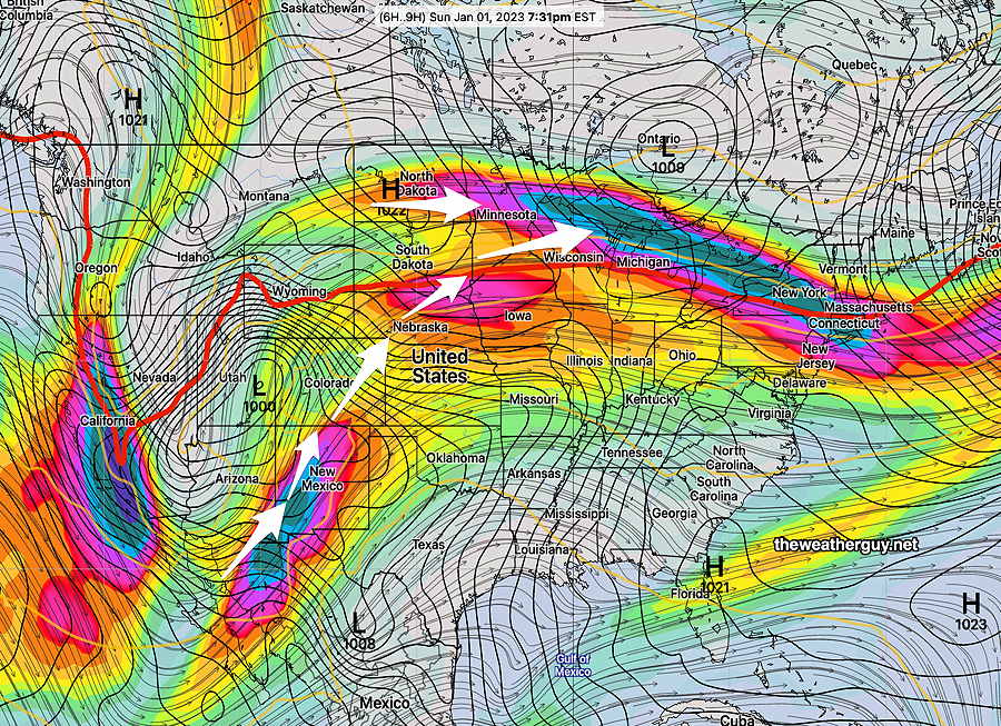
By Friday, some cold air associated with Canadian high pressure will push the jet into a moderate trough over the eastern US with low pressure spawned off the coast—
GEFS forecast for Friday morning. Upper trough over the eastern US with surface low pressure developing off the coast (Click on image for a larger view.)
With temperatures above freezing on Friday, we’ll have rain, but not far to our north, there will be some snow, despite temps above freezing.