#Philadelphia #weather #PAwx #PhillyWx
Friday Forecast & Weekend Outlook
Posted Thursday 06/12/25 @ 5:49 PM — A cold front will slowly slip through tonight into Friday morning. Most models are keeping the rain to near zero in the immediate Philadelphia area on Friday.
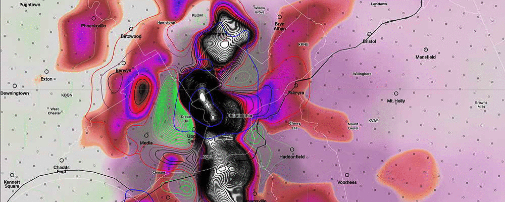
The REFS captures this well—
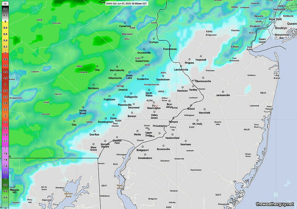
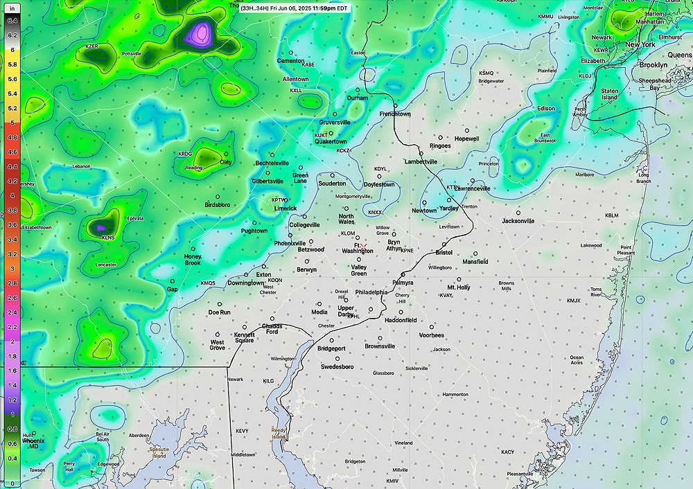
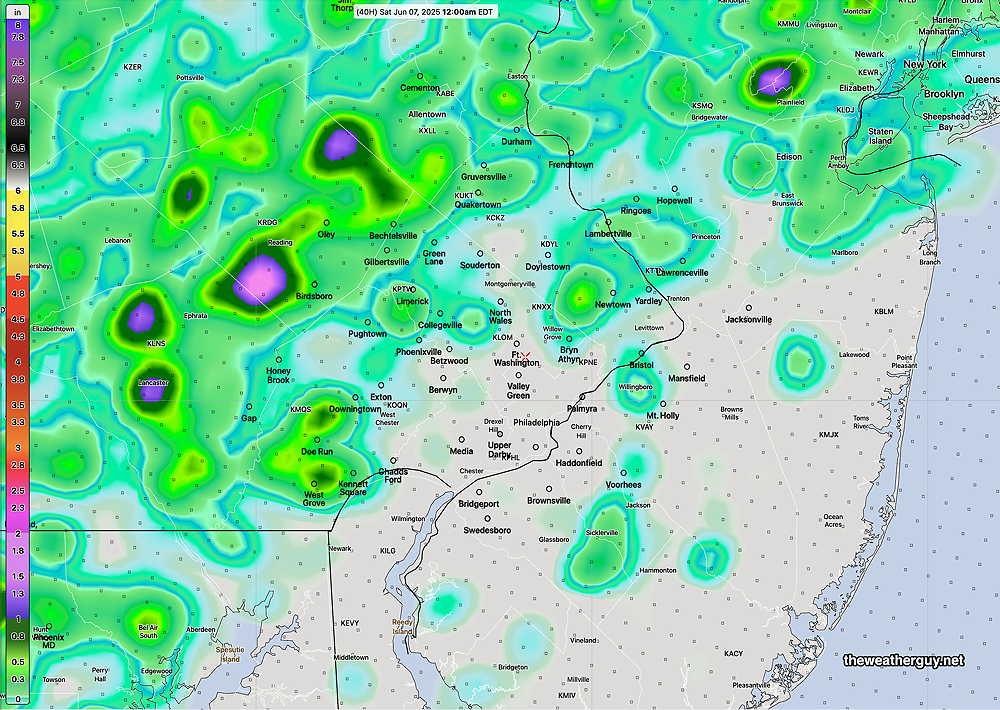
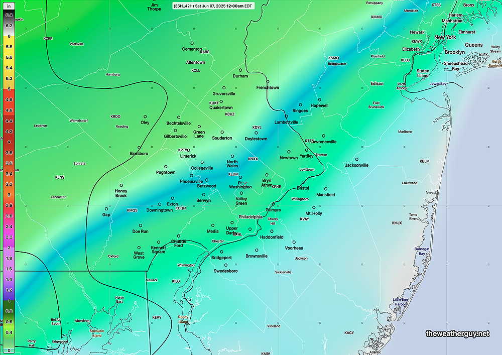
Scattered light rain with periods of just clouds for Saturday as waves of low pressure move along this stalled frontal boundary. Sunday just looks to be cloudy with little in the way of showers. The timing of these waves will likely change. Stay tuned.
Thursday and Weekend Outlook
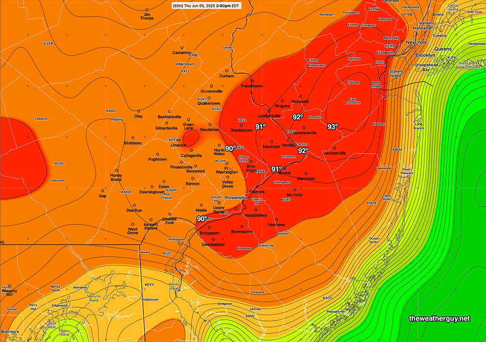
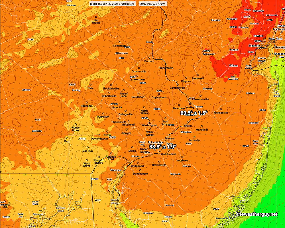
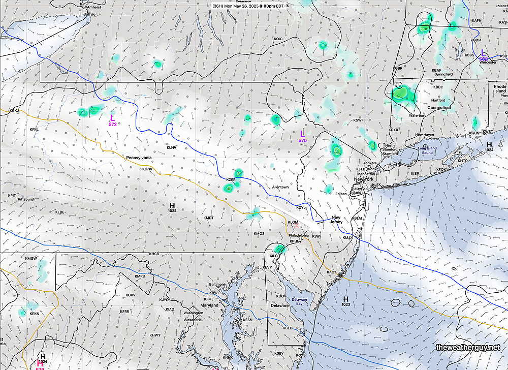
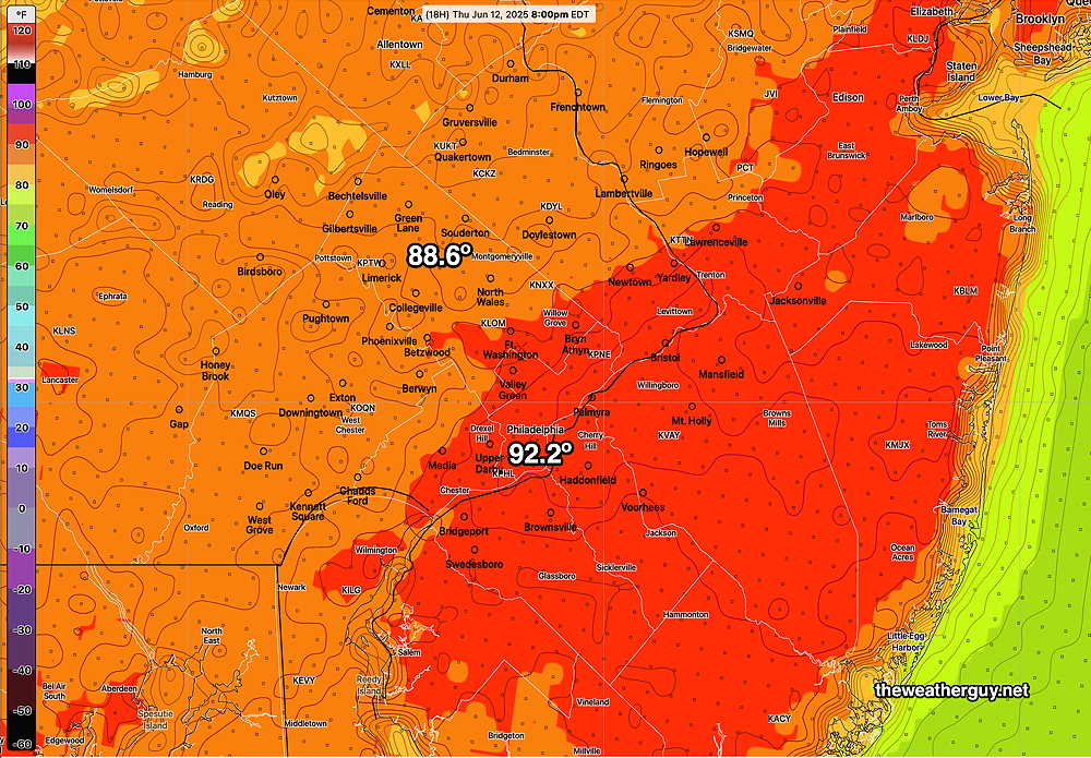
Posted Thursday 06/12/25 @ 9:11 AM — High temperatures for today will be near 90º in much of the area. Dew points near 65º will make the heat index (apparent temperature) about 1º higher than shown below.
A cold front will slowly sink south of our area on Friday and will then become stationary. Some showers are expected from Allentown and northward with this front early Friday morning. While it will be cloudy here in our immediate area, no showers are current forecast here on Friday. (That may change.)
Some thinning of the clouds later Friday afternoon with some sun possible.
Weekend: A cooler easterly wind flow will develop behind this cold front with plenty of clouds.
Waves of low pressure will form along this front during the weekend. Periods of showers are expected, but timing these showers will be difficult.
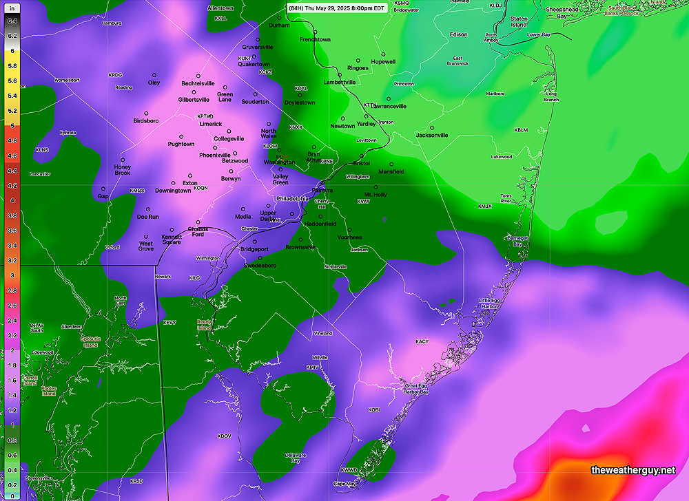
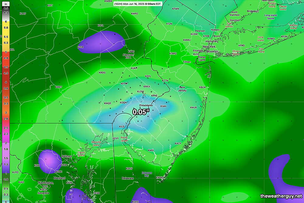
The GFS has been consistently maintaining relatively low rainfall around the immediately Philadelphia area with much of the showers to our far northwest and to our south over the weekend. Total rainfall for the weekend only about 0.30″ (NBM) and 0.05″ (GFS).
But, it’s really too early to identify timing and exact locations of the heavier showers with any degree of certainty.
I’ll update later today.
Tuesday
At about the same time, the radar showed something trying to get going, but ultimately the forecast was a bust.
These sorts of meteorological ‘experiments’ I thoroughly enjoy, even when the outcome is a bust. There’s always another day’s weather.
I should acknowledge that the RRFS is known to over-play this sort of convective rain forecast. Indeed, it’s one of the things they’ve been tinkering with to get the RRFS model ready for prime time release. The model is still considered experimental.
If and when they do release the model as operational, it will be likely known as RRFS-a. RRFS-b is already being explored, probably with a changed core from the current FV3 to a MPAS core. See my RRFS page for more info.
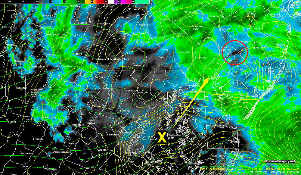
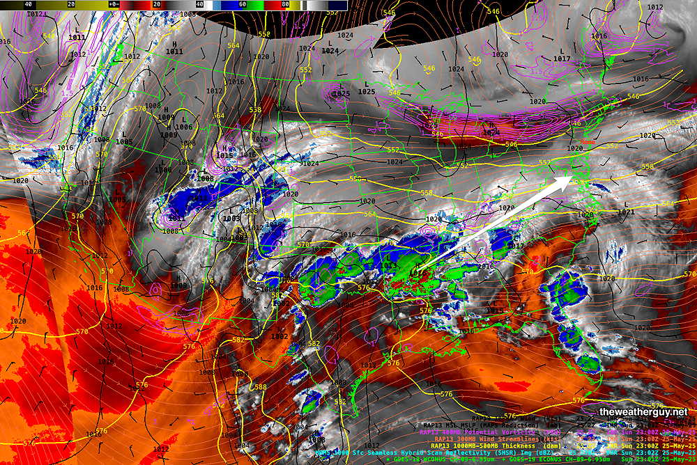
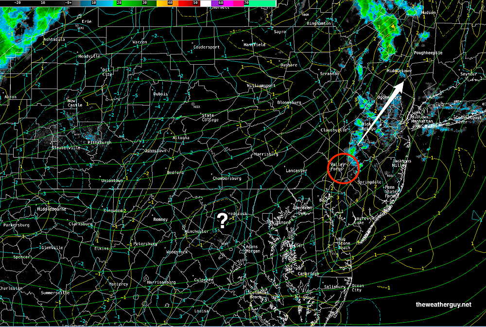
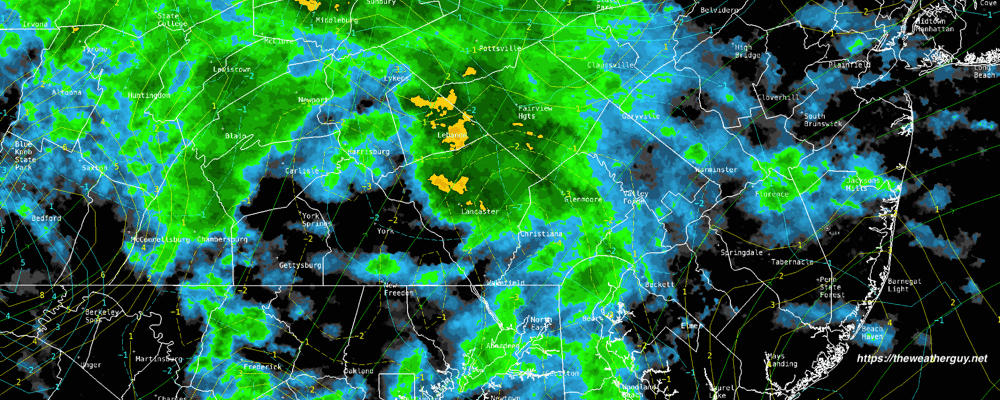
Posted Tuesday 06/10/25 @ 12:23 PM — Last night’s REFS correctly predicted the heavy rain that sprung up this morning over Philadelphia and northern sections. Last night’s (00z) HRRR really missed this forecast. I’m finding the experimental REFS increasingly useful and skillful.
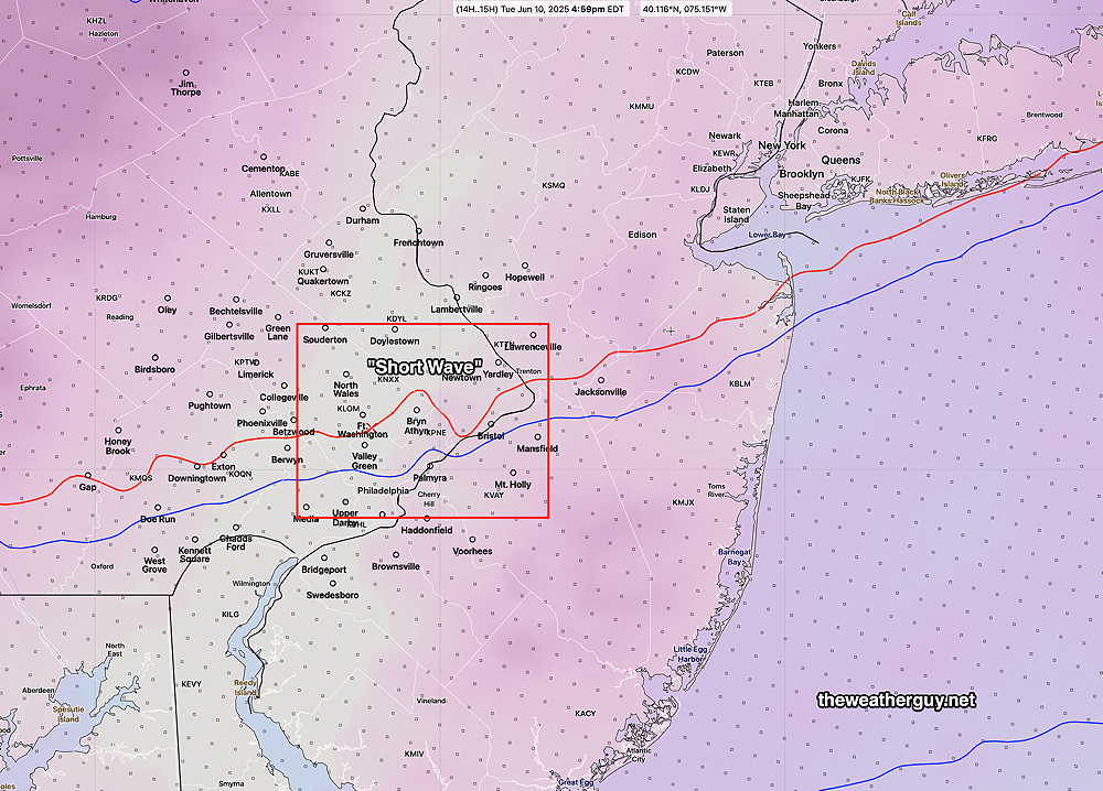
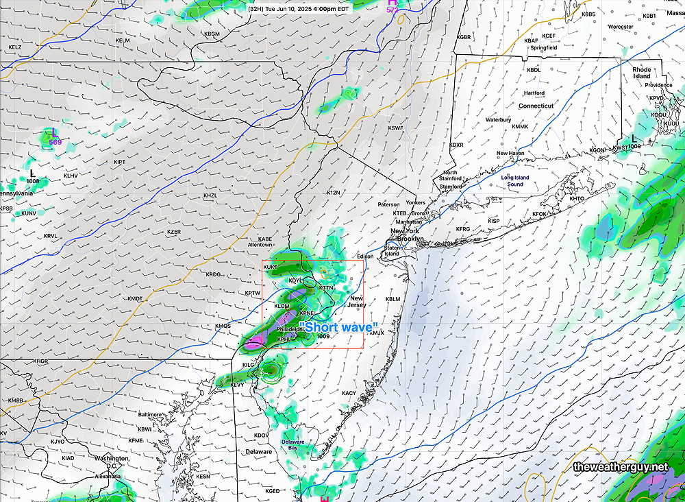
Sticking with the REFS and the RRFS, the last two runs continue to show a break in the rain, but another short wave is expected to move through between 3 and 5 PM this afternoon with another round of showers, possibly some low level thundershowers. Let’s see if this happens.
Tonight and Tuesday
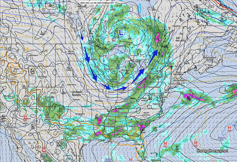
Posted Monday 06/09/25 @ 6:03 PM — It was reasonably dry around here after 11 AM.
For the Phillies game this evening, it appears that the scattered showers originally expected this evening likely won’t materialize.
The rain will wait until after midnight to move in.
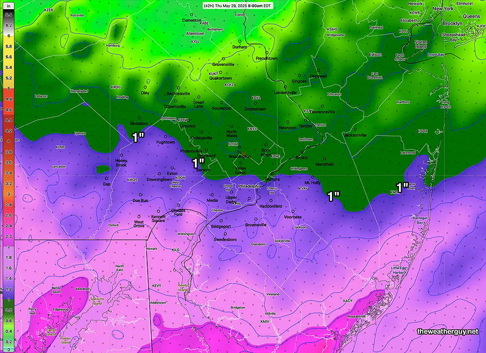
Rain ends Tuesday morning, by 10-11 AM in the city. About 0.35-0.40 inches of rain expected later tonight into Tuesday morning.
While the rain is expected to end Tuesday morning, several models show a ‘short wave’ moving through Tuesday afternoon about 3-6 PM with showers and possibly some thunder. Wednesday looks good!
Monday Forecast Update
Posted Monday 06/09/25 @ 9:22 AM — The latest ECMWF continues with light scattered showers through the day.
However, the latest RRFS, REFS and Canadian HRDPS forecasts no rain after 11 AM through the afternoon and based on current radar, I’m leaning in that direction. So low clouds with some breaks possible mid to late afternoon in western suburbs. Some widely scattered showers are possible as early as 6 PM. Light to moderate rain moves in tonight.
Originally Posted Sun 4:49 PM —Some of the uncertainty with this weekend’s forecasts will spill into Monday.
The showers that did move in this afternoon (forecast best by the European AI-Single model as well as the regular ECMWF, and disappointingly forecast by the HRRR, RRFS, REFS, GFS and NAM-NEST) will continue to develop this evening and into Monday morning.
The models are suggesting that the showers/rain taper late morning Monday with most (but not all) areas dry Monday afternoon. Rain redevelops Monday evening and night.
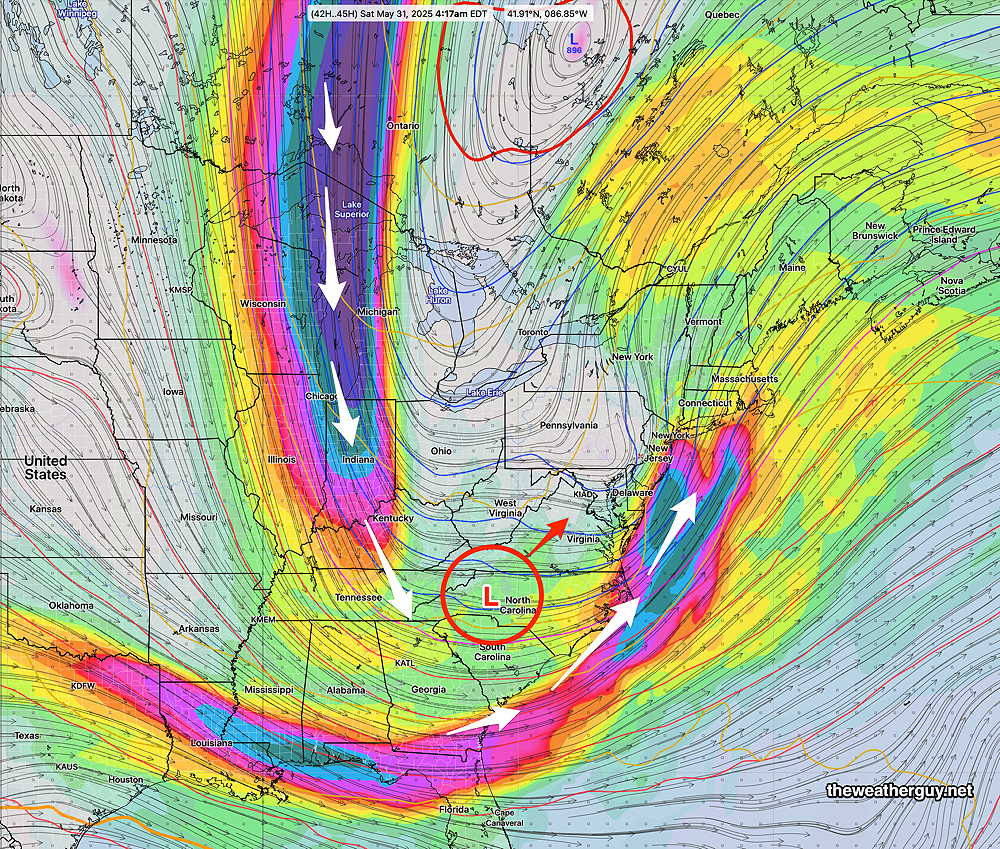
Here’s the latest ECMWF forecast for Monday afternoon, which shows the next element to affect our weather– another upper level low with a flow of cooler air.
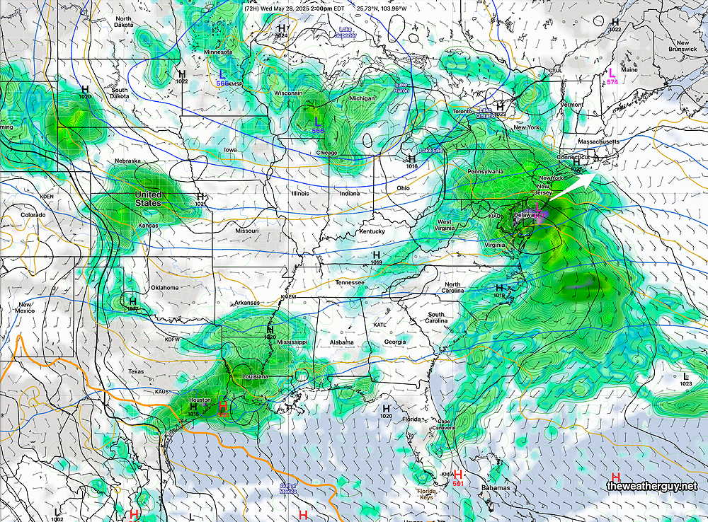
Moderate rain on Tuesday, then things improve. Unfortunately, there’s a hint that we’ll see rain part of next weekend.