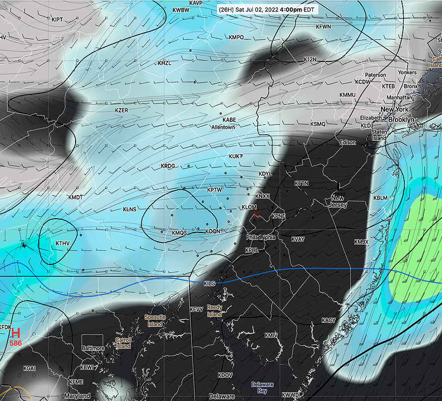
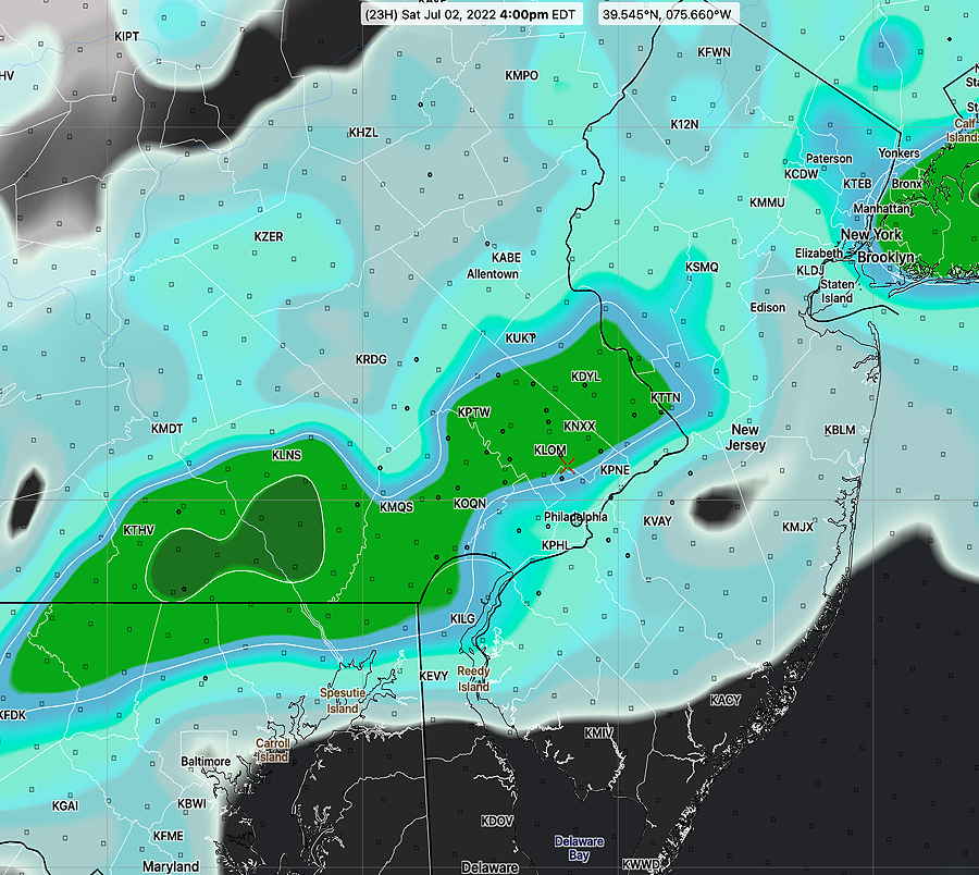
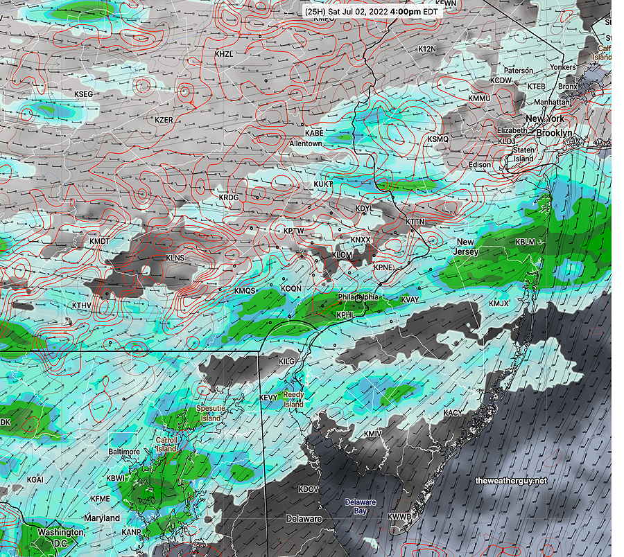
Updated Sun 4:38 PM — We’ve had no showers this afternoon (as forecast by the NAM-NEST, not the ECMWF). There may still may be some scattered activity late tonight. The main area of showers will move off to our north tonight.
The cold front comes through early evening Monday. The NAM-NEST shows a line of storms, but they may diminish in intensity as they move through our area. Updates tomorrow.
Update Sun @ 10:14 AM —
Forecast Review— We had some scattered storms after midnight, not forecast by last night’s US models. Still not much rain in the immediate PHL area—
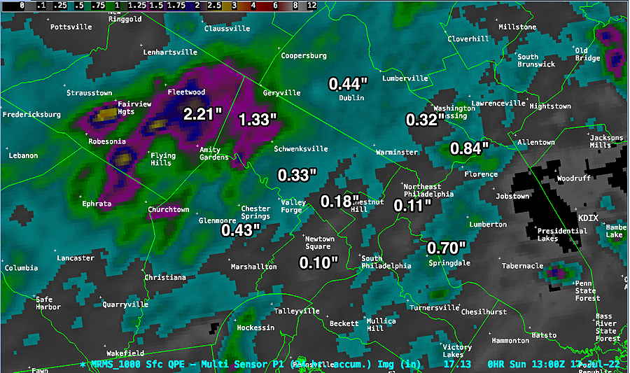
MRMS rainfall totals. The immediate PHL area received anywhere from 0.10″ to 0.44″, with a few localized exceptions. (Click on image for a larger view.)
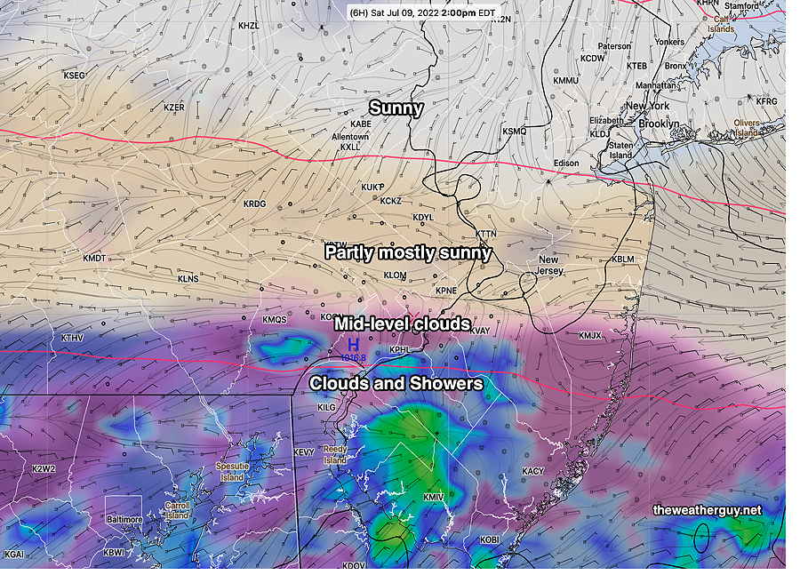
Sunday will be partly sunny/partly cloudy very warm and humid. High 86º ± 1.1º Dew points near 70º will make it feel much warmer. (~90º)
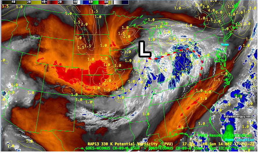
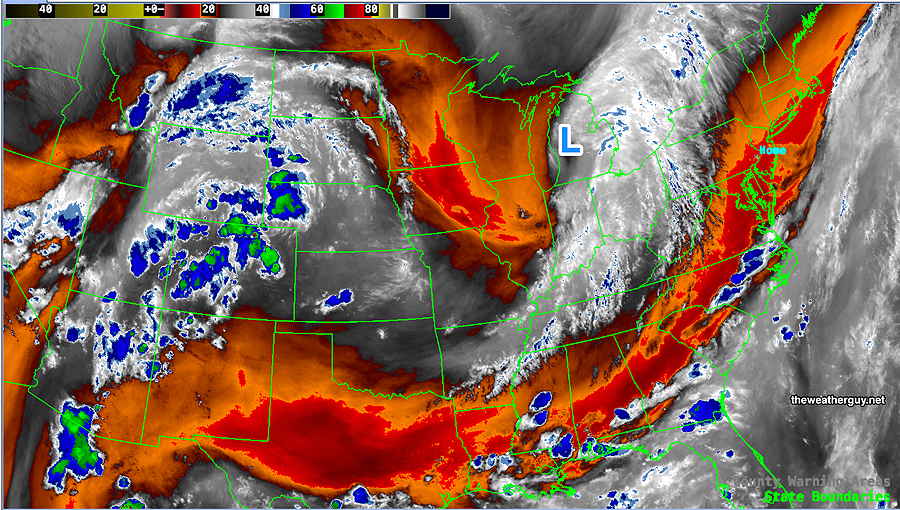
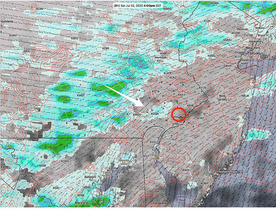
Sunday satellite water vapor image shows current conditions: warm front in western PA that will move north. Some models have most of the showers with this warm front moving north of our area tonight. Some models have some storms 3-5 PM this afternoon ahead of the front.
A warm front will move through around midnight with showers and thunderstorms. Most models have the bulk of the rain moving to our north. The ECMWF shows some storms developing around the Delaware Valley abut 3-5 PM or so, ahead of the warm front passage this evening.
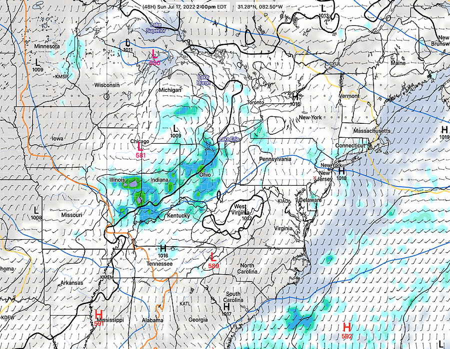
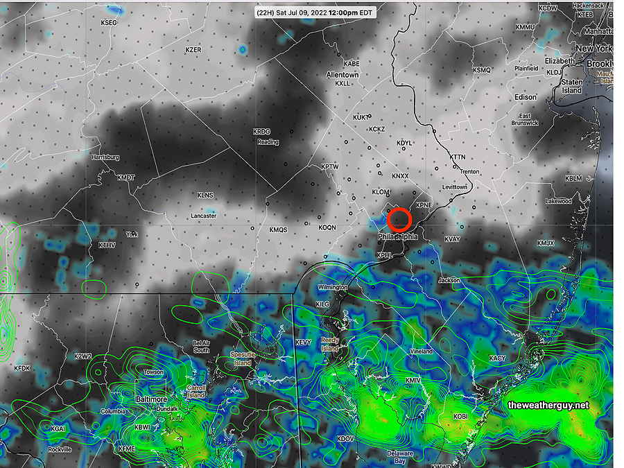
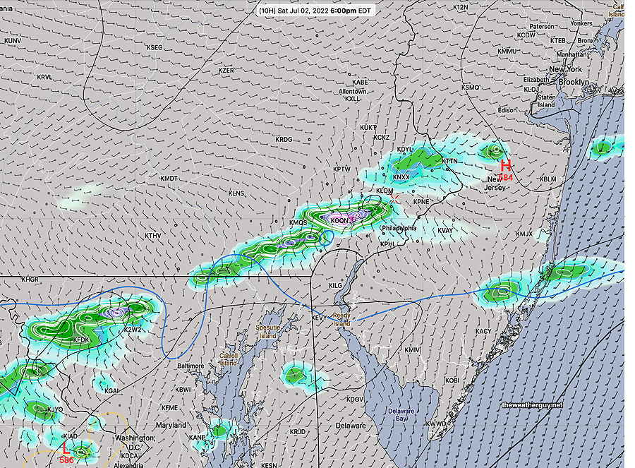
The ECMWF 3 previous hour rainfall forecast for 5 PM —
ECMWF forecast 3 hour rainfall at 5 PM today. Notice how the rainfall seems to bypass Philadelphia! (Click on image for a larger view.)
It should be noted that the NAM-NEST shows no showers here this afternoon. I’m including the ECMWF graphic because the ECMWF more correctly forecast the showers last night.
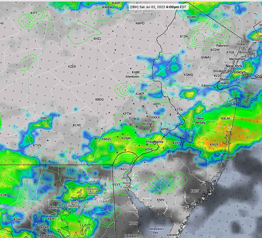
Monday afternoon shows the greatest promise of showers and thunderstorms here.
Updated Sat 11:11 PM —The rain most areas had today was minimal. For Sunday, there will be even less chance of rain.
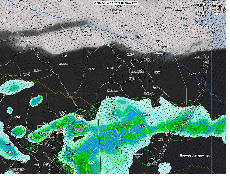
Temperatures approaching 88° will feel hotter with dew points near 70°. There’s a chance of highly isolated showers around 6 PM. Any rain Sunday night is forecast to move north of us. We’ll have to wait for Monday late afternoon for any chance of significant rain. Even Monday may not offer relief from the dry conditions.
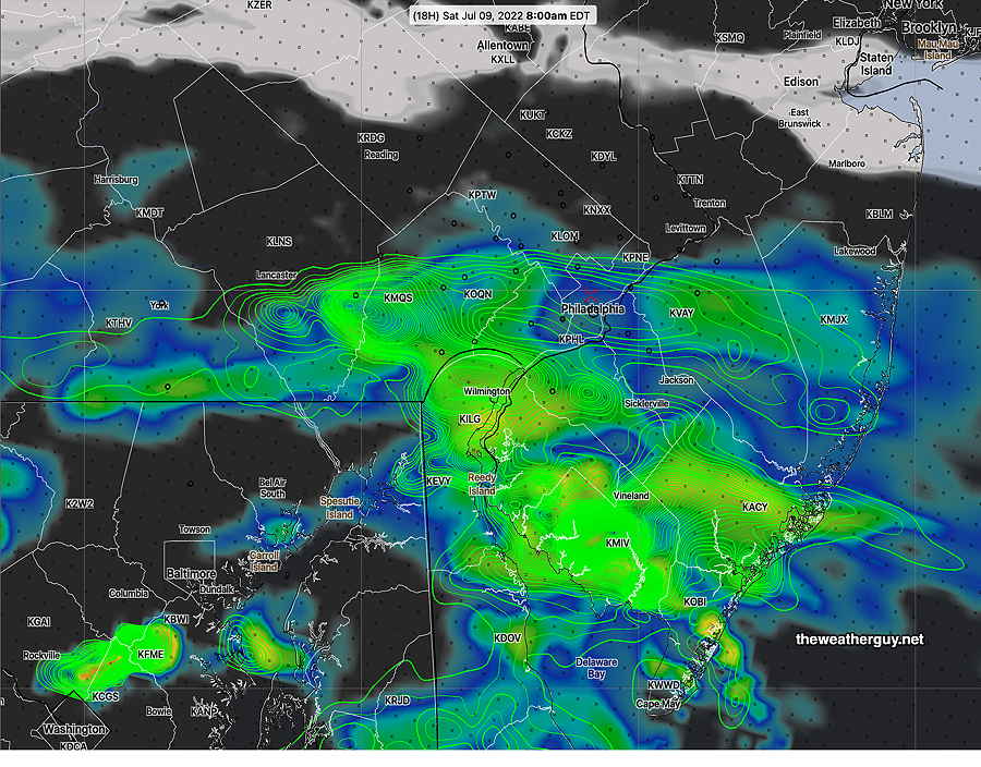
Update Sat @ 9:56 AM — Most models have no rain before 6 PM in the immediate PHL area. The European, ICON and HRDPS group of models maintain a dry area around PHL until about midnight. The latest RAP (12z) and HRRR (12z) show areas of showers and thunderstorms during the evening hours.
12z RAP shows no rain in the immediate PHL area before 6 PM (Click on image for a larger view.)12z HRRR shows showers/thunderstorms scattered around 11 PM.
Despite these forecasts, there is little indication that the dry spell we’re in will be ending today or Sunday.
Updated Fri 11:09 PM — Tonight’s NAM-NEST shows some impressive areas of thunderstorms around 5 PM.
NAM-NEST showers 5 PM Saturday.
Updated Fri 9:53 PM — Tonight’s early models are forecasting showers and thunderstorms Saturday evening. We’ll see if they’re correct; we could use the rain.
Previously Posted Fri 8:21 PM —
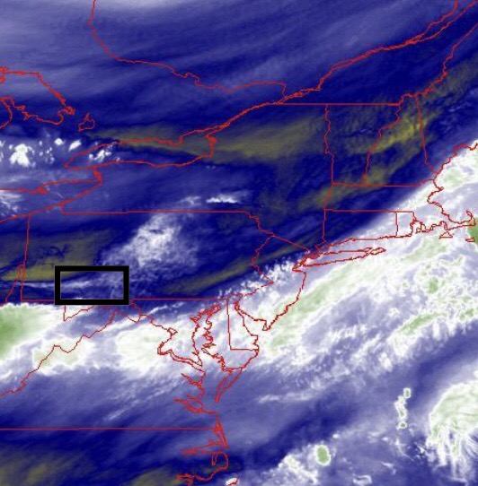
Low pressure in the Midwest will have mid-level and upper air disturbances move out ahead of the low.
Water Vapor image at 8 PM Friday. Upper and surface low over Michigan. (Click on image for a larger view.)
Ordinarily, summertime moisture will result in scattered thunderstorms. It doesn’t look like much for us.
I think it’s time to use the “d” word— it’s looking like there’s a mini drought situation developing in this area. It seems as though we’ve run into a situation where soil moisture levels have been reduced to low levels. A negative feedback loop can develop with thunderstorms where ‘dry begets dry’.
The last time I saw this in our region was back in 2000 and 2001 when very little rain had fallen. Radar images were similar…rain approaching from the west would appear to hit a wall and fall apart.
It often takes something like a strong tropical storm or hurricane to shake up the weather pattern. Nothing like this on the horizon yet.
But I digress….let’s talk about the weekend.
Saturday
Some upper air troughing will result in periods of cloudiness and sun, similar to what we had on Friday. Most of the day dry, although some very isolated popup storms may develop late afternoon. While some models have some rain moving in from the west during the evening, it appears that this will fall apart as it approaches the Delaware Valley.
High temperature 86.0º ± 2.2º NBM model Blue Bell, PA
Sunday
Previously Posted Fri 8:21 PM —
Some low clouds, maybe fog, in the morning. Perhaps a few sprinkles early. Most of the day will be a mix of sun and clouds. Little or no rain until evening.
GFS forecast for Sunday at 2 PM. Not much rain. (Click on image for a larger view.)
In fact, the latest NAM-NEST shows heavy storms in far western suburbs about 11 PM, falling apart as they try to move east towards us.
High temperature 86.5º ± 2.6º NBM model Blue Bell, PA
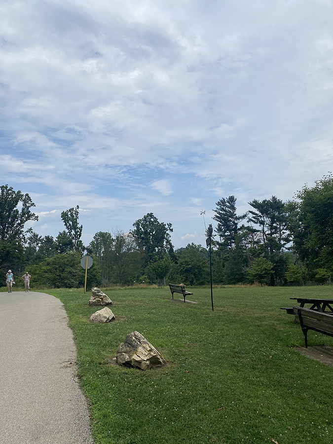
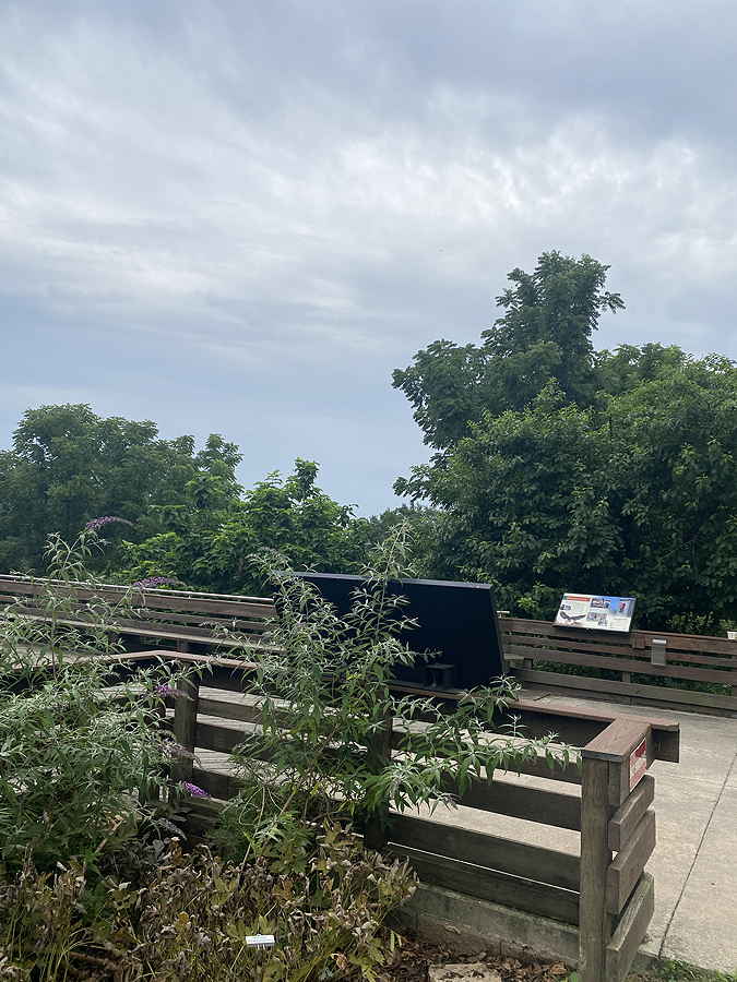
Forecast Review— Looking north and looking south at 2 PM from Fort Washington State Park. Dark clouds south; clearing and sun north. A couple of spits of rain on the way there!
Left- North view clearing Right- South view clouds
Update Sat @ 11:25 AM — It looks like another upper air disturbance will affect southern parts our area this afternoon.
Water Vapor image 11 AM shows upper air disturbance (white boxed) moving towards us, perhaps just south. Additional upper air disturbance in left lower corner of image may be the trigger for evening showers forecast by the NAM-NEST, mentioned in the forecast review below. (Click on image for a larger view.)
Update Sat @ 11:02 AM —Forecast Review— I’m waiting for the clearing I had predicted. The morning model runs are in lower consensus than previous runs. It looks like the dividing line will be right through Philadelphia—
This morning’s HIRESW-FV3 shows the north-south gradient dividing line between sun- clouds – showers for 2 PM (Click on image for a larger view.)
Adding more confusion: this morning’s NAM-NEST shows showers breaking out again about 6 PM around Philadelphia!
Updated Sat 8:46 AM — Last night’s 06z models continue with the general forecast of rain having mostly ended in Philadelphia. Water vapor imagery and current MRMS radar suggest another wave may bring some showers from Philadelphia on southward, but according to the models, precip ends in this area about 11 AM -12 this morning and clouds break/thin for some sunshine by 12-2 PM.
Updated Fri 10:46 PM — Tonight’s early models continue with the rain ending in the immediate PHL area in the morning. In fact, tonight’s NAM-NEST has the rain ending early morning Saturday with sun by late morning. The NAM-NEST is looking very similar to the the earlier Canadian HRDPS below.
Previously Posted Fri 5:10 PM —
There’s been some clarification on the rain and clearing for Saturday. Things are looking better.
Saturday
It appears that most of the immediate Philadelphia area will get rain/showers over the night time hours. The strong rainfall gradient north to south continues. Areas north of Philadelphia will have relatively little rain. Areas south and far south will have heavier rain lasting longer. Rainfall ends as early as 10 AM -12 noon.
The latest NAM-NEST has the most optimistic forecast.
A few pictures are worth a thousand words—
Today’s 18z NAM-NEST shows clouds (black) simulated radar (green-blue) and accumulated rain (green contours) at noon. Much of the northern suburbs will be in sunshine fairly early! (Click on image for a larger view.)Today’s 12z Canadian HRDPS showing a rain shield even further south at 10 AM. Today’s 18z HRRR at 8 AM Saturday. More clouds, but rain showers taper off in the morning. (Click on image for a larger view.)
While the rain ends early it remains to be seen how quickly the clouds will break. Northern locations will have earlier sunshine.
High temperature 75.1º ± 2.7º NBM model Blue Bell, PA
Sunday
Sunny. Light easterly winds.
High temperature 81.9º ± 1.3º NBM model Blue Bell, PA
Updated Sat 10:01 PM —Tonight’s models are showing light showers and clouds lingering early morning Sunday before clearing develops from Philadelphia and westward by noon. Mostly sunny skies develop in the afternoon.
Clouds and showers linger several hours longer in NJ.
Update Sat @ 9:00 PM —
Forecast Review— The storms, for the most part moved in and developed from Philadelphia south and eastward. Looking back at this morning’s models, the 12z HRRR and the 12z NAM-NEST were the closest “to reality”, but all over-predicted rain north and west of the city in the afternoon.
Sometimes the best (and only take-away) from a forecast is simply knowing that a specific forecast has higher than usual uncertainty.
Updated Sat 7:08 PM —So far today, the showers and thunderstorms developed south and east of Philadelphia with an upper air disturbance moving east. This feature was first visible on water vapor imagery at 12 PM.
Water Vapor at 12 PM streak would eventually spawn thundershowers to our south. (From iPhone screen shot while riding my bike 🙂 Water Vapor image at 4:45 PM Different software, different map projection. (Click on image for larger view)Water Vapor with superimposed radar at 4:45 PM (Click on image for larger view)Radar loop Saturday at 6:15 PM (click on image for larger view)
So the storms stayed to our south. Incredibly, the models are still showing showers and storms developing later this evening that will affect more of the Philadelphia area, but most activity south and in NJ. I’m not convinced
Mobile Update Sat 1:43 PM — Looking at water vapor imaging (while riding my bike!), it looks like the front boundary is right at Phladelphia at 1 PM. Any storms will develop from Philadephia south and east about 4-6 PM. Latest HRRR downplays storms.
Update Sat @ 9:36 AM — Latest 12z models just becoming available. Partly to mostly sunny for much of the day. Showers and thunderstorms move in between 4 and 6 PM.
Latest NBM at 4 PM—
12z NBM forecast for 4 PM Saturday (dark grey are clouds and contours of cloudiness standard deviation) (Click on image for a larger view.)
Latest 12z HRRR at 6 PM—
12z HRRR forecast for 6 PM Saturday. (Click on image for a larger view.)
Updated Fri 10:53 PM — Tonight’s early models continue with the moving target forecast for Saturday. Of interest is the NAM-NEST which has significant sunshine for most of the day, with a line of thunderstorms moving through between 7 and 8 PM Saturday evening. The NAM-NEST has been relatively consistent over the past day.
Tonight’s HIRESW is similar to the NAM-NEST, but the line of showers comes through 4-6 PM
The new NAM-NEST is similar to today’s Canadian High resolution model (HRDPS), so I’m leaning towards this forecast, but with low confidence.
Tonight’s HRRR has a forecast similar to that posted earlier this evening, with showers and storms beginning early afternoon. The latest ECMWF has showers throughout the day. So an uncertain forecast.
Previously Posted Fri 7:54 PM —
Over the past few days, I’ve watched the weekend forecast change with each model run. There hasn’t been any one model that has done any better than any other. Each model run has been different with little continuity. I expect the same with the specifics of Saturday’s forecast.
Even the current weather (Friday afternoon) was not accurately depicted by the morning models; storms developed Friday afternoon in Lancaster and Chester counties, but not in Lehigh or Carbon counties as forecast. The storms fell apart as they tried to move eastward; to some extent, this had been hinted at last night.
One thing that HAS been consistent: the weekend weather forecast for the immediate PHL area has continued to improve. Most models now show Sunday and Monday rain-free!
So, the unknown now is the specifics of Saturday’s forecast. The models differ: some have showers and storms early to mid afternoon. Some have showers and thunderstorms developing after 4 PM. Some keep most of the activity just south of the Philadelphia area into Delaware, Maryland and South Jersey.
Example: Several models (all different resolutions) showing precip at 4 PM Saturday—
18z HREF rain forecast for 4 PM Saturday (Click on image for a larger view.)18z NAM-NEST forecast for 4 PM Saturday (Click on image for a larger view.)18z GFS forecast for Saturday at 4 PM (Click on image for a larger view.)21Z RAP forecast for 4 PM Saturday (Click on image for a larger view.)
As different as these model forecast appear, this is actually as close as they’ve been. We can pretty much count on some rain at 4 PM somewhere. (or can we?)
Saturday
Sunny in the morning, some clouds. Increasing clouds in the afternoon. Showers/thunderstorms break out between 2-4 PM. (see NBM below for likely location) Showers and thunderstorms continue and taper after 8-10 PM. High temp 87.2º± 2.7º, NBM Model for Blue Bell PA.
19z NBM (model blend) rain forecast for Saturday 4 PM. (Click on image for a larger view.)
Sunday
Some clouds in the morning, breaking for sunshine by late morning. (Clouds linger later further east into NJ) High temp 85.6º± 2.6º, NBM Model for Blue Bell PA.
Monday
Sunny. Low humidity. High temp 86.6º± 1.6º, NBM Model for Blue Bell PA.