#Philadelphia #weather #PAwx
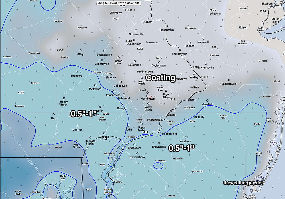
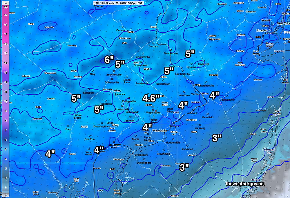
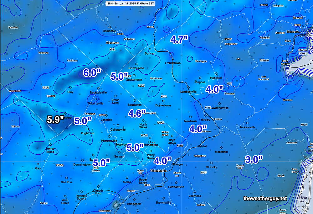
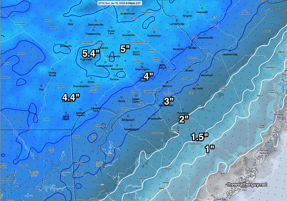
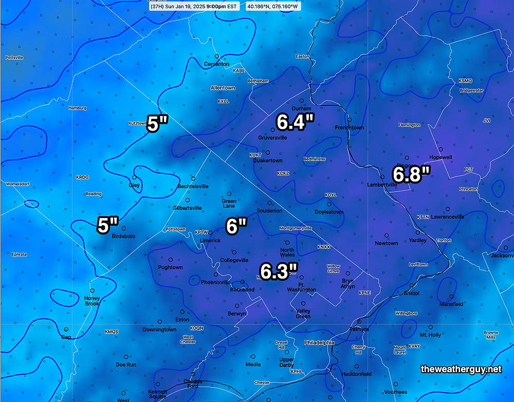
A surprise was the amount of graupel that fell early on, decreasing the snow accumulation depth.
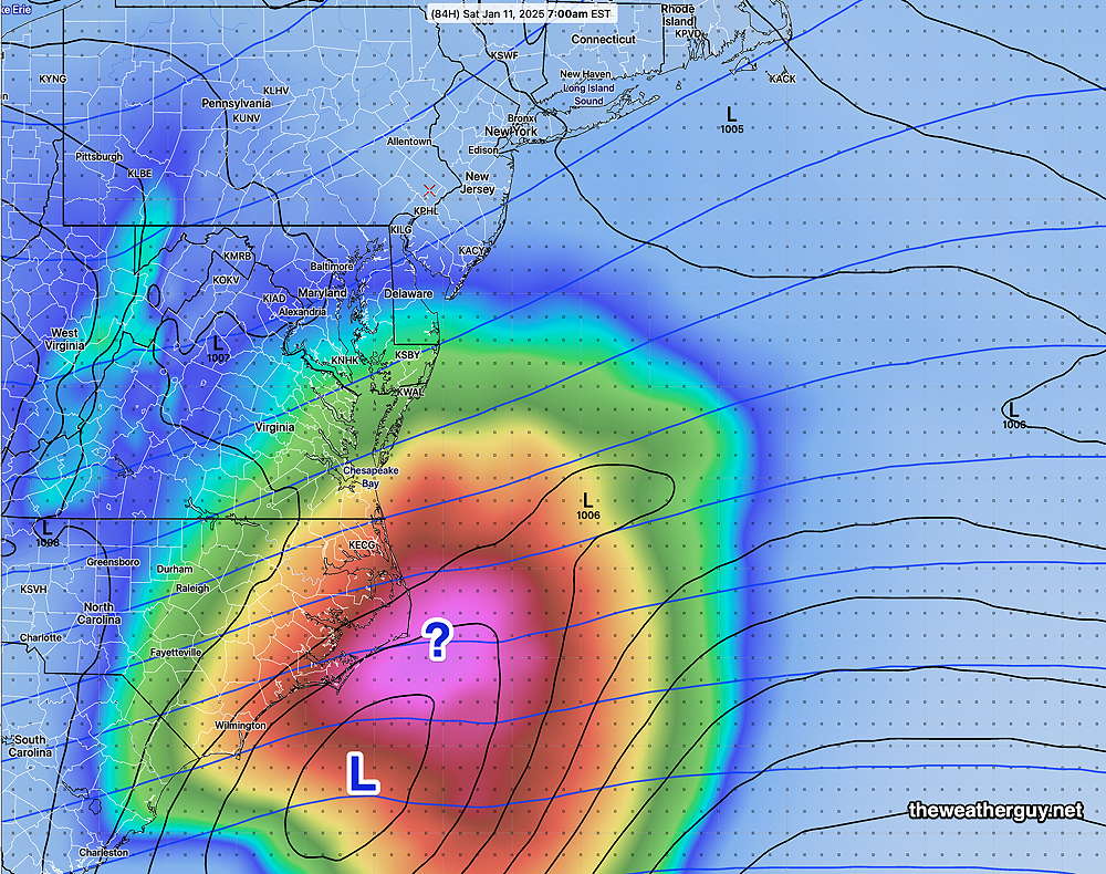
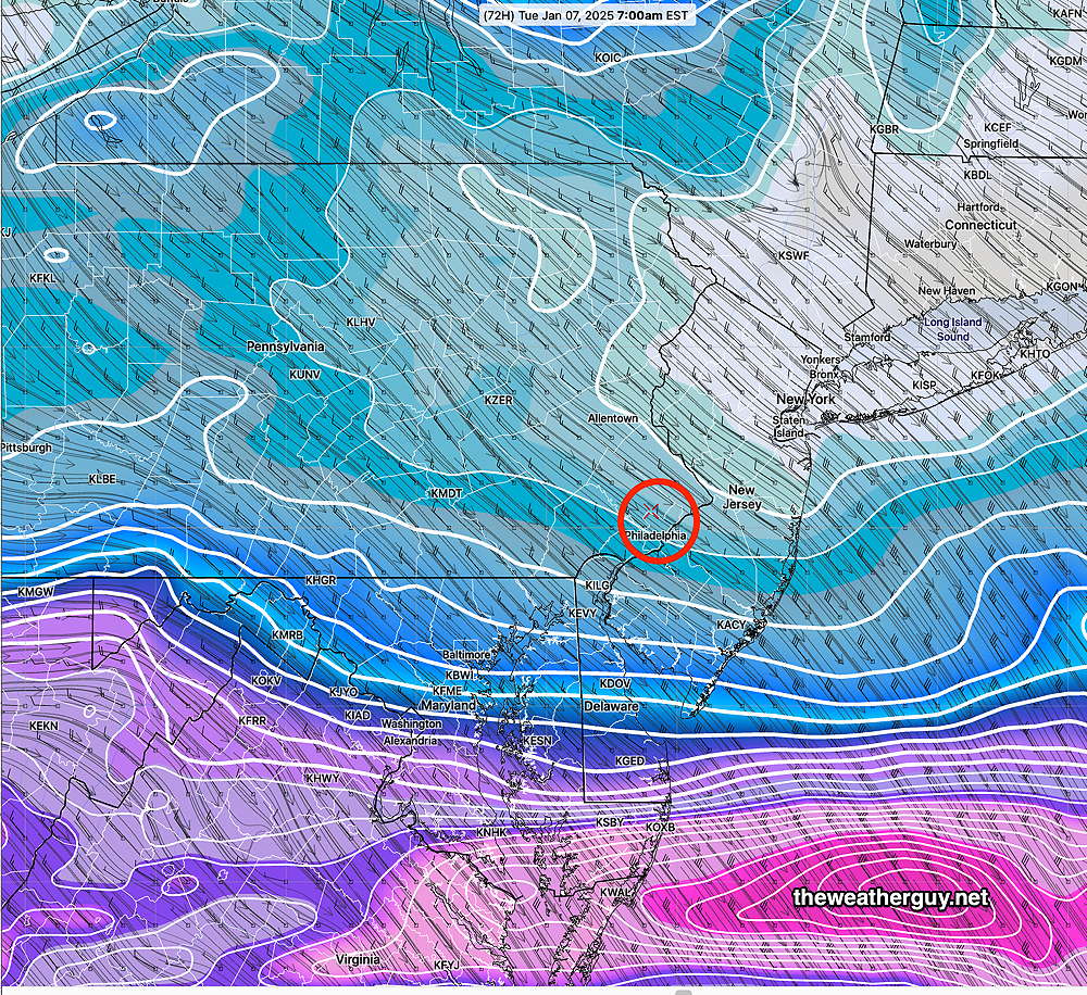
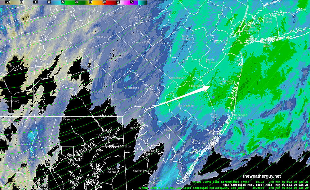
The back end of the heavier precip is just reaching the immediate Philadelphia area from the southwest about 8 PM. Light snow and snow flurries are possible for several hours more.
Yet Another Snow Update
Posted Sunday 01/19/25 @ 11:21 AM — Perhaps I should follow my own advise and not update the forecast as I posted at 8:41 AM this morning? Precipitation did start as originally forecast between 10 AM and 11 AM.
The big issue will be temperature. It won’t be a question of snow vs rain, but rather snow falling verses accumulating snow that doesn’t melt and compact.
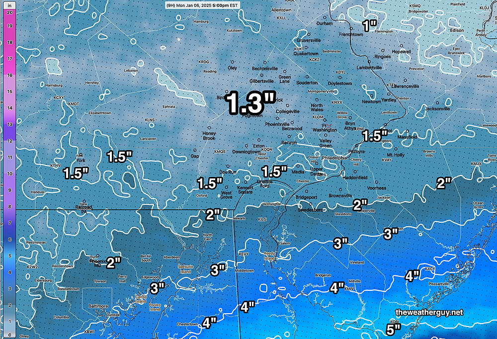
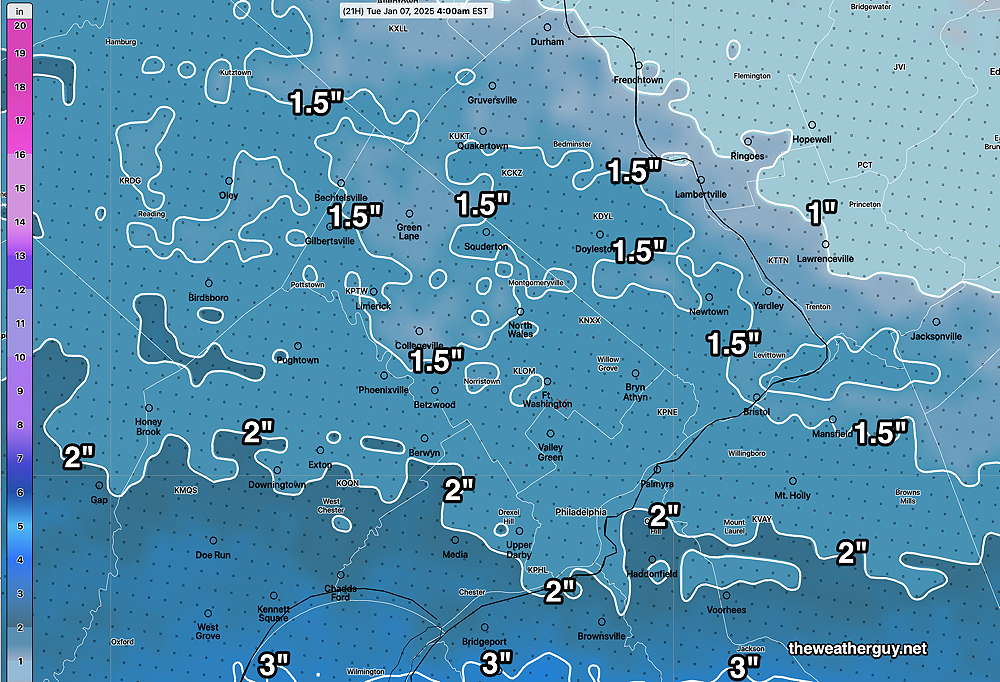
The NAM and NAM-NEST still show only small accumulations near the city—
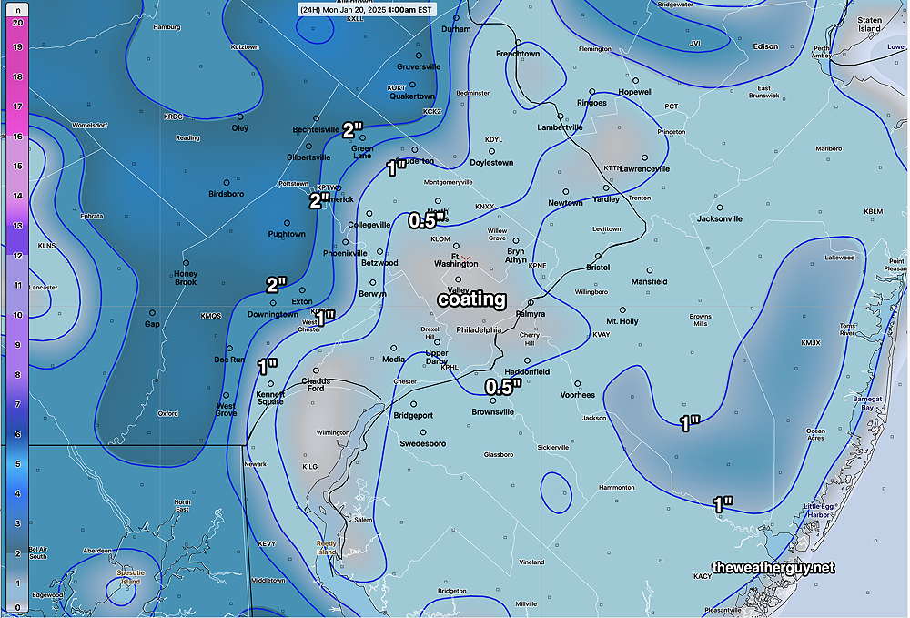
The NBM still maintains a significant snowfall, with accumulations near the city occurring after 3 PM and continuing heavy until 9 to 11 PM.
With the latest NBM above supporting last night’s forecast, I’m inclined to stay with it and its more substantial snowfall.
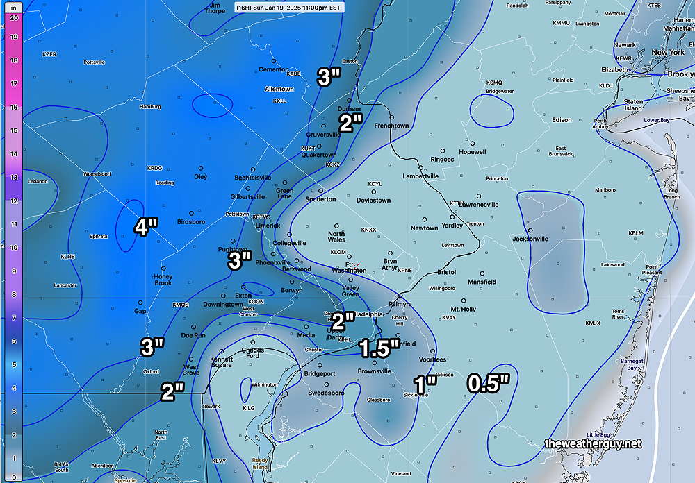
Sunday Snow Update- Significant Change
Posted Sunday 01/19/25 @ 8:41 AM —— There’s always a tendency to update the forecast with “the latest models”. Over the years, I’ve found that to be a mistake. Numerous weather journal articles point to the observation that often, the model run from the day before is more accurate than the most recent model run just a few hours old
This recognized phenomenon is called “model spin up error” and manifests itself in the first 3 to 6 hours of a model run. Very simply, it takes at least 3 to 6 hours for most models to reach equilibrium of the model state and during this spin up period, the model is not all that accurate.
That said, let me point out some observations from this morning—
- The observed temperatures this morning are higher than the forecast temperatures. Below (left) are the temperatures forecast by the NBM and on the (right) are actual temperatures registered on the RTMA at 6:45AM—
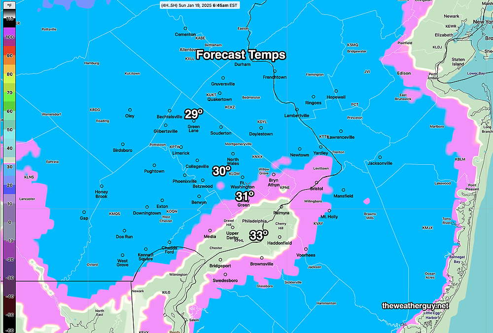
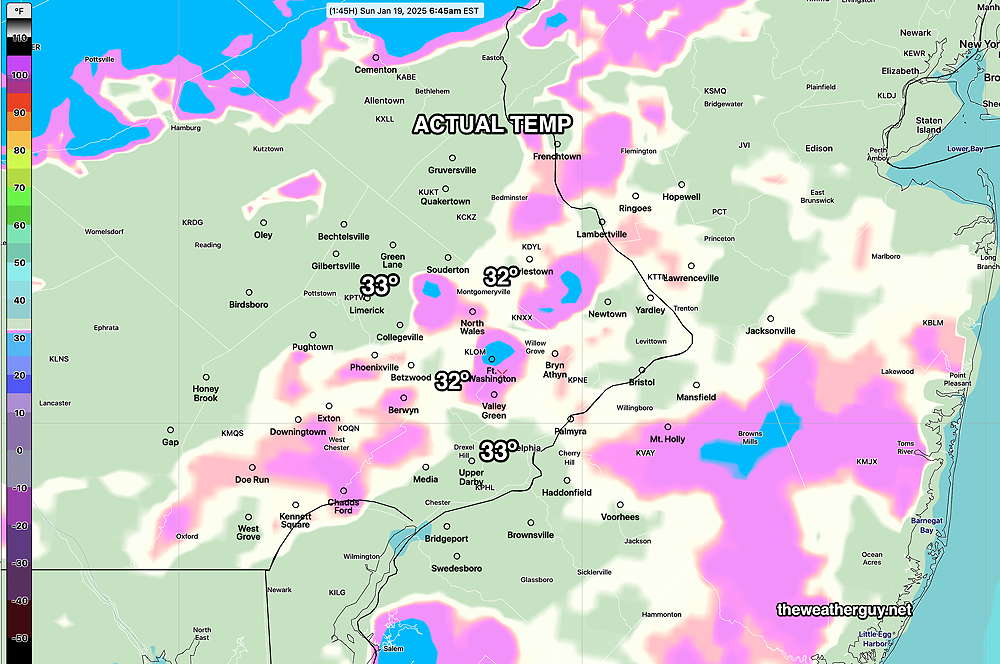
These higher temperatures may cut into the higher snow totals.
2. The 06z (1AM EST) models have snow moving in closer to 12- 1 PM instead of the 10-12 AM time frame.
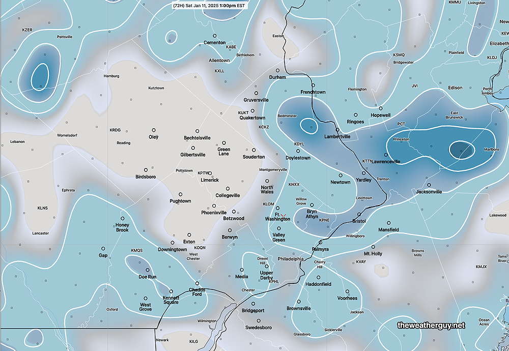
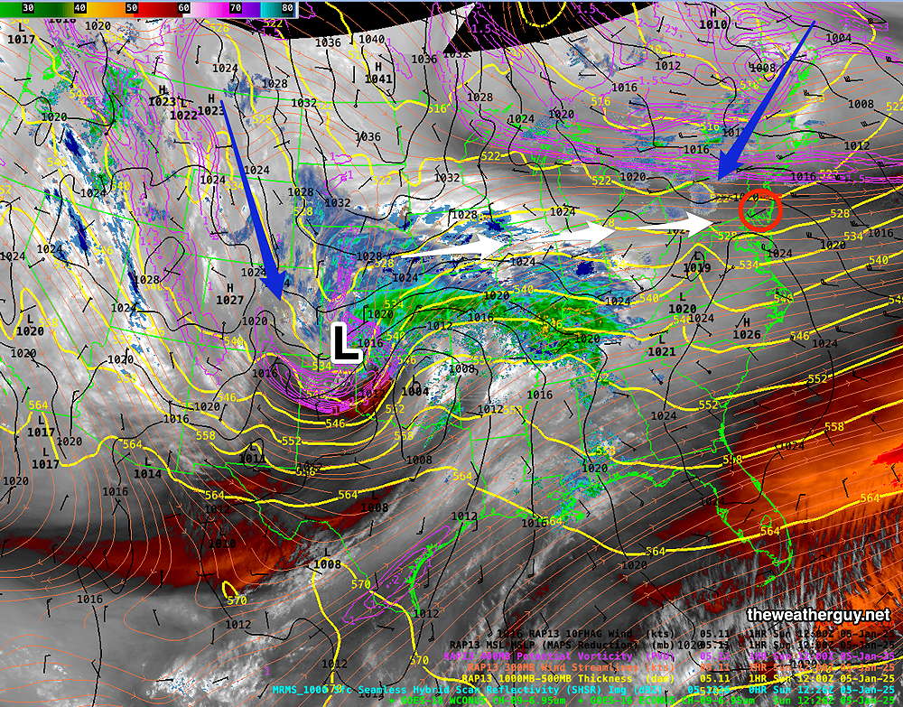
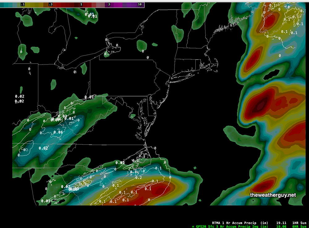
3. I’m trying to assess model forecast errors as they occur. Below is the RTMA (near actual) precipitation compared to the GFS forecast. Notice the GFS is too far south with it’s precip—
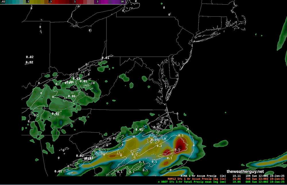
Here’ s the same comparing actual RTMA precip with NAM model precip. A closer match!
So, I hate to disappoint snow lovers, but based on the warmer temperatures and the closer match on precipitation of the NAM, I’m changing the moderate snow forecast to a much lighter snow forecast from the NAM—
Sunday Snow Update
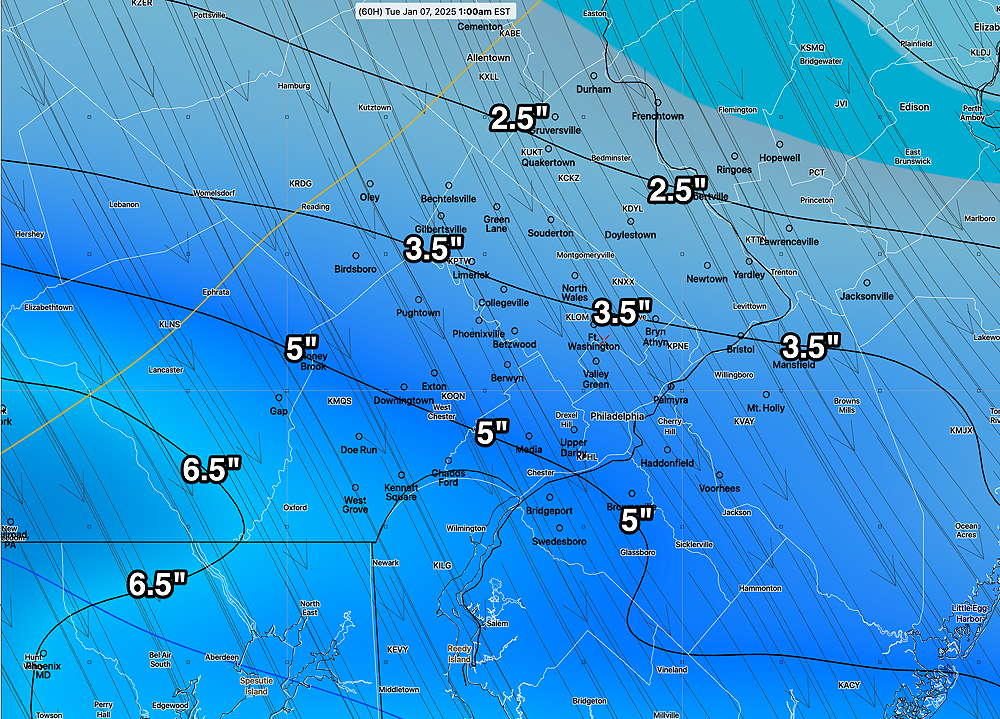
Posted Saturday 01/18/25 @ 10:01 PM — I wanted to do one more update based on the tonight’s early models. As mentioned earlier this evening, the precipitation from in the city and westward will likely be all snow.
Snow moves in from southwest to northeast between 10 AM and noon. Despite temperatures being slightly above freezing (33-34º) into the early afternoon, the precipitation will fall as snow because temperatures aloft are below freezing. I can’t rule out a slight mix around noontime, but if it occurs, it will be brief. The snow tapers off between 8 PM and 10 PM.
The models have fairly settled on a range of 0.38 inches water to as much as 0.53 inches water with the latest HRRR.
The big question is not be how much falls, but how much accumulates. The ECMWF “skin” temperatures drop below freezing early in the afternoon, which should allow accumulation despite temperatures being 33-34º early on. If it weren’t for temperature based melting and snow compaction, areas in the city would be seeing 6 inches.
I’m going with tonight’s HRRR forecast which captures the trend towards higher snow-water, mostly all snow, and colder temperatures—
The latest model blend (NBM) has similar total, yet tends to lag with changes in the forecast—
Sunday Snow Update
Posted Saturday 01/18/25 @ 5:17 PM — Each model run seems to vacillate between higher precipitation amounts and lower; between a delayed transition from rain to snow in the city to an earlier changeover.
The latest ECMWF has less total precip but an earlier changeover to snow.
The latest RGEM, compared to this morning captures the changes—
The models have, for now, consolidated on about 0.35-0.40 inches of water, falling as a mix, rain or snow. When the changeover occurs will determine the final snowfall.
My own sense is that most of the precipitation will fall as snow, but may not accumulate initially due to melting with the temperatures at the surface above 32º. I base that on review of critical thickness temperatures.
Here’s the latest model blend (NBM) which I think captures the current forecast well—
The latest GFS, just available, has a similar forecast as the above.
If I were to modify the above, I would add 1″ to the above in areas west of the city to account for more snowfall.
I may update again this evening if I can. Otherwise check back tomorrow morning.
Sunday Snow Update
Posted Saturday 01/18/25 @ 2:18 PM — You may have noticed that we had more rain today (Saturday) than predicted last night. After reviewing the models, the only model that got this right was the Canadian RGEM; the GFS, NAM and HRRR were way off.
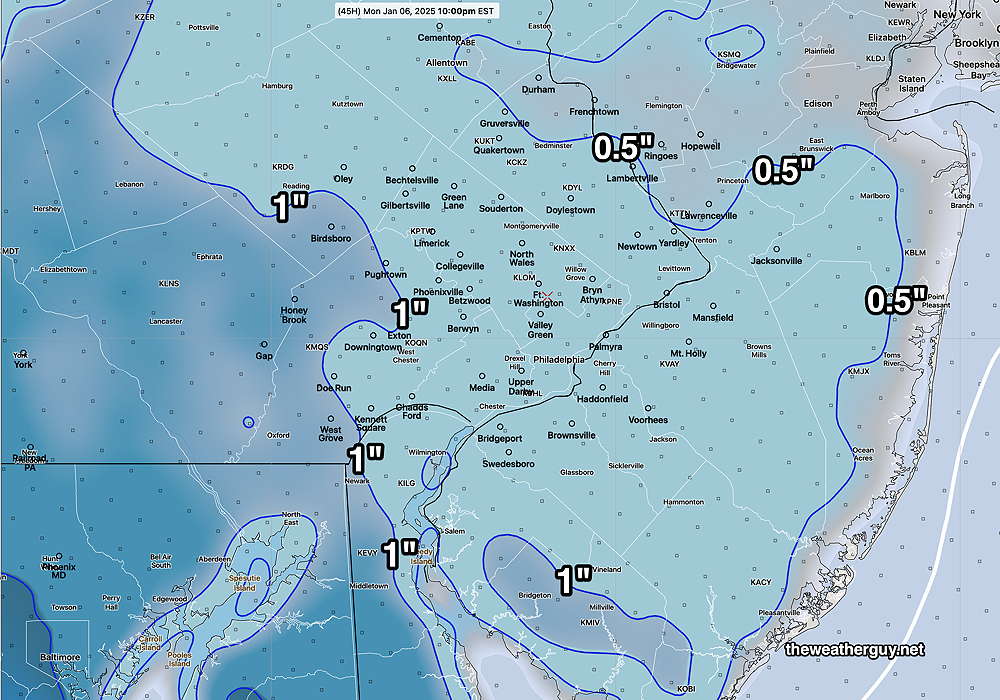
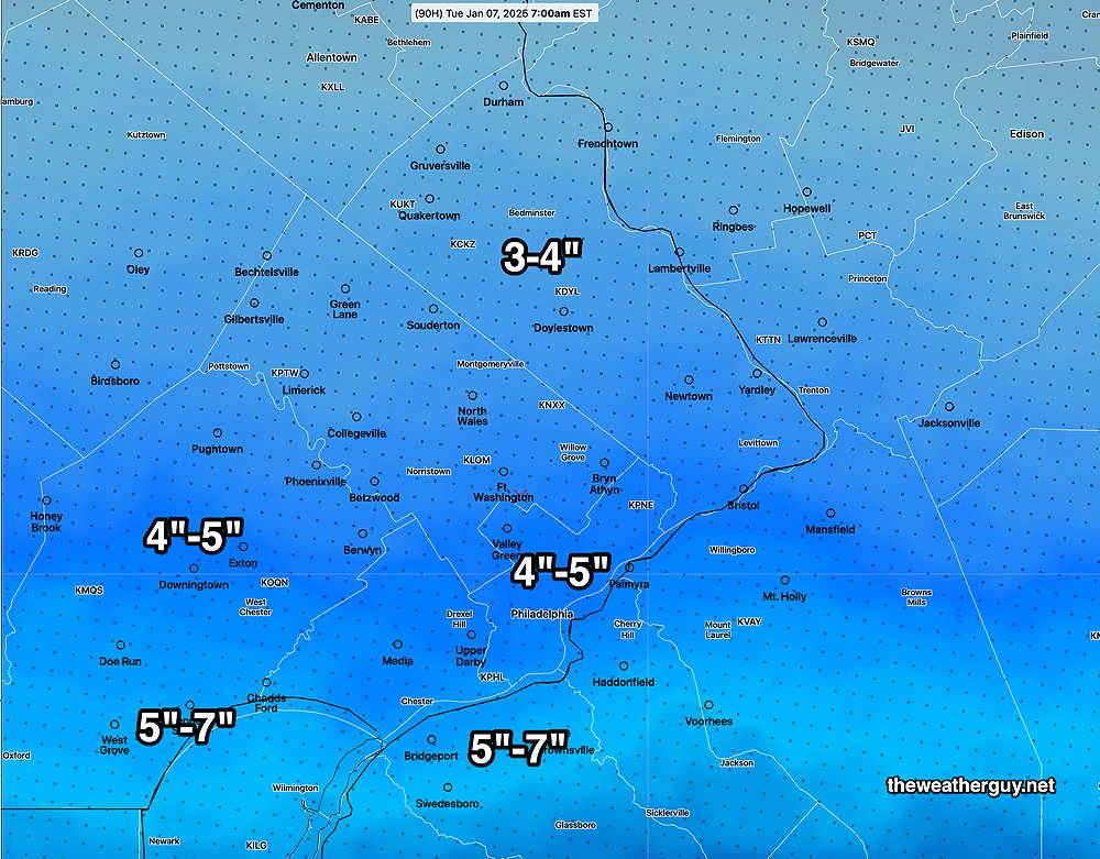
Does that mean the RGEM has a better handle on the snow for Sunday? The latest RGEM from this morning has trended colder with increased precipitation. Here’s the latest RGEM snow depth forecast—
Due to its highly unbalanced political environment, I’ve considerably cut back auto-posting there. To receive all forecast postings, I recommend following me on mastodon.social or bluesky.social
Sunday Snow Update
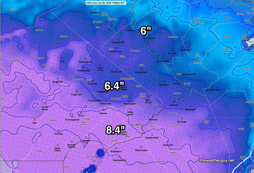
Posted Saturday 01/18/25 @ 11:35 AM — A quick update. Based on the latest GFS model which just became available, it appears that a major storm may affect us on Sunday. I’m bumping up potential snow accumulations from the city and westward to the 5″ to 8″ range.
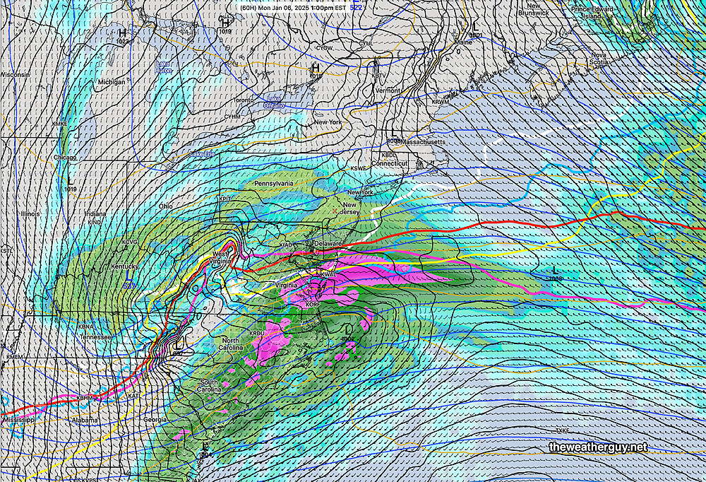
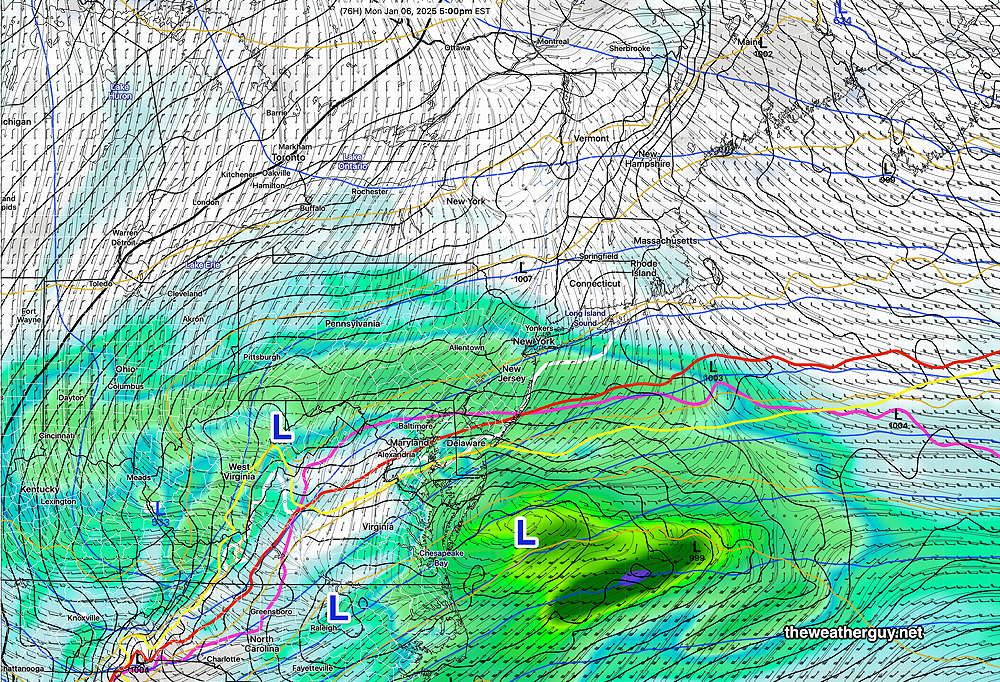
Here’s the latest GFS surface map—
Posted Saturday 01/18/25 @ 9:42 AM — Some important changes noted in the latest models—
- Light snow or flurries begins earlier, as early as 8-9 AM in areas west and southwest of the city.
- Total Precipitation has increased, from 0.20-0.30 water equivalent last night to 0.4-0.7″ water equivalent. Both a track closer to the coast and an increase in temperatures aloft may prolong a mix of snow/rain in the city but increase snow totals just to our west.
- Heaviest snow between 5 PM and 7 PM. Ends about 9 PM.
Here’s the latest NBM precipitation type map at 3 PM—
Some other trends—
The Canadian RGEM maintains a very wet storm from the city eastward.
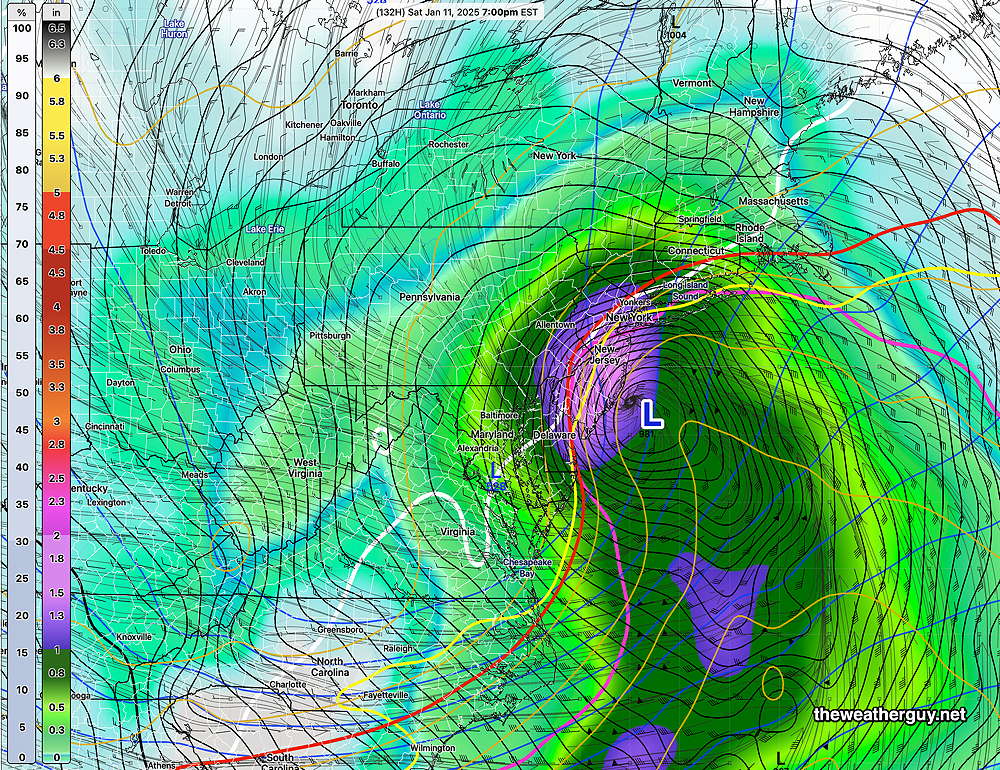
There’s much uncertainty demonstrated with the ECMWF model, as captured by the ECMWF ensemble. The large standard deviation to the northwest suggests a possible closer track to the coast—
With this storm, I’m going to continue to leave the heavy-lifting of sorting through the various models to the model blend (NBM) algorithms. Here’s one version of likely snow totals—
I’m just sharing below my own algorithm for snow totals, based on NBM snow-water ratio and total precipitation. Areas to the east of the city are calculated too high. That said, the 6″ totals are possible west of the city—
Updates later today between 5 PM and 6 PM.
Sunday Snow Update
Posted Friday 01/17/25 @ 9:51 PM — A quick update. This evening’s early models have come in along with the 01z model blend (NBM). There is increasing consensus that the overall precipitation will be on the order of 0.20 to 0.30 inches water which translates into about 2-3.5 inches of snow. This includes this afternoon’s ECMWF model.
Of interest (at least to me) is the NAM, which historically slightly over-predicts snowfall here compared with the GFS. With Sunday’s storm, it is consistently forecasting lower snowfall totals than the GFS. Something not to be ignored.
Here’s the latest NAM precipitation type (snow-sleet-rain) forecast at 4 PM Sunday—

The 01z model blend (NBM) also became available with its updated precipitation. Here’s it’s current forecast—
The new GFS won’t be available until after 11:05 PM but I go off-duty at 10:30PM. I’ll update tomorrow morning.
Previously Posted Fri @ 5:44 PM — —A warm front will move through Saturday with plenty of cloudiness for much of the day. Some widely scattered sprinkles/showers are possible in areas mostly east into NJ, but many areas will just be cloudy. There may be some clearing around sunset.
Saturday High Temps: 41 Blue Bell, 44 Philadelphia.
A cold front moves through overnight Saturday but slows and becomes nearly stationary as low pressure develops either near the coast or inland. Precipitation moves in from the southwest as snow in northwestern sections and possibly a mix nearer the city.
There’s still a wide range of forecasts for Sunday. What’s consistent is that some form of precipitation will start late morning. During the Eagles game, a mix of snow/sleet to start will change to all snow towards the end of the game. Temperatures fall during the game and it becomes increasingly windy.
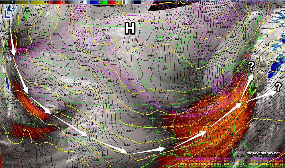
Let me use several models to illustrate the unknowns. The ECMWF currently has a more off-shore track for the low pressure system. It’s forecast is colder, with most areas seeing snow, but precipitation amounts are low.
The GFS continues with a rather hefty snowfall. It’s colder with more snowfall—
The NAM has a more scattered snowfall with a mix of sleet and rain reducing accumulations east of the city. It should be noted that the NAM forecast is supported by the Canadian RGEM —
Leaving the heavy lifting to the model blend, here’s the latest NBM snowfall—
So there is a wide range of snow forecasts at this time. Regular visitors here know my mantra, “never ignore the NAM”. We’ll see if it becomes the leading forecast. I’ll update tomorrow morning.