#Philadelphia #weather #PAwx
Clipper Snow Update
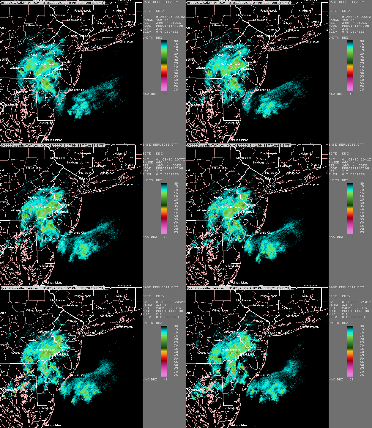
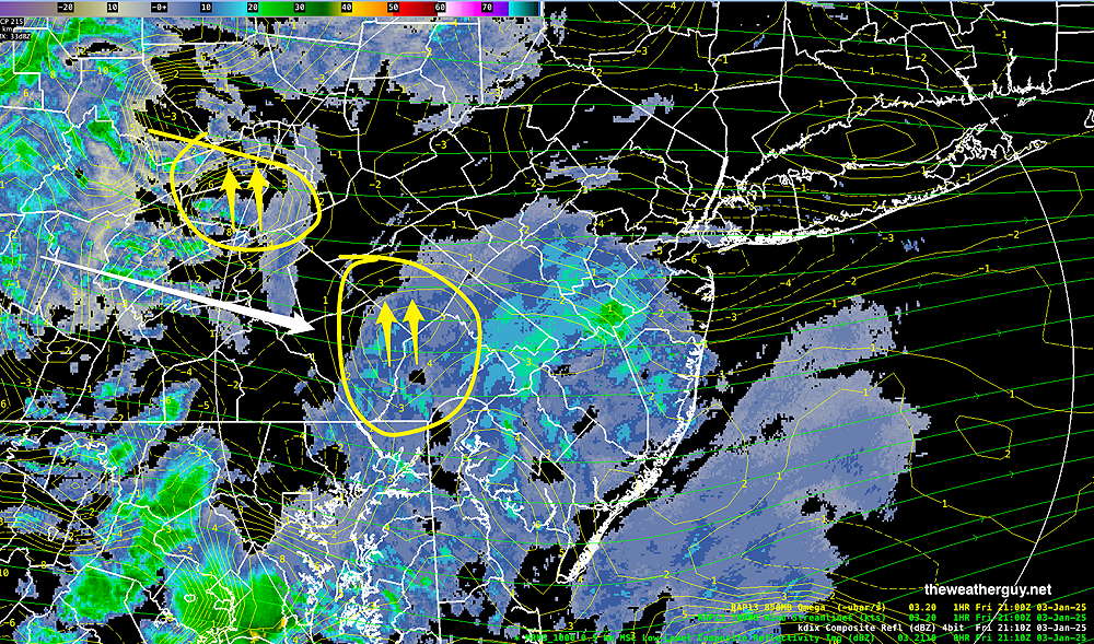
Posted Friday 01/03/25 @ 4:13 PM — We’re having some light snow in the Philadelphia area; the snow moved in about an hour earlier than previously forecast. Current radar shows the heaviest band developed just west of Philadelphia, closer to last night’s HRRR but definitely not forecast by today’s models, which had the banding to our south.
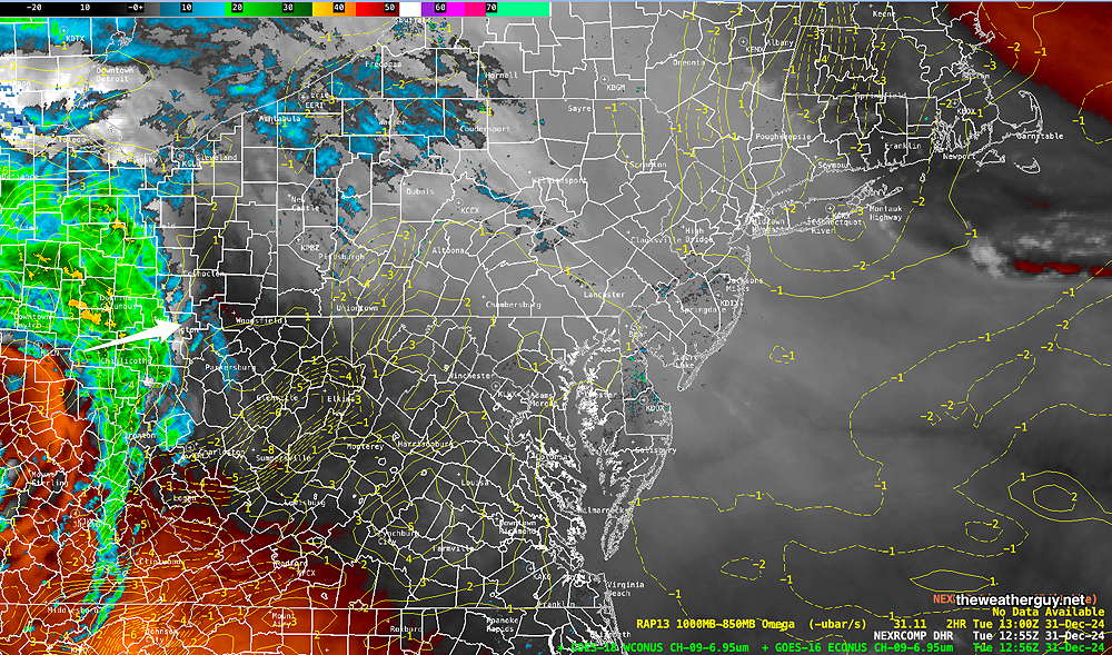
Here’s current radar—
Some additional snow may move in, based on current radar and RAP model analysis showing areas of upward motion (positive Omega)
I’m waiting until the latest GFS becomes available (in about an hour) to update the snow outlook for Monday. I hope to have another update before 6PM.
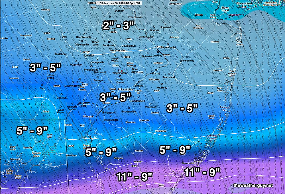
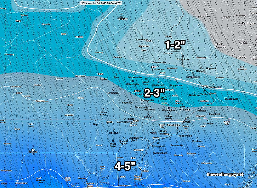
Posted Friday 01/03/25 @ 9:55 AM — One more thing. Regarding Monday’s storm, there’s still uncertainty in the exact track, with the latest ECMWF keeping the snow maxima further south—
Friday’s “Snow” and Monday’s Snow Storm Update
Posted Friday 01/03/25 @ 9:15 AM —As I said yesterday, “Clipper snowfalls are notorious for being over-forecast (and occasionally under-forecast).” Such is the case today. After reviewing last night’s trends and this morning’s early models, here’s the scoop on today’s clipper snowfall—
- Light snow starts as early as 3-4 PM western suburbs, early enough that temperatures will be above freezing initially, reducing accumulations.
- Snow accumulations will be spotty and occur mostly on grassy surfaces.
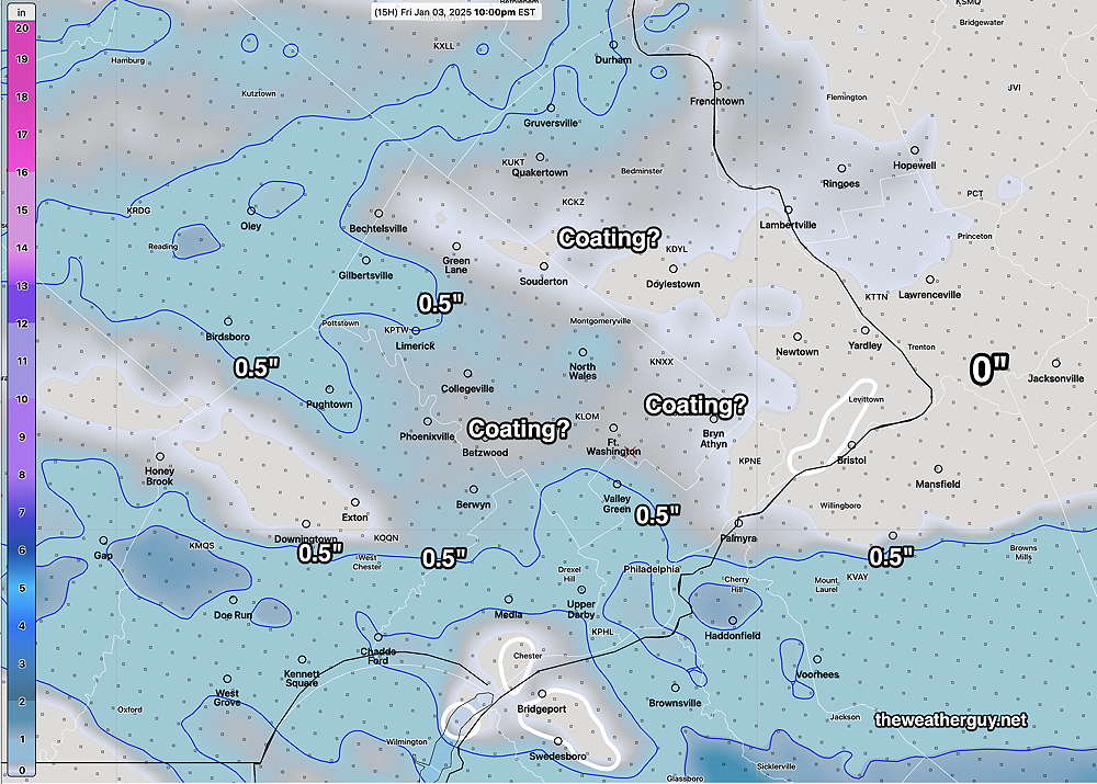
- The trend for the ‘heavier’ banding has been for to occur just south of Philadelphia, where general snowfall will be about 1/2 inch, most likely on grassy surfaces.
- Any light snow ends about 10 PM or earlier.
Here’s the latest HRRR (12z) which just became available—
As for the larger storm expected Monday, the models continue with forecasting a moderate snowfall, beginning before daybreak Monday and continuing through the day.
Unlike today’s clipper, where the snowfall is within model ‘noise error’, Monday’s storm is looking more certain. This storm is still more than 90 hours in the future, so expect some things to change.
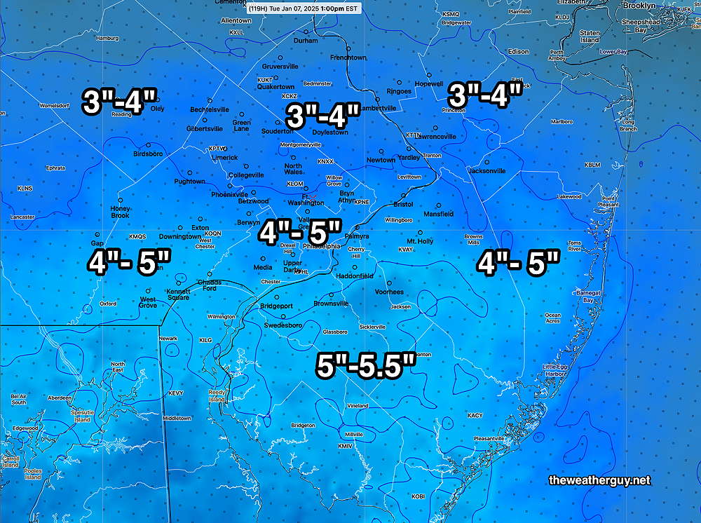
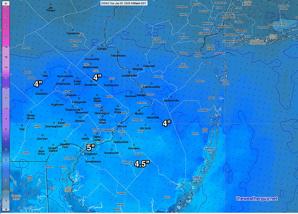
Here’s the latest NBM snowfall forecast by Tuesday morning—
I’ll be updating later today with my regular “Weekend Weather Forecast”.
Snow—Friday Evening and Sunday-Monday Update
Posted Thursday 01/02/25 @ 9:29 PM — A quick update. The latest higher resolution models are becoming available. The HRRR and NAM/NAM-NEST show the clipper moving in as early as 4-5 PM Friday and lasting just a few hours.
The earlier start, when temperatures are above freezing may limit accumulation in some areas. The latest HRRR snow accumulation occurs in a narrow band—
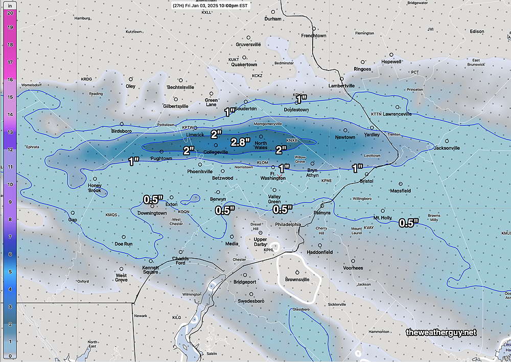
With model forecasts, the placement of the heaviest band snow should never be taken literally. As an example, tonight’s NAM-NEST shows less snow and the heavier banding occurs south of the city.
Posted Thursday 01/02/25 @ 5:21 PM — A clipper disturbance approaching Illinois now is expected to strengthen slightly as it receives upper air support just south of the Philadelphia area towards Friday evening.
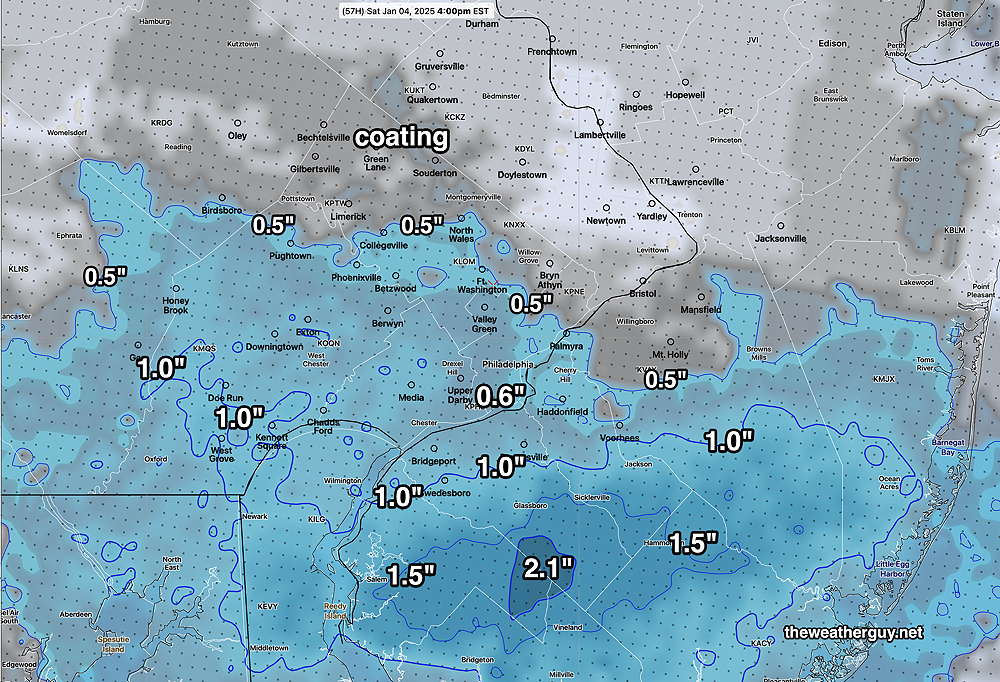
Clipper snowfalls are notorious for being over-forecast (and occasionally under-forecast). Here’s the latest NBM total snowfall by Saturday morning. (This may be over-done)—
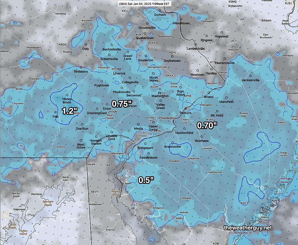
Another disturbance is expected to develop and move to our south late Sunday evening through Monday. The models are now consistent forecasting a moderate snowfall here. Here’s the latest NBM snow totals—
The above forecast for Monday will undoubtedly change. Stay tuned.
Snow Friday Evening
Posted Thursday 01/02/25 @ 10:44 AM — I guess I didn’t make it clear that the major snow posted earlier at 9:16 AM is for Monday.
But there’s additional snow possible late tomorrow (Friday) through the late night Friday associated with a clipper disturbance. Clipper disturbances often are difficult to forecast accurately. Here’s the forecast snow totals for Friday evening/night—
Significant Snow Looking Increasingly Likely (Monday)
Posted Thursday 01/02/25 @ 9:16 AM — The trend, first picked up by NBM yesterday, shows a change towards a more significant snowstorm in the Philadelphia area. The models are still trying to resolve this system, either as a main low that redevelops along the coast or as a series of lows that pass to our south.
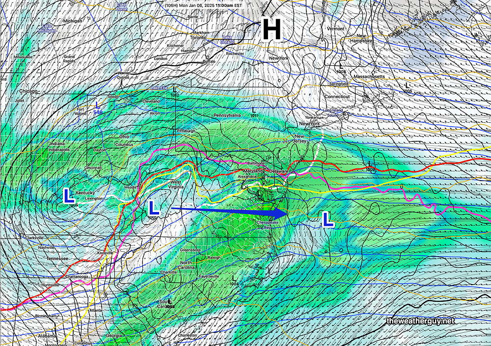
The trend, in contrast to previous forecasts, is for a more northern system with the precipitation shield covering our area, especially areas south of Philadelphia, South Jersey and Delaware where a major snowfall is now predicted.
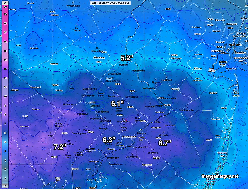
Here’s my latest snow forecast based on the latest ECMWF—
This forecast is still evolving. Additional changes are likely. I’ll have another update between 5 and 6 PM this evening. Stay tuned.
Snow Sunday Evening through Monday?
Posted Wednesday 01/01/25 @ 5:22 PM — There’s still great uncertainty regarding the track and timing of a storm expected to pass to our south sometime late Sunday into Monday. We will be on the cold side of this storm and the model blend (NBM), which tends to be conservative with snow forecasts in past seasons, is predicting measurable snow for us.
Many models show the storm too far to our south for significant snow. The AI models show either no snow or very little for Philadelphia, but greater amounts possible in Delaware and South Jersey.
(We’ve had very little snow the past two years and I’ve spent many hours programming model data and fine tuning graphics to display snow totals with little use for it. So I’m inclined to share the current snow forecast despite it being too soon to take it seriously. )
Here’s the latest NBM snow forecast. Don’t hang your hat on these numbers—
Weather Outlook- Today through Sunday
Posted Wednesday 01/01/25 @ 11:46 AM — Cold air is filtering in slowly and the most noticeably weather feature will be the decreasing temperatures today through early Friday.
For today, Wednesday, considerable cloudiness is forecast due to instability. Windy conditions also expected.
An arctic front will move through Friday with clouds; no showers/flurries currently expected. Cold temperatures in the 30s are expected for highs over the weekend.
There is the possibility of light snow in the Sunday through Monday time frame. The models have shifted back and forth with the trend for the storm to move to our south, possibly just clipping our area with a light snowfall. At most, the forecast has been for 2-3 inches, but that’s not currently the most likely forecast.
The ECMWF Ensemble (statistical) model shows high uncertainty in position of the low pressure system and an average (mean) position too far to our south for much or any snow.
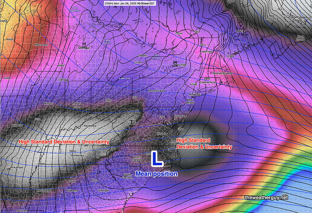
It was hoped that the AI models might improve forecasts, but over the past few days, they have been as changeable as the deterministic models regarding this potential snowfall.
Happy New Year!
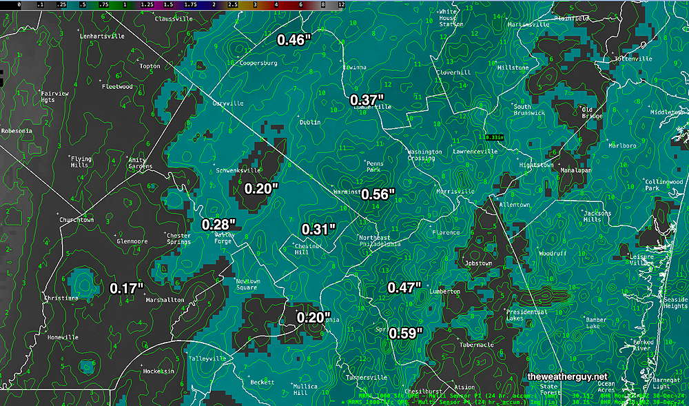
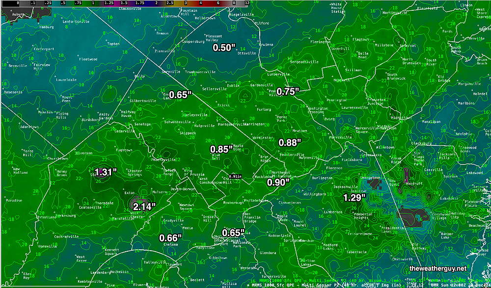
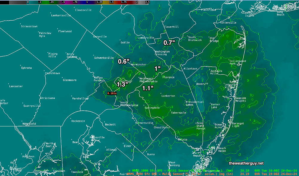
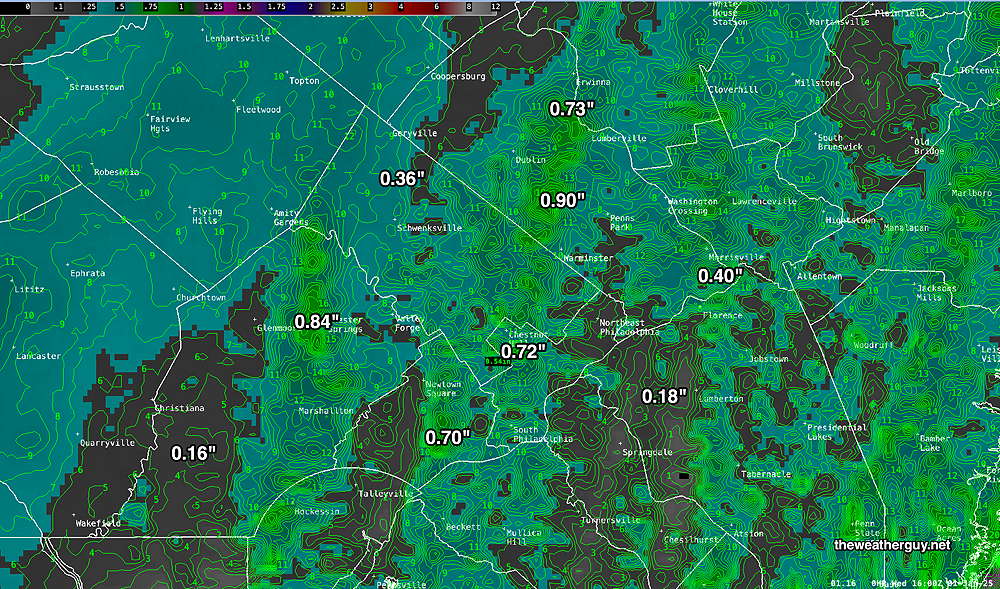
Rainfall was considerably higher than predicted by the models and the current standard, the model blend (NBM), forecast much less rainfall than we had. The convection (thunderstorms) were forecast by the models, but the intensity not so much.
Here’s the actual rainfall totals, from the MRM, from New Year’s Eve—
New Year’s Eve – New Year’s Day Forecast
Posted Tuesday 12/31/24 @ 8:31 AM — I’ve updated the timing of the rain tonight, based on the latest NBM which just became available.
Posted Tuesday 12/31/24 @ 7:43 AM — The first of several cold fronts for this week will move through this evening, associated with a secondary low pressure system expected to develop over eastern Pennsylvania. This low will move northeastward.
Light rain begins near the city 6 PM-7 PM, but some light scattered activity possible as early as 5 PM. It will taper off in the city about 12 AM – 2 AM, earlier to the south and west.
The system will be fast moving and much of the energy (and rain) will be enhanced to our north. Total rainfall is expected to be in the 0.25-0.4 inch range.
Wednesday, New Year’s Day, will start partly cloudy, but become quite cloudy by noon. It will be quite windy with gusts approaching 40 mph.
The wintry weather for the time frame Sunday-Monday looks like less of a sure thing, based on the latest models. It looks like any storm will be less developed.
New Year’s Eve Forecast Update
Posted Monday 12/30/24 @ 5:32 PM — Tuesday will may start out sunny in some areas, but clouds should predominate by late morning and into the afternoon, except at the Jersey Shore, where it will remain sunny into later in the day. There may be a break of sun again in some areas mid afternoon before the clouds roll back in.
Light rain moves in from the south and west as early as 5PM-6 PM and tapers off about 2 AM Wednesday morning. There’s a range of forecast rainfall intensities, depending upon the exact location of the secondary coastal low formation.
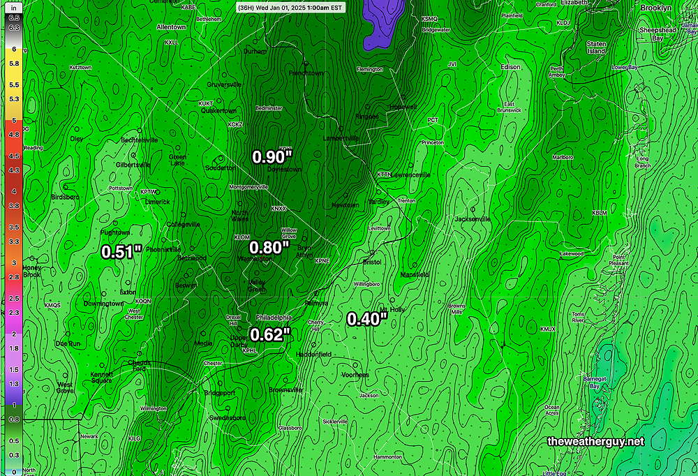
Some models have as little as 0.25 inches of rain, while others are showing as much as 1 inch. The model blend (NBM) is showing about 0.80 inches with a band of heavier rainfall in the city.
For snow lovers, there’s an increasing signal for possible snow Sunday night into Monday. Well into the future, but I’m keeping an eye on it.
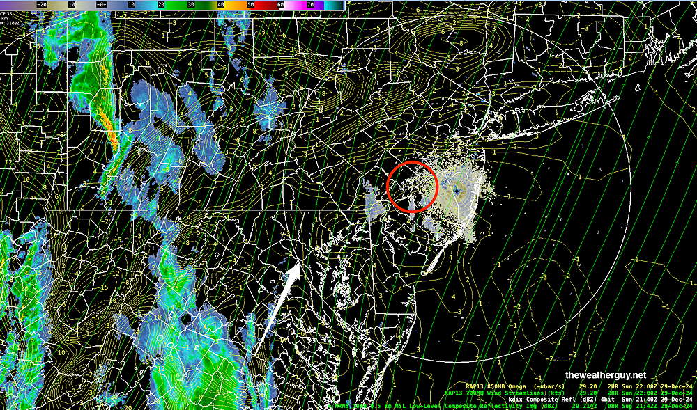
MRMS rainfall amounts for Sunday night’s storm posted.
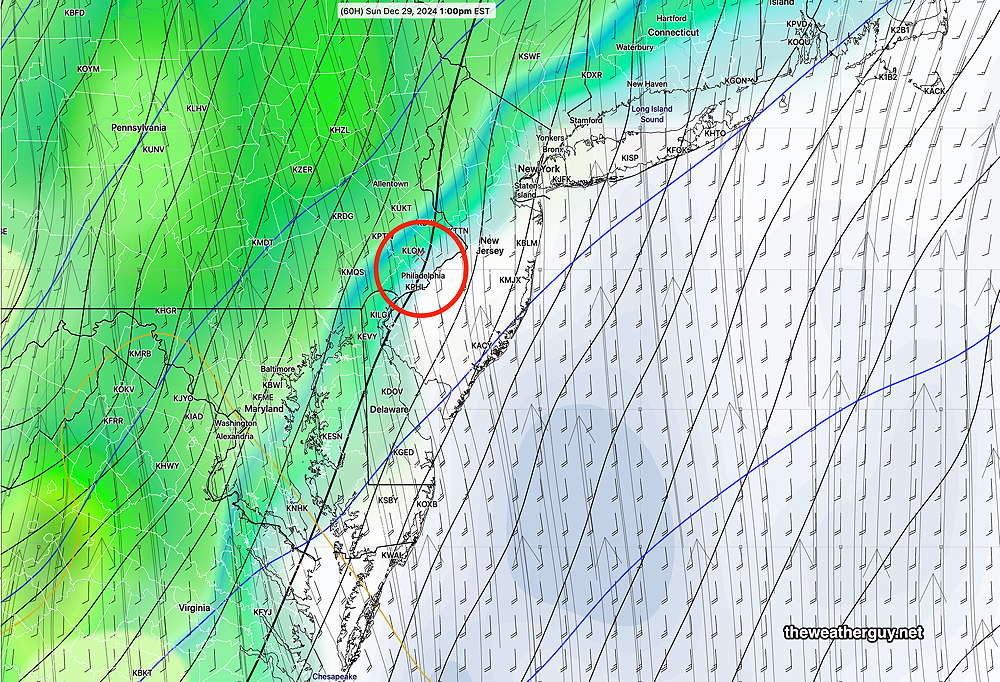
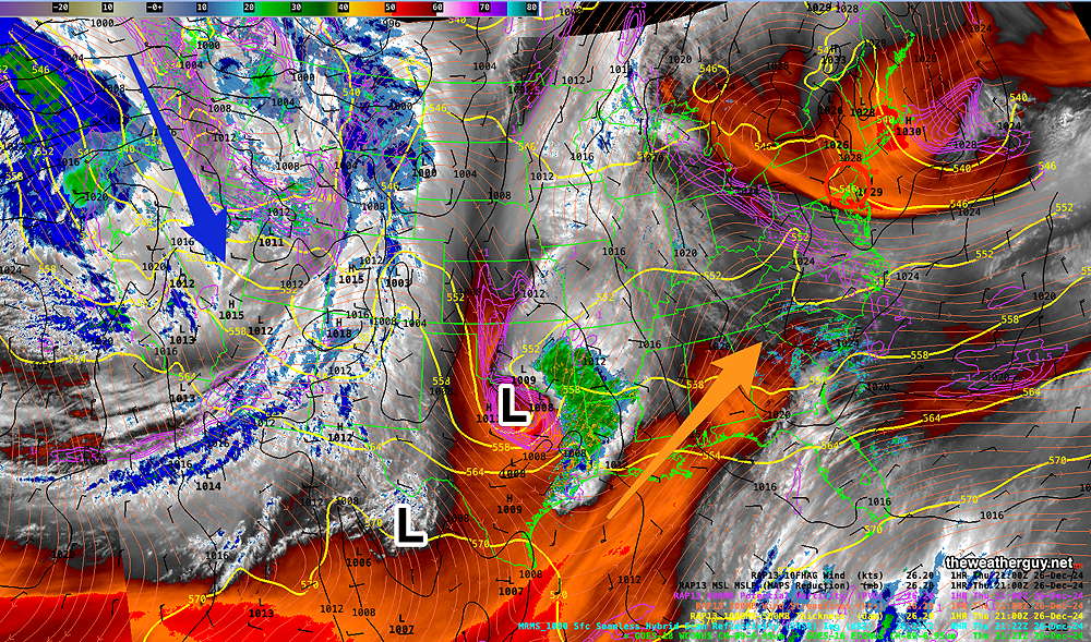
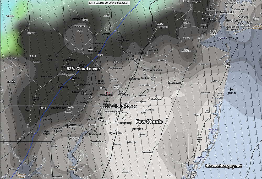
Previously Posted Mon @ 11:47 AM — —This week will be a transitional week weather-wise, from above average temperatures and an upper air ridge to somewhat below average temperatures by late Thursday into the weekend.
Today, Monday, will be sunny.
The next system to affect us will be a low pressure system that spawns a secondary low near the coast on Tuesday night. The timing for New Year’s Eve couldn’t be much worse, but at least it will be rain and not frozen precipitation—
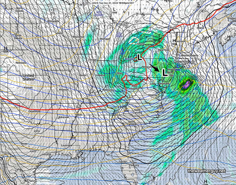
Clouds move in Tuesday early afternoon. Current timing is for light rain to move in about 6 PM Tuesday evening, heaviest towards midnight ending about 2-3 AM.
A windy day expected for New Year’s Day with clouds in the morning and more sunshine during the afternoon.
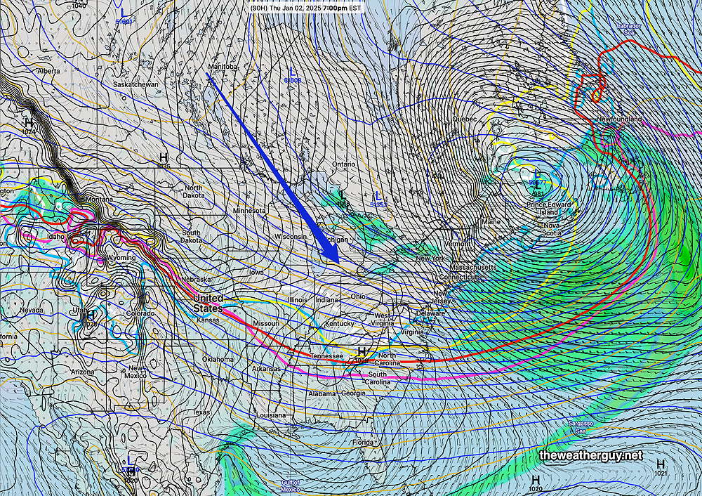
Colder Thursday and much colder Friday through Sunday.
There’s a hint for a possible wintry storm Sunday or Monday from the GraphCast GFS-AI model and to a less extent from the ECMWF-AIFS. Hardly a sure bet. Stay tuned.

