
#Philadelphia #weather #PAwx
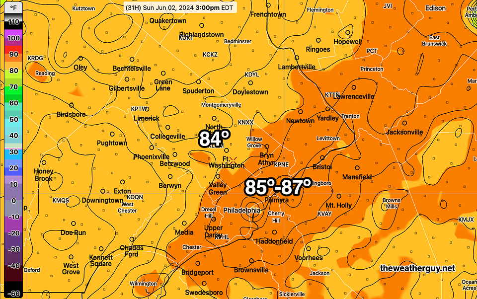
Posted Sat, 06/01/24 @ 7:19 PM— It appears that temperatures may be a little higher on Sunday than forecast yesterday. For a change of pace, I’m going to post the experimental REFS instead of my usual NBM model. The REFS is forecasting in the upper range of the NBM model’s temperature spread, but the NBM often runs a bit too cool.
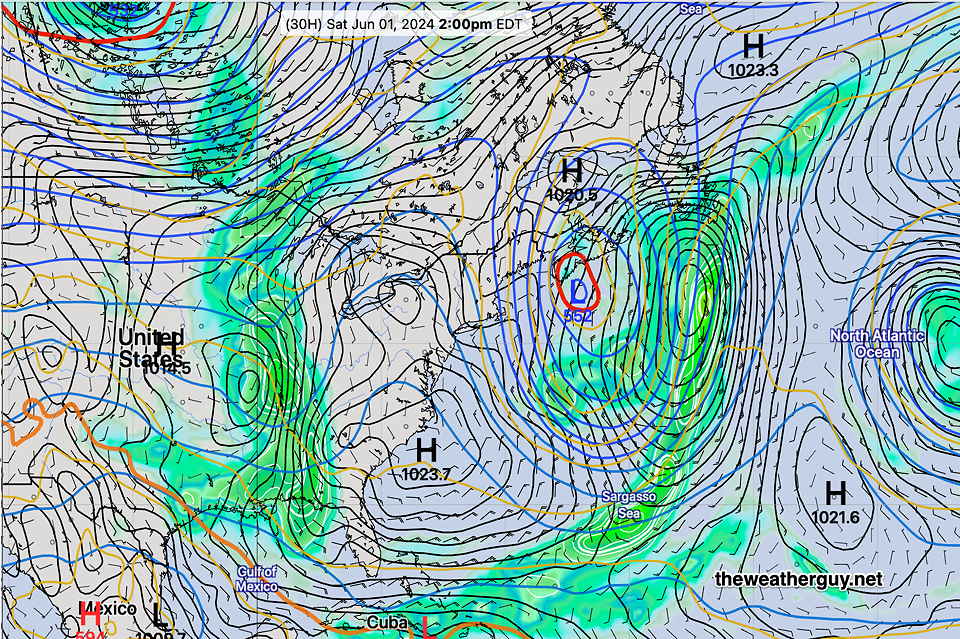
The experimental REFS is the ensemble version of the experimental RRFS. Being an ensemble, it consists of the mean (average) and statistical spread (standard deviation) of a group of models or variations of models. In the REFS case, the group of models consists of time-lagged versions of the RRFS and HRRR and perturbations of these same models.
There’s still a fair amount of clouds and sunshine through clouds forecast for Sunday, so we’ll see if these high temps are forecast too high.
Previously Posted Fri 3:30 PM —High pressure will gradually move off the coast Saturday through Sunday. A system to our west will be slow to move in, keeping our area dry over the weekend.
Much of next week looks somewhat unsettled.
Saturday
Sunny and pleasant. High 81-83º (average uncertainty)
Sunday
Sunshine through a thickening layer of high cirrus clouds. Light scattered showers will likely wait until evening or night time. High 83-85º (higher than average uncertainty due to cloud cover)