
#Philadelphia #weather #PAwx
Friday and Interesting Saturday
Posted Friday 03/08/24 @ 9:36 AM — Sunshine through a thin layer of clouds this morning will give way to sunshine for much of the afternoon Friday. High cirrus clouds move in mid afternoon and cloudiness thickens by 5 PM from the southwest. Light winds today with highs 55º-57º.
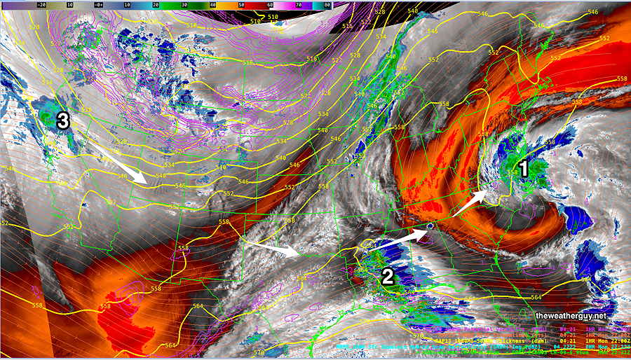
An interesting setup for Saturday as two jet streams interact over us—
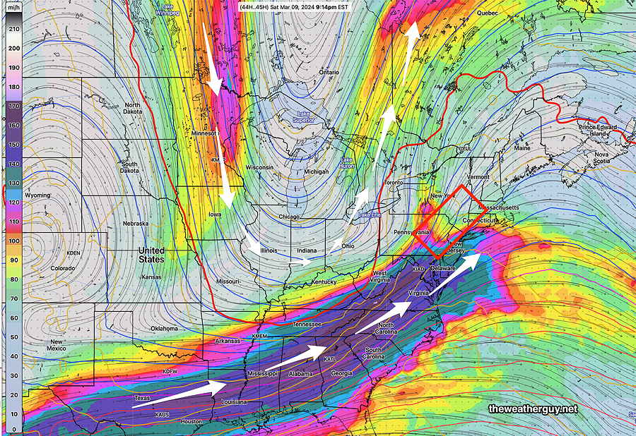
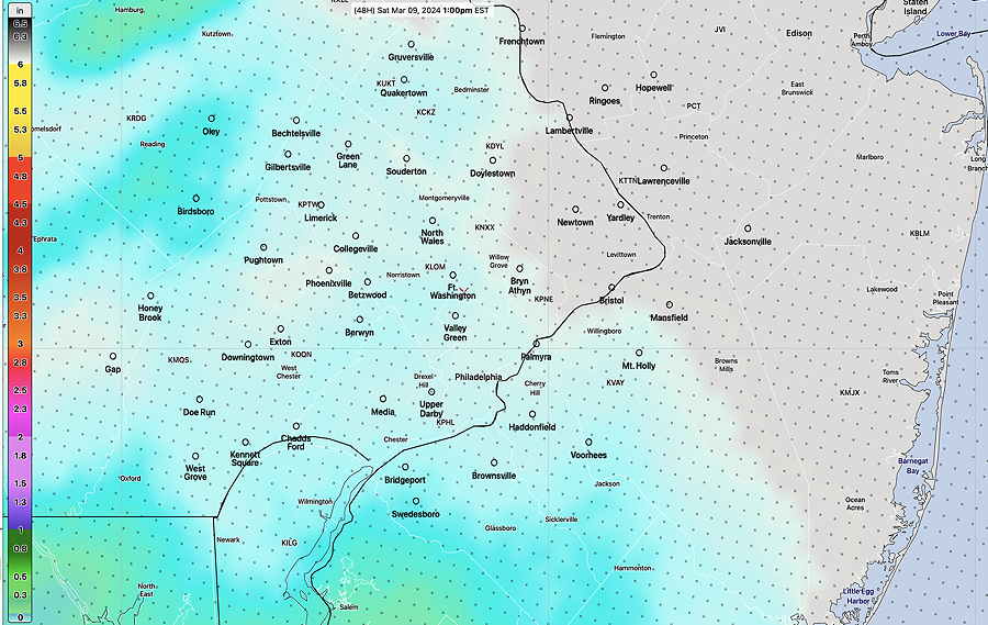
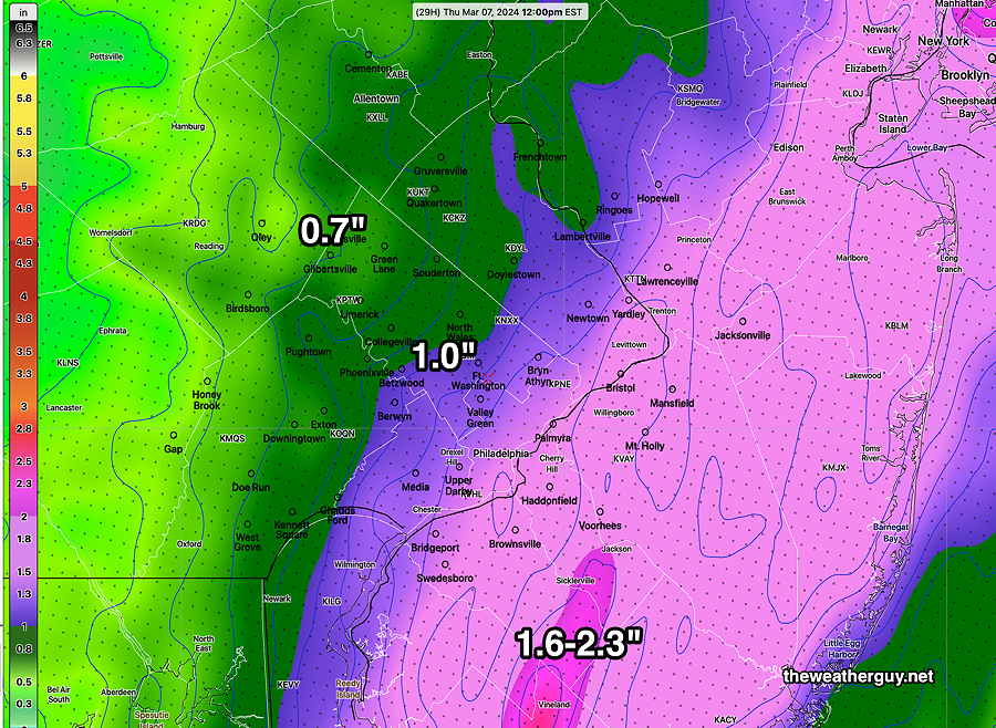
There’s a wide range of model forecast rainfall amounts for Saturday, depending on each model’s forecast position of the jet. As little as 0.7″ to 2″ is forecast. Hopefully, we’ll have some clarification later.
Today’s NAM-NEST has joined yesterday’s ECMWF in forecasting light drizzle or rain as early as 11 AM Saturday. Likely time is 11 AM to 2 PM.
The above jet stream configuration will spawn strong low pressure that will pass right near us. Colder air behind the low will be give us a windy and cold day on Sunday.
Stay tuned for the Weekend Weather Forecast late this afternoon.
Friday Sunshine
Updated Thursday 03/07/24 @9:26 PM — Sunshine will make its appearance on Friday. There may be a period of cloudiness moving through in the morning hours. Some high cirrus clouds come in from the west around sunset. Somewhat breezy. Highs near 58º in the city, 56º in Blue Bell.
Saturday starts quite cloudy. Light drizzle or rain moves in from the southwest as early as 11 AM (ECMWF) but more likely around 12-2 PM. Heavier rain moves in by evening. Another 0.8″- 1.1″ expected. An easterly wind will keep it temperatures a bit cooler, in the low 50s.
Colder and windy on Sunday.
Thursday Update
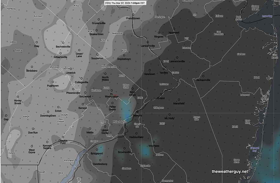
Posted Thursday 03/07/24 @ 9:07 AM — We had a few bright spots and even some blue skies for a brief period west of the city this morning. However, an upper trough will swing through today and a mix of clouds is expected to return with even some drizzle in eastern NJ.
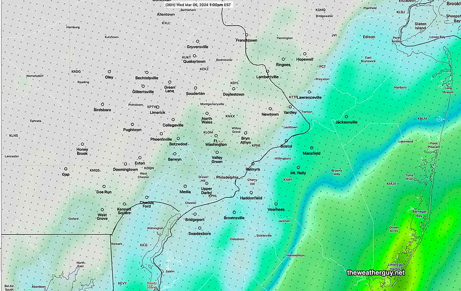
Last night’s HREF model most closely predicted this early brief clearing and here’s its forecast for 1 PM that includes the slight possibility of some drizzle or sprinkles —
Sunshine for Friday
Forecasting Sun instead of Rain
Posted Wednesday 03/06/24 @ 4:50 PM — Over the years, I’ve hoped this web site would be come a destination for storm forecasts. After this week, I may need to rethink this and become the destination for when we’ll see the sun again.
The rain moved in pretty much on schedule Wednesday. A generalized 1.1″ to over 2 inches in NJ.
There has been some question about whether the rain would linger well into Thursday.
It now appears that the rain will end during the early morning Thursday. No sun, but maybe some bright spots as varying amounts of low clouds appear to be the current model forecast.
Skies clear for Friday and we’ll see the sun return, but some cloudiness works its way back in Friday afternoon.
Saturday looks cloudy. Rain moves in early afternoon (1-2 PM, earlier western sections)
Wednesday Forecast Update
Posted Tuesday 03/05/24 @ 5:48 PM —The next system to bring rain will arrive as early as 11 AM Wednesday (earlier in S Jersey) . The system now appears to be somewhat elongated and is expected to bring heavy rain through at least Thursday morning. The heaviest rain will be along the NJ shore.
Yet Another Update- Looking for Sunshine
Posted Tuesday 03/05/24 @ 11:50 AM — Looking for a break in the rain, the latest GFS suggests that the rain ends late Thursday morning and we may be rain free from that point through Friday.
It looks like we’ll have sunshine on Friday. Cloudy on Saturday with rain mainly far western areas early. Rain moves into the immediate Philadelphia during the mid afternoon Saturday.
Tuesday Rain Update
Posted Tuesday 03/05/24 @ 10:56 AM — Over the weekend, it appeared that we might have some significant breaks between the low pressure systems expected this week. That’s looking less likely through Thursday.
We’ve had the rain since last night (total amounts less than forecast except in NJ) , but currently we have the low pressure center just approaching our area—
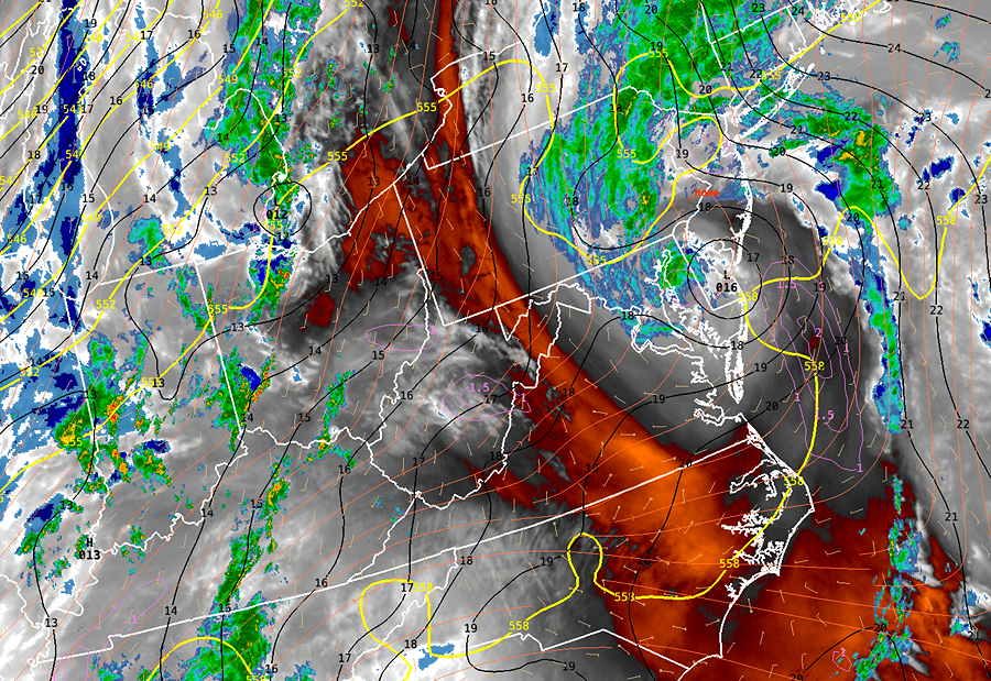
We’ll have a break in the rain tonight (still damp) but the models are showing rain moving back in as early as 11 AM to 1 PM on Wednesday—
An additional system is forecast to move in on Thursday. There may be little to no break in the action .
Rainy Tuesday and Wednesday and Saturday!
Posted Monday 03/04/24 @ 5:51 PM — Low pressure is forming as expected and rain will move in after midnight tonight and likely continue on and off until about 4 PM Tuesday.
Another system seems to have accelerated and will be here on Wednesday. Another system arrives Saturday, possibly sooner.
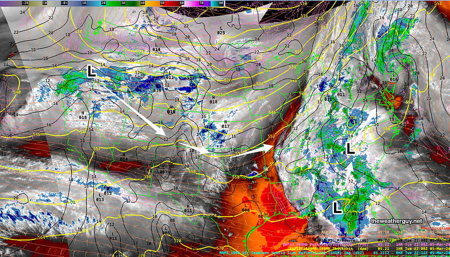
The latest water vapor satellite image captures the setup—
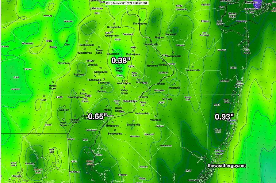
Rainfall on Tuesday will be less uniform than last Saturday’s storm—
Previously Posted Sun 5:47 PM —
This Week’s Weather Overview
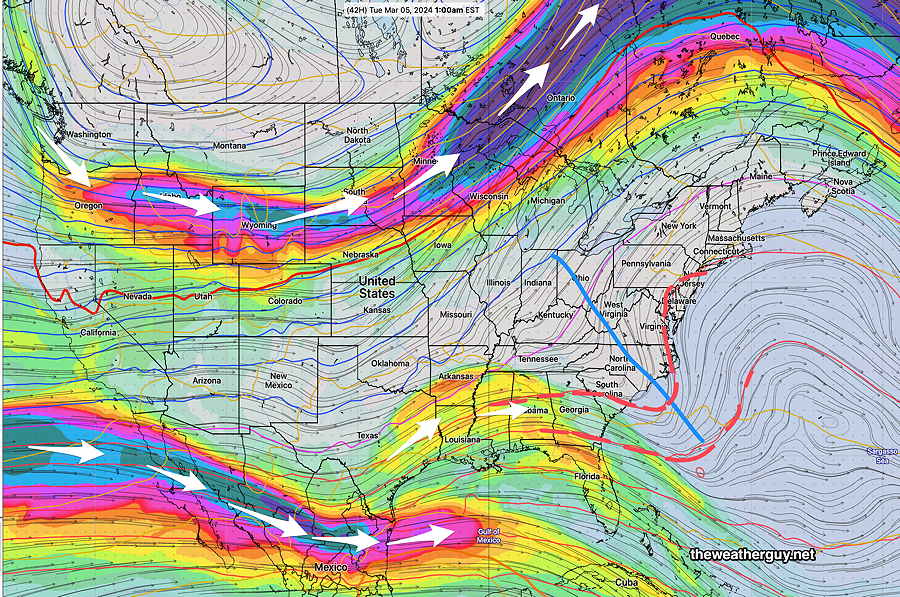
This week, we’ll see a continuation of the mild trend started this past weekend with a complex, split jet flow and an upper trough off of the southeastern US coast that will induce low pressure formation.
The latest ECMWF jet wind flow (300 mb level) shows the weak upper trough.
Here’s the NAEFS forecast for Tuesday showing a near coastal low (very similar structured to the system that gave us the rainy day Saturday) —
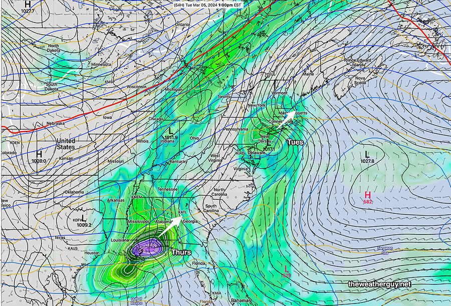
It may get briefly colder next Sunday.