
#Philadelphia #weather #PAwx
Sunday Forecast Update
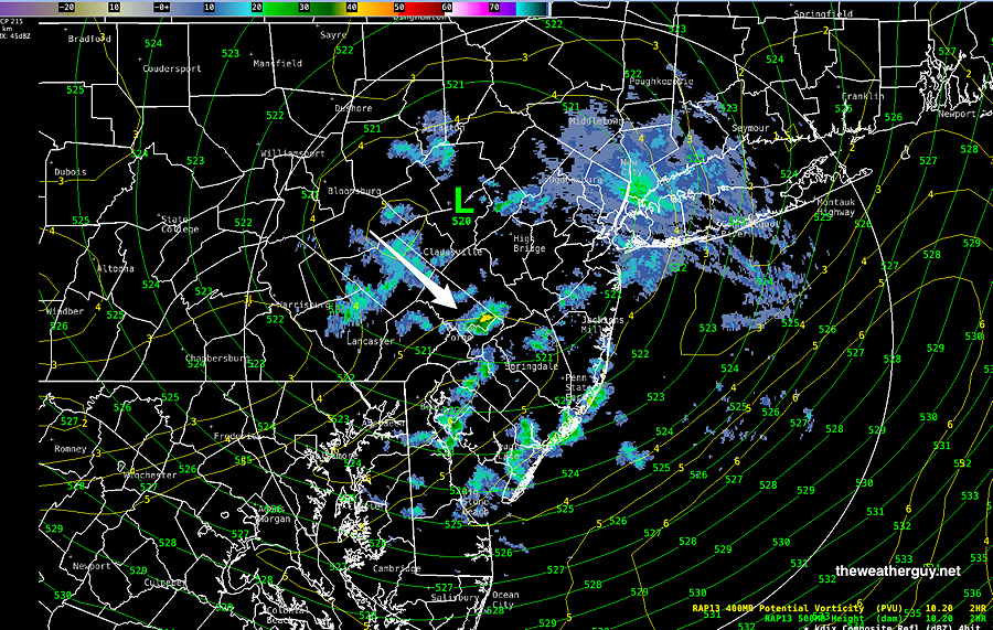
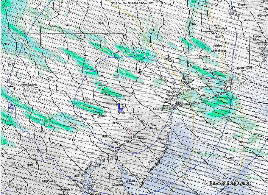
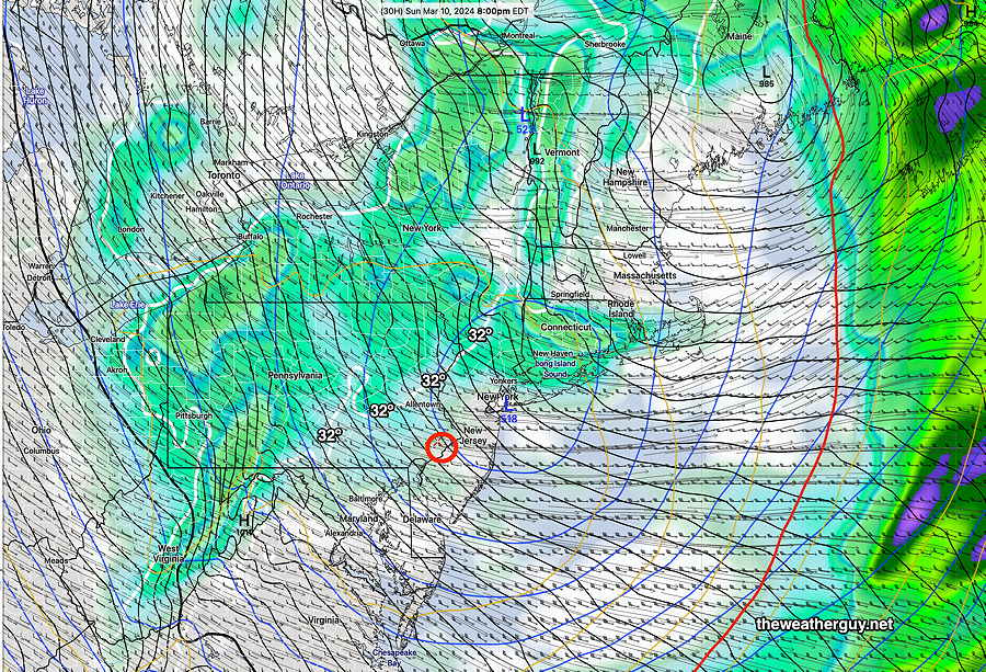
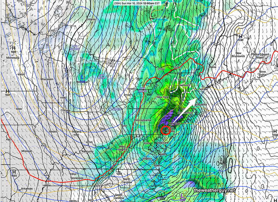
Posted Sunday 03/10/24 @ 5:54 PM — As forecast, rain and snow squalls are moving through now. Upper low is just north of us —
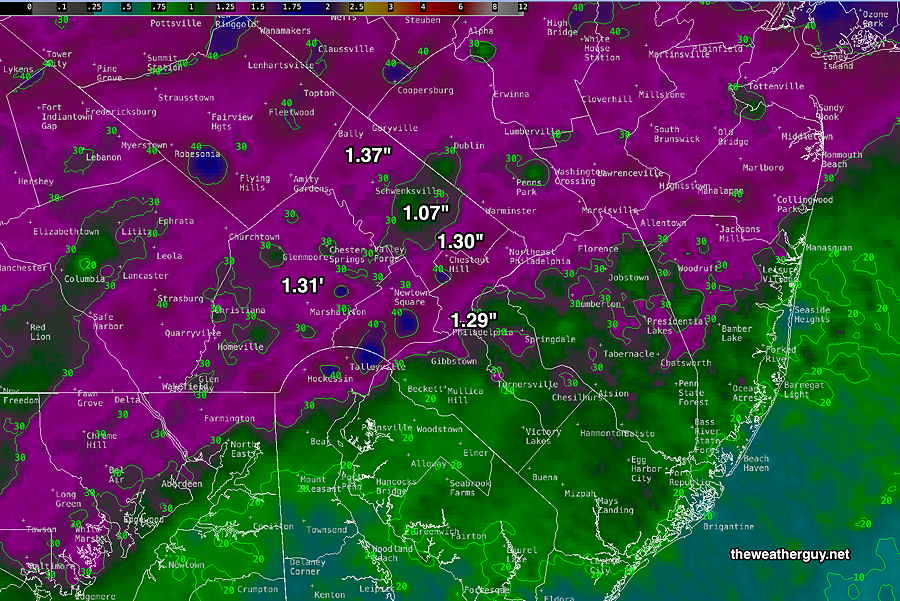
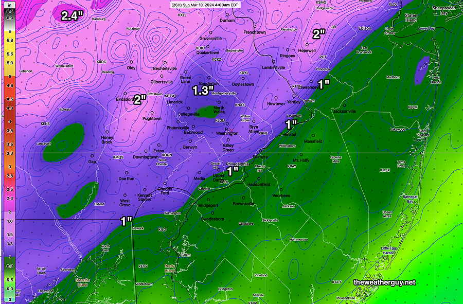
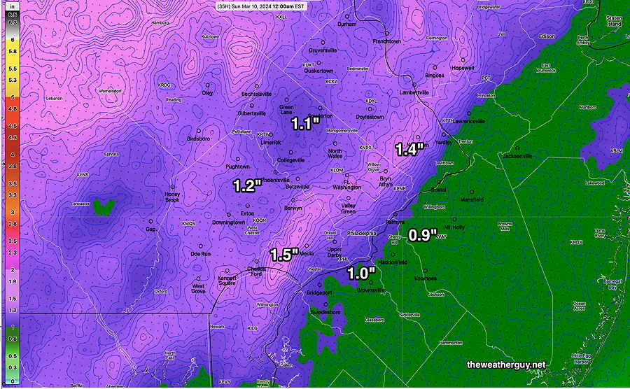
Posted Sunday 03/10/24 @ 4:40 PM — Here’s the MRMS tally of Saturday’s heavy rainfall—
Posted Sunday 03/10/24 @ 10:26 AM — I had hoped to have a MRMS estimate of the rainfall we received last night. Unfortunately, the server I access for that info is down today; I’ll do that tomorrow.
Increasing winds and an increasing chance of light showers/squalls as the day progresses. Max probability is between 3 and 8 PM this evening as the upper low moves over us.
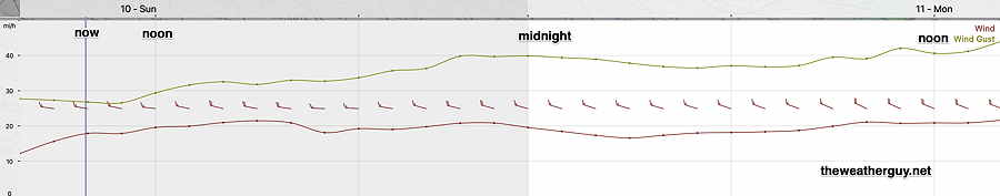
Winds/Gusts
Rain Update
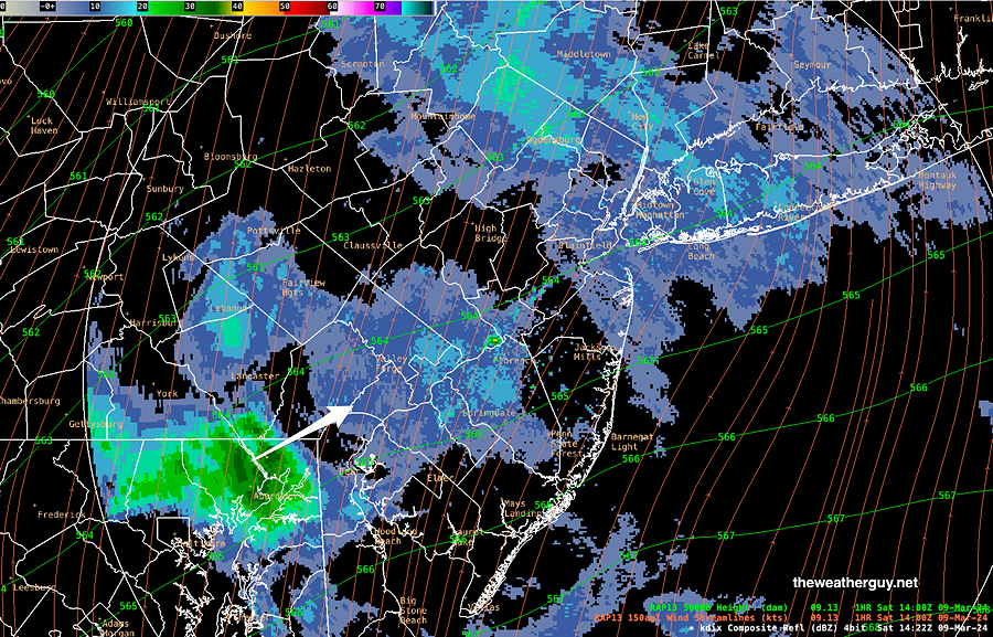
Posted Saturday 03/09/24 @ 8:06 PM — The heaviest rain has moved in this evening and it is expected to taper off from southwest to northeast between 10:30 PM and midnight.
The surface low will be directly over us around this time and wind should diminish for about an hour or two. (Almost like being in the eye of a hurricane.) The winds will pick up and become gusty again. The windy conditions should continue through Sunday.
Sunday is looking more and more unsettled, with plenty of clouds and wind. Wind gusts 40-45 mph. Some breaks of sun also. Intermittent light showers are possible, especially Sunday afternoon as the upper level low moves over us.
High temperatures will plateau around noon or 1 PM in the upper 40s and then drop during the afternoon. Continued fast moving light showers and even some squalls possible late afternoon. We may even see some snow flurries mixed in with the rain showers about 6-7 PM!
Saturday Rain Update
Posted Saturday 03/09/24 @ 9:35 AM — Last night’s models show little change in the storm forecast. Rain is showing already on radar, but much is not reaching the ground. A more significant batch of rain is quickly moving in from the southwest —
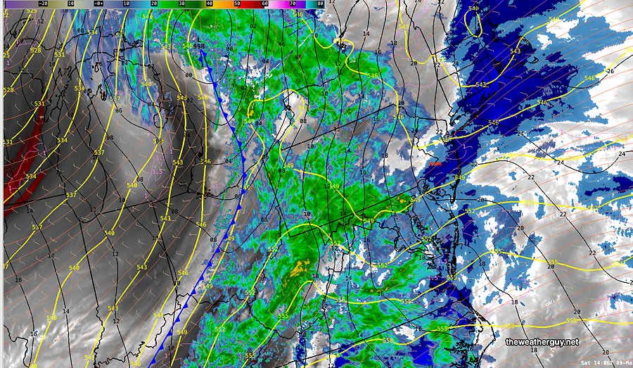
Satellite water vapor imagery shows the main event—
Forecast rainfall totals have shown good continuity in recent model runs. Here’s the latest HREF ensemble forecast —
Update Fri 3/08 10:07 PM — Tonight’s models continue with a trend towards an earlier start to the rain on Saturday. Scattered light sprinkles or drizzle may begin as early as 7- 8 AM, according to tonight’s NAM-NEST.
For Sunday there’s a chance of light widely scattered sprinkles with considerable cloudiness. High temperatures will be reached early in the day and temperatures will fall in the afternoon.
Previously Posted Fri 6:17 PM —
A strong low pressure system with plenty of moisture will move directly over Philadelphia Saturday night. The latest models are on-board with heavy rain especially in the evening.
As posted this morning, the energies of two jet streams will be coming together over our area—
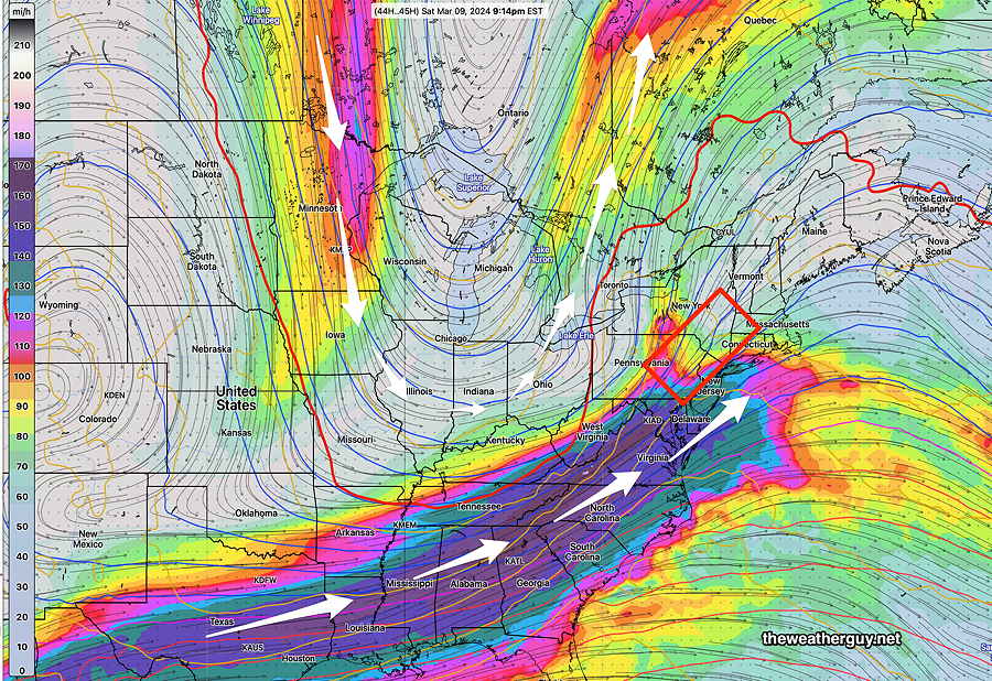
This energy will result in low pressure intensifying as it moves directly over Philadelphia Saturday night —
The NBM is cranking out high rainfall amounts with a fairly high chance of thunderstorms about 10 PM —
A cold front moves through about midnight. Sunday will be somewhat colder and very WINDY.
Saturday
Cloudy in the early morning. The latest models continue a trend of an earlier start of the rain. It now appears that it may start as early as 10-11 AM, earlier in western suburbs. Heaviest rain as we approach midnight. Increasing winds and a chance of thunderstorms about 10 PM.
NBM high temperatures: Blue Bell, PA 52º Philadelphia, PA 54º
Moderately high uncertainty (based on standard deviation): ± 3º
Sunday
Considerably cloudy and increasingly windy.
NBM high temperatures: Blue Bell, PA 49º Philadelphia, PA 51º
average uncertainty (based on standard deviation): ± 1.8º