#weather #paweather #wx #pawx #philadelphia #phillywx
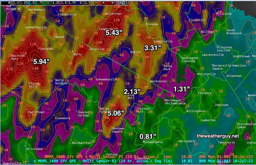
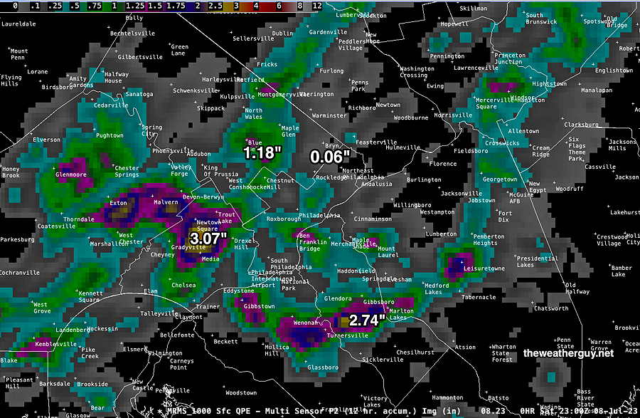
Total Rainfall
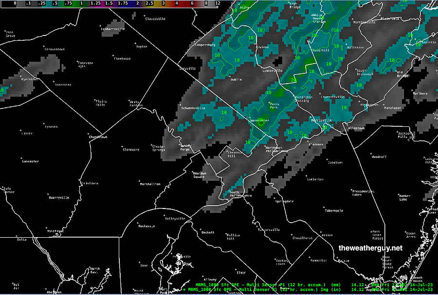
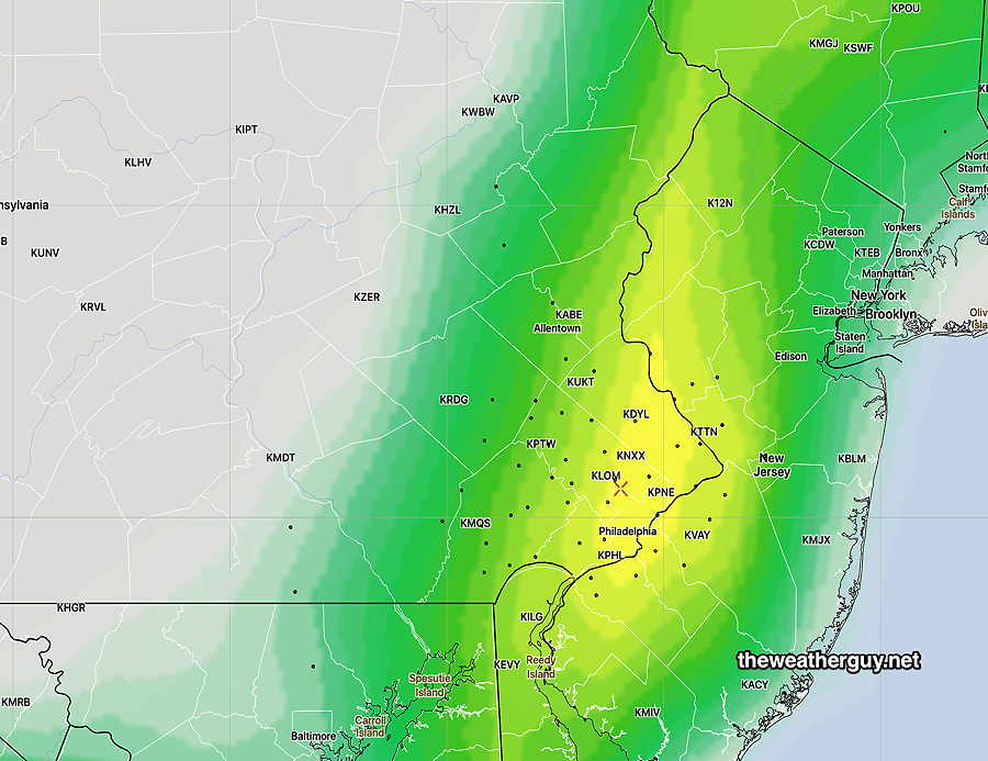
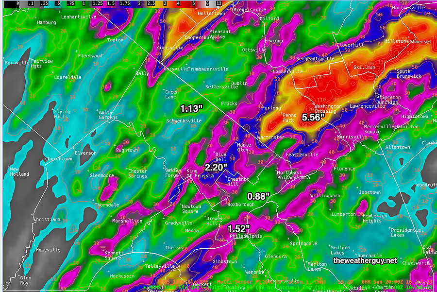
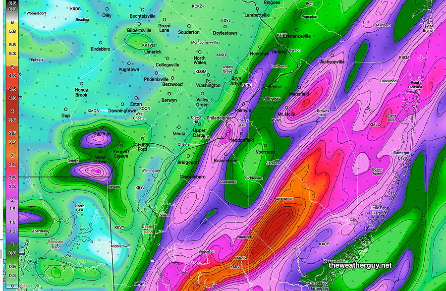
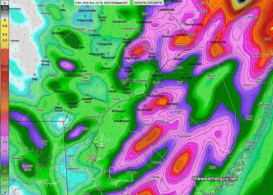
Updated Sun 07/16 @ 4:42 PM — Here’s the MRMS rain gauge/radar total rainfall estimate for the past 48 hours—
Live Blog
Updated Sun 07/16 @ 11:30AM—
Sunday Forecast Update
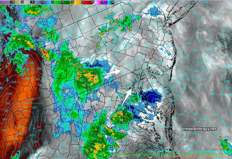
Updated Sun 07/16 @ 10:40 AM — Despite several model’s shift of the heavy rain axis into NJ, some of the new morning models (12z) still maintain a forecast of heavy rain this side of the Delaware river.
Here’s the HIRESW-FV3 forecast, similar to the 06z GFS model which prompted my earlier “forecast change” post—
The 12z HIRESW-ARW which is more in line with current radar trends—
Additional flareup of storms expected between noon and 3 PM. Another round of isolated showers/storms at about 8 PM.
Forecast Change
Update Sun 7/16 6:16 AM — Large change to forecast. Heavy rain axis has shifted east into NJ for today
Sunday Heavy Rain Event
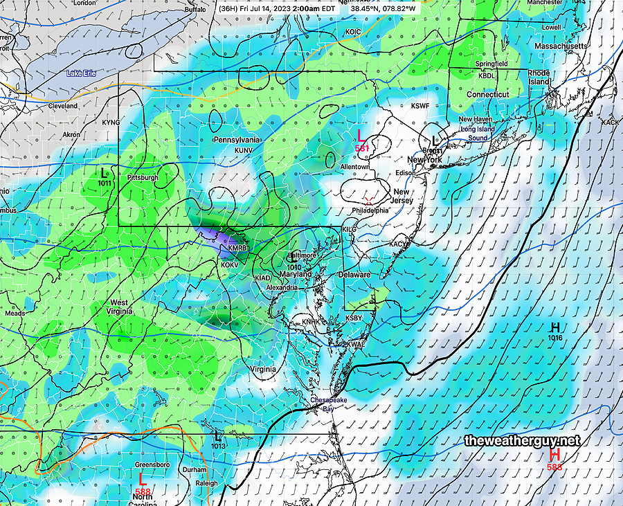
Updated Sat 07/15 @ 10:29 PM —The setup for a heavy rain event is taking shape with an upper level cyclonic flow, high precipitable water near 2.3″ (PWAT) and developing low pressure along a trough.
Rain and thunderstorms are already approaching the Baltimore area and the storms will be moving in to our area between midnight and 3 AM.
Looking over the latest 00z HRRR and 00z RAP models, it appears the main concern will be heavy rain and potential flooding from strong thunderstorms (but not severe). Tornadic activity is not expected, and while strong downdraft winds can occur in some spots, high winds should not be a major issue for most areas.
The rain will come through as two main clusters— morning and again late afternoon/evening.
Some of the heaviest rain will be in the morning hours, with a let up in activity possible about noontime before resuming with more scattered but still heavy rainfall during the late afternoon and early evening.
A possibility that the afternoon/evening storms will be severe is not clear at this. Since high rainfall is the main issue, I’ll defer posting my severity table until tomorrow morning.
As we saw today, rainfall amounts and locations are impossible to pin down exactly but the models are pretty much in the same ballpark of 1-3″ with locally higher amounts.
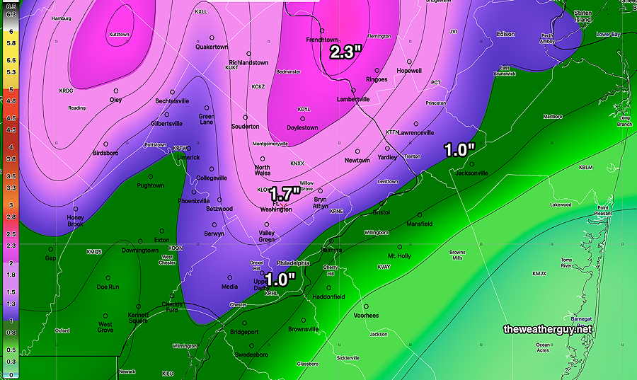
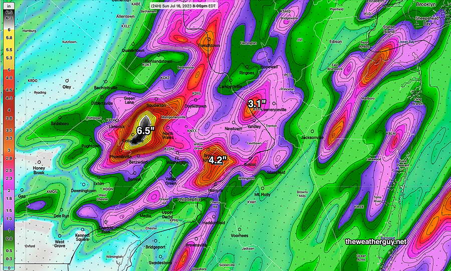
Here’s the latest HRRR total rainfall forecast—
Saturday Update
Updated Sat 07/15 @ 5:50 PM — For tonight, the main weather event for this weekend is taking shape. Heavy rain and thunderstorms should move into our area around 2-5 AM Sunday morning. PWATS are extremely high (2.5 inches), meaning that any storms are capable of putting down very heavy, flooding-type downpours.
I’ll have more details on tomorrow’s weather even later this evening after a few of 00z models come out. With our being on Daylight Saving Time, the 00z high resolution models start coming in between 9:30 PM and 10:45 PM tonight.
If you were at the Phillies game today, my forecast was a home run.
But if you were out biking in upper Montgomery County, my forecast was a bust. We almost got caught in quite a downpour about 1 PM. Luckily, a planned lunch stop provided shelter. I had been watching the radar while biking and the storms developed in central Chester County, then moved north. It was still a pretty wet ride back once the main cells passed by.
I went along with the HRRR forecast today after that model proved correct yesterday. Both the 06z and 11z mode runs showed no storms in our area, as shown in my morning update graphic. Even the 15z HRRR, which I accessed on my phone remotely, showed no storms. Go figure!
Reviewing today’s earlier models and last night’s models, not one really predicted what transpired today. The HRDPS was close on today’s forecast but had been totally wrong with yesterday’s late storm forecast. I mentioned this in my morning update below.
That said, today’s HRRR was an outlier since it showed a very minimum of shower activity, while most others showed some showers somewhere.
Updated Sat 07/15 @ 9:28 AM — Continuing with the HRRR emphasis from yesterday, the 06z HRRR showed virtually no showers this afternoon in the Philadelphia area. The latest 11z HRRR showed a few pop up storms about 2-3 PM with a period of cloudiness mid afternoon.
The HRRR puts the pop ups south of the city in Delaware county—
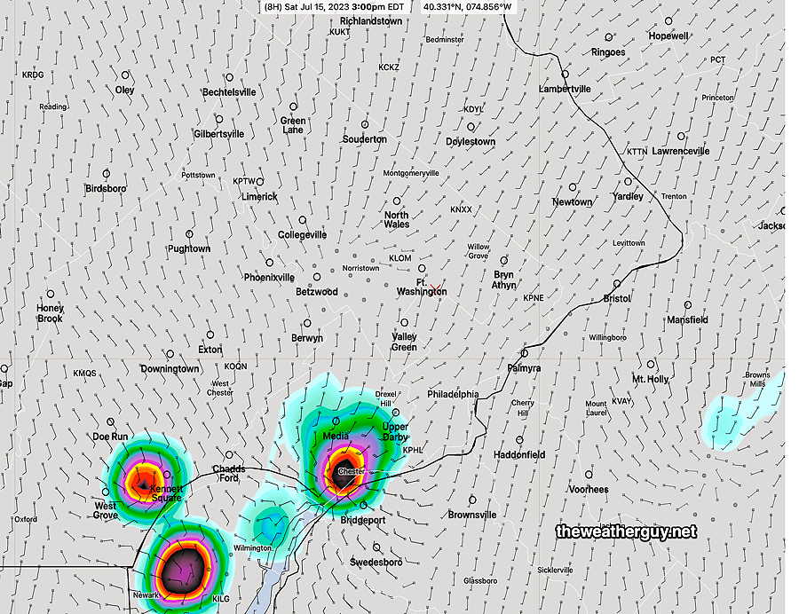
So some pop-up storms are possible. The issue with isolated pop-up forecasts is that the forecast location can’t be taken literally; the models just can’t do it more accurately. So we’ll see.
Just an FYI that other models, like the Canadian HRDPS, are forecasting much greater areal coverage of these pop-up storms during this afternoon. Since the HRDPS did not do well with yesterday’s forecast, I’m leaning towards the HRRR.
Sunday looks to be very “interesting” weather-wise, as a high degree of severity parameters are coming together for the potential for heavy rain, severe storms and even an isolated tornado. I’ll update later this afternoon or evening.
Update Fri 7/14 7:48 PM — It doesn’t appear as though any of the thunderstorms forecast for the city tonight will develop. (Good for the Phillies.) Indeed, looking back over today, the HRRR model forecasts were superior. So I’ve updated Saturday’s forecast below to be HRRR weighted.
Previously Posted Fri 6:15 PM —
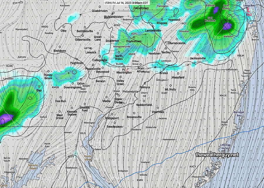
A disturbance approaching our area Friday evening has already brought some showers and thunderstorms to some areas of Montgomery and Bucks counties over the past few hours. Additional storms are possible in Philadelphia between 8-11 PM. The area of storms will be somewhat scattered and and rainfall will vary from about 0.15 inches to as much 1.2 inches in a few spots.
Saturday will be in-between systems and most areas will be dry.
BUT pop-up storms around Philadelphia and immediate suburbs in the mid and late afternoon are predicted by the latest NBM and HREF.
(The NBM and HREF forecast for today didn’t fare quite work so well, so my confidence in a dry Saturday is somewhat below average.)
An approaching disturbance will begin setting off some storms late evening Saturday.
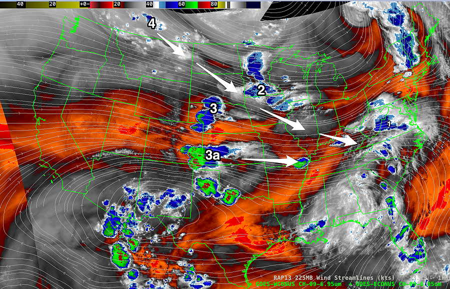
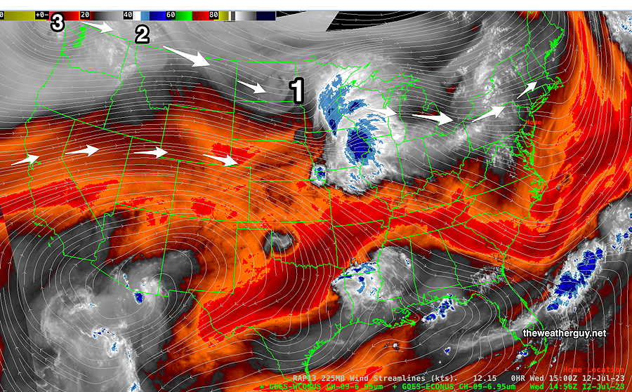
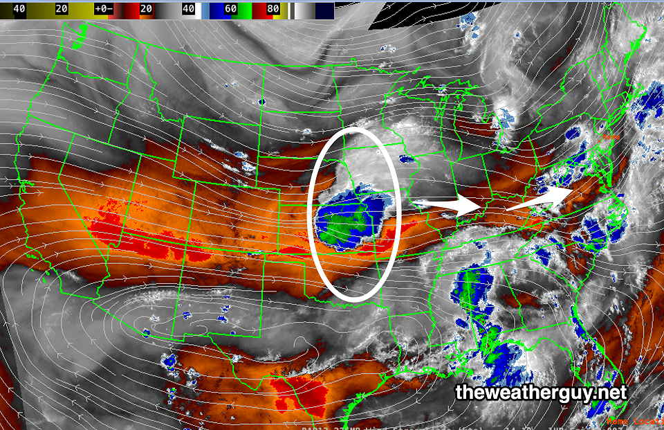
Another larger disturbance will interact with an approaching upper trough early Sunday. Showers and thunderstorms are expected.
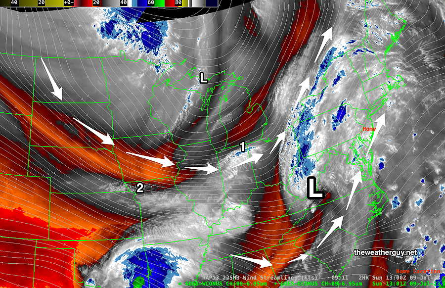
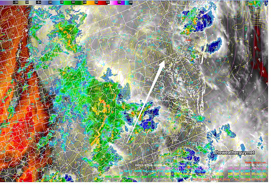
Sunday’s upper disturbance can be seen in this afternoon’s satellite image—
Saturday
We’ll be in-between systems Saturday. Partly sunny through high cirrus clouds. Some scattered pop up showers possible in the mid to late afternoon. Showers and thunderstorms possible beginning around midnight.
High temperature 89.1º sd 2.0º ( NBM model— location Blue Bell, PA)
Sunday
Cloudy with showers and thunderstorms beginning in the early morning. There may be a break in the showers/storms and even some sunny breaks before a cold front moves through later in the day with additional storms. The heaviest rain may fall in the morning hours and the storms later in the day will be more scattered, but possibly stronger.
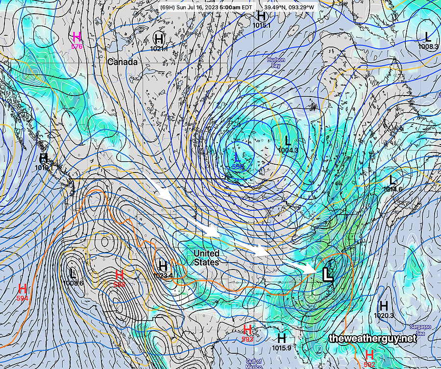
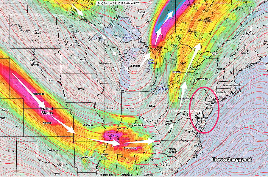
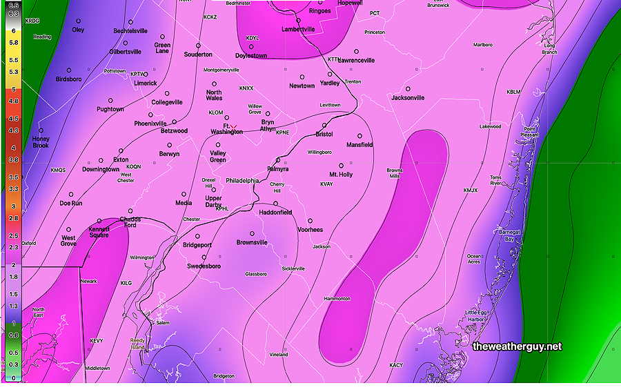
The GEFS model forecast for Sunday 2 PM—
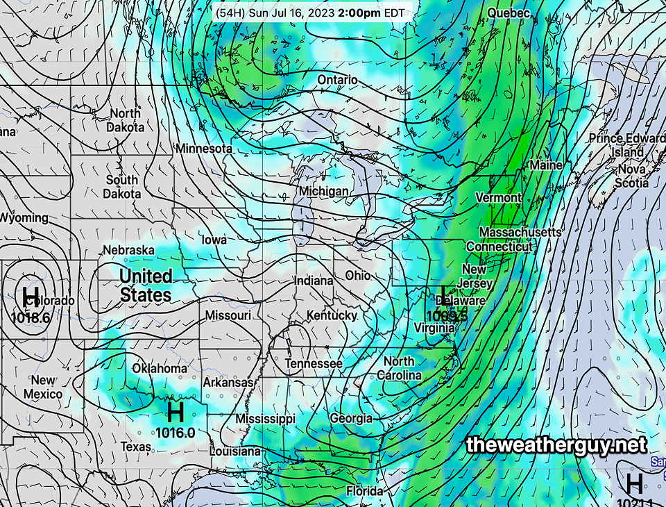
Over 1 inch of rain in many locations with some receiving much higher amounts. There will be plenty of dynamics and some of the storms may be strong to severe. Some gusty winds in the afternoon as the front moves through.
High temperature 84.2º sd 1.9º ( NBM model— location Blue Bell, PA)