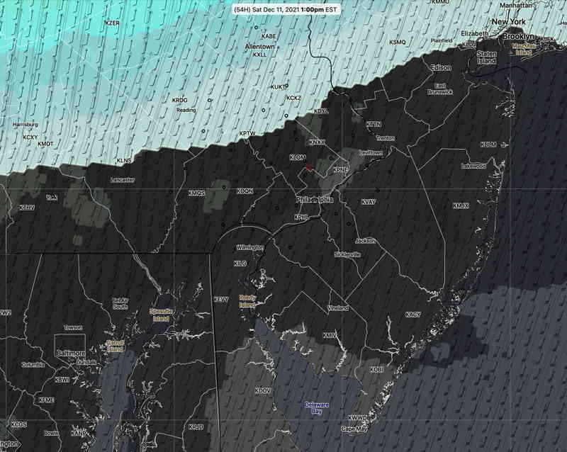
Update Fri @ 9:05 AM — A shift in the model blend (NBM) towards the higher resolution models shows the warm front that moves through Friday night lingering through Saturday morning with fog and light drizzle. Drizzle ends during the morning. Winds pick up during the late morning. VERY WINDY. Most of the afternoon (and possibly early evening) rain-free. Highest temperatures in the late afternoon 68-70º.
Front moves through with showers, possible thunder, about 5-8 PM.
Sunday looks to be sunny and breezy.
Update Thu @ 10:25 PM —The weekend has come within the range of the high resolution models. Saturday is looking very cloudy with low clouds in the morning. The NAM-NEST has light sprinkles/drizzle in the early morning. Most models (but not all) have high temperatures 65°+- 2.5°.. Very windy, as discussed below. Rain showers seem to reduce in intensity with the front late afternoon/evening. Check for my regular weekend weather forecast tomorrow.
Update Thu @ 4:27 PM — The latest NAM-NEST wind meteogram for Saturday—

It’s looking like most of the daytime hours will be dry with the actual cold front moving through about 6-8 PM.
Very mild temperatures still predicted for Saturday with possible recording breaking high temperatures in the upper 60s! Unfortunately, the models are also predicting cloudy conditions for much of the day.
The other big story may be the gusty winds that develop in the morning and continue through the evening. The GFS and NAM are predicting wind gusts in the 40-50 mph range for much of the day.
(The model blend (NBM) is only showing gusts to 35 mph.)
The latest models have the actual frontal passage about 6-7 PM (instead of the afternoon.) Rain and possibly some thunder will precede and accompany the cold front.

